 Arctic SDI catalogue
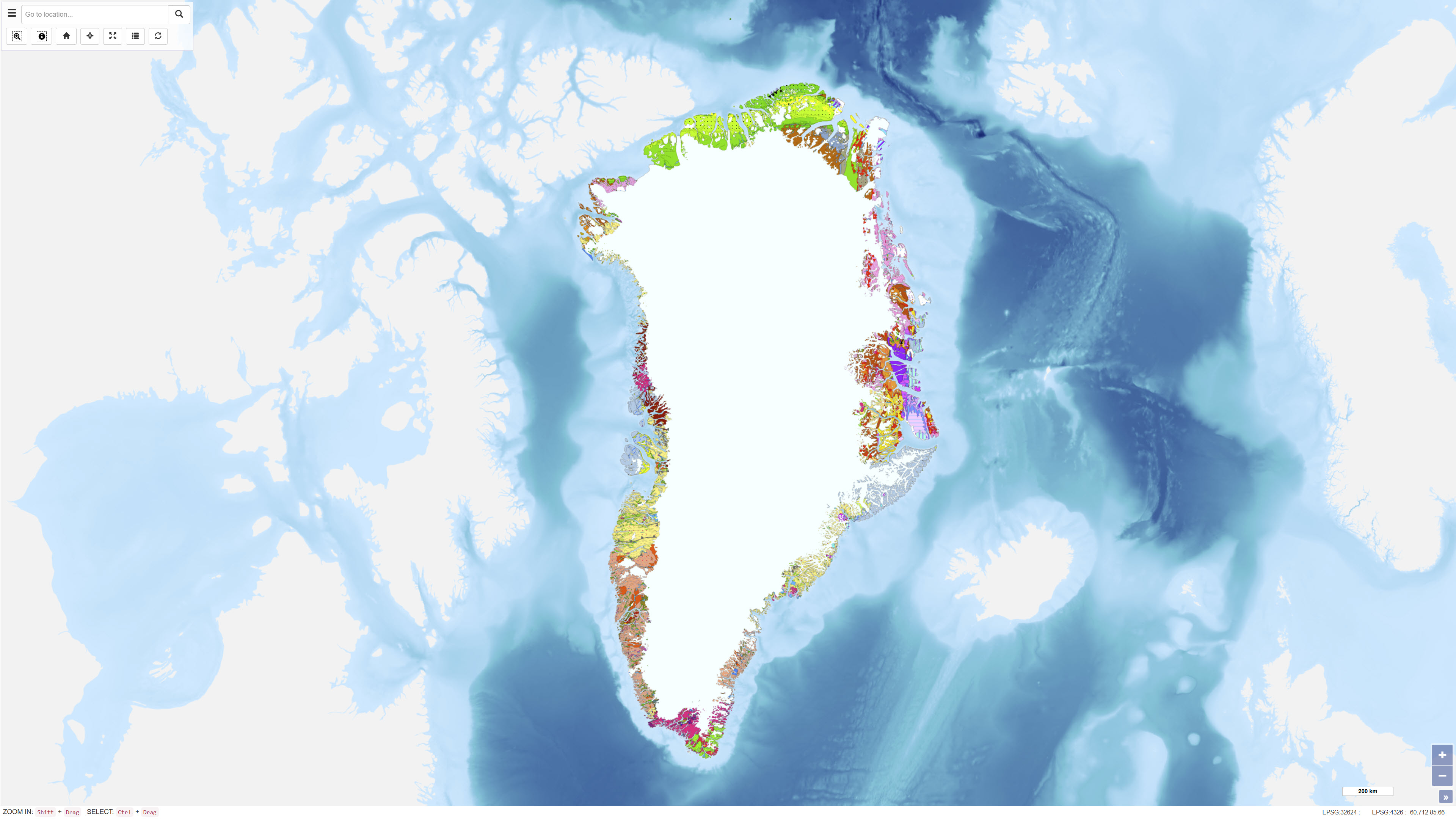
Provinces based on the Geological map of Greenland 1:2.500.000
The main geological environments in Greenland and their mineral resources have been described and divided into four main geological environments: infracrustal regions, supracrustal regions, magmatic provinces and sedimentary basin regions. Within the various geological environments, characteristic mineral deposits are outlined.
Within the infracrustal environment, relatively few mineral occurrences are recorded in Greenland, but three types are described: gold in gneiss, nickel and copper in mafic intrusions, and olivine in ultramafic rocks.
For more detailed information, reference is made to the report Greenland geological environments and mineral resources.
Simple
- Date ( Publication )
- 1998-01-01
- Identifier
- dk.geus / grl_geol_provinces_greenland_2500k
- Presentation form
- Digital map
- Purpose
- The purpose of the dataset is to provide a regional classification of geological provinces in Greenland based on the Geological map of Greenland at a scale of 1:2.500.000, with emphasis on the relationship between geological environments and mineral resources.
- Status
- Completed
- Maintenance and update frequency
- As needed
- Keywords ( Theme )
-
- Dataset
- Geology
- Greenland
- Geological provinces
- Mineral resources
- Forskningsemner Forskningsemner ( Theme )
- Geografisk Geografisk ( Place )
- Access constraints
- Other restrictions
- Use constraints
- Other restrictions
- Other constraints
- CC BY 4.0
- Other constraints
- Use of the dataset requires acknowledgement of the Geological Survey of Denmark and Greenland (GEUS) as the data source.
- Spatial representation type
- Vector
- Denominator
- 25000000
- Metadata language
- en
- Character set
- UTF8
- Topic category
-
- Geoscientific information
- Imagery base maps earth cover
- Begin date
- 1998-01-01
- End date
- 1998-01-01
))
- Supplemental Information
-
The dataset represents a thematic derivation of the Geological map of Greenland at a scale of 1:2.500.000 and provides a generalised classification of geological provinces and environments in Greenland. The provincial classification is intended for regional analysis and overview purposes and is not suitable for detailed geological assessments at local scale.
The map has been produced as an independent thematic dataset and should be used in conjunction with the underlying geological map and accompanying documentation to ensure correct scientific interpretation.
- Reference system identifier
- WGS 84 / UTM 24N (EPSG:32624)
- Distribution format
-
-
WMS
(
)
-
WMTS
(
)
-
REST
(
)
-
WMS
(
)
- OnLine resource
-
Interactive webmap
(
WWW:LINK-1.0-http--link
)
Interactive map displaying the dataset.
- OnLine resource
-
Greenland geological environments and mineral resources
(
DOI
)
Stendal, H., Secher, K., Nielsen, B. M., Schønwandt, H. K. V., & Thorning, L. (2005). Greenland geological environments and mineral resources. GEUS. Danmarks og Grønlands Geologiske Undersøgelse Rapport Vol. 2005 No. 8 https://doi.org/10.22008/gpub/25952
- OnLine resource
-
Geological_provinces_2500k
(
ESRI:REST
)
ArcGIS REST Service
- OnLine resource
-
Precambrian_basement
(
OGC:WMS-1.3.0-http-get-capabilities
)
ArcGIS WMS Service
- OnLine resource
-
Greenland_Geological_provinces_2500k
(
OGC:WMTS-1.0.0-http-get-capabilities
)
ArcGIS WMTS Service
- Hierarchy level
- Dataset
- Statement
- The dataset was derived from the Geological map of Greenland at a scale of 1:2.500.000. Geological provinces were defined through interpretation and generalisation of the geological units shown on the source map and grouped into major geological environments.
- File identifier
- ff55c92e-4fea-4787-b373-5c8af8f67274 XML
- Metadata language
- Danskda
- Character set
- UTF8
- Hierarchy level
- Dataset
- Date stamp
- 2026-02-09T12:01:44.407555Z
- Metadata standard name
- ISO 19115:2003/19139
- Metadata standard version
- 1.0
Overviews
Spatial extent
Provided by
