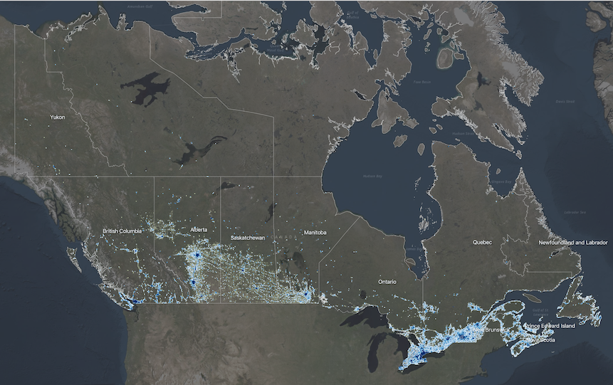
National Human Settlement - Social Fabric and Capacity Thresholds
The Social Vulnerability component of the National Human Settlement Layer (NHSL) includes information about broad spatial patterns of social vulnerability at the neighbourhood scale, and indicators about the capacities for a community to withstand and recover from disaster events based on intrinsic characteristics of housing, family structure, individual autonomy and financial agency.
Information in the model provides a means of comparing relative levels of social vulnerability from one region to another across Canada and helps to identify specific dimensions within a community that contributes to their relative levels of social vulnerability. This information is not intended for site-specific study, but instead to understand broad patterns of social characteristics and vulnerability across multiple census dissemination areas.
Simple
- Date ( RI_366 )
- 2020-06-15
- Date ( RI_367 )
- 2020-11-15
- Status
- onGoing; enContinue RI_596
- Maintenance and update frequency
- asNeeded; auBesoin RI_540
- Government of Canada Core Subject Thesaurus Thésaurus des sujets de base du gouvernement du Canada ( RI_528 )
-
- Planning
- Sustainable development
- Land management
- Use limitation
- Open Government Licence - Canada (http://open.canada.ca/en/open-government-licence-canada)
- Access constraints
- license; licence RI_606
- Use constraints
- license; licence RI_606
- Spatial representation type
- vector; vecteur RI_635
- Metadata language
- eng; CAN
- Topic category
-
- Society
- Begin date
- 2016
- End date
- 2021
))
- Reference system identifier
- http://www.epsg-registry.org / EPSG:4326 /
- Distribution format
-
-
ESRI REST
(
10.71
)
-
GPKG
(
1.2
)
-
WMS
(
1.3.0
)
-
ESRI REST
(
10.71
)
- OnLine resource
-
NHSL Social Fabric and Capacity Thresholds (Settlement Area)
(
HTTPS
)
Dataset;GPKG;eng,fra
- OnLine resource
-
NHSL Social Fabric and Capacity Thresholds
(
ESRI REST: Map Server
)
Web Service;ESRI REST;eng
- OnLine resource
-
NHSL Social Fabric and Capacity Thresholds
(
ESRI REST: Map Server
)
Web Service;ESRI REST;fra
- OnLine resource
-
NHSL Social Fabric and Capacity Thresholds
(
OGC:WMS
)
Web Service;WMS;eng
- OnLine resource
-
NHSL Social Fabric and Capacity Thresholds
(
OGC:WMS
)
Web Service;WMS;fra
- OnLine resource
-
Data Dictionary
(
HTTPS
)
Supporting Document;XLSX;eng
- OnLine resource
-
Data Dictionary
(
HTTPS
)
Supporting Document;XLSX;fra
- OnLine resource
-
GitHub Repository
(
HTTPS
)
Supporting Document;HTML;eng
- OnLine resource
-
Geological Survey of Canada Open File
(
HTTPS
)
Supporting Document;ZIP;eng
- File identifier
- 36d4b36f-e21f-49b7-b6a6-4d14551c8be6 XML
- Metadata language
- eng; CAN
- Character set
- utf8; utf8 RI_458
- Parent identifier
- Human Settlement and Natural Hazards in Canada e9905001-6a39-43ca-a02d-4ab5144df0f8
- Hierarchy level
- dataset; jeuDonnées RI_622
- Date stamp
- 2022-08-26T16:04:53
- Metadata standard name
- North American Profile of ISO 19115:2003 - Geographic information - Metadata
- Metadata standard version
- CAN/CGSB-171.100-2009
Overviews

Spatial extent
))
Provided by

 Arctic SDI catalogue