 Arctic SDI catalogue
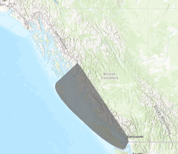
Defining Distinct Nearshore Marine Biotopes Coastwide in British Columbia Canada
To ensure informed decision-making, management, and conservation of marine ecosystems along the British Columbia (BC) coastline, a comprehensive understanding of marine communities and habitats is necessary. Marine planning initiatives, including environmental incident response planning and the development of a marine protected area network, have long been challenged by significant gaps in our knowledge of the distribution of many nearshore marine species. This lack of critical information can impede our ability to effectively manage and protect vulnerable species and ecosystems.
We developed a set of species distribution models (single-SDMs) using data collected from the benthic habitat mapping survey. These models correlate species occurrence data with environmental variables. We used these models to make predictions of the probability of occurrence of each species across the entire BC coast. A cluster analysis of the single-SDM predictions was then used to determine biotopes, which are distinct combinations of physical and chemical water properties and associated biological communities.
We defined and mapped the spatial distribution and probability of nine nearshore macrofauna epibenthic biotopes along with three physiotopes based on environmental conditions. The definition of the biotopes includes correlated species, the type of substrate, and range of environmental conditions (slope, depth, current, temperature, salinity, and tidal current) occurring within each biotope. The biotopes defined here are a first, but important, step in quantitative bioregionalization for the Pacific region as the resolution of nearshore marine community information has been lacking in BC and has hindered marine spatial initiatives.
This dataset contains 71 of the 72 single-SDMs (which excludes Northern abalone, an endangered species), the spatial distribution of 9 biotopes and 3 physiotopes, and the species richness calculated as the sum of occurrence probabilities across all 72 species.
Simple
- Date ( RI_367 )
- 2026-04-09
- Date ( RI_366 )
- 2026-04-09
https://www.gis-hub.ca/dataset/bhm-biotope
- Credit
-
Joanne Lessard, Patrick Thompson, Jessica Nephin, Sarah Davies, Emily Rubidge, Sharon Jeffery, Kayleigh Gillespie,
Carrie Robb, Sarah Dudas
- Status
- completed; complété RI_593
- Maintenance and update frequency
- notPlanned; nonPlanifié RI_542
- Keywords ( RI_528 )
-
- marine spatial planning
- oil spill response
- Government of Canada Core Subject Thesaurus Thésaurus des sujets de base du gouvernement du Canada ( RI_528 )
-
- Ecology
- Marine biology
- Biological diversity
- Use limitation
- Open Government Licence - Canada (http://open.canada.ca/en/open-government-licence-canada)
- Access constraints
- license; licence RI_606
- Use constraints
- license; licence RI_606
- Spatial representation type
- grid; grille RI_636
- Metadata language
- eng; CAN
- Character set
- utf8; utf8 RI_458
- Topic category
-
- Biota
- Begin date
- 2013-09-12
- End date
- 2024-09-29
))
- Supplemental Information
-
DIVE SURVEY DATA COLLECTION
Data were collected from SCUBA-based research surveys that were used to assess the presence or absence of 103 benthic invertebrates and 59 algae species or species groups, conducted during the spring to early fall (April–October) from 2013 to 2023; no surveys were conducted in 2016 and 2020. This dataset spans the BC coastline and includes both species presence and absence data, collected along randomly placed transects.
ANALYSIS
In the first phase of the analysis the distribution of benthic nearshore species was estimated using geostatistical models fit with the sdmTMB R package (Anderson et al., 2022). sdmTMB fits single species spatial generalized linear mixed effects models (GLMM). We excluded species with prevalence less than 0.5% and species we deemed too generic to be used in analysis (e.g. ‘other barnacles’), resulting in 127 species included in the sdmTMB analysis.
Quadrats were excluded from the analysis if they lacked recorded observations of depth or substrate. Transect or quadrats falling outside of the spatial extent of environmental covariates data layers were also excluded. The final dataset used for analysis consisted of 17,452 quadrats.
Modelled environmental covariate layers included in analysis were substrate type (classified as rock, mixed, sand, or mud), seafloor depth, slope, relative exposure index (REI), relative tidal current index, mean summer bottom temperature, and mean summer bottom salinity. Substrate, slope, and depth data used in the model fitting were derived from direct observations during the dive surveys. The other environmental covariates (REI, salinity, temperature, tidal current) were matched from spatial layers to each quadrat by extracting values from the grid cell of the predicted raster layer overlapping the midpoint of the transect. The spatial layers used to generate SDM predictions are listed in the Data Source section of the metadata, and more information on the single SDM analysis method is available in the CSAS Research Document (in press.)
To define biotopes through cluster analysis, we determined the number of clusters (9) and the clustering method (k-means) that provided the most ecologically meaningful and statistically robust results. Due to computational constraints, clustering on the entire prediction grid was not feasible. Instead, we generated a Euclidean distance matrix using the distances R package and used it to assign cluster labels to the remaining coastal cells based on clustering results derived from a subset of the data (Miller et al., 2019).
RESULTING DATASET
72 Single-SDMs (but only 71 available):
The 127 single species SDMs were evaluated though spatial block cross validation and only those that converged and were well-preforming (AUC > 0.7) were retained for the cluster analysis, which amounted to 72 single species SDMs. In order to accommodate SARA regulations the abalone SDM has been removed from the public version of this dataset.
Biotope/Physiotope Assignment:
Nine biotope clusters were identified across the coast with an assemblage of species correlated with each. These clusters are SRE (shallow, rock, exposed); MRE (mid-depth, rock, exposed); SRMM (shallow, rock and mixed, moderately sheltered); MRS (mid-depth, rock, sheltered); DRM (deep, rock, moderately exposed); SRSM (shallow, rock and sand, moderately sheltered); MSS (mid-depth, sand, sheltered); MSM (mid-depth, sand, moderately sheltered); and DSM (deep, sand, moderately sheltered).
There were several areas that were excluded from our model predictions because their environmental characteristics were not represented adequately in our BHM survey data. Nevertheless, these areas, which we call Physiotopes, can be defined by their environmental covariates. Areas with high freshwater input (index value >0.0008) were rarely sampled during the Benthic Habitat Mapping (BHM) survey due to poor visibility caused by the freshwater lens and increased turbidity. This physiotope is labeled as FW. Similarly, areas that were excluded from the predictions due to very high exposure, and for which we have no data because they are inaccessible to divers, were mapped as a distinct physiotope here. This physiotope is labelled H-REI. In addition to physiotopes added from excluded areas, we define an additional physiotope for sandy exposed beaches (SEB). The SEB physiotope replaced the assigned biotope where ShoreZone identified intertidal sandy, > 30 m wide, exposed beaches.
Species Richness:
Predicted species richness in a given location was calculated as the sum of occurrence probabilities across all 72 species. This provides a predicted number of species that would be expected to be found in a 5 x 1 m quadrat, on average. It accounts for the fact that predicted occurrence values range from 0 to 1, and so individual species would only contribute partial species to the species richness estimate.
- Reference system identifier
- https://epsg.io / EPSG:4326 /
- Number of dimensions
- 2
- Cell geometry
- area; surface RI_452
- Transformation parameter availability
- Yes
- Distribution format
-
-
TIFF
(
unknown
)
-
CSV
(
unknown
)
-
TIFF
(
unknown
)
https://www.gis-hub.ca/dataset/bhm-biotope
- OnLine resource
-
Defining Distinct Nearshore Marine Biotopes Coastwide in BC
(
HTTPS
)
Dataset;TIFF;eng,fra
- OnLine resource
-
Data Dictionary English
(
HTTPS
)
Supporting Document;XLSX;eng
- OnLine resource
-
Data Dictionary French
(
HTTPS
)
Supporting Document;XLSX;fra
- OnLine resource
-
Biotope Definitions Table English
(
HTTPS
)
Supporting Document;DOCX;eng
- OnLine resource
-
Biotope Definitions Table French
(
HTTPS
)
Supporting Document;DOCX;fra
- OnLine resource
-
References
(
HTTPS
)
Supporting Document;DOCX;eng,fra
- OnLine resource
-
Supporting Information English
(
HTTPS
)
Supporting Document;DOCX;eng
- OnLine resource
-
Supporting Information French
(
HTTPS
)
Supporting Document;DOCX;fra
- OnLine resource
-
Defining Distinct Nearshore Marine Biotopes Coastwide in BC
(
ESRI REST: Map Service
)
Web Service;ESRI REST;eng
- OnLine resource
-
Defining Distinct Nearshore Marine Biotopes Coastwide in BC
(
ESRI REST: Map Service
)
Web Service;ESRI REST;fra
- File identifier
- 91adb2a7-eb07-4ed6-ae82-6b8601a61553 XML
- Metadata language
- eng; CAN
- Character set
- utf8; utf8 RI_458
- Hierarchy level
- dataset; jeuDonnées RI_622
- Date stamp
- 2026-06-15T18:13:24.347549Z
- Metadata standard name
- North American Profile of ISO 19115:2003 - Geographic information - Metadata
- Metadata standard version
- CAN/CGSB-171.100-2009
https://www.gis-hub.ca/dataset/bhm-biotope
Overviews
Spatial extent
Provided by
