 Arctic SDI catalogue
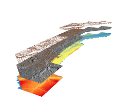
AAFC Infrastructure Flood Mapping in Saskatchewan - LASer (LAS) Files
Simple
- Date ( RI_367 )
- 2013-07-02
- Date ( RI_366 )
- 2013-07-02
- Presentation form
- mapDigital;carteNumérique RI_391
- Status
- completed; complété RI_593
- Maintenance and update frequency
- notPlanned; nonPlanifié RI_542
- Government of Canada Core Subject Thesaurus Thésaurus des sujets de base du gouvernement du Canada ( RI_528 )
-
- Topography
- Use limitation
- Open Government Licence - Canada (http://open.canada.ca/en/open-government-licence-canada)
- Access constraints
- license; licence RI_606
- Use constraints
- license; licence RI_606
- Spatial representation type
- textTable; texteTable RI_637
- Metadata language
- eng; CAN
- Topic category
-
- Elevation
- Begin date
- 2008-01-01
- End date
- 2013-01-01
))
- Reference system identifier
- www.epsg.org / EPSG: 3857 / 8.3.4
- OnLine resource
-
Pre-packaged LASer files (Bilingual)
(
HTTPS
)
Dataset;ZIP;eng,fra
- OnLine resource
-
Data Product Specification (French)
(
HTTPS
)
Supporting Document;PDF;fra
- OnLine resource
-
Data Product Specification (English)
(
HTTPS
)
Supporting Document;PDF;eng
- OnLine resource
-
AAFC - Multiple Sites - Saskatchewan Spring 2012 Collection LiDAR Survey Report
(
HTTPS
)
Supporting Document;PDF;eng
- OnLine resource
-
AAFC - Multiple Sites - Saskatchewan LiDAR Survey Report
(
HTTPS
)
Supporting Document;PDF;eng
- OnLine resource
-
Sask Dams-LiDAR
(
HTTPS
)
Supporting Document;TXT;eng
- File identifier
- c495dc2b-6988-4d1f-a6a4-6db4ac14c311 XML
- Metadata language
- eng; CAN
- Character set
- utf8; utf8 RI_458
- Parent identifier
- AAFC Infrastructure Flood Mapping in Saskatchewan 7ca9fbd2-f3b9-4589-b3ed-0aac545b54bd
- Hierarchy level
- dataset; jeuDonnées RI_622
- Date stamp
- 2023-02-07T12:07:17
- Metadata standard name
- North American Profile of ISO 19115:2003 - Geographic information - Metadata
- Metadata standard version
- CAN/CGSB-171.100-2009
Overviews
Spatial extent
Provided by
