 Arctic SDI catalogue
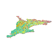
Southern Ontario Surficial 3D Model
Simple
- Date ( RI_367 )
- 2024-06-14
- Date ( RI_366 )
- 2024-01-25
- Presentation form
- modelDigital; modèleNumérique RI_393
- Name
- Open File
- Issue identification
- 9165
- Other citation details
- Logan, C.E., Russell, H.A.J., Burt, A., Mulligan, R.P.M., Sharpe, D.R., and Bajc, A.F. 2024. A three-dimensional surficial geology model of Southern Ontario. Geological Survey of Canada, Open File 9165. 36 p.
- Purpose
- To support improved groundwater geoscience knowledge for southern Ontario
- Credit
- Charles E. Logan, Hazen A.J. Russell, Abigail K. Burt, Riley P.M. Mulligan, David R. Sharpe, and Andy F. Bajc
- Status
- completed; complété RI_593
- Maintenance and update frequency
- notPlanned; nonPlanifié RI_542
- GSC Keywords Vocabulary - Thesaurus Thésaurus - vocabulaire de mots-clé de la CGC ( RI_528 )
-
- Anthropogenic deposits
- Colluvial and mass-wasting deposits
- Undifferentiated deposits
- Organic deposits
- Samples
- Geomorphological features
- Recent Geological Events
- Surficial Geology
- Glacial Ice or Snowpack
- Material
- Methods
- Weathered bedrock or regolith
- Alluvial sediments
- Eolian sediments
- Glaciofluvial sediments
- Glacial sediments
- Glaciolacustrine sediments
- Glaciomarine sediments
- Lacustrine sediments
- Marine sediments
- Volcanic deposits
- Bedrock
- Surficial Geology Unit Types
- Named units
- NRCan - GSC - Groundwater - Keywords list Liste de mots-clés - RNCan - CGC - Eau souterraine ( RI_528 )
-
- Aquifer
- Aquifer system
- Aquitard
- Government of Canada Core Subject Thesaurus Thésaurus des sujets de base du gouvernement du Canada ( RI_528 )
-
- Surficial geology
- Use limitation
-
Research and derived products that make use of this data should cite Geological Survey of Canada Open File 9165:
Logan, C.E., Russell, H.A.J., Burt, A., Mulligan, R.P.M., Sharpe, D.R., and Bajc, A.F. 2024. A three-dimensional surficial geology model of Southern Ontario. Geological Survey of Canada, Open File 9165. 36 p.
- Use limitation
- Open Government Licence - Canada (http://open.canada.ca/en/open-government-licence-canada)
- Access constraints
- license; licence RI_606
- Use constraints
- otherRestrictions; autresRestrictions RI_609
- Spatial representation type
- vector; vecteur RI_635
- Metadata language
- eng; CAN
- Character set
- utf8; utf8 RI_458
- Topic category
-
- Geoscientific information
- Environment description
- Seequent Leapfrog Works 2023.2.3
- Description
- Southern Ontario
))
- Begin date
- 1899-04-05
- End date
- 2014-12-21
- Supplemental Information
- This model was developed as a Geological Survey of Canada and Ontario Geological Survey collaboration, with support from the Groundwater Geoscience Program and Canada1Water Project.
- Reference system identifier
- http://www.epsg-registry.org/ / EPSG:26917 / 6.14
- Geometric object type
- solid; solide RI_509
- Distribution format
-
-
DXF
(
unknown
)
-
DXF
(
unknown
)
- Transfer size
- 10700
- OnLine resource
-
Southern Ontario Surficial 3D Model - French
(
HTTPS
)
Dataset;HTML;fra
- OnLine resource
-
Southern Ontario Surficial 3D Model - English
(
HTTPS
)
Dataset;HTML;eng
- OnLine resource
-
Southern Ontario Surficial 3D Model - spatial extent - French
(
ESRI REST: Map Service
)
Web Service;ESRI REST;fra
- OnLine resource
-
Southern Ontario Surficial 3D Model - spatial extent - English
(
ESRI REST: Map Service
)
Web Service;ESRI REST;eng
- OnLine resource
-
Southern Ontario Surficial 3D Model - spatial extent - English
(
HTTPS
)
Dataset;WMS;eng
- OnLine resource
-
Southern Ontario Surficial 3D Model - spatial extent - French
(
HTTPS
)
Dataset;WMS;fra
- OnLine resource
-
Southern Ontario Surficial 3D Model - French
(
HTTPS
)
Dataset;DXF;fra
- OnLine resource
-
Southern Ontario Surficial 3D Model - English
(
HTTPS
)
Dataset;DXF;eng
- OnLine resource
-
Southern Ontario Surficial 3D Model - spatial extent - French
(
HTTPS
)
Dataset;SHP;fra
- OnLine resource
-
Southern Ontario Surficial 3D Model - spatial extent - English
(
HTTPS
)
Dataset;SHP;eng
- OnLine resource
-
Southern Ontario Surficial 3D Model - associated publication - French
(
HTTPS
)
Supporting Document;HTML;fra
- OnLine resource
-
Southern Ontario Surficial 3D Model - associated publication - English
(
HTTPS
)
Supporting Document;HTML;eng
- Hierarchy level
- dataset; jeuDonnées RI_622
- Description
-
Title: 3D Surficial Model Development -- Description: 3D model was developed using Seequent Leapfrog Works geomodelling software following a methodology outlined in:
Logan, C.E., Russell, H.A.J., Burt, A.K., Mulligan, R.P.M., Sharpe, D.R., and Bajc, A.F., 2024. A three-dimensional surficial geology model of southern Ontario; Geological Survey of Canada, Open File 9165, 1 .zip file. https://doi.org/10.4095/pudw24j7tx
- Date / Time
- 2023-01-18T00:00:00
- Description
-
Archival subsurface and surface 3D data supported 3D modelling including: i) boreholes logs from the Ontario Ministry of Environment, Conservation and Parks (MECP), the Geological Survey of Canada and other Ontario provincial agencies; ii) Digital Elevation Models (DEMs) from NASA Shuttle Radar Topography Mission (SRTM); iii) Lake bathymetry from the National Oceanic and Atmospheric Administration (NOAA) and the Canadian Hydrographic Service (CHS); and iv) Geophysical surveys from the Geological Survey of Canada. Details are outlined in:
Logan, C.E., Russell, H.A.J., Burt, A.K., Mulligan, R.P.M., Sharpe, D.R., and Bajc, A.F., 2024. A three-dimensional surficial geology model of southern Ontario; Geological Survey of Canada, Open File 9165, 1 .zip file. https://doi.org/10.4095/pudw24j7tx
- Description
-
Model stratigraphy and surface model components were developed from simplified and reclassified surficial geology mapping from:
Ontario Geological Survey, 2010. Surficial geology of southern Ontario. Ontario Geological Survey, Miscellaneous Release-Data 128 - Revised. Ontario Government 2006. Clean Water Act (S.O. 2006, Chapter 22)
- File identifier
- d9d3a8c5-b9a8-f90b-9a3c-a8f4d4027b95 XML
- Metadata language
- eng; CAN
- Character set
- utf8; utf8 RI_458
- Parent identifier
- Surficial Geological Units, Groundwater Geoscience Program 11436a7f-87fc-afd7-a531-58dce5791d32
- Hierarchy level
- dataset; jeuDonnées RI_622
- Date stamp
- 2024-06-21T09:45:01
- Metadata standard name
- North American Profile of ISO 19115:2003 - Geographic information - Metadata
- Metadata standard version
- CAN/CGSB-171.100-2009
Overviews
Spatial extent
Provided by
