 Arctic SDI catalogue
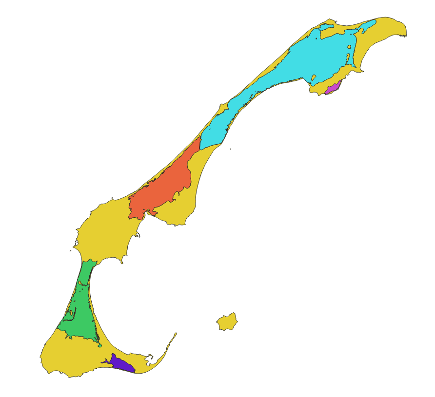
Polygons of inland water bodies of the Magdalen Islands Lagoons Marine Refuge
This cartographic dataset represents a geomorphological update of the boundaries of the five inland water bodies that form the Magdalen Islands Marine Refuge. It was produced by Fisheries and Oceans Canada (DFO) as part of its marine refuge characterization work.
The data used comes from the August 15, 2022 version of the Quebec maritime Geospatial Database of Coastal Ecosystems (GDB), developed from various sources including satellite and airborne images from 2019 (Jobin et al. 2021; Provencher-Nolet et al. 2024). The boundaries of the inland water bodies were defined according to the upper high tide line, which represents the maximum extent of the water during the highest tides.
The final product is a polygonal shapefile representing the five inland water bodies of the marine refuge as well as the terrestrial areas of the archipelago. The data are projected in NAD83 / MTM zone 4.
For more information on the method used to generate this layer from the GDB, see Grégoire et al. (2026). The method used to create the source geospatial data is described in Jobin et al. (2021) and Provencher-Nolet et al. (2024).
Simple
- Date ( RI_367 )
- 2026-03
- Date ( RI_366 )
- 2026-03
- Status
- completed; complété RI_593
- Maintenance and update frequency
- notPlanned; nonPlanifié RI_542
- Keywords ( RI_528 )
-
- Magdalen Islands
- Marine refuge
- Marine conservation
- Lagoon
- Thésaurus des sujets de base du gouvernement du Canada Government of Canada Core Subject Thesaurus ( RI_528 )
-
- Marine conservation areas
- Use limitation
- Open Government Licence - Canada (http://open.canada.ca/en/open-government-licence-canada)
- Access constraints
- license; licence RI_606
- Use constraints
- license; licence RI_606
- Classification
- unclassified; nonClassifié RI_484
- Spatial representation type
- vector; vecteur RI_635
- Metadata language
- fra; CAN
- Topic category
-
- Inland waters
- Oceans
- Boundaries
- Begin date
- 2023-05
- End date
- 2024-11-13
- Description
- Magdalen Islands
))
- Reference system identifier
- NAD83 / MTM zone 4 / EPSG:32184
- Distribution format
-
-
SHP
(
1
)
-
SHP
(
1
)
- OnLine resource
-
Data dictionary for Magdalen islands lagoons data
(
HTTPS
)
Supporting Document;CSV;eng,fra
- OnLine resource
-
Magdalen islands lagoons data
(
HTTPS
)
Dataset;SHP;eng,fra
- OnLine resource
-
References
(
HTTPS
)
Supporting Document;PDF;eng,fra
- OnLine resource
-
Map service for polygons of inland water bodies
(
ESRI REST: Map Service
)
Web Service;ESRI REST;eng
- OnLine resource
-
Map service for polygons of inland water bodies
(
ESRI REST: Map Service
)
Web Service;ESRI REST;fra
- File identifier
- f695f30c-027d-41aa-9784-a9e69fca52f3 XML
- Metadata language
- fra; CAN
- Character set
- utf8; utf8 RI_458
- Hierarchy level
- dataset; jeuDonnées RI_622
- Date stamp
- 2026-05-04T13:58:08.76343Z
- Metadata standard name
- North American Profile of ISO 19115:2003 - Geographic information - Metadata
- Metadata standard version
- CAN/CGSB-171.100-2009
Overviews
Spatial extent
Provided by
