 Arctic SDI catalogue
_uuid_OR_identifier
a75c3d6c-354d-436d-999d-431fb3a9de79
Type of resources
Topics
Keywords
Contact for the resource
Provided by
Representation types
Update frequencies
status
From
1
-
1
/
1
-
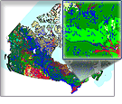
The Ontario Detailed Soil Survey dataset series is at a scale of 1: 50 000 and consists of geo-referenced soil polygons with linkages to attribute data found in the associated Component File (CMP), Soil Names File (SNF) and Soil Layer File (SLF). Together, these datasets describe the spatial distribution of soils and associated landscapes for nearly all agricultural areas in southern Ontario.