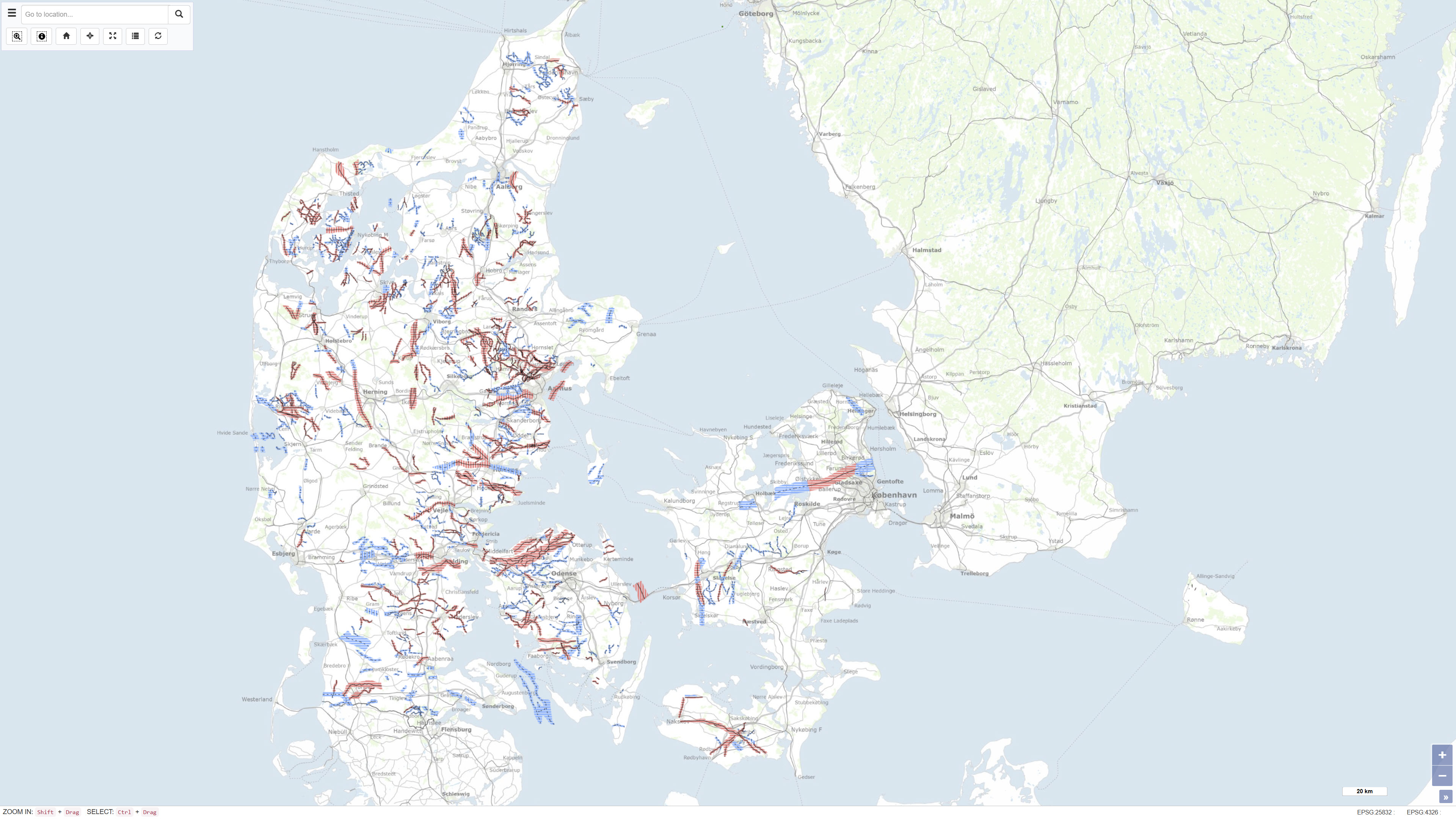
 Arctic SDI catalogue
200000
Type of resources
Available actions
Topics
Keywords
Contact for the resource
Provided by
Years
Formats
Representation types
Update frequencies
status
Scale
-
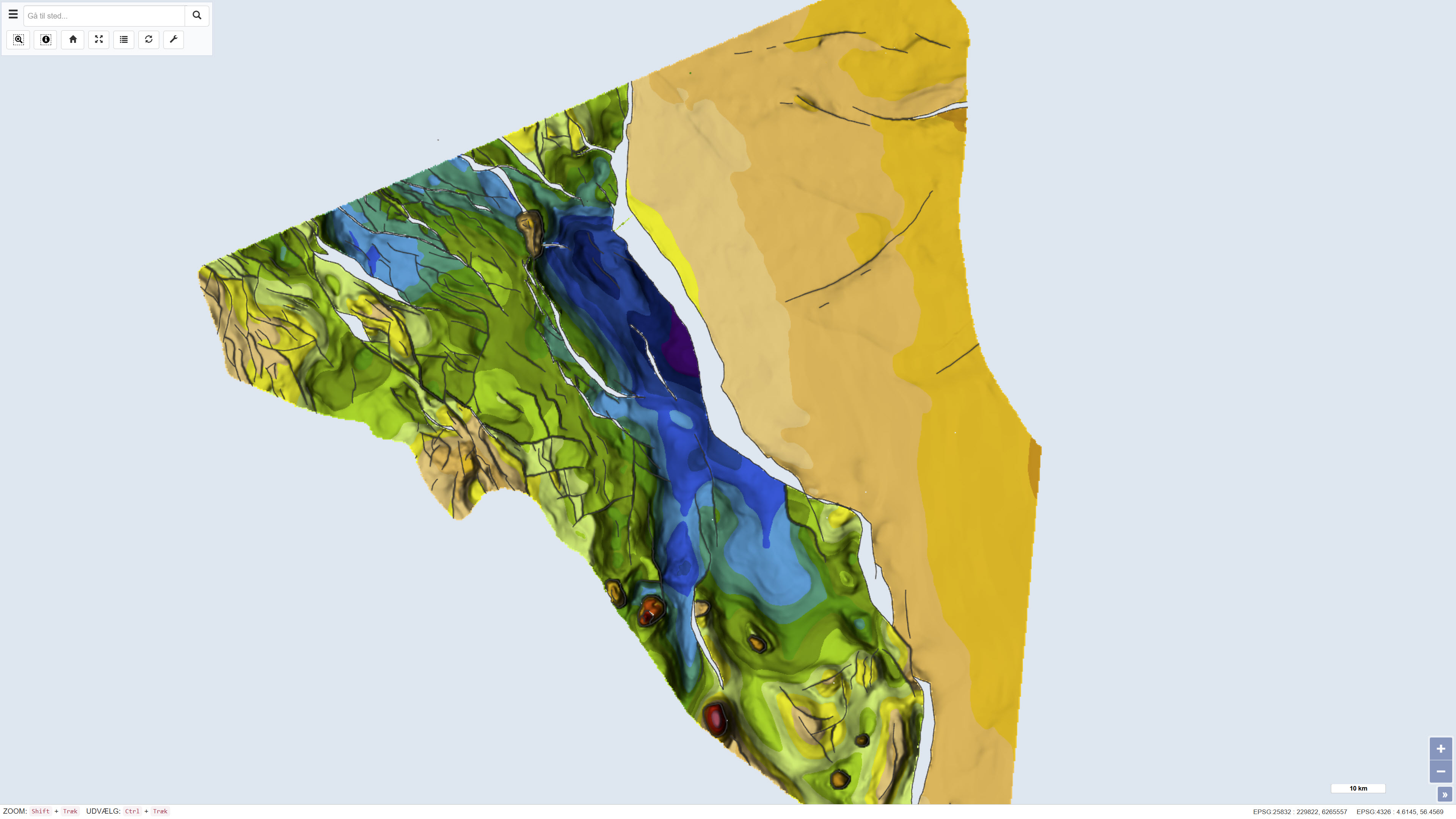
The dataset represents a nationwide mapping of buried valleys in Denmark. The map depicts the occurrence, distribution and general geometry of mapped buried valleys in the Danish subsurface. Buried valleys are elongated depressions in the subsurface that are today fully or partly infilled with younger sediments. In Denmark, the majority of mapped buried valleys are interpreted to have formed during repeated glaciations in the Quaternary period. The valleys are typically 0.5–2 km wide and may reach depths of up to approximately 400 m. The dataset is based on interpretation of geophysical data, primarily TEM and SkyTEM surveys, supplemented by seismic data and borehole information. The mapping provides a national overview of buried valleys and forms a key basis for understanding the geological framework of the subsurface.
-
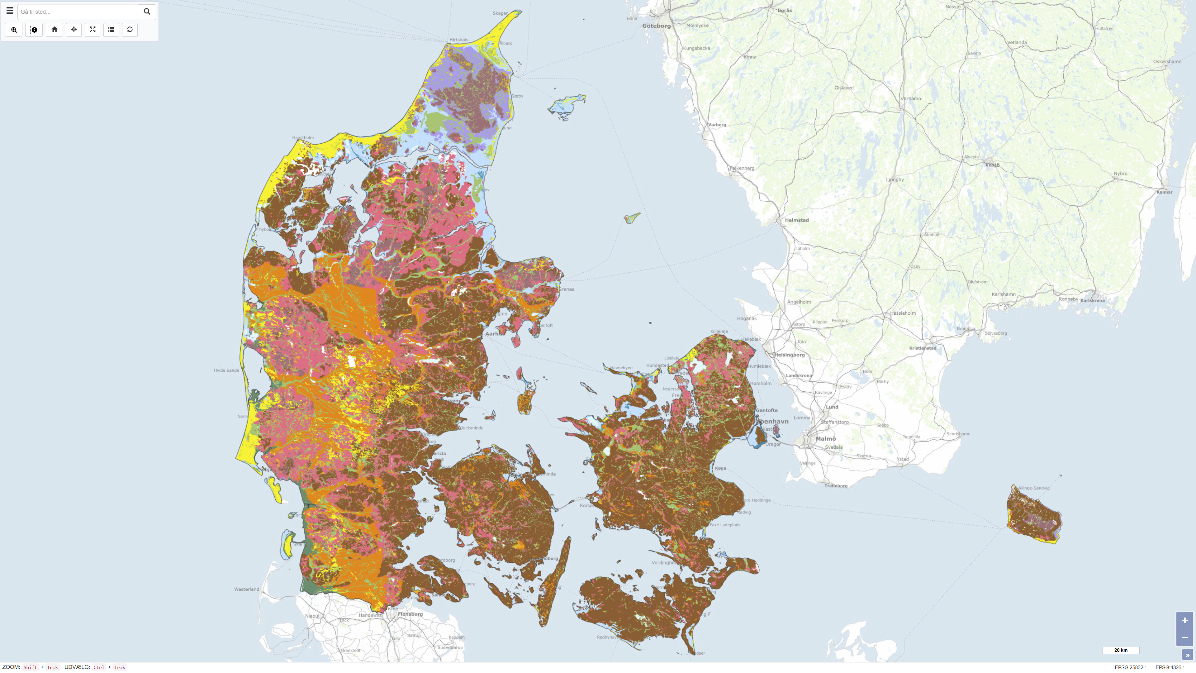
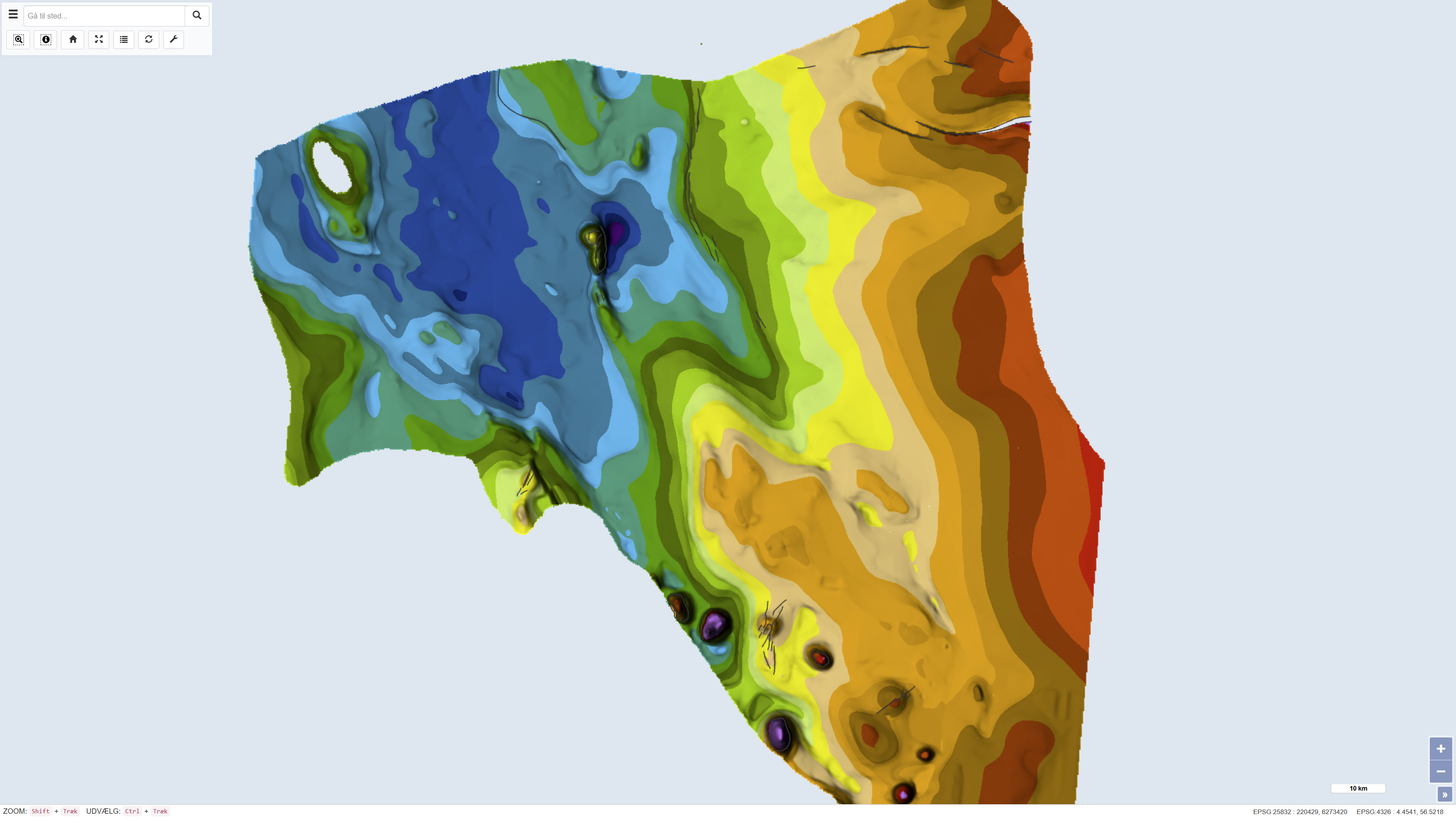
This dataset represents a nationwide digital geological map of superficial deposits in Denmark at a scale of 1:200.000. The map shows the classification and distribution of near-surface deposits, primarily glacial and post-glacial sediments. The dataset is based on the Digital Soil and Sediment Map of Denmark at 1:25.000 in areas where detailed mapping is available. In other areas, the distribution of deposits has been interpreted based on borehole data, landscape analysis and other available geological information. The deposits are classified into 12 generalised types, making the dataset a simplified and generalised version of the detailed 1:25.000 map. The dataset provides a national overview of superficial deposits and serves as a reference for regional and national applications.
-
The dataset comprises a geological map of the Danish Central Graben at a scale of 1:200,000 presenting regional maps of the Base Upper Jurassic and the Upper Jurassic. The map was published in 1995 as part of the DGU Map Series no. 50 and was produced as part of a comprehensive geological mapping of the Danish Central Graben. The mapping is based on regional interpretation of seismic data supplemented by information from boreholes. The map covers the Danish part of the Central Graben and parts of the eastern North Sea, and adjacent areas in the Norwegian, British and German sectors are included in order to define regional structural relationships. The map sheet consists of several thematic sub-maps that together describe the structure and stratigraphy of the area.
-

The dataset comprises a geological map of the Danish Central Graben at a scale of 1:200,000 presenting regional maps of ‘Base Cretaceous’ and the Cromer Knoll Group. The map was published in 1995 as part of the DGU Map Series no. 49 and was produced as part of a comprehensive geological mapping of the Danish Central Graben. The mapping is based on regional interpretation of seismic data supplemented by information from boreholes. The map covers the Danish part of the Central Graben and parts of the eastern North Sea, and adjacent areas in the Norwegian, British and German sectors are included in order to define regional structural relationships. The map sheet consists of several thematic sub-maps that together describe the structure and stratigraphy of the area.
-
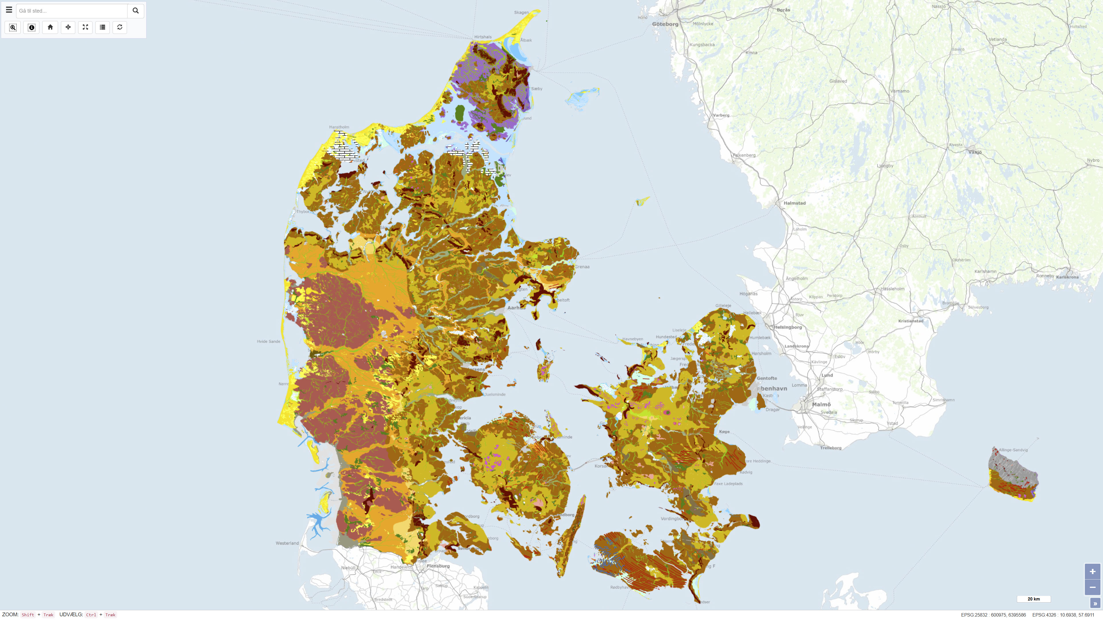
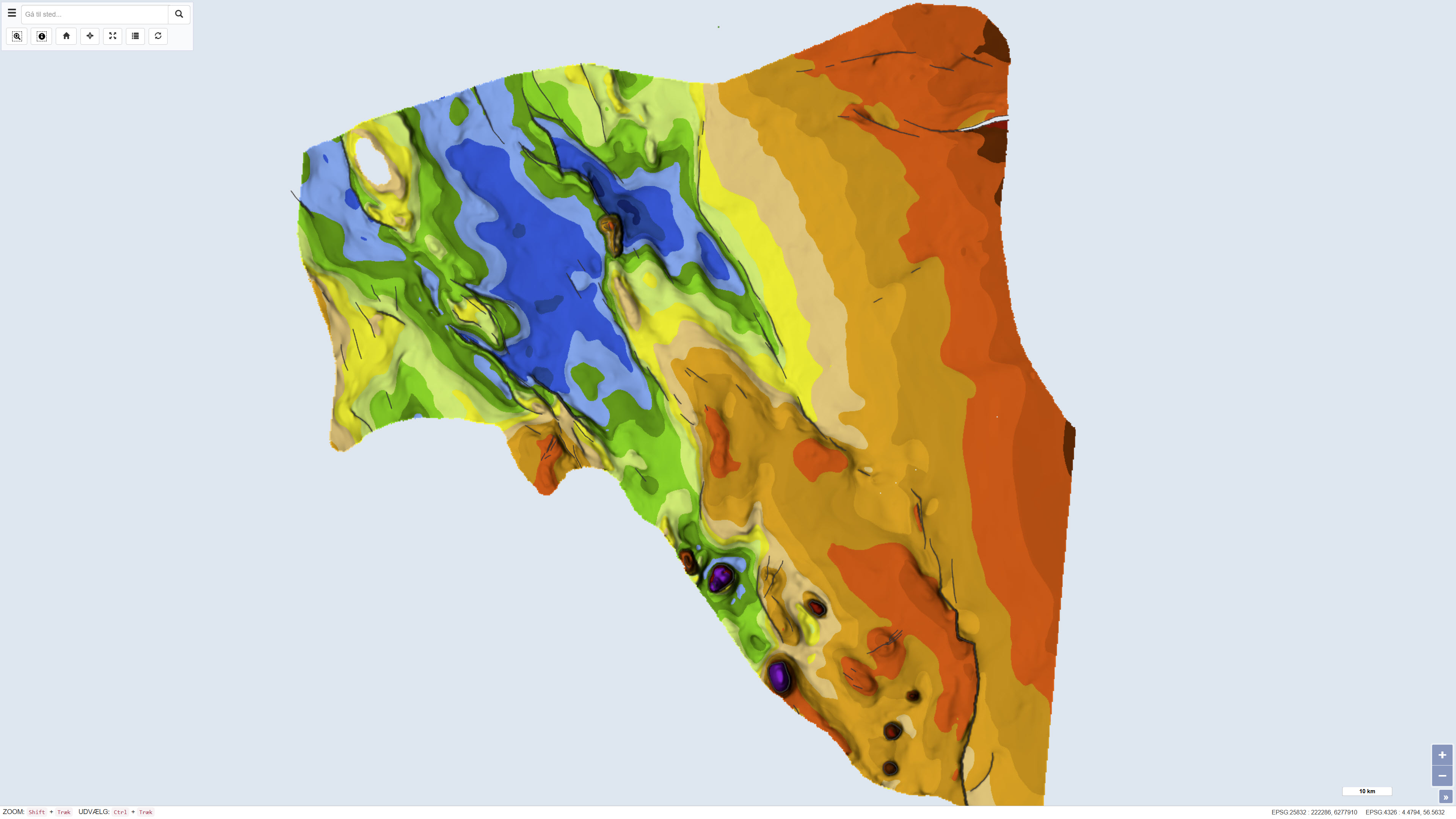
The Geomorphological Map of Denmark, version 3 (2022), depicts landscape types across Denmark at a scale of 1:200.000. The landscape types are defined based on shared geomorphological characteristics that can be related to the processes responsible for their formation. Most landscape types were formed during Quaternary glaciations and by meltwater from the glaciers, while the map also includes post-glacial landscapes such as marine and coastal environments, river valleys, lakes and wetlands, as well as aeolian landforms. The map further reflects landscape features influenced by pre-Quaternary bedrock, including exposed crystalline basement on Bornholm and chalk formations in northern Jutland, as well as surface features related to subsurface structural movements. Anthropogenic landscapes resulting from land reclamation, drainage, excavation, and infilling are also represented. The map is based on systematic geomorphological mapping and interpretation of landforms derived from geological data, terrain analysis and existing cartographic material.
-
The dataset comprises a geological map of the Danish Central Graben at a scale of 1:200,000 presenting regional maps of ‘Top Chalk’ and the Post-Chalk Group in terms of two-way travel time, depth and interval velocity. The map was published in 1995 as part of the DGU Map Series no. 47 and was produced as part of a comprehensive geological mapping of the Danish Central Graben. The mapping is based on interpretation of seismic data supplemented by information from boreholes. The map covers the Danish part of the Central Graben and parts of the eastern North Sea block, and adjacent areas in the Norwegian, British and German sectors are included where data were available in order to define regional structural relationships. The map sheet comprises several thematic sub-maps that together describe regional variations in structure and stratigraphy.
-
The dataset comprises a geological map of the Danish Central Graben at a scale of 1:200,000 presenting regional maps of ‘Base Chalk’ and the Chalk Group in terms of two-way travel time, depth, interval velocity and vertical thickness (isochore). The map was published in 1995 as part of the DGU Map Series no. 48 and was produced as part of a comprehensive geological mapping of the Danish Central Graben. The mapping is based on regional interpretation of seismic data supplemented by information from boreholes. The map covers the Danish part of the Central Graben and parts of the eastern North Sea, and adjacent areas in the Norwegian, British and German sectors are included in order to define regional structural relationships. The map sheet consists of several thematic sub-maps that together describe the structure and stratigraphy of the area.
-
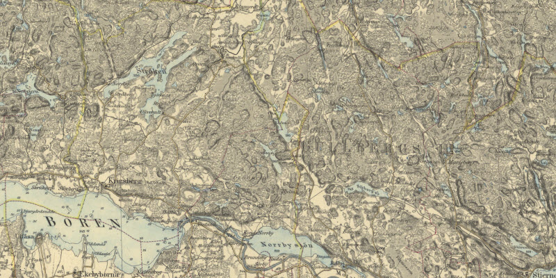
Generalstabskartan (1827–1971) beskriver naturlandskapet inklusive höjdförhållanden, kommunikationer, bebyggelse och översiktlig markanvändning. Skalan är 1:100 000 i Södra verket och 1:200 000 i Norra verket.
-
GE.Jordarter 1:200 000, Västernorrland är en transformerad version av SGUs produkt Jordarter 1:200 000, Västernorrland i syfte att uppfylla Inspire dataspecifikation för tema Geologi genom kodning enligt GeoSciML 4.1. Kartan ger en mycket översiktlig bild av jordartsförhållandena inom de delar av Västernorrlands län där SGU saknar mer detaljerad jordartsinformation. Den kommer successivt att ersättas med jordartskartor i skalområdet 1:25 000 till 1:100 000. Kartan bör användas med stor försiktighet vid analyser och bedömningar av markförhållanden.
-
Kartan ger en mycket översiktlig bild av jordartsförhållandena inom de delar av Västernorrlands län där SGU saknar mer detaljerad jordartsinformation. Den kommer successivt att ersättas med jordartskartor i skalområdet 1:25 000 till 1:100 000. Kartan bör användas med stor försiktighet vid analyser och bedömningar av markförhållanden.