 Arctic SDI catalogue
Science
Type of resources
Categories
Available actions
Topics
Keywords
Contact for the resource
Provided by
Years
Formats
Representation types
Update frequencies
status
Service types
Scale
-
Critical habitat polygons and lines were assembled by SARA regional biologists and recovery teams. They are designed to support the protection and recovery of species listed as Endangered or Threatened under the Species at Risk Act. They are also described and displayed in species’ Recovery Documents and Action Plans. For the complete extent and view of a species' Critical Habitat both Lines and Polygons must be displayed simultaneously. Please note: there are different types of Critical Habitat descriptors. This dataset may use a “bounding box” or "parcel" approach that delineates an area or extent in which the species may be found. Descriptors (such as bounding box coordinates are not included in this dataset).
-
Critical habitat polygons and lines were assembled by SARA regional biologists and recovery teams. They are designed to support the protection and recovery of species listed as Endangered or Threatened under the Species at Risk Act. They are also described and displayed in species’ Recovery Documents and Action Plans. For the complete extent and view of a species' Critical Habitat both Lines and Polygons must be displayed simultaneously. Please note: there are different types of Critical Habitat descriptors. This dataset may use a “bounding box” or "parcel" approach that delineates an area or extent in which the species may be found. Descriptors (such as bounding box coordinates are not included in this dataset).
-
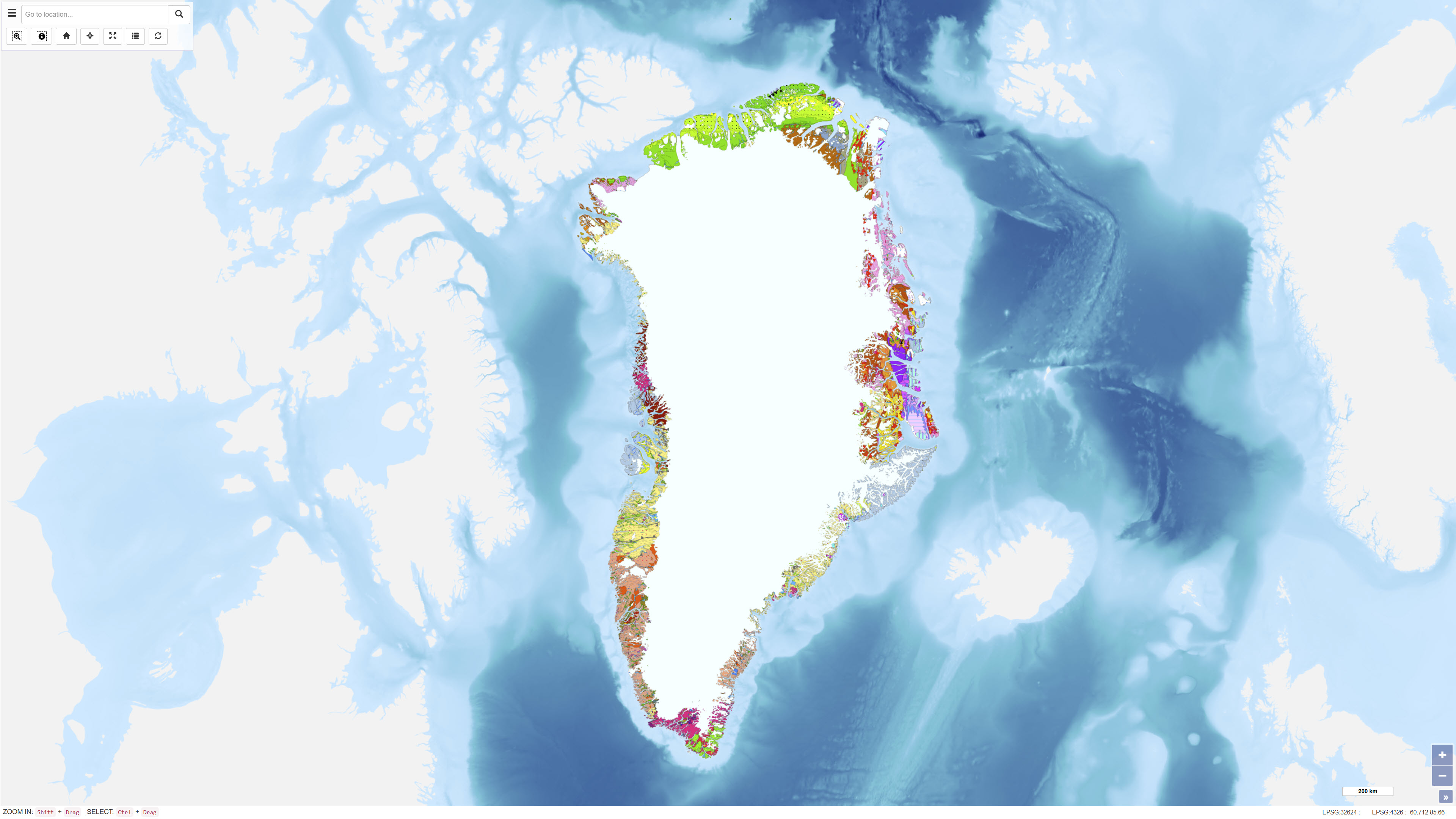
The Geological Map of Greenland at scale 1:2.500.000 provides a comprehensive regional synthesis of the geological evolution of Greenland from the earliest Archaean to the Quaternary. The map presents an integrated overview of Greenland’s geological framework, including Precambrian crystalline basement provinces, major orogenic belts, Phanerozoic sedimentary basins and widespread volcanic provinces. Greenland is characterised by large exposures of continental crust dominated by Archaean and early Proterozoic shield rocks that stabilised as part of the Laurentian shield. Younger geological elements are mainly developed along the margins of the shield, where sedimentation, deformation and magmatic activity reflect successive tectonic regimes through time. The map illustrates the distribution and relationships of these geological units and highlights the structural and stratigraphic architecture of Greenland and adjacent offshore areas. The map integrates onshore and offshore geological information and serves as a regional reference for geological interpretation, research, education and resource-related studies in Greenland.
-
Critical habitat polygons and lines were assembled by SARA regional biologists and recovery teams. They are designed to support the protection and recovery of species listed as Endangered or Threatened under the Species at Risk Act. They are also described and displayed in species’ Recovery Documents and Action Plans. For the complete extent and view of a species' Critical Habitat both Lines and Polygons must be displayed simultaneously. Please note: there are different types of Critical Habitat descriptors. This dataset may use a “bounding box” or "parcel" approach that delineates an area or extent in which the species may be found. Descriptors (such as bounding box coordinates are not included in this dataset).