background
Type of resources
Available actions
Topics
Keywords
Provided by
Formats
Representation types
Update frequencies
status
-

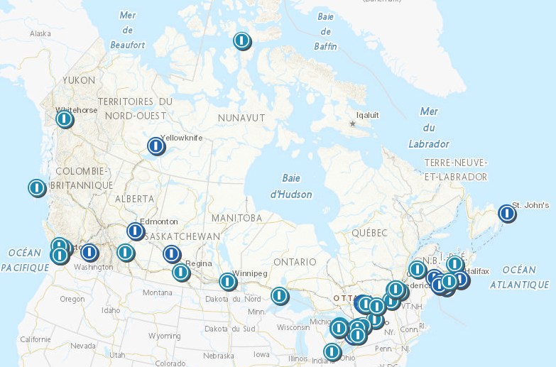
This dataset provides the background radiation dose results from Health Canada’s Canadian Radiological Monitoring Network (CRMN) monitoring sites. More information about the CRMN network can be found on the Health Canada website (see link below). This background radiation data contains both “monitoring” and “transit” dosimeters starting in 2016. The historical background radiation dose data can be found on the Open Data portal. A transit dosimeter is sent along with the monitoring dosimeter to determine if there is a significant dose recorded by the dosimeter while it is in transit to the sampling station. The transit dosimeter is shipped out with a station monitor, and shipped back with the station monitor from the previous quarter. The monitoring dosimeters are deployed over a longer time (around three months) than the transit dosimeters (around 3 weeks). This difference largely explains the lower recorded dose values for the transit dosimeter. The results provided for the monitoring and transit dosimeters are expressed as ambient dose equivalent to a cesium source, in units of millisieverts (mSv). The measured dose rate is reported in mSv/day. The external dose can be attributed almost exclusively to natural radiation (of terrestrial and cosmic origin) with fluctuations based on several factors including location, soil characteristics, and seasonal changes. The map shows the approximate sampling location for each monitoring station. Stations are found within the associated location range.
-

Terrestrial gamma dose rates, reported as ambient dose equivalent in the unit nSv/hr, are presented for the past ninety days to present. Data is measured in real-time, typically from the spectroscopic dosimeters of the Fixed Point Surveillance (FPS) Network. Dosimeter stations of this network are located in population centres and other strategic locations across Canada. Real-time data provides insight into typical levels and fluctuations of radioactivity in the Canadian environment and may provide early detection of sources of radioactivity other than environmental background. As a reference, the Nuclear facilities and uranium mines and mills can be found in the Open Maps catalogue and added to the Real-time Environmental Radioactivity Monitoring map using the "+" (Add layer) button of the viewer’s “Layers” panel. The ESRI REST or WMS links found in the Nuclear facilities and uranium mines and mills metadata record is what’s needed to proceed. These links can be found here: https://open.canada.ca/data/en/dataset/6478153c-829f-4649-bd52-41f63b41021f. The Nuclear facilities and uranium mines and mills dataset provided by the Canadian Nuclear Safety Commission corresponds to nuclear licensees that operate across Canada. This includes uranium mines and mills, uranium processing facilities, nuclear power plants, research reactors, particle accelerators, and nuclear substances processing facilities. All of these facilities are licensed by the CNSC and are subject to strict regulatory oversight to ensure the safety of the public and the environment.
-

[IS] Grunnkort NÁTT var búið til fyrir grunngerð landupplýsinga, ætlunin er að kortið sé notað sem bakgrunnur og skyggi ekki á þau gögn sem lögð eru ofaná. [EN] The NÁTT base map was created for the basic framework of geographic information. The intention is that the map serves as a background and does not overshadow the data placed on top of it.
 Arctic SDI catalogue