 Arctic SDI catalogue
Climate indicators
Type of resources
Topics
Keywords
Contact for the resource
Provided by
Representation types
Update frequencies
status
-
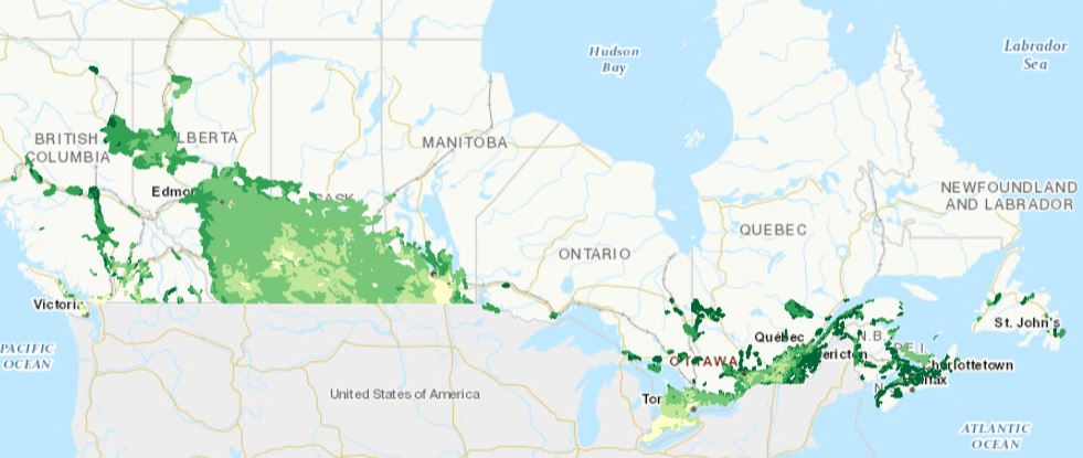
The Agri-Environmental Indicator Soil Cover Days dataset provides a calculation of the amount of time each year that the soil of Canada agricultural lands is covered by a crop, crop residues on its surface, or snow.
-

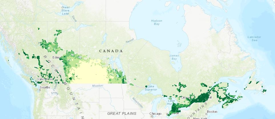
The Agri-Environmental Indicator Soil Organic Matter data series provides a measure of soil health and an estimate of how much carbon dioxide (CO2) has been removed from the atmosphere by plants and sequestered as soil organic carbon (SOC) in agricultural soils.
-
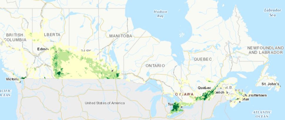
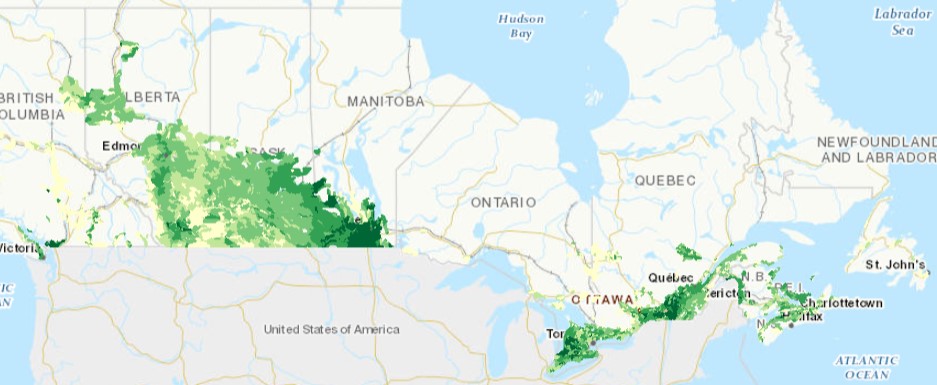
The Agri-Environmental Indicator Soil Erosion Risk dataset provides the estimated risk of soil loss from the combined effects of wind, water, and tillage for Soil Landscapes of Canada agricultural areas for each year since 1981 to 2021.
-

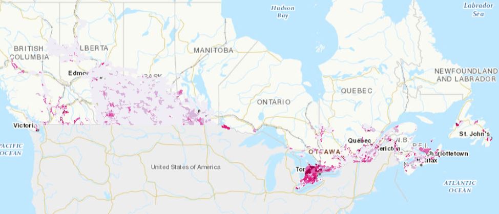
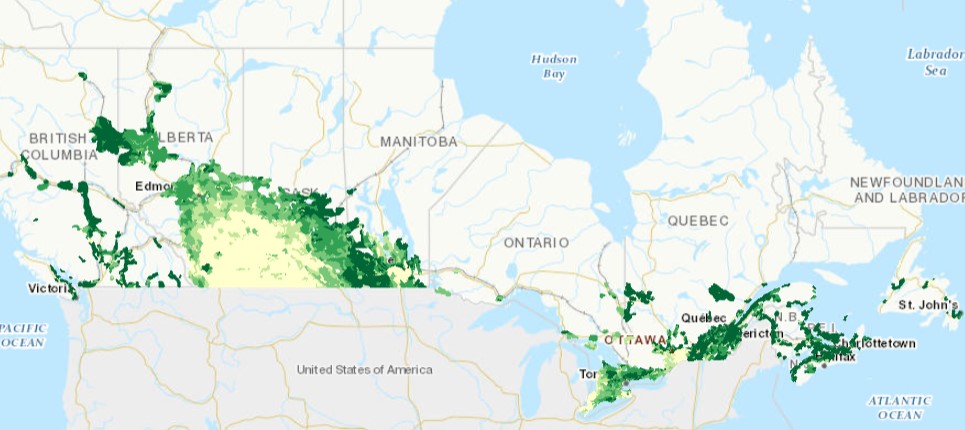
The "Agri-Environmental Indicator Risk of Soil Salinization" dataset estimates the risk of accumulation of soluble salts on agricultural lands in the Canadian Prairies. At high levels, the accumulation of these salts in soil and groundwater in the landscape can inhibit the growth of many plant species.
-
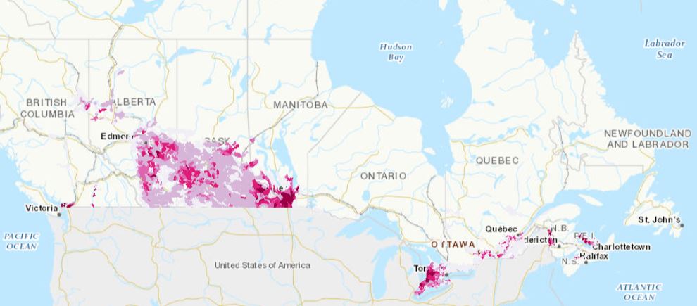
The Agri-Environmental Indicator Risk of Water Contamination by Pesticides dataset reports the annual and semi-decadal status of pesticide transport to surface water, the concentration of pesticide in ground water, and the risk of water contamination by pesticide. Products in this data series present results for predefined areas as defined by the Soil Landscapes of Canada (SLC v.3.2) data series, uniquely identified by SOIL_LANDSCAPE_ID values.
-
The Agri-Environmental Indicator - Agriculture Ammonia Emissions datasets provides estimated amounts of ammonia (NH3) emitted into the atmosphere through agricultural activities. Products in this data series present results for predefined areas as defined by the Soil Landscapes of Canada (SLC v.3.2) data series, uniquely identified by SOIL_LANDSCAPE_ID values.
-
The Agri-Environmental Indicator Particulate Matter dataset provides an estimated net emissions of particulate matter from agricultural lands.
-
The Agri-Environmental Indicator Agricultural Greenhouse gas Budget datasets provide estimated net greenhouse gas emissions due to agricultural activities per hectare of Soil Landscapes of Canada agricultural areas. Products in this data series present results for predefined areas as defined by the Soil Landscapes of Canada (SLC v.3.2) data series, uniquely identified by SOIL_LANDSCAPE_ID values.
-
The Agri-Environmental Indicator Risk of Water Contamination by Coliforms provides two variables including the Soil Coliform Load and the Coliform Risk to Water. The Soil Coliform Load indicator is the estimated accumulation of coliforms on the soil and the Coliform Risk to Water indicator is the relative risk of coliforms getting into the waterways. Products in this data series present results for predefined areas as defined by the Soil Landscapes of Canada (SLC v.3.2) data series, uniquely identified by SOIL_LANDSCAPE_ID values.
-
The Agri-Environmental Indicator Residual Soil Nitrogen (RSN) dataset estimates the amount of nitrogen remaining in the soil at the end of the growing season (after harvest) on Canadian agricultural lands annually.