 Arctic SDI catalogue
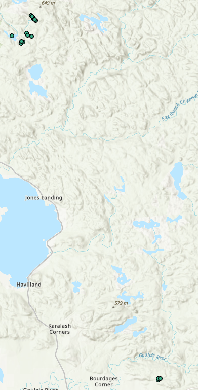
Grands Lacs
Type of resources
Keywords
Contact for the resource
Provided by
Years
Representation types
Update frequencies
status
Service types
-
PURPOSE: Chlorophyll a is a photosynthetic pigment common to aquatic algae, and its measurement can provide an estimate of free-floating algae abundance in an aquatic system. For more than 40 years, the Fisheries and Oceans Canada - Great Lakes Laboratory for Fisheries and Aquatic Sciences (DFO-GLLFAS) office in Sault Ste. Marie Ontario has collected water samples for chlorophyll a spectrophotometric analysis, producing data in the form of mg/m3. The collection of chlorophyll a data was generally conducted to assist in characterizing the aquatic systems level of primary productivity, since that can influence fish abundance. This was a supplementary measure of the quality of fish habitat in these systems for a variety of fish-related projects of relevance to DFO’s mandate. Consistency of data collection was dependent on the duration of each project and funding available. DESCRIPTION: The initial study collected chlorophyll a data from the five lakes in the Turkey Lakes Watershed (TLW – Upper and Lower Batchawana Lakes, Wishart Lake, Little Turkey Lake and Turkey Lake) as well as Quinn Lake which is located outside of the TLW (see Smokorowski et al. 2006) in partnership with Environment and Climate Change Canada (ECCC) and Natural Resources Canada (NRCAN), as part of Canada’s Acid Rain Initiative. The TLW study was established in 1979 to evaluate the impacts of acid rain on terrestrial and aquatic ecosystems. This dataset encompasses chlorophyll a data collected from five lakes in the TLW and Quinn Lake (data also collected by the Canadian Wildlife Service and Environment and Climate Change Canada) from 1983 - 2010 with some gaps of varying duration (Webster et al., 2021). Note that an experimental habitat removal took place in some TLW lakes and Quinn Lake in 1999 and 2000. Specifically, in autumn of 1999, 50% of the coarse woody material was removed from the shorelines of Little Turkey Lake and Quinn Lake, and in autumn of 2000, 50% of the course woody material was removed from Wishart Lake shoreline (details available in Smokorowski et al., 2006). Methods Summary: Sampling was only conducted during the open water season and the frequency and extent of sampling frequency in each waterbody varied and was project- and funding-dependent. There are no chlorophyll a data for the years 1986, 1989 – 1990, 1996 – 1997, 2006-2007 and 2009. Sampling was accomplished by rinsing on site an appropriately-cleaned 1 L, brown-opaque polyethylene bottles at least three times. For hand draw samples, the bottle was immersed sub-surface (less than 0.5 meters) to collect the sample. Composite tube samples were collected using an integrated water sampling tube that collected epilimnion water from the entire water column to a depth of 5 meters. Up to five - 1 L (1000 mL) samples were collected per station and returned to the lab on ice. Each 1 L sample was filtered using glass fiber filters (Whatman GF/C, 42.5 mm) within one day of sampling, and then frozen prior to standard chlorophyll a analysis (American Public Health Association [APHA] 1985). From 1983-1998, Chlorophyll a concentrations (mg/L) was calculated based on APHA 1985; from 1998 to present the calculation was based on APHA (1998). The sample dataset information includes the georeferenced sampling locations, the raw data for chlorophyll a calculations, and the calculated chlorophyll a concentrations using both the APHA (1985) and APHA (1998) methods. This dataset was published in partnership with the Canadian Institute of Ecology and Evolution - Living Data Project, which was funded by a CREATE grant from the Natural Science and Engineering Research Council of Canada. We would like to recognize Caroline Dallstream for her effort in publishing this dataset. SAMPLING METHODS: Methods Summary: Sampling was only conducted during the open water season and the frequency and extent of sampling frequency in each waterbody varied and was project- and funding-dependent. There are no chlorophyll a data for the years 1986, 1989 – 1990, 1996 – 1997, 2006-2007 and 2009. See Sampling was accomplished by rinsing on site an appropriately-cleaned 1 L, brown-opaque polyethylene bottles at least three times. For hand draw samples, the bottle was immersed sub-surface (less than 0.5 meters) to collect the sample. Composite tube samples were collected using an integrated water sampling tube that collected epilimnion water from the entire water column to a depth of 5 meters. Up to five - 1 L (1000 mL) samples were collected per station and returned to the lab on ice. Each 1 L sample was filtered using glass fiber filters (Whatman GF/C, 42.5 mm) within one day of sampling, and then frozen prior to standard chlorophyll a analysis (American Public Health Association [APHA] 1985). From 1983-1998, Chlorophyll a concentrations (mg/L) was calculated based on APHA 1985; from 1998 to present the calculation was based on APHA (1998). The sample dataset information includes the georeferenced sampling locations, the raw data for chlorophyll a calculations, and the calculated chlorophyll a concentrations using both the APHA (1985) and APHA (1998) methods. USE LIMITATION: To ensure scientific integrity and appropriate use of the data, we would encourage you to contact the data custodian.
-

The Great Lakes Migrant Waterfowl Surveys provide periodic data on waterfowl abundance, spatial and temporal distributions, and use along the shorelines of major water bodies and river systems in Ontario during mostly during spring and fall, and to a lesser extent during summer and winter, seasons. The primary survey area covers the shoreline and nearshore (~1km) waters of the Lower Great Lakes region of Ontario, specifically including the St. Lawrence River, Lake Ontario, Niagara River, Lake Erie, Detroit River and Lake St. Clair and associated major marshes and embayments. Aerial surveys, typically flown several times within spring (March –May: 1969, 1971, 1972, 1975 –1979, 1981, 1982, 1984 –1988, 1991 –1996, 1998 –2003 & 2009 –2011) and fall (September –December: 1968, 1970, 1971, 1974 –2003 & 2009 –2011) survey periods, have been conducted periodically on a relatively regular basis (approx. 5-10 years) along the Lower Great Lakes shorelines between 1968 and 2011. Smaller-scale surveys also have been conducted periodically during summer (June –August: 1968 –1970, 1972, 1974, 1975, 1977, 1982, 1984, 1986, 1989, 1999 & 2002) in this region. This survey often has been conducted in conjunction with the Midwinter Survey, so its data (up to 2004) also are included in the CWS Migrant Waterfowl Surveys database (Year ≥2004 & Month = January & February).Data from several aerial surveys conducted periodically during the non-breeding period outside the Lower Great Lakes region also are included in this database. Spring and fall surveys have been conducted along the shorelines and nearshore waters of the Upper Great Lakes region of Ontario, specifically at St. Clair River (Fall 2012 & 2013), Lake Huron (Fall 1973, 1996; Spring 1974) / Georgian Bay (Fall 1973, 1996, 2012 & 2013) & Lake Superior (Fall 2000). Aerial surveys also have been conducted inland in southeastern Ontario along the Rideau River (Fall 1998 & Spring 1999).
-

The Great Lakes Fish Biodiversity Science Database is a compilation of fish community and habitat data from DFO Science surveys, primarily related to freshwater fishes of conservation concern in the Great Lakes basin. Data include: sampling site location, date, fish species and counts, and associated habitat information. Project-specific details including purpose/objectives and study methodology are often reported in the DFO Canadian data report of fisheries and aquatic sciences series.
-

Water quality and ecosystem health data used to conduct a cumulative effects assessment of Canadian Great Lakes nearshore waters in support of the Great Lakes Water Quality Agreement are included in this dataset. The data was collected by various government and non-government agencies and organizations and integrated into this dataset to allow the assessment to be conducted. By conducting a regular, systematic assessment of cumulative effects in the nearshore waters of the Great Lakes Environment and Climate Change Canada (ECCC) is able to identify areas of high quality and areas under stress. Knowledge of ecological thresholds, other Great Lakes assessments, stressor information, indicators and local and traditional ecological knowledge will be used to aid in: 1) the identification and mapping of high quality nearshore areas and areas that are or may become subject to high stress and; 2) the determination of factors and cumulative effects that are causing stress or threats. Cumulative effects impacting the nearshore and future threats to areas of high ecological value will be better understood and the knowledge shared will assist in priority setting for science and management at a meaningful and practical spatial scale within each Great Lake and connecting channel.
-

This dataset contains the Great Lakes Shoreline Ecosystem (GLSE) inventory, which is a geospatial digital inventory of: * ecosite polygon mapping * field survey calibration points * associated ground level ecological data It replaces Great Lakes Shoreline Ecosystem mapping products versions 1.0 and 2.0. It is an update to those products and includes the data and information contained in them but now includes data and information for the entire Canadian side of the Great Lakes shoreline including connecting channels, from the land to water or wetland interface to two kilometers inland. Mapping and ground sampling adheres to the Great Lakes Shoreline Ecosystem classification system, (Lee et. al., in prep.) which is a detailed ecological classification and surveying method.
-
WMS service maintained by ECCC. Map of Upper Intertidal shoreline segmentation with Shoreline Cleanup Assessment Teams (SCAT) classification. Segmentation covers shorelines for Northern Canada, the North coast of British Columbia, as well as Ontario, QC, and Atlantic regions.
-
WMS service maintained by ECCC. Map of Upper Intertidal shoreline segmentation with Shoreline Cleanup Assessment Teams (SCAT) classification. Segmentation covers shorelines for Northern Canada, the North coast of British Columbia, as well as Ontario, QC, and Atlantic regions.