 Arctic SDI catalogue

heather.mcgrath@NRCan-RNCan.gc.ca
Type of resources
Available actions
Topics
Keywords
Contact for the resource
Provided by
Formats
Representation types
Update frequencies
status
-
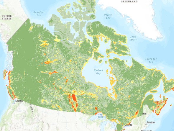
This national map of flood susceptibility or flood prone areas is based on patterns of historic flood events as predicted by an ensemble machine learning model. The recommended use is national, provincial or regional scale and can be used as a guide for identifying areas for further investigation. The Flood Susceptibility Index (FSI) Dataset, while processed and available at 30m cell size, is not recommended for use at the pixel or street level, given the uncertainty in the modelling process and the variability of results as discussed in https://www.mdpi.com/2673-4931/25/1/18 . For additional details on the methods, tests, models and datasets used to generate this data layer, please see https://geoscan.nrcan.gc.ca/starweb/geoscan/servlet.starweb?path=geoscan/fulle.web&search1=R=329493