 Arctic SDI catalogue
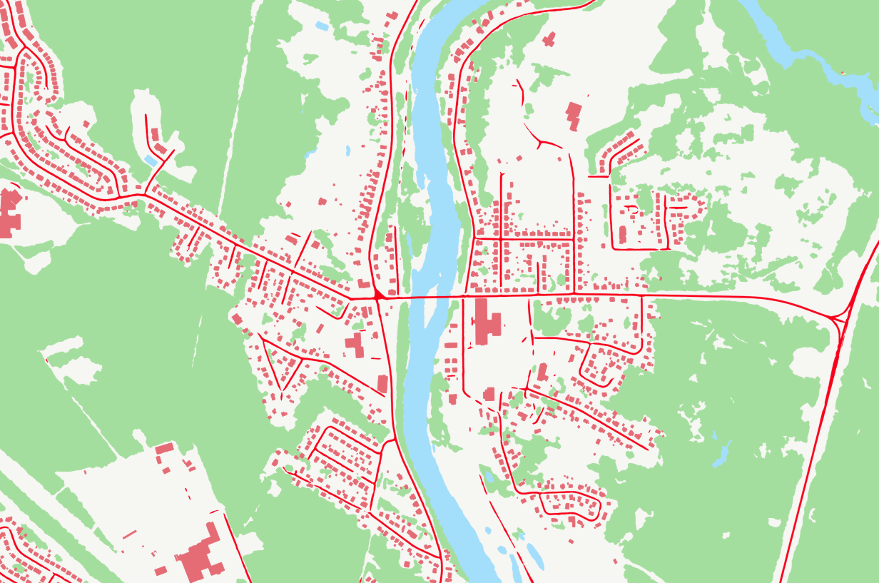
Bâtiments
Type of resources
Available actions
Keywords
Contact for the resource
Provided by
Years
Representation types
Update frequencies
status
Service types
-

**Note that topographic maps at a scale of 1/100,000 are no longer updated. For the latest update date, see the [metadata] (ftp://transfert.mern.gouv.qc.ca/public/diffusion/RGQ/Documentation/BDAT/Metadonnees_BDAT100k_NordSud.xls). The reference map data is now constituted using a continuous information layer approach: ** * [AQNetwork+] (https://www.donneesquebec.ca/recherche/fr/dataset/adresses-quebec) * [Quebec Hydrographic Network Geobase (GRHQ)] (https://www.donneesquebec.ca/recherche/dataset/grhq) * [Administrative divisions on a scale of 1/20,000 (SDA)] (https://www.donneesquebec.ca/recherche/fr/dataset/decoupages-administratifs) * [Regional Coherent Hydro Digital Terrain Models (RTM)] (https://www.donneesquebec.ca/recherche/fr/dataset/modeles-numerique-de-terrain-hydro-coherents-a-l-echelle-regionale) ___ Topographic maps at a scale of 1/100,000 offer an overview of the occupation of Quebec territory at a scale of 1/100,000. A series in the south (266 sheets) and a series in the north (151 sheets) of the 53rd parallel cover the majority of Quebec. The data is less than 10 meters accurate and each file covers an area of approximately 4,000 km2, equivalent to 16 sheets at [a scale of 1/20,000] (https://www.donneesquebec.ca/recherche/fr/dataset/cartes-topographiques-a-l-echelle-de-1-20-000 “Topographic maps at a scale of 1/20,000”). Main components: * Hydrography (lakes of more than three hectares, permanent watercourses, swamps, etc.). * Vegetation (wooded areas and peatlands of more than 13 hectares). * The constructions of man: * transport infrastructures (passable roads, bridges, airports, etc.); * buildings larger than 12,500 m2; * equipment and designated areas. * The relief (level curves at an equidistance of 20 meters and elevation points). ##### Special features of the series south of the 53rd parallel * The data is obtained by generalizing map data at a scale of 1/20,000. Between the 51st and 53rd parallel, they are extracted from SPOT satellite imagery at 10 meters of resolution. * The data formats available for this series are: * ArcInfo cover (vector); * GeoTIFF, CCL projection (matrix); * GeoTIFF, MTM projection (matrix); * PDF (matrix). ##### Special features of the series north of the 53rd parallel * The data is obtained by generalizing cartographic data from Natural Resources Canada (CanVec product) at a scale of 1:50,000. Multi-source data, namely data from Adresses Québec, data on airports and hydrobases from the Ministère des Transports du Québec, and data on reservoirs from Hydro-Québec, increase the quality of this cartographic product on a scale of 1/100,000. * The data format available for this series is: * FGDB (vector).**This third party metadata element was translated using an automated translation tool (Amazon Translate).**
-
**Note that topographic maps at a scale of 1/20,000 are no longer updated. For the latest update date, see the [metadata] (ftp://transfert.mern.gouv.qc.ca/public/diffusion/RGQ/Documentation/BDTQ/Metadonnees_Topo-20K.xls). The reference cartographic data is now constituted according to a continuous information layer approach: ** * [AQNetwork+] (https://www.donneesquebec.ca/recherche/fr/dataset/adresses-quebec) * [Quebec Hydrographic Network Geobase (GRHQ)] (https://www.donneesquebec.ca/recherche/dataset/grhq) * [Administrative divisions on a scale of 1/20,000 (SDA)] (https://www.donneesquebec.ca/recherche/fr/dataset/decoupages-administratifs) * [Regional Coherent Hydro Digital Terrain Models (RTM)] (https://www.donneesquebec.ca/recherche/fr/dataset/modeles-numerique-de-terrain-hydro-coherents-a-l-echelle-regionale) * [Quebec framework for buildings] (https://www.donneesquebec.ca/recherche/dataset/referentiel_bati) *** Topographic maps at a scale of 1/20,000 are the official cartographic base of the Government of Quebec. They cover almost all of the territory south of the 52nd parallel. The data is extracted from aerial photographs at a scale of 1:40,000 taken at an altitude of 6,300 meters. They offer an accuracy of approximately four meters in planimetry. In hypsometry, it is about two meters for dimensional points and about five meters for level curves. Each file covers an area of approximately 250 km2. The main components are: * Hydrography (lakes, rivers, streams, swamps, etc.). * Vegetation (forests, peatlands, nurseries, orchards, etc.). * The constructions of man: * transport infrastructure (roads, bridges, airports, etc.); * buildings (mobile homes, silos, greenhouses, etc.); * equipment (docks, electrical power transmission lines, surface tanks, etc.); * designated areas (golf courses, loan benches, etc.) * The relief (the level curves are generally at an equidistance of ten meters and, in some cases, they can vary between eight and twenty meters).**This third party metadata element was translated using an automated translation tool (Amazon Translate).**
-
Service de mise à disposition des planches cadastrales vecteurs
-

Temporal analysis of changes in the Iqaluit region, Nunavut, based on GeoAI features automatically extracted from satellite images acquired in 2012 and 2022. Simple geospatial analysis intersecting GeoAI multidate building features enables the detection of buildings observed in 2022 that were not detected in 2012. The addition of new buildings is a good indicator of urban development and/or sprawl. GeoAI enables temporal coverage of various areas in Canada, thus providing a useful tool for change detection and trend analysis at high resolution. While the series is still fairly new, and such examples are limited for the time being, NRCan strives to gradually increase its GeoAI data offering for both spatial and temporal coverage. For more information about the GeoAI - GeoBase Series, please visit the following link: https://open.canada.ca/data/en/dataset/74738ff5-5367-5958-9aee-98fffdcd1876
-
Topographic mapping of northern indigenous villages is available for 23 villages. It was produced by photogrammetric method, from aerial photographs taken between 2009 and 2011. The accuracy of this mapping is of the order of ±40 centimeters in planimetry. In hypsometry, it is ±50 centimeters for dimensional points and ±1 meter for level curves. This precision may vary locally. The main components are: * Hydrography (body of water, watercourse, etc.); * Communication routes and road and airport infrastructures (road, bridge, airport, etc.); * Buildings and various structures (building, wharf, surface reservoir, etc.); * Vegetation; * Geomorphology; * Level curves at an equidistance of 2 meters; * The points listed. The following villages are available: * Akulivik; * Aupaluk; * Chisasibi; * Eastmain; * Inukjuak; * Ivujivik; * Kangiqsualujjuaq; * Kangiqsujuaq; * Kangirsuk; * Kawawachikamach; * Kuujjuaq; * Kuujjuarapik-Whapmagoostui; * Mistisini; * Nemaska; * Ouje-Bougoumou; * Puvirnituq; * Quaqtaq; * Hello; * Tasiujaq; * Umiujaq; * Waskaganish; * Waswanipi; * Wemindji.**This third party metadata element was translated using an automated translation tool (Amazon Translate).**
-

Temporal analysis of changes in Winnipeg, Manitoba, based on GeoAI features automatically extracted from satellite images acquired in 2013 and 2023. Simple geospatial analysis enables the detection of features present in 2023 that were not already there in 2013. The addition of new buildings is a good indicator of urban development and/or sprawl. Complementarily, an analysis of changes in the forest coverage from the GeoAI datasets is done. This analysis reflects the gains and losses between both dates. GeoAI enables temporal coverage of various areas in Canada, thus providing a useful tool for change detection and trend analysis at high resolution. While the series is still fairly new, and such examples are limited for the time being, NRCan strives to gradually increase its GeoAI data offering for both spatial and temporal coverage. For more information about the GeoAI - GeoBase Series, please visit the following link: https://open.canada.ca/data/en/dataset/74738ff5-5367-5958-9aee-98fffdcd1876
-

Temporal analysis of changes in Trois-Rivières, Québec, based on GeoAI features automatically extracted from satellite images acquired in 2013 and 2021-22. Simple geospatial analysis intersecting Statistics Canada's Open Database of Buildings, version 3 (ODB v3) with GeoAI multidate building features enables the detection of buildings observed in 2021-22 that were not detected in 2013. The addition of new buildings is a good indicator of urban development and/or sprawl. GeoAI enables temporal coverage of various areas in Canada, thus providing a useful tool for change detection and trend analysis at high resolution. While the series is still fairly new, and such examples are limited for the time being, NRCan strives to gradually increase its GeoAI data offering for both spatial and temporal coverage. For more information about the GeoAI - GeoBase Series, please visit the following link: https://open.canada.ca/data/en/dataset/74738ff5-5367-5958-9aee-98fffdcd1876
-

Temporal analysis of changes for Victoria, British Columbia, based on GeoAI features automatically extracted from satellite images acquired in the 2000s, 2010s and 2020s. Simple geospatial analysis intersecting Statistics Canada's Open Database of Buildings, version 3 (ODB v3) with GeoAI multidate building features enables the detection of buildings observed in the 2000s, 2010s and 2020s. The addition of new buildings is a good indicator of urban development and/or sprawl. Using the same approach, GeoAI multidate roads enable the detection of Statistics Canada's National Roads Network (NRN) segments present in the 2000s, 2010s and 2020s. The development of new roads is also indicator of urban development and/or sprawl. Complementarily, an analysis of changes in the forest coverage from the GeoAI datasets is done between the 2000s and the 2020s. This analysis reflects the gains and losses between both dates. GeoAI enables temporal coverage of various areas in Canada, thus providing a useful tool for change detection and trend analysis at high resolution. While the series is still fairly new, and such examples are limited for the time being, NRCan strives to gradually increase its GeoAI data offering for both spatial and temporal coverage. For more information about the GeoAI - GeoBase Series, please visit the following link: https://open.canada.ca/data/en/dataset/74738ff5-5367-5958-9aee-98fffdcd1876
-

Temporal analysis of changes in Quebec city based on GeoAI features automatically extracted from satellite images acquired in 2006 and 2022. Simple geospatial analysis enables the detection of features present in 2022 that were not already there in 2006. The addition of new buildings is a good indicator of urban development and/or sprawl. GeoAI enables temporal coverage of various areas in Canada, thus providing a useful tool for change detection and trend analysis at high resolution. While the series is still fairly new, and such examples are limited for the time being, NRCan strives to gradually increase its GeoAI data offering for both spatial and temporal coverage. For more information about the GeoAI - GeoBase Series, please visit the following link: https://open.canada.ca/data/en/dataset/74738ff5-5367-5958-9aee-98fffdcd1876
-
GeoAI are buildings, hydrography, forests, and roads automatically extracted using Deep Learning models applied to a source dataset, typically aerial or satellite images. The primary aim of GeoAI is to increase Canada's availability of high-resolution foundational geospatial data for both spatial and temporal coverage. The infrastructure and expertise put in place by NRCan enables a rapid, efficient, and scalable data creation process through the use of leading-edge technology and Artificial Intelligence models. Published datasets for a given source can be revisited at a later date as more accurate models are developed and put into production. For now, only static files are available, but as the series develops, new products and services will be added. Several use cases of GeoAI data for change detection have been created. To view them, please follow the links below: - Iqaluit: https://open.canada.ca/data/en/dataset/ef29513d-a007-408c-beba-65f86e7b5b01 - Calgary: https://open.canada.ca/data/en/dataset/bd07b597-5166-4b62-ae9c-245b3c62ea03 - Québec City: https://open.canada.ca/data/en/dataset/4026720e-f7fb-478e-a58f-c62ebe20005d - Winnipeg: https://open.canada.ca/data/en/dataset/a6874aac-cfcd-4b92-bb3f-6031eedb5b57 - Victoria: https://open.canada.ca/data/en/dataset/f011c7b9-f79e-42f8-9481-9bf9788bb189 - Trois-Rivières: https://open.canada.ca/data/en/dataset/2b11a323-52c2-43d5-9c09-bc4b15b1bcc8