 Arctic SDI catalogue
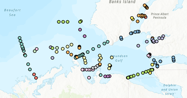
Mollusks
Type of resources
Topics
Keywords
Contact for the resource
Provided by
Formats
Representation types
Update frequencies
status
-

PURPOSE: The objective of the sea scallop survey is to obtain fishery independent data on the abundance, size distribution and location of scallops in the southern Gulf of St. Lawrence and to provide science advice on stock status to fishery managers, decision makers and industry stakeholders. DESCRIPTION: The sea scallop research survey is conducted on CCGS MPerley (or chartered vessels) and has stratified random sampling. For each tow (or sample), data is recorded on tow, all specimens caught, geolocation, shell height frequency and biological samples. This monitoring program is currently on-hold. It will resume if a survey is deemed necessary to provide a new or updated science advice in the future. Stock status is currently (2024) in the critical zone. Rebuilding plan to follow. PARAMETERS COLLECTED: Catch number (biological), catch weight (biological), individual lengths (biological), age (biological), meat weight (biological). PHYSICAL SAMPLE DETAILS: A sub-sample of scallop shells is retained and analysed for age determination in the lab. SAMPLING METHODS: From 2012 to 2016, an annual, rotational, multispecies research survey program for scallop in the sGSL was conducted to obtain fishery independent indices of abundance, biomass estimates, and biological characteristics information (shell height, meat weight, sex, clappers). One section of a SFA or the SFA in its entirety was surveyed per year, with the exception of SFA 23 which was excluded because of the low scallop fishing effort reported from this area in recent years. From 2019 to 2023, annual surveys were conducted on the three major beds in the Northumberland Strait (West Point and Cape Tormentine in SFA 22, Pictou in SFA 24), using a similar methodology as the previous surveys. Methodology can be found in the Science Advisory Report and the Research Document listed in the citations list. USE LIMITATION: To ensure scientific integrity and appropriate use of the data, we would encourage you to contact the data custodian.
-

From August 6th to September 9th, 2014, Fisheries and Oceans Canada conducted a baseline survey of marine fishes and their habitats on the Canadian Beaufort Shelf and slope. Sampling was conducted from the F/V Frosti at 56 stations along thirteen transects, with an additional three stations not located on transects. Standardized sampling was conducted on the transects at pre-determined depth stations (20-40, 75, 200, 350, 500, 750, and 1000 m) using a variety of sampling equipment including benthic fishing trawls, plankton nets, sediment cores, and CTD and water sample profiles. Presented here is the information on the sampling locations, and the sampling gear deployed at each station.
-
PURPOSE: The Department of Fisheries and Oceans (DFO) conducted a baseline survey of biological communities and habitat parameters in the offshore Canadian Beaufort Sea between 2012 and 2014, as part of the federally administered Beaufort Regional Environmental Assessment. The BREA-Marine Fishes Project (BREA-MFP) was the first comprehensive baseline study of offshore marine fish diversity and associated habitats in the Canadian Beaufort Sea. Knowledge gained during the BREA-MFP supports regulatory processes pertaining to offshore development and Oceans Management in the Inuvialuit Settlement Region, and provides baseline context for studies of the effects of climate change and variability. The Canadian Beaufort Sea – Marine Ecosystem Assessment (CBS-MEA, 2017-2019 and 2021-2024) is building on system baselines and ecological knowledge derived from the BREA-MFP to develop a comprehensive research and monitoring approach for the offshore Canadian Beaufort Sea. This approach will enable us to better understand the relationship between oceanographic drivers and ecosystem responses. The CBS-MEA focuses on integrating oceanography, food web linkages, physical-biological couplings and spatial and inter-annual variabilities, while also expanding baseline coverage of species diversity, abundances, and habitat associations to areas of the Beaufort Sea and Canadian Archipelago that are previously unstudied in this context. DESCRIPTION: Between 2017 and 2019, and between 2021 and 2024, Fisheries and Oceans Canada conducted a baseline survey of marine fishes and their habitats on the Canadian Beaufort Shelf and slope in August and early September each year. Sampling was conducted from the F/V Frosti at over 150 stations along ten multi-year transects, and over 50 non-transect stations. Standardized sampling was conducted at pre-determined depth stations (20-40, 75, 200, 350, 500, 750, and 1000 m) using a variety of sampling equipment including benthic fishing trawls, plankton nets, sediment cores, and CTD and water sample profiles. Presented here is the information on the sampling locations, and the sampling gear deployed at each station.