 Arctic SDI catalogue
Photogrammetry
Type of resources
Topics
Keywords
Contact for the resource
Provided by
Formats
Representation types
Update frequencies
status
Scale
-
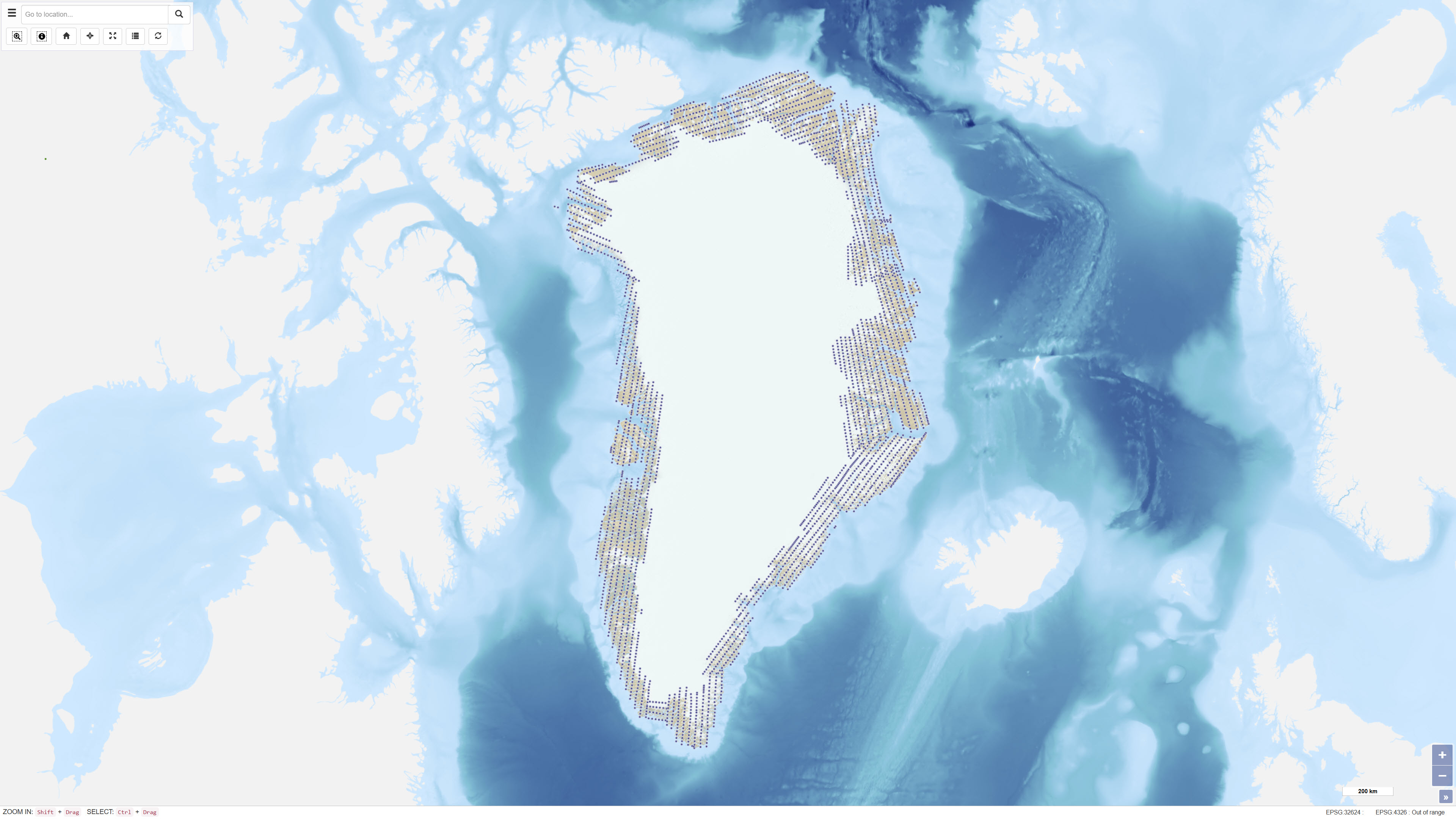
Uniform vertical aerial photographic coverage of Greenland was achieved between 1978 and 1987 at a scale of 1:150.000 by Mark Hurd Aerial Surveys, Inc., Minneapolis, Minnesota, U.S.A., on behalf of the Danish Geodetic Institute. The photography provided systematic nationwide coverage and formed a fundamental reference dataset for mapping and geodetic purposes. The black-and-white photographs were acquired using a Wild RC-10 camera equipped with a super wide-angle lens (focal length 88 mm). The aircraft used was a Gates Learjet 25C, flying at approximately 14 km altitude to achieve the image scale of 1:150.000. To minimise blind areas caused by steep mountain slopes in combination with the wide-angle lens, photographs were acquired with 80% forward overlap and 40% side overlap. Photo centre coordinates were established through aerotriangulation performed by the Danish Geodata Agency. The dataset has subsequently been used for mapping, aerotriangulation and scanning applications.