 Arctic SDI catalogue
Dataset
Type of resources
Available actions
Topics
Keywords
Contact for the resource
Provided by
Formats
Representation types
Update frequencies
status
Scale
-
Nationwide geophysical database for environmental and raw material data, also known as GERDA (GEophysical Relational DAtabase). The database contains various types of geophysics, including geoelectrics, electromagnetics, borehole logs and seismic. All data is freely available for download on the GEUS website. The database is updated continuously.
-

The dataset consists of three different datasets with combined place names in various geological maps: Geological map of Greenland 1:2.500.000, Geological maps of Greenland 1:500.000 and Topographic map of Greenland 1:250.000. The dataset has not been updated or maintained since 2014.
-
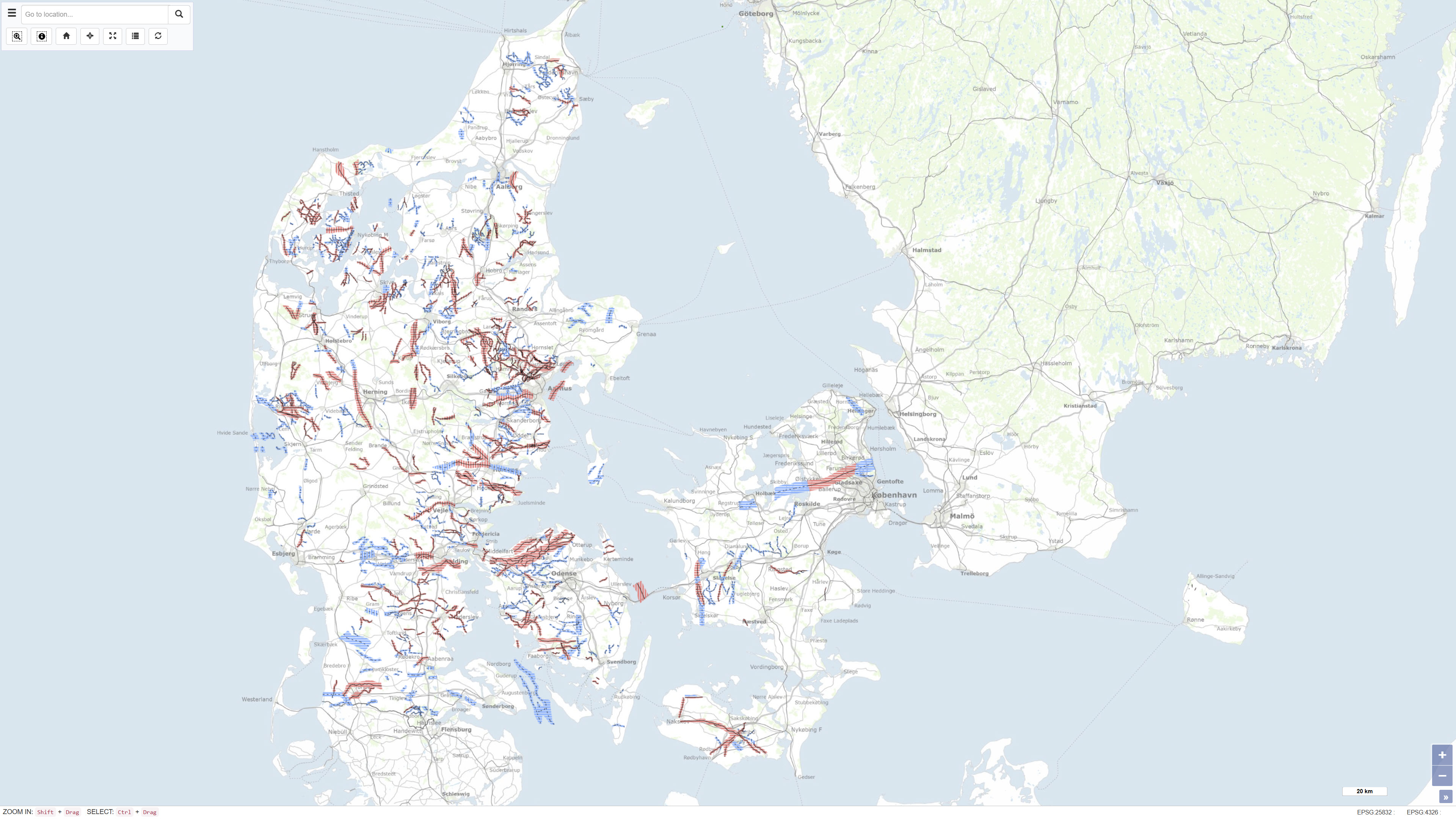
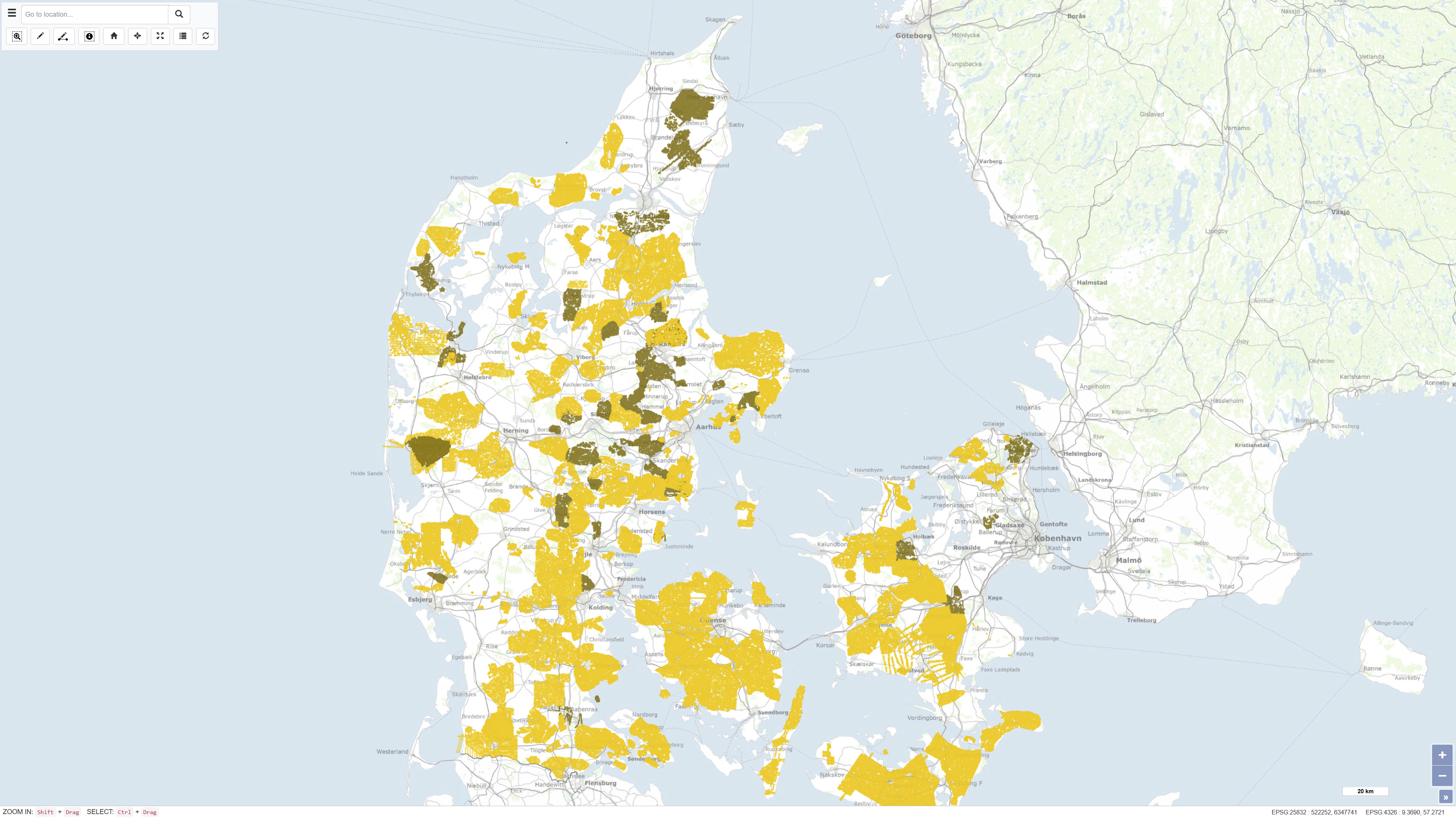
The dataset represents a nationwide mapping of buried valleys in Denmark. The map depicts the occurrence, distribution and general geometry of mapped buried valleys in the Danish subsurface. Buried valleys are elongated depressions in the subsurface that are today fully or partly infilled with younger sediments. In Denmark, the majority of mapped buried valleys are interpreted to have formed during repeated glaciations in the Quaternary period. The valleys are typically 0.5–2 km wide and may reach depths of up to approximately 400 m. The dataset is based on interpretation of geophysical data, primarily TEM and SkyTEM surveys, supplemented by seismic data and borehole information. The mapping provides a national overview of buried valleys and forms a key basis for understanding the geological framework of the subsurface.
-
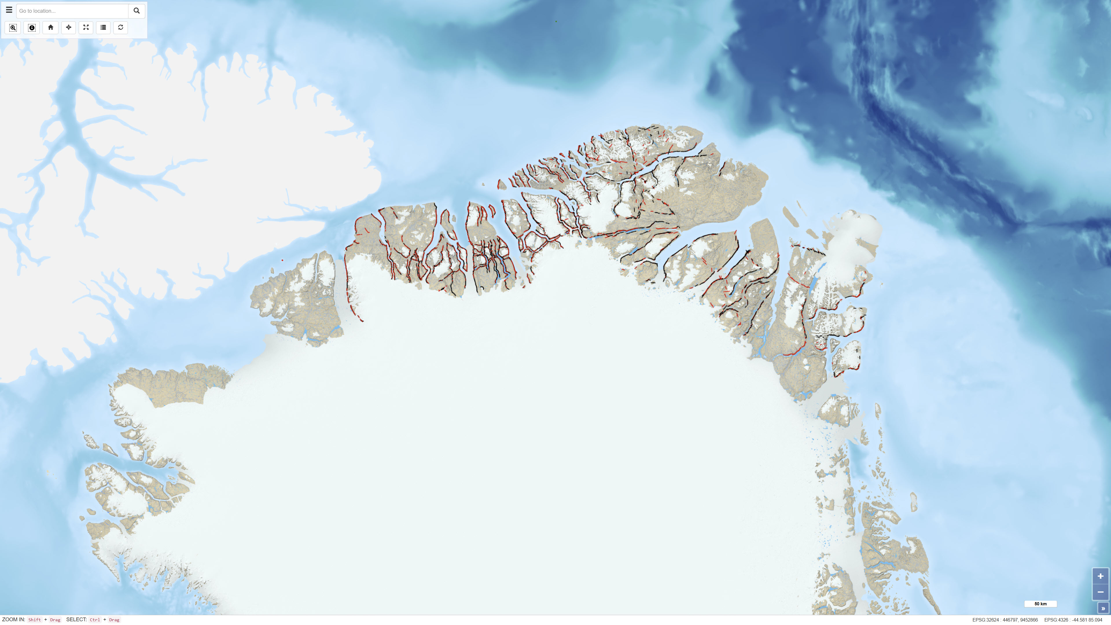
The dataset comprises more than 6,400 oblique aerial photographs acquired during the systematic 1:500,000 geological mapping programme in North Greenland carried out by the Geological Survey of Greenland (now GEUS) between 1978 and 1985. The photographs document steep fjord and valley walls and were collected as part of geological field investigations. The images have been digitised and made available through a web-based interface, allowing users to access individual photographs, their geographic locations and associated geological coding linked to the regional geological map. The dataset represents a systematic visual documentation of geological features in North and Northeast Greenland.
-
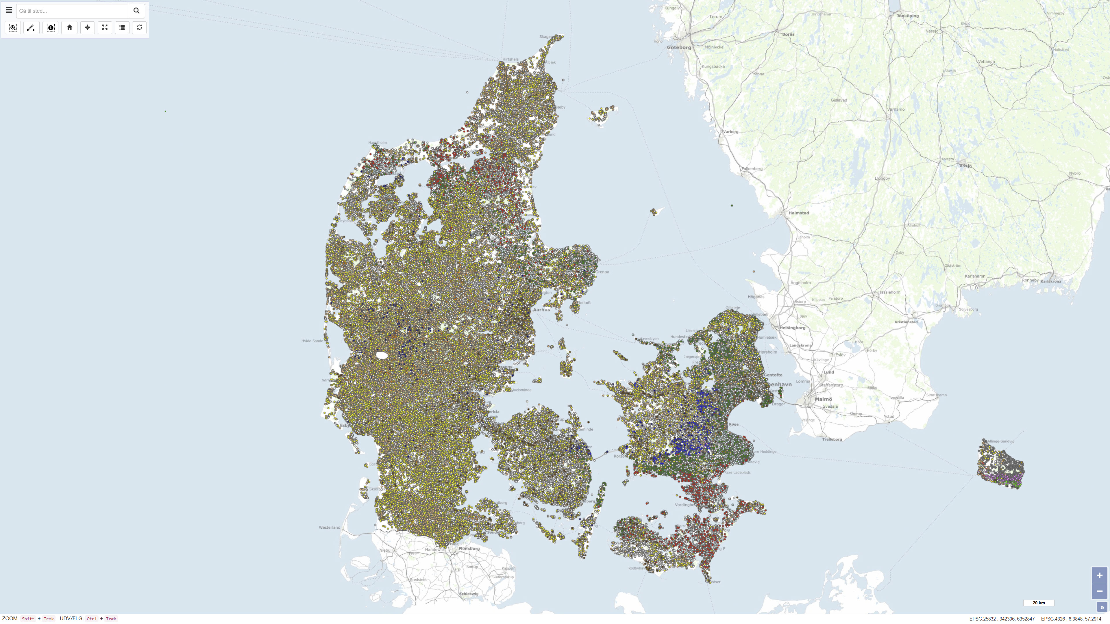
The National well database (Jupiter) among other things contains water level measurements from Danish wells. The database contains water level measurements from the municipalities, the groundwater-monitoring program, the regions soil pollution investigations and from the establishment of new wells.
-
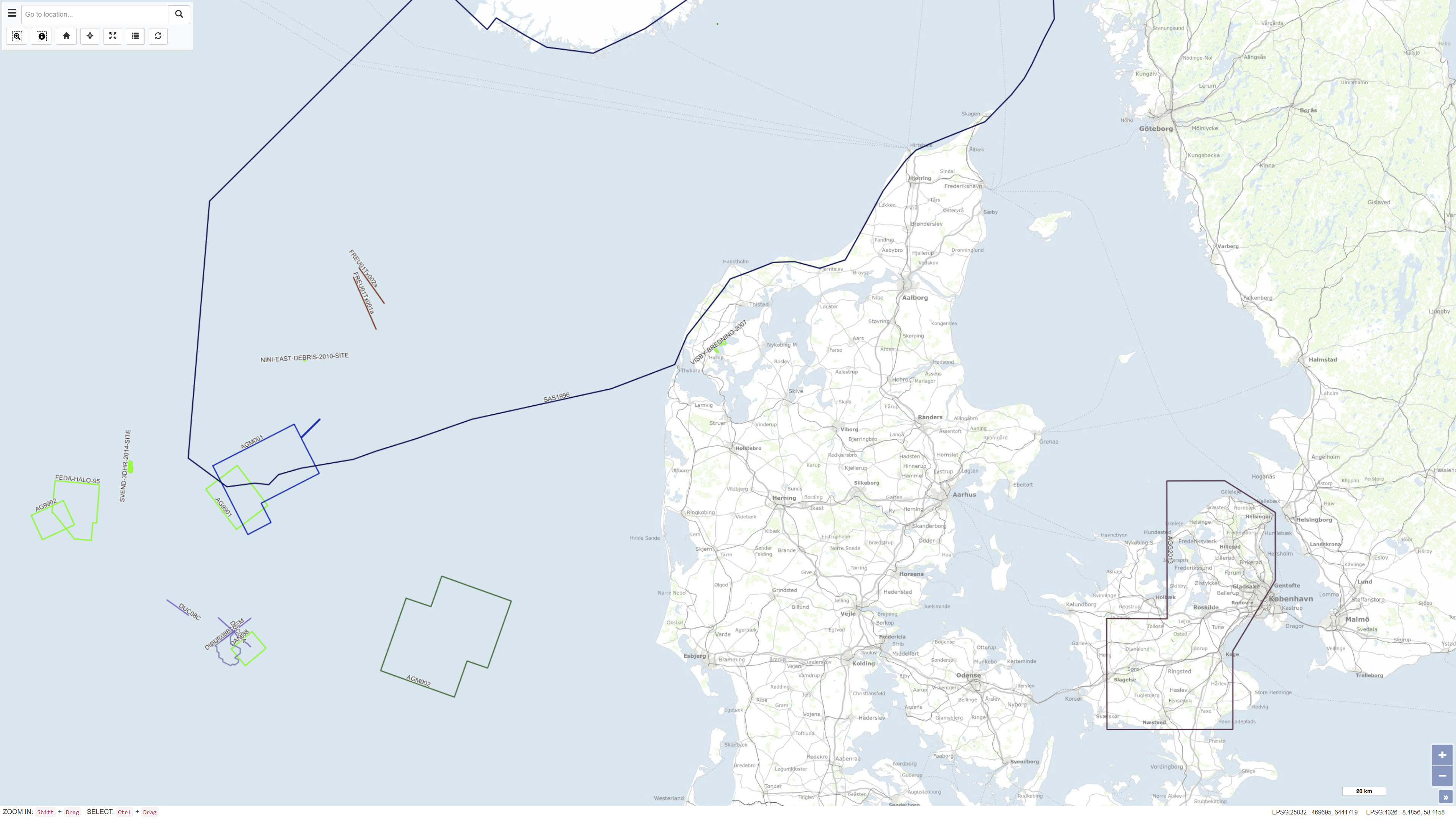
The Samba database contains information about geophysical investigations made in the Danish sector, acquired according to the Danish Act on the Use of the Subsoil. The data is acquired in relation to investigation for oil/gas, geothermal energy, the storage of gas or salt. That is: Seismic (2D & 3D) acquisitions, CSEM as well as other magnetic and gravity acquisitions shipborne as well as airborne. The dataset also contains geophysical measurement performed in the deep wells and meta data about the seismic surveys. The data has been submitted by the licensees. The database is updated on an ongoing basis.
-
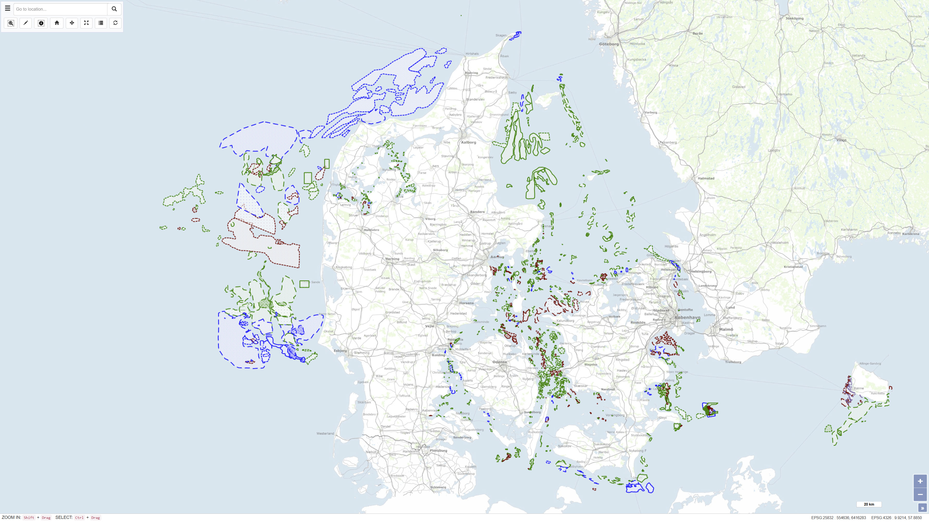
The MARTA database contains shallow seismic and acoustic data, information and geological samples. MATRA shows the distribution of marine sand and gravel resources and gives access to reports on raw material surveys. MARTA shows the distribution of marine sand and gravel resources and gives access to reports on raw material surveys. Data has primarily been acquired by GEUS and our partners., MARTA is the official Danish marine raw material database for data reported in accordance with the Danish Raw Material Act. MARTA is used by the raw materials industry and authorities and as a planning tool in connection with raw material extraction and marine construction projects including beach nourishment.
-

The Canadian National Wetlands Inventory (CNWI) is a comprehensive, publicly available national geodatabase developed by the Canadian Wildlife Service (CWS) of Environment and Climate Change Canada (ECCC), in collaboration with federal, provincial, and territorial governments, academia, Indigenous groups, and Non-Governmental Organizations (NGOs). It consists of the best available wetland mapping data, along with its metadata, published in a standardized manner. The CNWI is continuously updated through the compilation of existing data and the acquisition of new high-resolution datasets to address coverage gaps, with an emphasis on peatlands and coastal wetlands, which are key habitats for greenhouse gas (GHG) sequestration. ECCC plans to use the CNWI to train and validate machine-learning algorithms to delineate and classify wetlands at a national scale and to measure trends over time. This will directly support Canada’s Nature-Based Climate Solutions by informing biodiversity conservation, guiding climate change mitigation and adaptation strategies, and supporting GHG emissions reporting. The CNWI was initially released in February 2024 with 13 source datasets. In June 2025, the Inventory was updated to include 14 additional datasets. Collectively, these 27 source datasets comprise approximately 12.1 million wetland polygon features, covering a total area of roughly 640,000 square kilometers across ten provinces and territories (BC, MB, NB, NL, NS, PE, ON, QC, SK, YT). These source datasets were cross-walked into a standardized CNWI classification schema, which is based on two foundational documents: the Canadian Wetland Classification System (National Wetlands Working Group, 1997) and the Canadian Wetland Inventory Data Model (2016). The CNWI Schema contains five major wetland classes (Bog, Fen, Swamp, Marsh, and Shallow/Open Water) and eight subclasses (Rich Fen, Poor Fen, Organic Swamp, Mineral Swamp, Organic Marsh, Mineral Marsh, Shallow Water, and Open Water). Non-conforming wetlands can be categorized into three groups: Peatland, Mixed, and Unclassified. For more information on the CNWI and the related database, please refer to the CNWI User Manual and other supporting documents that accompany this publication. The User Manual provides detailed information on how data are collected, managed, and distributed to meet CNWI data standards.
-
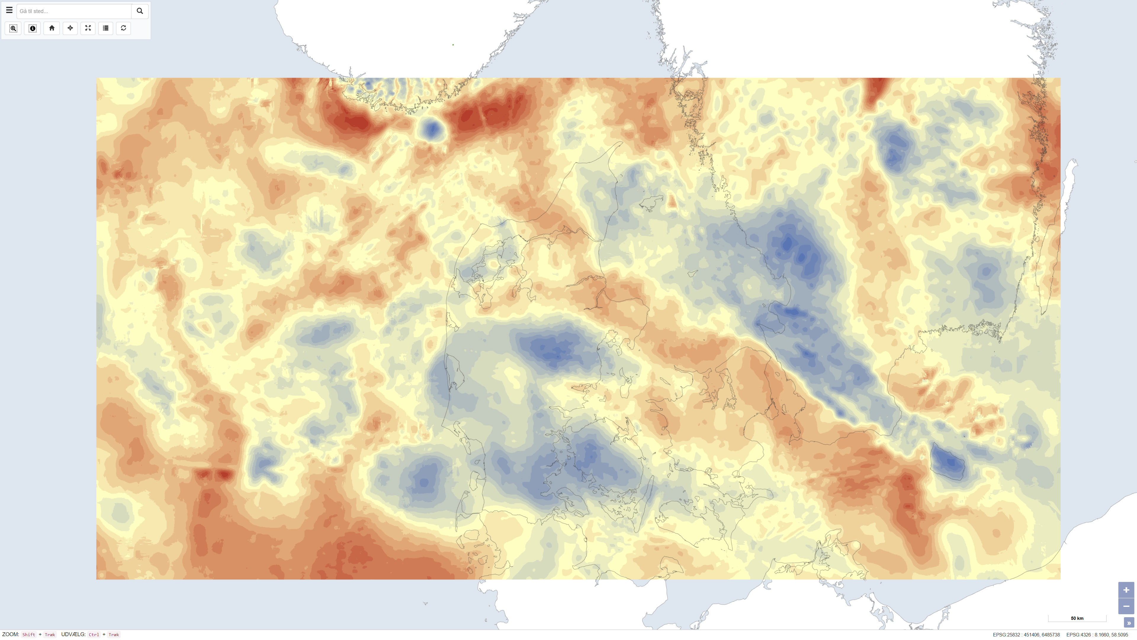
The dataset presents Bouguer gravity anomalies on land and free-air gravity anomalies in Danish marine areas based on gravity measurements from the national gravity database. The Bouguer anomaly is terrain corrected and is used to investigate variations in subsurface mass distribution, while the free-air anomaly at sea reflects variations in the gravity field without full terrain correction. Gravity anomalies are expressed in milligals (mGal). The dataset was produced by DTU Space and represents a consolidated gravimetric foundation for geological and geophysical analyses in Denmark.
-
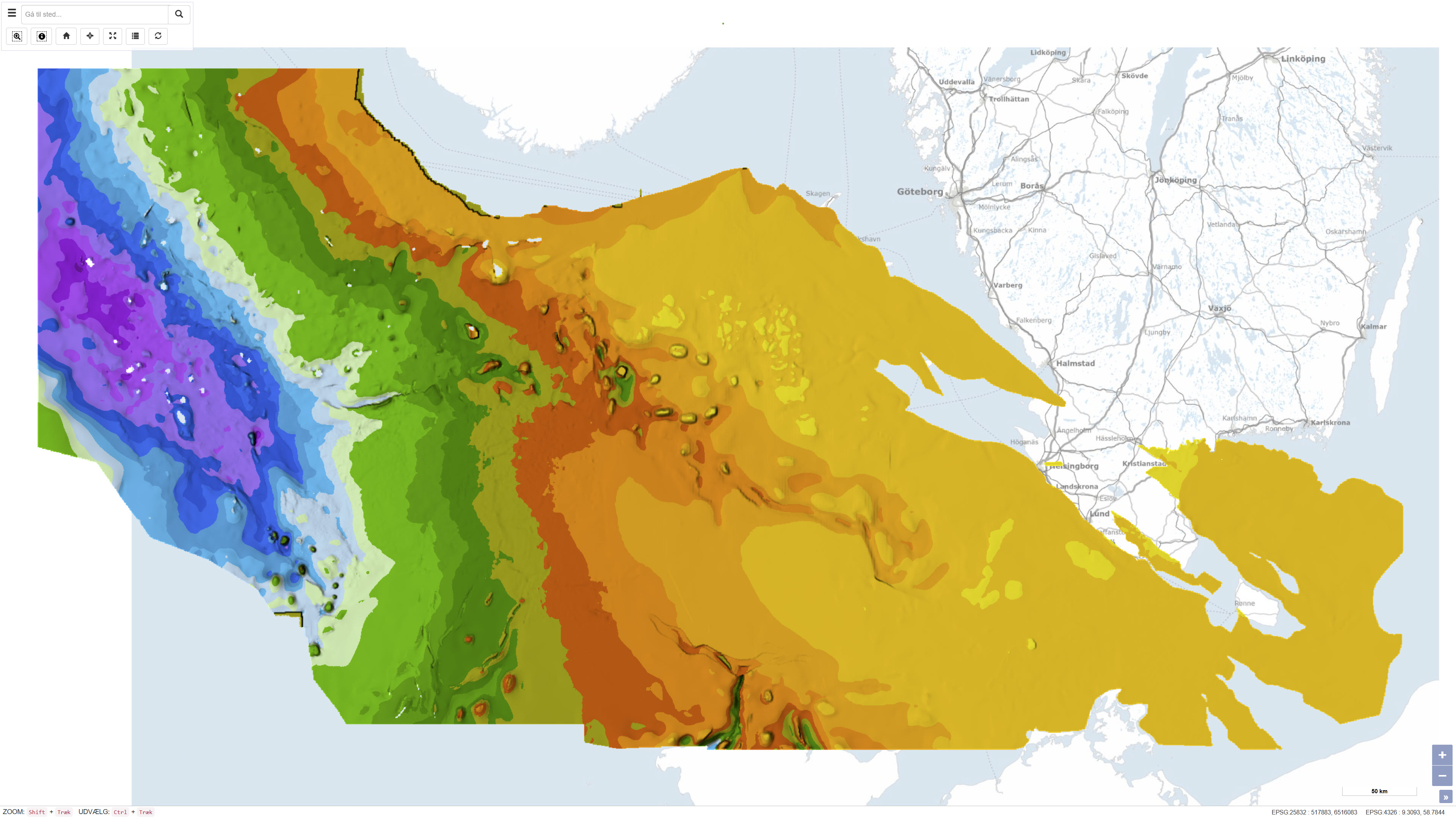
This dataset represents the structure and topography of the Top Chalk surface, i.e. the top of the Chalk Group (including Upper Cretaceous to Danian), in the Danish subsurface. The map illustrates regional variations in the depth and structural configuration of the chalk surface from the central North Sea to the eastern Danish areas. It is based on an integrated geological and geophysical interpretation of seismic profiles, well data and earlier mapping. The map provides an essential basis for geological, geophysical and subsurface reservoir analyses.