 Arctic SDI catalogue
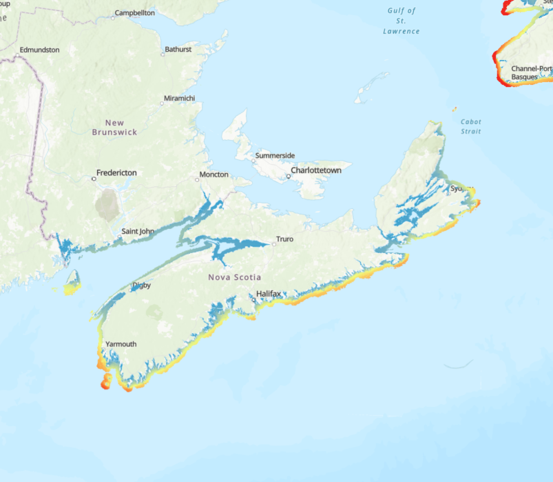
Bay of Fundy
Type of resources
Topics
Keywords
Contact for the resource
Provided by
Formats
Representation types
Update frequencies
status
-

This dataset represents meat weight and shell height data of commercial size Sea Scallop (Placopecten magellanicus; ≥ 80 mm shell height) from 2011-2023 from the Bay of Fundy Inshore Scallop Survey collected from June to mid-August. Wet meat weights were recorded to a tenth of a gram and shell heights are measured in millimeters. Meat weights and shell heights are sampled from a subset of scallops caught on survey and this detailed sampling is conducted from approximately half of the tows conducted. Each row in the dataset represents an individual scallop and contains information such as tow number, tow date, cruise name, geographical coordinates (decimal degrees, WGS 84) and the Scallop Production Area in which the tow took place. Survey protocols are documented in Glass (2017). This dataset contains tow data from a comparative survey conducted in 2012 (Smith et al., 2013). Further, these data correspond to the publication of Hebert et al. (2025). References Glass, A. 2017. Maritimes Region Inshore Scallop Assessment Survey: Detailed Technical Description. Can. Tech. Rep. Fish. Aquat. Sci. 3231: v + 32 p. Hebert, N, Sameoto, J.A., Keith, D.M., Murphy, O.A., Brown, C.J., Flemming, J. 2025. Interannual variability in the length–weight relationship can disrupt the abundance–biomass correlation of sea scallop (Placopecten magellanicus). ICES. J. Mar. Sci. Smith, S.J., Glass, A., Sameoto. J., Hubley, B., Reeves, A., and Nasmith, L. 2013. Comparative survey between Digby and Miracle drag gear for scallop surveys in the Bay of Fundy. DFO Can. Sci. Advis. Sec. Res. Doc. 2012/161. iv + 20 p. Cite this data as: Sameoto, J.A. Data of: Bay of Fundy Sea Scallop Meat Weight and Shell Height Data 2011 to 2023. Published: December 2025. Population Ecology Science Division, Fisheries and Oceans Canada, Dartmouth, N.S. https://open.canada.ca/data/en/dataset/65d32794-2d81-4682-b0ea-8d8bbe907a58
-

This dataset represents abundance data of commercial size Sea Scallop (Placopecten magellanicus; ≥ 80 mm shell height) from 2011-2023 from the Bay of Fundy Inshore Scallop Survey. Data is binned into 5-mm shell height bins, is prorated to an 800 m tow length and 17.5 feet (5.334 m) drag width (i.e., representing an area swept of 4267 m2), and was collected using unlined dredge gear. Each row represents a tow and contains information such as tow date, cruise name, gear type, geographical coordinates (decimal degrees, WGS 84) and the Scallop Production Area in which the tow took place. Survey protocols are documented in Glass (2017). This dataset contains tow data from a comparative survey conducted in 2012 (Smith et al., 2013). Further, these data correspond to the publication of Hebert et al. (2025). References Glass, A. 2017. Maritimes Region Inshore Scallop Assessment Survey: Detailed Technical Description. Can. Tech. Rep. Fish. Aquat. Sci. 3231: v + 32 p. Hebert, N, Sameoto, J.A., Keith, D.M., Murphy, O.A., Brown, C.J., Flemming, J. 2025. Interannual variability in the length–weight relationship can disrupt the abundance–biomass correlation of sea scallop (Placopecten magellanicus). ICES. J. Mar. Sci. Smith, S.J., Glass, A., Sameoto. J., Hubley, B., Reeves, A., and Nasmith, L. 2013. Comparative survey between Digby and Miracle drag gear for scallop surveys in the Bay of Fundy. DFO Can. Sci. Advis. Sec. Res. Doc. 2012/161. iv + 20 p. Cite this data as: Sameoto, J.A. Data of: Bay of Fundy Sea Scallop Commercial Size Abundance Data. Published: December 2025. Population Ecology Science Division, Fisheries and Oceans Canada, Dartmouth, N.S. https://open.canada.ca/data/en/dataset/ecc09d98-56ed-4a27-ad62-5c3714a1d9b4
-

The data layer (.shp) presented is the result of an unsupervised classification method for classifying seafloor habitat in the Bay of Fundy (Northwest Atlantic, Canada). This method involves separating environmental variables derived from multibeam bathymetry (slope, bathymetric position index), backscatter, and oceanographic information (wave-shear current velocity) into spatial units (i.e. image objects) and classifying the acoustically and oceanographically separated units into 7 habitat classes (Bedrock and Boulders, Mixed Sediments, Gravelly Sand, Sand, Silty Gravel with Anemones, Silt, and Tidal Scoured Mixed Sediments) using in-situ data (imagery). Benthoscape classes (synonymous to landscape classifications in terrestrial ecology) describe the geomorphology and biology of the seafloor and are derived from elements of the seafloor that were acoustically and oceanographically distinguishable. Reference: Wilson, B.R., Brown, C.J., Sameoto, J.A., Lacharite, M., Redden, A. (2021). Mapping seafloor habitats in the Bay of Fundy to assess macrofaunal assemblages associated with Modiolus modiolus beds. Estuarine, Coastal and Shelf Science, 252. https://doi.org/10.1016/j.ecss.2021.107294 Cite this data as: Wilson, B.R., Brown, C.J., Sameoto, J.A., Lacharite, M., Redden, A. Bay of Fundy Benthoscape. Published May 2023. Population Ecology Division, Fisheries and Oceans Canada, Dartmouth, N.S. https://open.canada.ca/data/en/dataset/dbabd17a-a2c7-4b3f-9bd8-a77a9c7f9c1c
-
Exposure to wind-driven waves forms a key physical gradient in nearshore environments influencing both ecological communities and human activities. We calculated a relative exposure index (REI) for wind-driven waves covering the coastal zone of the Scotian Shelf-Bay of Fundy bioregion. We derived REI and two other fetch-based indices (sum fetch, minimum fetch) from two formulations of wind fetch (unweighted and effective fetch) for input points in an evenly spaced fishnet grid (50-m resolution) covering a buffered area within 5 km from the coastline and shallower than 50 m depth. We calculated unweighted fetch lengths (m) for 32 compass headings per input point (11.25° intervals), and effective fetch lengths for 8 headings per point (45° intervals). Unweighted fetch is the distance along a given heading from a point in coastal waters to land. Effective fetch is a directionally weighted average of multiple fetch measures around a given heading that reduces the influence of irregular coastline shape on exposure estimates. For fetch calculations, we used land features at a 1:50,000 scale for Canadian administrative boundaries (NrCan 2017), and unknown resolution for St. Pierre and Miquelon, and US states bordering the Gulf of Maine (GADM 2012). The summed and minimum unweighted fetch lengths for each point provide coarse summaries of wave exposure and distance to land, respectively. The relative exposure index (REI) gives a more accurate metric of exposure by combining effective fetch with modelled wind speeds (m s-1) and frequency data. We provide the original calculations of unweighted fetch, effective fetch, and other fetch-based indices (i.e., sum, minimum) in csv format along with the REI layer (GeoTIFF format) resampled to 35-m resolution. With broad spatial coverage and high resolution, these indices can support regional-scale distribution modelling of species and biological assemblages in the coastal zone as well as marine spatial planning activities. When using data please cite following: O'Brien JM, Wong MC, Stanley RRE (2022) A relative wave exposure index for the coastal zone of the Scotian Shelf-Bay of Fundy Bioregion. figshare. Collection. https://doi.org/10.6084/m9.figshare.c.5433567 References GADM database of Global Administrative Areas (2012). Global Administrative Areas, version 2.0. (accessed 2 December 2020). www.gadm.org Natural Resources Canada (2017) Administrative Boundaries in Canada - CanVec Series - Administrative Features - Open Government Portal. (accessed 2 December 2020). https://open.canada.ca/data/en/dataset/306e5004-534b-4110-9feb-58e3a5c3fd97.
-

Exposure to wind-driven waves manifests an important physical gradient in the coastal zone that influences a variety of physical and biological processes (i.e., species distribution). Fetch, the unobstructed distance over which wind-driven waves can build, is a popular proxy for wave exposure at a given location commonly used for site-specific evaluations. Here, we provide two measures of fetch (unweighted fetch, effective fetch) and three fetch-derived indices of wave exposure (sum fetch, minimum fetch, and a relative exposure index) covering the coastal zones of two Canadian bioregions (Scotian Shelf-Bay of Fundy, Newfoundland-Labrador Shelves). For each region, we calculated fetch and exposure indices for input points in an evenly spaced fishnet grid (see linked records below for datasets by region). We provide unweighted fetch lengths (m) for 32 compass headings per input point (11.25° intervals), and effective fetch lengths for 8 headings per point (45° intervals). Effective fetch is a weighted average of multiple fetch measures around a given heading that reduces the influence of irregular coastline shape on exposure estimates. We also include calculations of the summed and minimum unweighted fetch lengths for each point that provide coarse proxies of exposure and distance to land, respectively. The relative exposure index (REI), provided as regional spatial layers in raster format, provides a more accurate metric of exposure by combining effective fetch with modelled wind speeds (m s-1) and frequency data. Users may also use fetch calculations to derive their own exposure layers using alternative sources of wind data, indices, or formulations. Detailed methodology on the calculations for fetch, effective fetch and REI are outlined in the Supplementary Information below. Citation information and differences in data pre-processing methods and spatial resolution of the regional analyses are described in their respective data records. The broad spatial coverage and high resolution offered by these indices are suitable to support regional-scale modelling and planning exercises. In particular, these indices will be of value to ongoing Marine Spatial Planning efforts, which includes regional conservation planning, that seek to evaluate the distribution of coastal species and overlap with human activities.
-

Appropriately responding to a marine pollution event, especially hydrocarbon spills, often requires detailed knowledge of local habitat and environmental features. Access to high resolution habitat profiles can support effective spill response plans, informing discussions on protection priorities or expediated remediation. However, marine habitat composition data for a given area is often lacking due to the high cost and effort of conducting such surveys across the vast shorelines of Canada. The purpose of this study was to develop methodologies for conducting rapid and affordable habitat compositions in the marine environment via drone aerial photography; an emerging technology for conducting high resolution surveys. We used the Musquash Marine Protected Area (MPA; Musquash, NB, Canada) as a model system as it contains a diverse range of habitat types, is a region of conservation concern in Atlantic Canada, and is in close proximity to oil and gas handling facilities and vessel traffic. The MPA consists of a tidal river that outflows into the Bay of Fundy. Using Geographic Information System (GIS) software, we subdivided the MPA into several transects (N =61) that were used to generate flight plans for a Remotely Piloted Aircraft System (RPAS; DJI Mavic 3 Enterprise, DJI ). The RPAS was flown (6 m s-1) at an altitude of 100m (Above ground level) taking images with side (70%) and front (80%) overlap. Resulting images were then compiled as an orthomosaic map using Pix4Dmatic software. These data will be used to inform marine spill response planning in the region, to support marine planning and conservation, and Marine Protected Area (MPA) monitoring efforts as well as develop further methodological approaches for conducting RPAS-based habitat surveys in other coastal systems within Atlantic Canada. Cite this data as: Lawrence MJ, Coates PJ, Matheson K, Hamer A. Characterisation of intertidal habitat types in the Musquash Marine Protected Area using aerial drone photography. Published November 2025. Coastal Ecosystems Science Division, Fisheries and Oceans Canada, St. Andrews, N.B.