 Arctic SDI catalogue
Océan Atlantique
Type of resources
Keywords
Contact for the resource
Provided by
Years
Formats
Representation types
Update frequencies
status
Service types
-
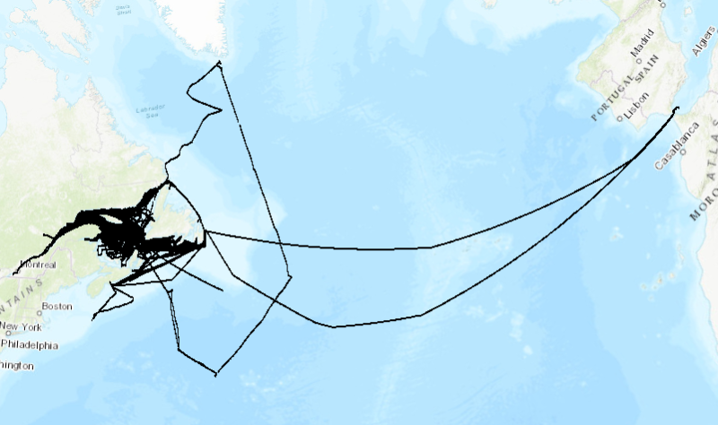
1999 to 2023 surface temperature and salinity measured along the track of commercial ships, mostly between Montreal (Quebec) and St. John's (Newfoundland). Monitoring of surface water conditions in the Estuary and Gulf of St. Lawrence is carried out with different complementary methods such as thermosalinographs (TSG) installed on commercial ships. These ships are sailing all year long from Montreal to St. John’s, one round trip per week, and are sampling water near the surface (3 to 8 meters deep) to determine the temperature and salinity all along the route. Purpose The recorded data are used as input to numerical forecasting models for sea ice conditions and as a monitoring tool for the Gulf of St. Lawrence. Annual reports are available at the Canadian Science Advisory Secretariat (CSAS), (http://www.dfo-mpo.gc.ca/csas-sccs/index-eng.htm). Galbraith, P.S., Chassé, J., Caverhill, C., Nicot, P., Gilbert, D., Lefaivre, D. and Lafleur, C. 2018. Physical Oceanographic Conditions in the Gulf of St. Lawrence during 2017. DFO Can. Sci. Advis. Sec. Res. Doc. 2018/050. v + 79 p.
-

A modelling analysis conducted by Fisheries and Oceans Canada (DFO) identified these areas as the most suitable habitat for Blue whales: Gulf of St. Lawrence, waters off the southern coast of Newfoundland, the region of Mecatina Trough, the Esquiman Channel and the continental shelf margin off Nova Scotia. They represent important areas for foraging, feeding and socializing for Blue whales. The sources of data used to determine these important areas (by the enclosing boxes method) and the annual and seasonal cycles of Blue whale travel patterns include, but are not limited to, radio and satellite telemetry, passive acoustic monitoring, line-transect aerial surveys, anecdotal reports of observations and modelling. This layer does not represent the general distribution of the Blue whale. Important areas have been identified by reviewing several sources of information and to the best of researchers' knowledge. Several information about Blue whales, their behaviour and habitat use are still unknown. Data is scarce in some areas during winter periods. Observation efforts mostly occur during the summer period, however, data sources can validate their presence during seasons when the observation effort is lower. The Mecatina trough region represents an important area based on historical and non-current data. The presence data per month refers strictly to the information available in the cited research document, and does not express the absence of the species outside the months when a presence was validated. The presented information is valid until the following research survey. Reference: Lesage, V., J.-F. Gosselin, J. W. Lawson, I. McQuinn, H. Moors-Murphy, S. Plourde, R. Sears. and Y. Simard. 2018. Habitats important to blue whales (Balaenoptera musculus) in the Western North Atlantic. DFO Can. Sci. Advis. Sec. Res. Doc. 2016/080: iv + 50 p.
-
WMS service maintained by ECCC. Map of Upper Intertidal shoreline segmentation with Shoreline Cleanup Assessment Teams (SCAT) classification. Segmentation covers shorelines for Northern Canada, the North coast of British Columbia, as well as Ontario, QC, and Atlantic regions.
-
WMS service maintained by ECCC. Map of Upper Intertidal shoreline segmentation with Shoreline Cleanup Assessment Teams (SCAT) classification. Segmentation covers shorelines for Northern Canada, the North coast of British Columbia, as well as Ontario, QC, and Atlantic regions.