 Arctic SDI catalogue
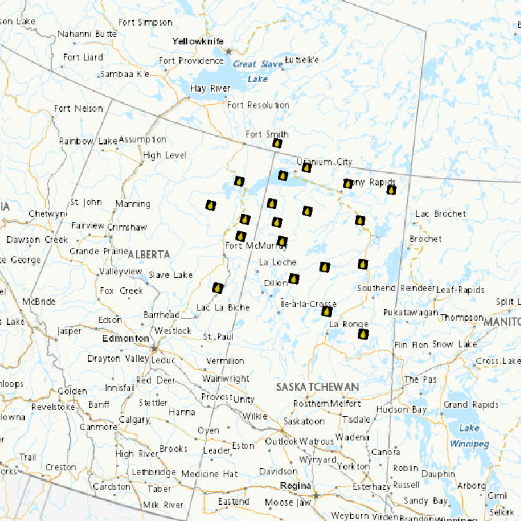
Prairie - Alberta (AB)
Type of resources
Available actions
Topics
Keywords
Contact for the resource
Provided by
Formats
Representation types
Update frequencies
status
-

Air emissions from oil sands development can come from a number of sources including industrial smokestacks, tailings ponds, transportation, and dust from mining operations. Air quality monitoring under the Joint Canada-Alberta Implementation Plan for the Oil Sands is designed to determine the contribution of emissions from oil sands activities to local and regional air quality and atmospheric deposition both now and in the future. Deposition data include: - Passive Sampling of PACs deployed for two month periods across a network of 17 sites - Active sampling of PACs at three sites to inform the amount of dry deposition - Particulate metals (24 hour integrated samples following the one in six day National Air Pollution Surveillance (NAPS) cycle)
-

The health of individual amphibians, amphibian populations, and their wetland habitats are monitored in the oil sands region and at reference locations. Contaminants assessments are done at all sites. Amphibians developing near oil sands activities may be exposed to concentrations of oil sands-related contaminants, through air emissions as well as water contamination. The focus of field investigations is to evaluate the health of wild amphibian populations at varying distances from oil sands operations. Wood frog (Lithobates sylvaticus) populations are being studied in Alberta, Saskatchewan and the Northwest Territories in order to examine the relationship of proximity to oil sands activities and to prevalence of infectious diseases, malformation rates, endocrine and stress responses, genotoxicity, and concentrations of heavy metals, naphthenic acids and polycyclic aromatic hydrocarbons.
-

Air emissions from oil sands development can come from a number of sources including industrial smokestacks, tailings ponds, transportation, and dust from mining operations. Air quality monitoring under the Joint Canada-Alberta Implementation Plan for the Oil Sands is designed to determine the contribution of emissions from oil sands activities to local and regional air quality and atmospheric deposition both now and in the future. Ambient air quality data include: - Filter Pack (24-hour integrated concentrations of particle-bound SO2-4, NO-3, Cl-, NH+4, Ca2+, Mg2+, Na+, K+ and gaseous SO2 and HNO3 collected daily by the Canadian Air and Precipitation Monitoring Network) - Total Gaseous Mercury (hourly mixing ratios measured by the Canadian Air and Precipitation Monitoring Network and Prairie and Northern Region) - Atmospheric speciated mercury (Hg) (2-hour average concentrations of gaseous elemental Hg (GEM), reactive gaseous Hg (RGM), and Hg on PM2.5 (total particulate Hg - TPM) - Comprehensive set of measurements collected from an aircraft (various time resolutions) covering an area of 140,000 km2 over the oil sands region - Comprehensive set of measurements collected from the Fort McKay Oski-ôtin monitoring site - Ozone (hourly mixing ratios measured by the Canadian Air and Precipitation Monitoring Network) - Ozone Vertical Profiles (ozone mixing ratios as a function of height) measured by the Canadian Ozone Sonde Network - Aerosol Optical Depth (measure of the degree to which the presence of aerosols in the atmosphere prevents the transmission of light, from the ground to the top of the atmosphere) measured as part of the AErosol RObotic CANadian (AEROCAN) network - Satellite overpass data have a relatively high spatial resolution over the Oil Sands region to produce images and geo-referenced data of nitrogen dioxide (NO2) and sulphur dioxide (SO2) “vertical column density” (which correlates with surface concentration)
-

Aquatic bird eggs are being collected for contaminants analysis. Egg collections in the Peace-Athabasca Delta area support Parks Canada’s activities at Wood Buffalo National Park and the multi-stakeholder Peace-Athabasca Ecosystem Monitoring Program. This monitoring activity employs repeated censuses of birds and builds on initial egg collections made in 2009 from Egg Island (Lake Athabasca) and Wood Buffalo National Park, with the goal of evaluating contaminant burdens, contaminant sources and changes in sources through time. Egg samples are collected from colonial waterbirds California Gulls (Larus californicus), Herring Gulls (Larus argentatus), Ring-billed Gulls (Larus delawarensis), Caspian Terns (Hydroprogne caspia) and Common Terns (Sterna hirundo) and insectivorous birds Bank Swallows (Riparia riparia), Cliff Swallows (Petrochelidon pyrrhonota) and Tree Swallows (Tachycineta bicolor) to monitor health and contaminant levels of aquatic and terrestrial birds in the oil sands region and in reference areas. The samples collected are analysed for oil sands-related contaminants including polycyclic aromatic hydrocarbons (PAHs) and metals such as mercury (Hg) and arsenic (As).
-

Tree swallow (Tachycineta bicolor) nest boxes are installed in oil sands area and in reference locations to monitor contaminant levels and impacts on tree swallow nestlings. The exposure to tree swallow nestlings to air-borne oil sands-related contaminants such as polycyclic aromatic hydrocarbons (PAHs) is assessed using passive air samplers. Measures of avian health are examined in relation to location of sampling and contaminants measured.
-

Benthic invertebrates monitoring includes both lotic (rivers/streams) and lentic (wetlands) ecosystems. Aquatic biomonitoring provides a direct measure of change in biotic populations and communities in relation to benchmark or reference conditions and can help identify the ecological effects of cumulative stressors. Used together with the water chemical and physical monitoring components, this program uses an integrated approach to assess whether ecological affects are occurring in response to OS developments. Sampling can include the collection of invertebrates, algal biomass, water chemistry, and appropriate supporting habitat information and is conducted during periods of high abundance and diversity of macroinvertebrates. Sampling focuses on near-shore gravel and sand habitats on the Athabasca River, erosional habitats on major tributaries and in wadable areas in deltaic wetlands within the Expanded Geographical Area. As of October 2012, over 80 locations have been visited.
-

The surface water quality (WQ) program, as part of the Joint Canada/Alberta Implementation Plan, is designed to improve the ability to detect change and predict effects in relation to point and non‐point sources. A mass‐balance approach has been used for assessing the quantity, movement, and cycling of materials in the watershed. Applying this approach required a sampling program which included quantification of the sources, transport, flux, and fate of materials and contaminants. The Surface WQ monitoring sampling includes, in part, collection of; - event (freshet and rain) based WQ samples in tributaries ranging from daily to bi-weekly, - WQ samples in the Athabasca River using cross-channel transect methods at specified Phase 1 sites, - enhanced (additional parameters) WQ sampling at M9, M12, and M11A and at 5 new interconnecting channel stations within the Expanded Geographical Area (EGA), - ground water samples in specific high priority tributaries, and - auto-monitoring (near real-time) on a subset of parameters at sites in the EGA
-
Acid-Sensitive Lakes Nine hundred and thirty-three lakes located in Saskatchewan, Alberta and the Northwest Territories were sampled to establish current acidification status. Of the 933 lakes, 244 (or 26%) are considered acid sensitive, almost always because of naturally low calcium and magnesium (or "base cation") concentrations. The most acid-sensitive lakes (i.e., those with extremely low base cation concentrations) are located on the Canadian Shield in both Alberta and Saskatchewan and east of the oils sands development area. Fifty-one of the 244 acid-sensitive lakes were sampled twice annually (spring and fall) to identify chemical changes through trend analyses. Results revealed that 55% of these lakes had concentrations of some metals in excess of Canadian Council of Ministers of the Environment guidelines. Of the 291 samples taken in the 51 lakes, iron concentrations were greater than guidelines in 36% (105 samples), aluminum in 33% (97 samples), lead in 0.3% (1 sample) and copper in 0.3% (1 sample). The metals in these lakes occur naturally and are expected to be found in a wide range of concentrations given the geology and physiography of the Canadian Shield. It remains to establish the relationship between acid sensitivity, geology and high metal concentrations.
-

Plant health assessments and vegetation surveys are undertaken at both terrestrial and wetland sites in the oil sands region and in reference areas. Plant monitoring is being conducted for biodiversity and contaminants, and because plants are important both as wildlife habitat and as traditional-use species. Plant and soil samples are collected at monitoring sites near and at varying distances from oil sands operations. Plant tissues are being examined for levels of naphthenic acids (NAs), polycyclic aromatic hydrocarbons (PAHs) and heavy metals. Plant indicator species include Vaccinium spp. (blueberry), Ledum groenlandicum (Labrador tea), Arctostaphyllos uva-ursi (common bearberry), and Cornus canadensis (bunchberry). Soil samples from riparian banks and boreal forest locations are also collected for greenhouse studies. These experiments evaluate the uptake, distribution, and toxicity of the contaminants in plant tissue.
-
Assess the importance of atmospheric deposition of contaminants as a contributor to ecological impacts of oil sands development and identify sources. • Use snowpack measurements sampled across a gridwork to develop maps of winter-time atmospheric contaminant loadings for the region ~100 km from the major upgrading facilities • Assess long-term trends in winter-time atmospheric deposition • Determine the potential impact of wintertime snowpack mercury loads on tributary river water mercury concentrations (Spring Freshet) using Geographic Information System and hydrological modelling approaches • Compare snowpack loadings to those obtained from precipitation monitoring and compare spatial patterns to PAC air measurements obtained from passive sampling network All data are subjects of a publication containing method details, full QA/QC, interpretations and conclusions. Citations: A. Dastoor, A. Ryjkov, G. Kos, J. Zhang, J.L. Kirk, M. Parsons, A. Steffen. 2021. Impact of Athabasca oil sands operations on mercury levels in air and deposition. Atmospheric Chemistry and Physics 21, 12783-12807. L. Chibwe, D.C.G. Muir, Y. Gopalapillai, D. Shang, F. Yang, J.L. Kirk, C. Manzano, B. Atkinson, X. Wang, C. Teixeira. 2021. Long-term spatial and temporal trends, and source apportionment of polycyclic aromatic compounds in the Athabasca Oil Sands Region. Environmental Pollution 268A, 115351. J. Culp, I. Droppo, P. di Cenzo, A. Alexander-Trusiak, D. Baird, S. Beltaos, G. Bickerton, B. Bonsal, R. Brua, P. Chambers, Y. Dibike, N. Glozier, J.L. Kirk, L. Levesque, M. McMaster, D.C.G. Muir, J. Parrott, D. Peters, K. Pippy, J. Roy. 2021. Ecological effects and causal synthesis of oil sands activity impacts on river ecosystems: water synthesis review. Environmental Reviews 29. Doi: https://doi.org/10.1139/er-2020-0082. Y. Gopalapillai, J. L. Kirk, M.S. Landis, D.C.G. Muir, C.A. Cooke, C.A., A. Gleason, A. Ho, E. Kelly, D. Schindler, X. Wang, G. Lawson. 2019. Source analysis of pollutant elements in winter air deposition in the Athabasca oil sands region: A Temporal and Spatial Study. ACS Earth and Space Chemistry 38, 1656-1668. W. Wasiuta, J.L. Kirk, P.A. Chambers, A.C. Alexander, F.R. Wyatt, R.C. Rooney, C.A. Cooke. 2019. Accumulating mercury and methylmercury burdens in watersheds impacted by oil sands pollution. Environmental Science & Technology 53, 12856-12864. C. Manzano, D. Muir, J. L. Kirk, C. Teixeira, M. Siu, X. Wang, J.P. Charland, D. Schindler, E. Kelly. 2016. Temporal variation in the deposition of polycyclic aromatic compounds in snow in the Athabasca Oil Sands area of Alberta. Environmental Monitoring and Assessment 188, 542. and J.L. Kirk, D. Muir, A. Gleason, X, Wang, R. Frank, I. Lehnherr, F. Wrona. 2014. Atmospheric deposition of mercury and methyl mercury to landscapes and waterbodies of the Athabasca oil sands region. Environmental Science & Technology 48, 73747383.