 Arctic SDI catalogue
Société
Type of resources
Available actions
Keywords
Contact for the resource
Provided by
Years
Representation types
Update frequencies
status
Service types
Scale
-
Voici une carte politique interactif du monde qui montre les frontières nationales, les noms de pays, la population, les rivières, les lacs et les océans pricipaux. Cette carte fait partie d'une série de cartes illustrant la participation du Canada à divers sujets, notamment le commerce international et la participation du Canada à divers les partenariats et organisations internationaux. L'ensemble de données comprend les pays, les rivière, les lacs et les océans pricipaux, les îles du Pacifique, les annotations marines et les annotations par pays, qui peuvent être téléchargés en anglais et en français. De plus, les cartes statiques du monde et de chaque continent seront disponibles en anglais et en français.
-
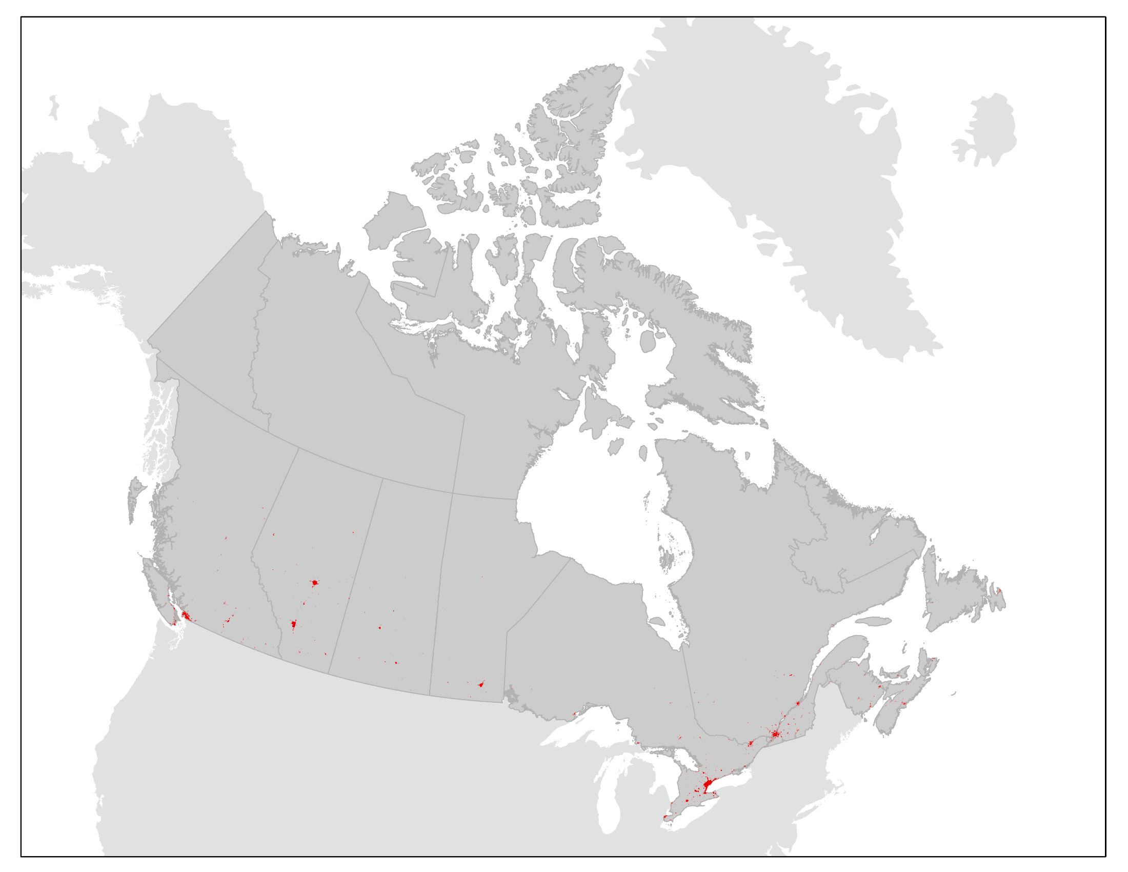
This product contains contiguously settled area (CSA) boundaries for a subset of Canadian population centres for 2010 and 2020. The CSA boundaries are derived from land cover data and represent the geographic extent of settled areas based on their physical footprint on the landscape. The boundaries can be used for reference, mapping and spatial analysis of settled areas and urban ecosystems. The CSA boundaries are created and maintained under the umbrella of the Census of Environment, and will support Statistics Canada’s ecosystem accounting efforts following the System of Environmental-Economic Accounting — Ecosystem Accounting (SEEA EA) framework. The primary purpose of the CSA boundaries is to represent the extent of the contiguous urban footprint and allow for the measurement of settled area expansion over time. They will also contribute to the urban and industrial ecosystem class in Statistics Canada’s ecosystem accounting efforts. The boundaries will be used for other types of urban ecosystem analyses, including measures of urban ecosystem condition and services. The CSA boundaries may also be used for urban thematic accounts or to inform where users of ecosystem services are located. Moving forward, CSA boundaries will be updated on an ongoing basis.
-

This collection is a legacy product that is no longer supported. It may not meet current government standards. The North American Atlas data are standardized geospatial data sets at 1:10,000,000 scale. A variety of basic data layers (e.g. roads, railroads, populated places, political boundaries, hydrography, bathymetry, sea ice and glaciers) have been integrated so that their relative positions are correct. This collection of data sets forms a base with which other North American thematic data may be integrated. The North American Atlas data are intended for geographic display and analysis at the national and continental level. Any data outside of Canada, Mexico, and the United States of America included in the North American Atlas data sets is strictly to complete the context of the data.