 Arctic SDI catalogue
Uranium
Type of resources
Categories
Available actions
Topics
Keywords
Contact for the resource
Provided by
Formats
Representation types
Update frequencies
status
Scale
-

This dataset shows the location of the distribution of structure form lines for the Province of Saskatchewan. This dataset shows the structure form lines for the Province of Saskatchewan and is designed for the Resource Map of Saskatchewan. Mapping in support of the dataset includes years of field observations which were then compiled and integrated into this dataset. The data was created as a file geodatabase feature class and output for public distribution. **Please Note – All published Saskatchewan Geological Survey datasets, including those available through the Saskatchewan Mining and Petroleum GeoAtlas, are sourced from the Enterprise GIS Data Warehouse. They are therefore identical and share the same refresh schedule.
-
This dataset shows the location of the distribution of uranium deposits for the Province of Saskatchewan. This dataset shows the uranium deposits for the Province of Saskatchewan and is designed for the Resource Map of Saskatchewan. Mapping in support of the dataset includes years of field observations which were then compiled and integrated into this dataset. The data was created as a file geodatabase feature class and output for public distribution. **Please Note – All published Saskatchewan Geological Survey datasets, including those available through the Saskatchewan Mining and Petroleum GeoAtlas, are sourced from the Enterprise GIS Data Warehouse. They are therefore identical and share the same refresh schedule.
-
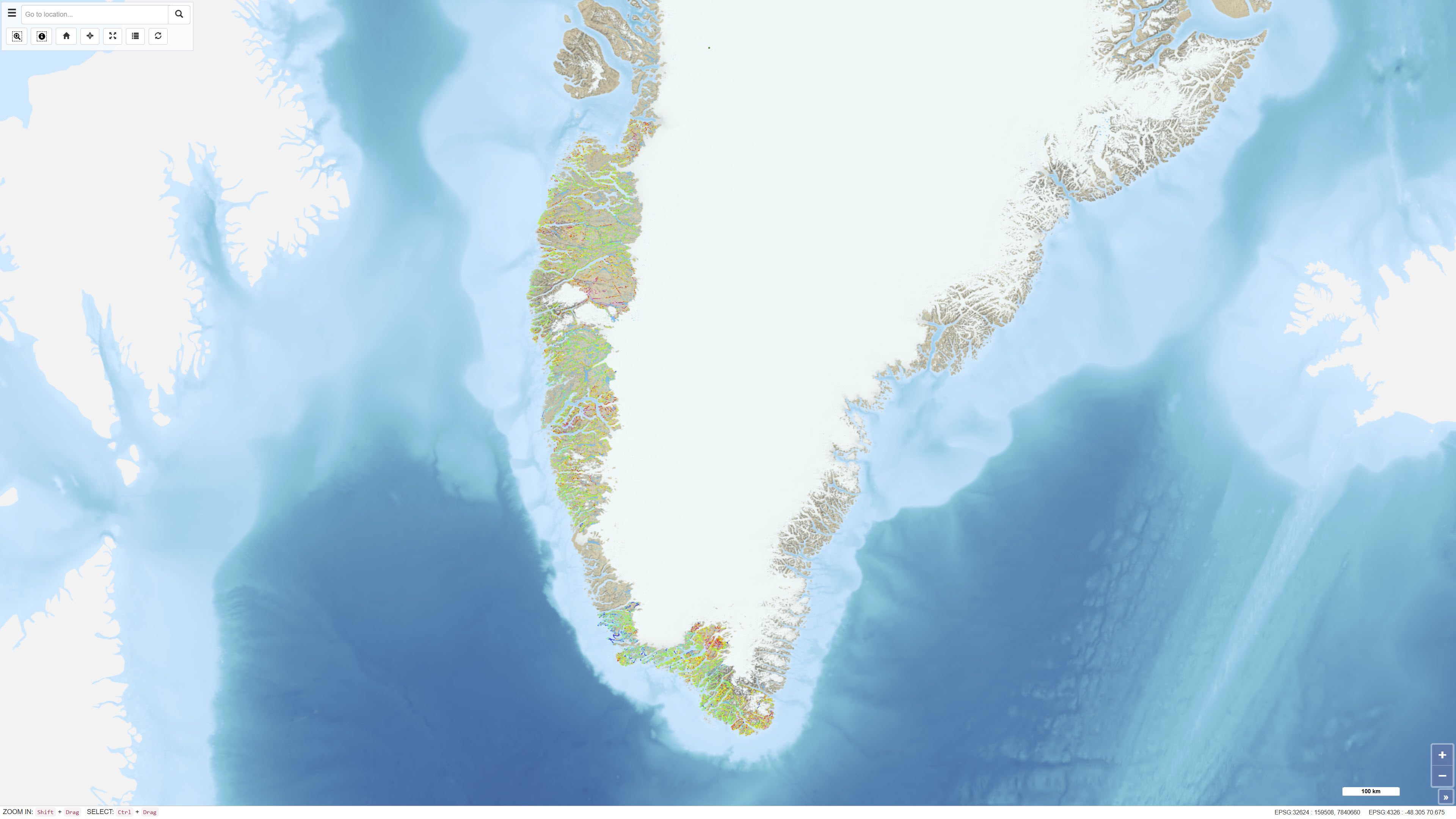
The dataset comprises regional airborne radiometric measurements acquired in Greenland during 1975–1982 as part of systematic geophysical mapping programmes. The measurements were collected using aircraft-mounted gamma spectrometers and record natural gamma radiation from potassium (K), thorium (Th) and uranium (U). The surveys covered large parts of Greenland and were conducted to support regional geological mapping and mineral exploration. The data constitute a historical geophysical reference dataset for analyses of near-surface lithological variations and the distribution of radioactive elements.
-
This map service provides access to most of the Resource Map datasets shown on the GeoAtlas application. **Please Note – All published Saskatchewan Geological Survey datasets, including those available through the Saskatchewan Mining and Petroleum GeoAtlas, are sourced from the Enterprise GIS Data Warehouse. They are therefore identical and share the same refresh schedule. This map service is used by the GeoATLAS web application, sub-section Resource Map in the Mineral Exploration theme. It includes Base Metals Potential, Coal Potential, Gold Potential, Helium Potential, Bitumen (Oil Sands) Potential, Lithium Potential, Potash and Salt Resource Potential, Rare Earth Elements Potential and Uranium Potential schema in Production Data Warehouse. Note: Oil and Gas pools are found in the /Petroleum service.
-
This map service provides access to most of the Resource Map datasets shown on the GeoAtlas application. **Please Note – All published Saskatchewan Geological Survey datasets, including those available through the Saskatchewan Mining and Petroleum GeoAtlas, are sourced from the Enterprise GIS Data Warehouse. They are therefore identical and share the same refresh schedule. This map service is used by the GeoATLAS web application, sub-section Resource Map in the Mineral Exploration theme. It includes Base Metals Potential, Coal Potential, Gold Potential, Helium Potential, Bitumen (Oil Sands) Potential, Lithium Potential, Potash and Salt Resource Potential, Rare Earth Elements Potential and Uranium Potential schema in Production Data Warehouse. Note: Oil and Gas pools are found in the /Petroleum service.
-
This map service provides access to most of the Resource Map datasets shown on the GeoAtlas application. **Please Note – All published Saskatchewan Geological Survey datasets, including those available through the Saskatchewan Mining and Petroleum GeoAtlas, are sourced from the Enterprise GIS Data Warehouse. They are therefore identical and share the same refresh schedule. This map service is used by the GeoATLAS web application, sub-section Resource Map in the Mineral Exploration theme. It includes Base Metals Potential, Coal Potential, Gold Potential, Helium Potential, Bitumen (Oil Sands) Potential, Lithium Potential, Potash and Salt Resource Potential, Rare Earth Elements Potential and Uranium Potential schema in Production Data Warehouse. Note: Oil and Gas pools are found in the /Petroleum service.
-
This map service provides access to most of the Resource Map datasets shown on the GeoAtlas application. **Please Note – All published Saskatchewan Geological Survey datasets, including those available through the Saskatchewan Mining and Petroleum GeoAtlas, are sourced from the Enterprise GIS Data Warehouse. They are therefore identical and share the same refresh schedule. This map service is used by the GeoATLAS web application, sub-section Resource Map in the Mineral Exploration theme. It includes Base Metals Potential, Coal Potential, Gold Potential, Helium Potential, Bitumen (Oil Sands) Potential, Lithium Potential, Potash and Salt Resource Potential, Rare Earth Elements Potential and Uranium Potential schema in Production Data Warehouse. Note: Oil and Gas pools are found in the /Petroleum service.
-
This map service provides access to most of the Resource Map datasets shown on the GeoAtlas application. **Please Note – All published Saskatchewan Geological Survey datasets, including those available through the Saskatchewan Mining and Petroleum GeoAtlas, are sourced from the Enterprise GIS Data Warehouse. They are therefore identical and share the same refresh schedule. This map service is used by the GeoATLAS web application, sub-section Resource Map in the Mineral Exploration theme. It includes Base Metals Potential, Coal Potential, Gold Potential, Helium Potential, Bitumen (Oil Sands) Potential, Lithium Potential, Potash and Salt Resource Potential, Rare Earth Elements Potential and Uranium Potential schema in Production Data Warehouse. Note: Oil and Gas pools are found in the /Petroleum service.
-
This map service provides access to most of the Resource Map datasets shown on the GeoAtlas application. **Please Note – All published Saskatchewan Geological Survey datasets, including those available through the Saskatchewan Mining and Petroleum GeoAtlas, are sourced from the Enterprise GIS Data Warehouse. They are therefore identical and share the same refresh schedule. This map service is used by the GeoATLAS web application, sub-section Resource Map in the Mineral Exploration theme. It includes Base Metals Potential, Coal Potential, Gold Potential, Helium Potential, Bitumen (Oil Sands) Potential, Lithium Potential, Potash and Salt Resource Potential, Rare Earth Elements Potential and Uranium Potential schema in Production Data Warehouse. Note: Oil and Gas pools are found in the /Petroleum service.
-
This map service provides access to most of the Resource Map datasets shown on the GeoAtlas application. **Please Note – All published Saskatchewan Geological Survey datasets, including those available through the Saskatchewan Mining and Petroleum GeoAtlas, are sourced from the Enterprise GIS Data Warehouse. They are therefore identical and share the same refresh schedule. This map service is used by the GeoATLAS web application, sub-section Resource Map in the Mineral Exploration theme. It includes Base Metals Potential, Coal Potential, Gold Potential, Helium Potential, Bitumen (Oil Sands) Potential, Lithium Potential, Potash and Salt Resource Potential, Rare Earth Elements Potential and Uranium Potential schema in Production Data Warehouse. Note: Oil and Gas pools are found in the /Petroleum service.