 Arctic SDI catalogue
Carcinus maenas
Type of resources
Topics
Keywords
Contact for the resource
Provided by
Formats
Representation types
Update frequencies
status
-
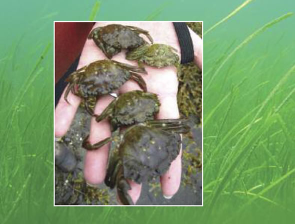
PURPOSE: Provide presence/absence and abundance data for the non-indigenous and invasive European green crab (EGC) in selected southern Gulf of St. Lawrence (sGSL) estuaries along the Northumberland Strait coast of New-Brunswick and eastern Prince-Edward-Island. DESCRIPTION: Temporal monitoring during ice-free seasons of European green crab abundance is completed in response to previous regional population declines in the Maritime provinces. Note that where presence is not indicated on the map does not mean absence - this survey is limited to a few sites. Traps that did not fish correctly were not included in the dataset. Examples of defective traps include: an open trap, an open bait container, a trap filled with algae and falling into the open position, a trap that has not been fished for over 48 hours, an overturned trap, or a trap that has been significantly moved or otherwise tampered with. Population estimates are not derived from this data. PARAMETERS COLLECTED: 1) EGC count, size measurement, sex, and catch weight 2) Counts of bycatch species. Categories reported in this dataset are finfish (cunner, striped bass, mummichog, winter flounder, smooth flounder, sculpin, tomcod, American eel, banded killifish, flounder, unknown bony fish), Atlantic rock crab, American lobster, and other (lion's mane jellyfish, moon jellyfish, other crabs, moon snail). Other smaller species were often in the trap but were not included as bycatch in this dataset as they can easily escape the mesh size and would not consistently be trapped. 3) Environmental data: water depth at trap setting, sediment type, vegetation types noted, salinity, water temperature, dissolved oxygen (not included), specific conductance (not included), conductivity (not included), weather, cloud cover (not included), tide state and direction (upon fishing). NOTES ON QUALITY CONTROL: Data entry of morphological parameters randomly verified for accuracy. Weights are not reported for PEI sites due to inconsistencies with types of weighing scales and measurement protocols. PHYSICAL SAMPLE DETAILS: Whole European green crab specimens SAMPLING METHODS: Baited trapping with Fukui traps. Bait was in a bait can or bag. Types of bait included herring (predominant type used), as well as other species when herring were not available (gaspereau, canned fish [tuna, kippers, snack sardines], mackerel, tilapia, and perch). USE LIMITATION: To ensure scientific integrity and appropriate use of the data, we would encourage you to contact the data custodian.
-
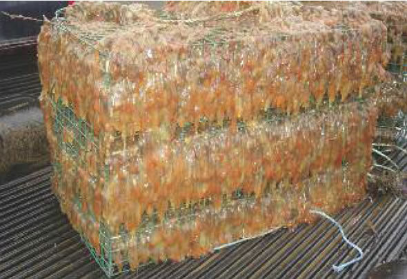
PURPOSE: Provide early detection of newly arrived Aquatic Invasive Species (AIS) and determine the spread, establishment and spatial distribution of existing AIS within marine waters of the southern Gulf of St. Lawrence (sGSL), DFO Gulf Region boundaries (northern and eastern coastal shores of NB, Gulf shore of NS, and PEI shoreline). DESCRIPTION: DFO Science monitors for AIS in the Gulf Region. The data collected from DFO's biofouling monitoring program provides an overview of the distribution and abundance of Aquatic Invasive Species (AIS) in the Gulf Region. This information can be used by the general public, scientists and DFO managers. Monitoring program targeting aquatic invasive species (AIS). Native biofouling species are not included in this dataset. Botrylloides violaceus: Violet tunicate Botryllus schlosseri: Golden star tunicate Ciona intestinalis: Vase tunicate Styela clava: Clubbed tunicate Caprella mutica*: Japanese skeleton shrimp Membranipora membranacea: Coffin box bryozoan Carcinus maenas*: European green crab Codium fragile*: Oyster thief alga Juxtacribrilina mutabilis**: Ribbed bryozoan (JCM) *indicates species that are not included as percent cover as they are not accurately captured by the sampling method, but are included as detections. **indicates species was only integrated fully into the monitoring protocol starting in 2025. Included here is a dataset of detection and percent cover data of AIS, as well as a monitoring station dataset. Environmental data collected, including from temperature loggers, are stored but not included here. PARAMETERS COLLECTED: Air and water temperature, salinity, depth, dissolved oxygen, weather conditions, list of biofouling AIS, percent cover of AIS on PVC plates, and incidental detection of other species and AIS in surrounding area. Only species data is pushed to the Open Data platform. NOTES ON QUALITY CONTROL: Each sample and species is processed and identified in a standardized fashion using standardized DFO Science AIS protocols and taxonomic references. Data is manually entered into DFO Gulf Region's AIS Science biofouling database and randomly verified for accuracy. SAMPLING METHODS: Biofouling monitoring is conducted using PVC collector plates that are deployed in the water column approximately 1 meter below the sea surface in the spring of each year. Biofouling organisms settle on these plates which are collected in the fall of the same year. Abundances of AIS are given as percent plate cover. Physico-chemical data including temperature, conductivity, and depth as well as weather conditions are noted at each geo-referenced biofouling monitoring site during initial deployment and at time of retrieval. All biofouling organisms settled on the underside of the PVC plates are noted and percent cover of each AIS is estimated. Any AIS present at the location is also noted. A HOBO temperature and light logger was deployed. USE LIMITATION: To ensure scientific integrity and appropriate use of the data, we would encourage you to contact the data custodian.