 Arctic SDI catalogue
Echinoderms
Type of resources
Topics
Keywords
Contact for the resource
Provided by
Formats
Representation types
Update frequencies
status
-

A derivative of DFO's benthic imagery surveys for the Marine Conservation Targets Program in the St. Anns Bank Marine Protected Area (https://open.canada.ca/data/en/dataset/2a55e2b4-cbb6-4fea-b17e-a16f5e99e68f), occurrence records in this analysis represent presence/absence and density of a biogenic habitat-forming species in five drift-camera transects in the southeast corner of the MPA, off the coast of Cape Breton, Nova Scotia, Canada. Presence/absence and count data of the unstalked crinoid (Heliometra glacialis) were derived from the use of high-resolution Nikon D850 still images (n=428, see link to parent record for more descriptive survey information and complete imagery dataset) and continuous high-definition video observations (approximately one observation every second using a 1Cam Mk6, SubC Imaging camera; n=8522). Densities were estimated by dividing the crinoid counts by the field of view (calculated from lasers with 10-cm spacing). Substrates were reported for each video observation, documenting the dominant substrate (>50% cover) according to a modified Wentworth scale (i.e., sand, gravel, pebble, cobble, boulder, bedrock; Wentworth 1922). Crinoids were observed in ~44% of the area of the five transects (~4811 m2), forming dense beds along sloped features from 77-119-m depths, predominantly on cobble and pebble substrates, reaching densities of up to 59 ind. m-2 and 139 ind. m-2 in the digital still images and video observations, respectively. Cite this data as: Lawton P, Teed L. Fine-scale observations of high density Heliometra glacialis (Crinoidea) beds from five near-seafloor imagery transects from a two-year survey in the St. Anns Bank Marine Protected Area, Atlantic Canada. Published March 2026. Coastal Ecosystems Science Division, Fisheries and Oceans Canada, St. Andrews, N.B. References: - Wentworth, C.K. 1922. A scale of grade and class terms for clastic sediments. The Journal of Geology 30(5): 377-392.
-

From August 2nd to September 9th, 2013, Fisheries and Oceans Canada conducted a baseline survey of marine fishes and their habitats on the Canadian Beaufort Shelf and slope. Sampling was conducted from the F/V Frosti at 64 stations along ten transects. Standardized sampling was conducted on the transects at pre-determined depth stations (20-40, 75, 200, 350, 500, 750, and 1000 m) using a variety of sampling equipment including benthic fishing trawls, plankton nets, sediment cores, and CTD and water sample profiles. A specialized CTD probe (UCTD) was deployed at an additional 72 locations while the ship was underway.Presented here is the information on the sampling locations, and the sampling gear deployed at each station.
-

From August 5th to September 3rd, 2012, Fisheries and Oceans Canada conducted a baseline survey of marine fishes and their habitats on the Canadian Beaufort Shelf and slope. Sampling was conducted from the F/V Frosti at 28 stations along four transects. Standardized sampling was conducted at pre-determined depth stations (20-40, 75, 200, 350, 500, 750, and 1000 m) using a variety of sampling equipment including benthic fishing trawls, plankton nets, sediment cores, and CTD and water sample profiles. A specialized CTD probe (UCTD) was deployed at an additional 30 locations while the ship was underway. Presented here is the information on the sampling locations, and the sampling gear deployed at each station.
-
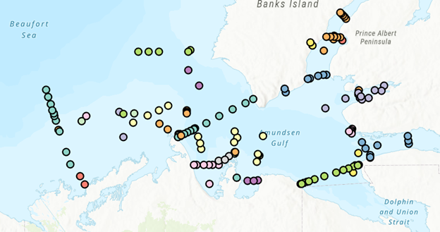
PURPOSE: The Department of Fisheries and Oceans (DFO) conducted a baseline survey of biological communities and habitat parameters in the offshore Canadian Beaufort Sea between 2012 and 2014, as part of the federally administered Beaufort Regional Environmental Assessment. The BREA-Marine Fishes Project (BREA-MFP) was the first comprehensive baseline study of offshore marine fish diversity and associated habitats in the Canadian Beaufort Sea. Knowledge gained during the BREA-MFP supports regulatory processes pertaining to offshore development and Oceans Management in the Inuvialuit Settlement Region, and provides baseline context for studies of the effects of climate change and variability. The Canadian Beaufort Sea – Marine Ecosystem Assessment (CBS-MEA, 2017-2019 and 2021-2024) is building on system baselines and ecological knowledge derived from the BREA-MFP to develop a comprehensive research and monitoring approach for the offshore Canadian Beaufort Sea. This approach will enable us to better understand the relationship between oceanographic drivers and ecosystem responses. The CBS-MEA focuses on integrating oceanography, food web linkages, physical-biological couplings and spatial and inter-annual variabilities, while also expanding baseline coverage of species diversity, abundances, and habitat associations to areas of the Beaufort Sea and Canadian Archipelago that are previously unstudied in this context. DESCRIPTION: Between 2017 and 2019, and between 2021 and 2024, Fisheries and Oceans Canada conducted a baseline survey of marine fishes and their habitats on the Canadian Beaufort Shelf and slope in August and early September each year. Sampling was conducted from the F/V Frosti at over 150 stations along ten multi-year transects, and over 50 non-transect stations. Standardized sampling was conducted at pre-determined depth stations (20-40, 75, 200, 350, 500, 750, and 1000 m) using a variety of sampling equipment including benthic fishing trawls, plankton nets, sediment cores, and CTD and water sample profiles. Presented here is the information on the sampling locations, and the sampling gear deployed at each station.