 Arctic SDI catalogue
Environmental inequalities
Type of resources
Topics
Keywords
Contact for the resource
Provided by
Formats
Resolution
-

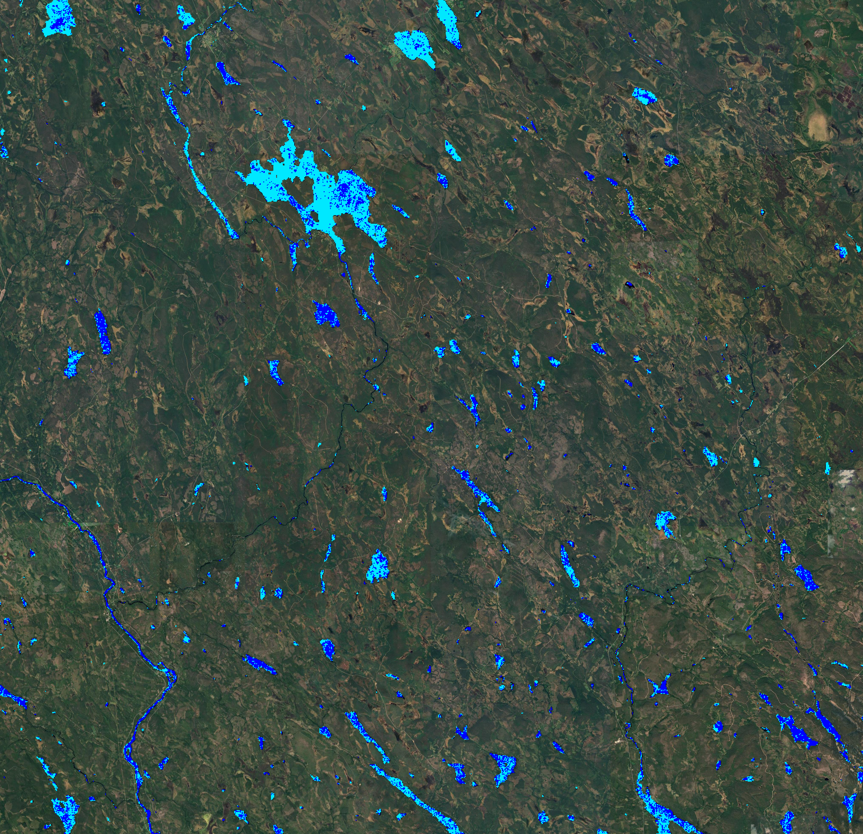
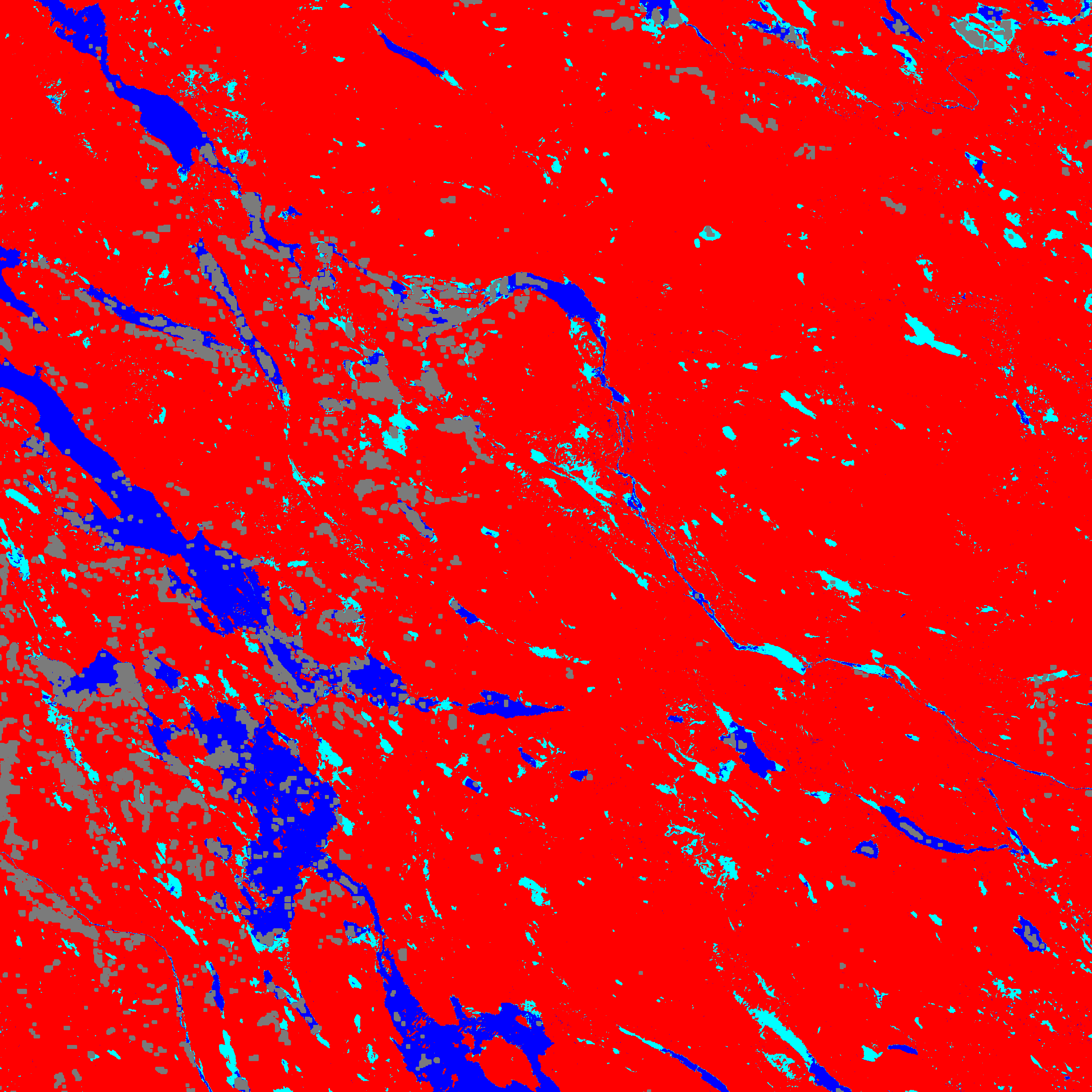
This is the metadata covering the Water Layer (WL) product. The WL is one of the products of the pan-European High-Resolution Water Snow & Ice portfolio (HR-WSI), which are provided at high spatial resolution from the Sentinel-2 and Sentinel-1 constellations data from September 1, 2016 onwards.. The WL is generated for the 2021 reference year. It is a a multi-annual product based on the information covering the period 2016-2021. In the context of the HR-WSI, the water and dry frequency masks are derived from intermediate outputs of the WCD workflow, the monthly surface water masks in combination with the WIC S2 NRT product. It provides detailed information about the presence and condition of water surfaces across Europe. It is also generated in different spatial resolutions (10m and 100m) and projections (LAEA & WGS84/UTM). The High Resolution Water Layer portfolio consists of the WL, the Water Presence Index (WPI), the Water confidence layer (WCL) and the Rolling archive (WLRA). There are 5 major classes like: - Dry (always or mostly dry with minor instances of wet) - permanent water (always contains water) - temporary water ( temporary water surfaces, aliteration of dry and water) - sea water (oceans and sea) - clouds
-
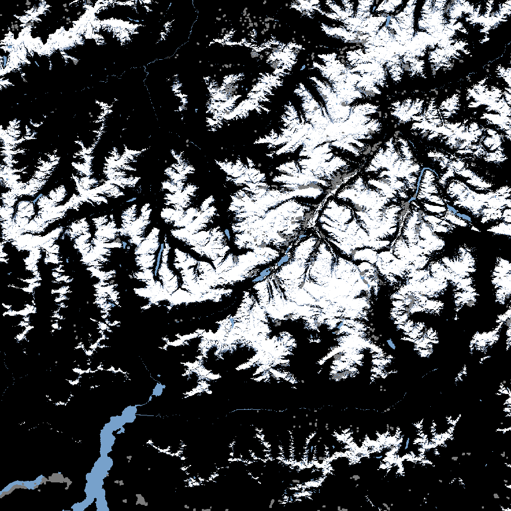
The Fractional Snow Cover (FSC) product is generated in near real-time at European scale based on optical satellite data from the Sentinel-2 constellation (revisit time: 5 days with Sentinel-2A and Sentinel-2B). The product provides the fraction of the surface covered by snow at the top of canopy (FSC-TOC) and on ground (FSC-OG) per pixel as a percentage (0% – 100%) with a spatial resolution of 20 m x 20 m. FSC is one of the products of the pan-European High-Resolution Water Snow & Ice portfolio (HR-WSI), which are provided at high spatial resolution from the Sentinel-2 and Sentinel-1 constellations data from September 1, 2016 onwards. The FSC product is distributed in raster files covering an area of 110 km by 110 km with a pixel size of 20 m by 20 m in UTM/WGS84 projection, which corresponds to the Sentinel-2 input L1C product tile. Each product is composed of separate files corresponding to the different layers of the product, and another metadata file.
-

This metadata covers the Water Cover Duration (WCD) product which is one of the products of the pan-European High-Resolution Water Snow & Ice portfolio (HR-WSI), which are provided at high spatial resolution from the Sentinel-2 and Sentinel-1 constellations data from September 1, 2016 onwards. The High Resolution Water Layer portfolio consists of the Water Layer (WL), the Water Presence Index (WPI), the Water confidence layer (WCL) and the Rolling archive (WLRA). The WCD is generated on a yearly basis, starting in 2017 (01.09 to 30.08 each year), and is published in October. It provides an estimated number of days during which the area was covered by water for each pixel within the entire EEA-38+UK region. The product is derived from data obtained from the Sentinel-1 and Sentinel-2 satellites, as well as from the Sentinel-2 Water and Ice Cover (WIC S2) product. The product has a spatial resolution of 10m x 10m and 100 m x 100 m, is delivered in LAEA and WGS84/UTM projection and is updated on an annual basis. This methodology results in a high-quality WCD information layer. The WCD product represents one of the two water products within the overall WSI product portfolio, which includes not only water but also snow and ice data.
-

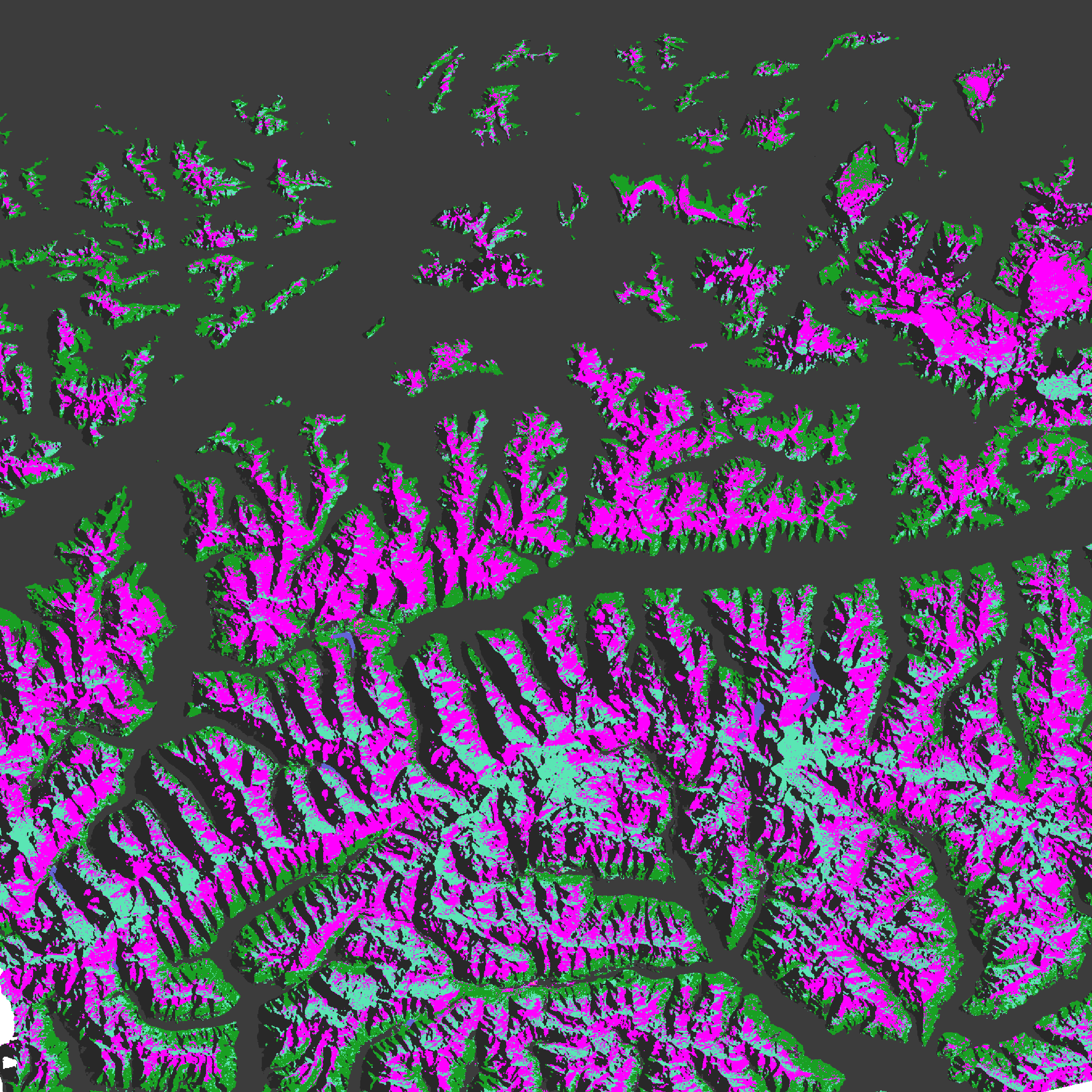
This metadata covers the Ice Cover Duration (ICD) product is generated once a year and it provides an estimated number of ice covered days for each pixel in the inland waters at European scale. The product is derived from Water/Ice Cover (WIC) products, both from Sentinel-1 and Sentinel-2 observations. It has a spatial resolution of 20 m x 20 m. It is also available in another projection as tiles aligned with the Pan-European High-Resolution Layers in the European 20 m x 20 m grid (ETRS89 LAEA - EPSG: 3035). ICD is one of the products of the pan-European High-Resolution Water Snow & Ice portfolio (HR-WSI), which are provided at high spatial resolution from the Sentinel-2 and Sentinel-1 constellations data from September 1, 2016 onwards.
-
The Daily Cumulative Gap-filled Fractional Snow Cover (GFSC) product is generated on a daily basis at European scale based on synthetic aperture radar data from the Sentinel-1 constellation and optical imaging data from the Sentinel-2 constellation. The product provides the extent of the snow cover per pixel as a percentage (0% – 100%) with a spatial resolution of 60 m x 60 m. GFSC is one of the products of the pan-European High-Resolution Water Snow & Ice portfolio (HR-WSI), which are provided at high spatial resolution from the Sentinel-2 and Sentinel-1 constellations data from September 1, 2016 onwards. The GFSC product is distributed in raster files covering an area of 110 km by 110 km with a pixel size of 60 m by 60 m in UTM/WGS84 projection, which corresponds to the Sentinel-2 input L1C product tile. Each product is composed of separate files corresponding to the different layers of the product, and another metadata file.
-
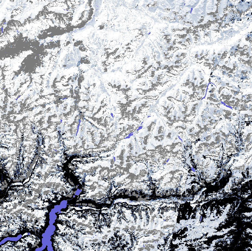
The SAR Wet Snow (SWS) product is generated in near real-time for selected high mountain areas at European scale based on C-band SAR satellite data from the Sentinel-1 constellation. The product provides the wet snow extent for high mountain areas with a spatial resolution of 60 m x 60 m. Dry snow cannot be discriminated from patchy snow or snow free areas by the means of C-band SAR data only and are thus combined in one class. Radar shadow / layover / foreshortening, water bodies, forests, urban areas, and non-mountain regions are masked. SWS is one of the products of the pan-European High-Resolution Water Snow & Ice portfolio (HR-WSI), which are provided at high spatial resolution from the Sentinel-2 and Sentinel-1 constellations data from September 1, 2016 onwards. The SWS product is distributed in raster files covering an area of 110 km by 110 km with a pixel size of 60 m by 60 m in UTM/WGS84 projection, which corresponds to the Sentinel-2 input L1C product tile. Each product is composed of separate files corresponding to the different layers of the product, and another metadata file.
-

The Rolling Archive database (WLRA) is one of the products of the pan-European High-Resolution Water Snow & Ice portfolio (HR-WSI), which are provided at high spatial resolution from the Sentinel-2 and Sentinel-1 constellations data from September 1, 2016 onwards. The High Resolution Water Layer portfolio consists of the Water Layer (WL), the Water Presence Index (WPI), the Water confidence layer (WCL) and the Rolling archive (WLRA). The WLRA consists of intermediate production layers such as water and wetness masks showing the seasonal water and dry occurrences starting 2009. The masks are used for the generation of the Water Layer which covers a period of seven years per reference year and is regularly updated every three years. It is therefore important that it is consistent over the entire period. To guarantee reproducibility and future continuation of the baseline product, these masks are provided within a database consisting of all seasonal masks starting from 2009. With the new update of the Water product, the HR WL for the reference year 2021 only water masks will be continued. Additionally, the computation frequency changed from seasonal to monthly masks. This update covers a period from 2016.09.01 to 20211231 including an update of the masks already availbe from the historic 2018 production. The binary masks are provided across Europe in a spatial resolution of 10 m x 10 m as GeoTiffs zipped in a ZARR file.
-
The Sentinel-1 Water and Ice Cover (WIC S1) product is generated in near real-time at European scale, based on radar data from the Sentinel-1 constellation. The product provides the water and ice extent on water bodies (rivers and lakes), at a spatial resolution of 60 m x 60 m. WIC S1 is one of the products of the pan-European High-Resolution Water Snow & Ice portfolio (HR-WSI), which are provided at high spatial resolution from the Sentinel-2 and Sentinel-1 constellations data from September 1, 2016 onwards. The WIC S1 product is distributed in raster files covering an area of 110 km by 110 km with a pixel size of 60 m by 60 m in UTM/WGS84 projection, which corresponds to the Sentinel-2 input L1C product tile. Each product is composed of separate files corresponding to the different layers of the product, and another metadata file.
-
The Sentinel-2 Water and Ice Cover (WIC S2) product is generated in near real-time at European scale, based on optical satellite data from the Sentinel-2 constellation. The product provides the water and ice extent, including snow-covered or snow-free ice on water bodies (rivers and lakes), at a spatial resolution of 20 m x 20 m. WIC S2 is one of the products of the pan-European High-Resolution Water Snow & Ice portfolio (HR-WSI), which are provided at high spatial resolution from the Sentinel-2 and Sentinel-1 constellations data from September 1, 2016 onwards. The WIC S2 product is distributed in raster files covering an area of 110 km by 110 km with a pixel size of 20 m by 20 m in UTM/WGS84 projection, which corresponds to the Sentinel-2 input L1C product tile. Each product is composed of separate files corresponding to the different layers of the product, and another metadata file.
-

This metadata covers the Water Cover Duration (WCD) product which is one of the products of the pan-European High-Resolution Water Snow & Ice portfolio (HR-WSI), which are provided at high spatial resolution from the Sentinel-2 and Sentinel-1 constellations data from September 1, 2016 onwards. The High Resolution Water Layer portfolio consists of the Water Layer (WL), the Water Presence Index (WPI), the Water confidence layer (WCL) and the Rolling archive (WLRA). The WCD is generated on a yearly basis, starting in 2017 (01.09 to 30.08 each year), and is published in October. It provides an estimated number of days during which the area was covered by water for each pixel within the entire EEA-38+UK region. The product is derived from data obtained from the Sentinel-1 and Sentinel-2 satellites, as well as from the Sentinel-2 Water and Ice Cover (WIC S2) product. The product has a spatial resolution of 10m x 10m and 100 m x 100 m, is delivered in LAEA and WGS84/UTM projection and is updated on an annual basis. This methodology results in a high-quality WCD information layer. The WCD product represents one of the two water products within the overall WSI product portfolio, which includes not only water but also snow and ice data.