 Arctic SDI catalogue
Photographie aérienne
Type of resources
Available actions
Keywords
Contact for the resource
Provided by
Years
Representation types
Update frequencies
status
Service types
-

284 reports including 7324 photographs of various sectors of Montreal between 1960 and 1992, taken at low altitude. The photos were mostly taken in the 1960s and 1970s. ATTENTION: For any use of these photographic archives, it is required that the credit mention be: “Archives de la Ville de Montréal”. See also vertical aerial views of Montreal Island: [1925-1935] (https://donnees.montreal.ca/ville-de-montreal/vues-aeriennes-de-l-ile-de-montreal-1925-1935), [1947-1949] (https://donnees.montreal.ca/ville-de-montreal/vues-aeriennes-archives), [1958—1975] (https://donnees.montreal.ca/ville-de-montreal/vues-aeriennes-de-montreal-1958-1975).**This third party metadata element was translated using an automated translation tool (Amazon Translate).**
-
Lignes de courbes de niveau générés à partir des données LiDAR capturés par McElhanney Consulting Services Ltd (MCSL). Les courbes de niveau relient les points de même élévation pour le paysage visé par le projet. Pour plus d'information, consulter : http://ouvert.canada.ca/data/fr/dataset/9bdc1a9c-baf7-4eb0-a532-c1057b284b8f
-

Spot Height Points for the Pasqua, Crooked, Echo, and Round Lakes area within the Qu'Appelle Valley River system in Saskatchewan
-

Note: To visualize the data in the viewer, zoom into the area of interest. The National Air Photo Library (NAPL) of Natural Resources Canada archives over 6 million aerial photographs covering all of Canada, some of which date back to the 1920s. This collection includes Time Series of aerial orthophoto mosaics over a selection of major cities or targeted areas that allow the observation of various changes that occur over time in those selected regions. These mosaics are disseminated through the Data Cube Platform implemented by NRCan using geospatial big data management technologies. These technologies enable the rapid and efficient visualization of high-resolution geospatial data and allow for the rapid generation of dynamically derived products. The data is available as Cloud Optimized GeoTIFF (COG) files for direct access and as Web Map Services (WMS) or Web Coverage Services (WCS) with a temporal dimension for consumption in Web or GIS applications. The NAPL mosaics are made from the best spatial resolution available for each time period, which means that the orthophotos composing a NAPL Time Series are not necessarily coregistered. For this dataset, the spatial resolutions vary from 10 cm to 50 cm. The NAPL indexes and stores federal aerial photography for Canada, and maintains a comprehensive historical archive and public reference centre. The Earth Observation Data Management System (EODMS) online application allows clients to search and retrieve metadata for over 3 million out of 6 million air photos. The EODMS online application enables public and government users to search and order raw Government of Canada Earth Observation images and archived products managed by NRCan such as aerial photos and satellite imagery. To access air photos, you can visit the EODMS web site: https://eodms-sgdot.nrcan-rncan.gc.ca/index-en.html
-

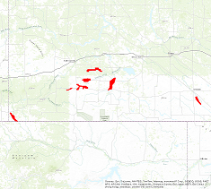
Flight lines for the Pasqua, Crooked, Echo, and Round Lakes area within the Qu'Appelle Valley River system in Saskatchewan
-
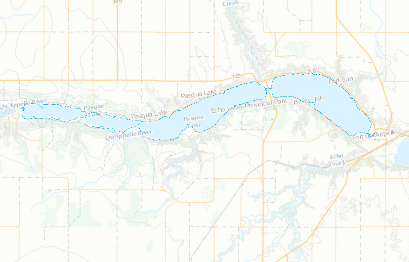
Shorelines for the Pasqua, Crooked, Echo, and Round Lakes within the Qu'Appelle Valley River system in Saskatchewan
-

Contour Lines for the Pasqua, Crooked, Echo, and Round Lakes within the Qu’Appelle Valley river system in Saskatchewan
-

Note: To visualize the data in the viewer, zoom into the area of interest. The National Air Photo Library (NAPL) of Natural Resources Canada archives over 6 million aerial photographs covering all of Canada, some of which date back to the 1920s. This collection includes Time Series of aerial orthophoto mosaics over a selection of major cities or targeted areas that allow the observation of various changes that occur over time in those selected regions. These mosaics are disseminated through the Data Cube Platform implemented by NRCan using geospatial big data management technologies. These technologies enable the rapid and efficient visualization of high-resolution geospatial data and allow for the rapid generation of dynamically derived products. The data is available as Cloud Optimized GeoTIFF (COG) files for direct access and as Web Map Services (WMS) or Web Coverage Services (WCS) with a temporal dimension for consumption in Web or GIS applications. The NAPL mosaics are made from the best spatial resolution available for each time period, which means that the orthophotos composing a NAPL Time Series are not necessarily coregistered. For this dataset, the spatial resolutions vary from 150 cm to 200 cm. The NAPL indexes and stores federal aerial photography for Canada, and maintains a comprehensive historical archive and public reference centre. The Earth Observation Data Management System (EODMS) online application allows clients to search and retrieve metadata for over 3 million out of 6 million air photos. The EODMS online application enables public and government users to search and order raw Government of Canada Earth Observation images and archived products managed by NRCan such as aerial photos and satellite imagery. To access air photos, you can visit the EODMS web site: https://eodms-sgdot.nrcan-rncan.gc.ca/index-en.html
-
LiDAR data collected in the fall of 2011 and spring 2012 for AAFC owned water control structures in the Cypress, Middle Creek, Pheasant Creek, Roughbark, Moosomin,Braddock, Maple Creek, Eastend, Altawan, Admiral, Russell Creek, Cadillac-Gouveneur and Lafleche areas. Includes Digital Terrain Models, Grid Points, Hillshades, Contours and Orthorectified Imagery.