 Arctic SDI catalogue
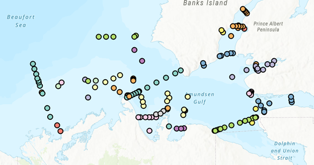
Tunicates
Type of resources
Topics
Keywords
Contact for the resource
Provided by
Formats
Representation types
Update frequencies
status
-

Fisheries and Oceans Canada’s (DFO) National Biofouling Monitoring Program (BMP) has conducted annual field surveys to monitor the introduction, establishment, spread, species richness, and relative abundance of native and non-indigenous species (NIS) since 2006. Standardized monitoring protocols employed by DFO-Maritimes, -Gulf, and -Quebec Regions include biofouling collector plates deployed from May to October at intertidal and shallow subtidal, geo-referenced sites, including public and private docks, aquaculture lease sites, public and private marinas and yacht clubs. Initially in the Maritimes Region (2006-2017) collectors consisted of 3, 10 cm by 10cm PVC plates deployed in a vertical array and spaced approximately 40-cm apart with the shallowest plate hung at least 1 m below the surface to sample shallow subtidal and intertidal species (Sephton et al. 2011, 2017). Two replicate arrays were deployed at least 5 m apart per site. Since 2018, collector arrays were modified to enhance statistical replication, including 10 individual collectors deployed per site at 1 m depth and at least 5 m apart (as above) from May to October. The percent cover of AIS on all collectors was determined by visual examination and scored as follows; (i) ‘0’ = absent, (ii) ‘1’ = ≤25 % cover, (iii) ‘2’ = 25 to ≤50 %, (iv) ‘3’ = 50–75% , and (v) ‘4’ = >75%. Average percent cover is provided for all NIS observed annually per site. Presence-absence indicates that an NIS was observed on at least one collector plate. One additional rocky intertidal species (Asian shore crab; Hemigrapsus sanguineus) was assessed via beach surveys as permitted by time and resources following its initial siting in St Mary’s Bay (Nova Scotia) in April 2020. Rapid assessment surveys conducted in the Fall of 2020 and 2021 were employed to delineate H. sanguineus’ distribution and relative abundance. Areas deemed suitable and at high risk for spread were targeted, including exposed rocky intertidal habitat in southwest regions of Nova Scotia and New Brunswick. Each rapid assessment consisted of 30-minute beach surveys per site conducted by 2 or 3 people (modified from Stephenson et al. 2011). During each survey, crabs were collected under rocks and seaweed in preferred cobble/boulder habitat (Lohrer et al. 2000). Count data was standardized for each site as the number of crabs collected per 30-min search per person. Cite as: DFO-Maritimes Biofouling Monitoring Program. Published October 2018, Updated December 2023. Coastal Ecosystems Science Division, Fisheries and Oceans Canada, Dartmouth, NS Citations: Sephton D, B Vercaemer, JM Nicolas, J Keays (2011) Monitoring for invasive tunicates in Nova Scotia, Canada (2006-2009) Aquatic Invasions 6: 391-403. Sephton D, B Vercaemer, A Silva, L Stiles, M Harris, K Godin (2017) Biofouling monitoring for aquatic invasive species (AIS) in DFO Maritimes Regions (Atlantic shore of Nova Scotia and southwest New Brunswick): May-November, 2012-2015. Canadian Technical Report of Fisheries and Aquatic Sciences 3158: 72 pp. Stephenson EH, RS Steneck, RH Seeley (2009) Possible temperature limits to range expansion of non-native Asian shore crabs in Maine. Journal of Experimental Marine Biology and Ecology 375: 21–31. doi:10.1016/j.jembe.2009.04.020
-

From August 6th to September 9th, 2014, Fisheries and Oceans Canada conducted a baseline survey of marine fishes and their habitats on the Canadian Beaufort Shelf and slope. Sampling was conducted from the F/V Frosti at 56 stations along thirteen transects, with an additional three stations not located on transects. Standardized sampling was conducted on the transects at pre-determined depth stations (20-40, 75, 200, 350, 500, 750, and 1000 m) using a variety of sampling equipment including benthic fishing trawls, plankton nets, sediment cores, and CTD and water sample profiles. Presented here is the information on the sampling locations, and the sampling gear deployed at each station.
-
PURPOSE: The Department of Fisheries and Oceans (DFO) conducted a baseline survey of biological communities and habitat parameters in the offshore Canadian Beaufort Sea between 2012 and 2014, as part of the federally administered Beaufort Regional Environmental Assessment. The BREA-Marine Fishes Project (BREA-MFP) was the first comprehensive baseline study of offshore marine fish diversity and associated habitats in the Canadian Beaufort Sea. Knowledge gained during the BREA-MFP supports regulatory processes pertaining to offshore development and Oceans Management in the Inuvialuit Settlement Region, and provides baseline context for studies of the effects of climate change and variability. The Canadian Beaufort Sea – Marine Ecosystem Assessment (CBS-MEA, 2017-2019 and 2021-2024) is building on system baselines and ecological knowledge derived from the BREA-MFP to develop a comprehensive research and monitoring approach for the offshore Canadian Beaufort Sea. This approach will enable us to better understand the relationship between oceanographic drivers and ecosystem responses. The CBS-MEA focuses on integrating oceanography, food web linkages, physical-biological couplings and spatial and inter-annual variabilities, while also expanding baseline coverage of species diversity, abundances, and habitat associations to areas of the Beaufort Sea and Canadian Archipelago that are previously unstudied in this context. DESCRIPTION: Between 2017 and 2019, and between 2021 and 2024, Fisheries and Oceans Canada conducted a baseline survey of marine fishes and their habitats on the Canadian Beaufort Shelf and slope in August and early September each year. Sampling was conducted from the F/V Frosti at over 150 stations along ten multi-year transects, and over 50 non-transect stations. Standardized sampling was conducted at pre-determined depth stations (20-40, 75, 200, 350, 500, 750, and 1000 m) using a variety of sampling equipment including benthic fishing trawls, plankton nets, sediment cores, and CTD and water sample profiles. Presented here is the information on the sampling locations, and the sampling gear deployed at each station.