polar bear
Type of resources
Available actions
Topics
Keywords
Contact for the resource
Provided by
Formats
Representation types
Update frequencies
status
-
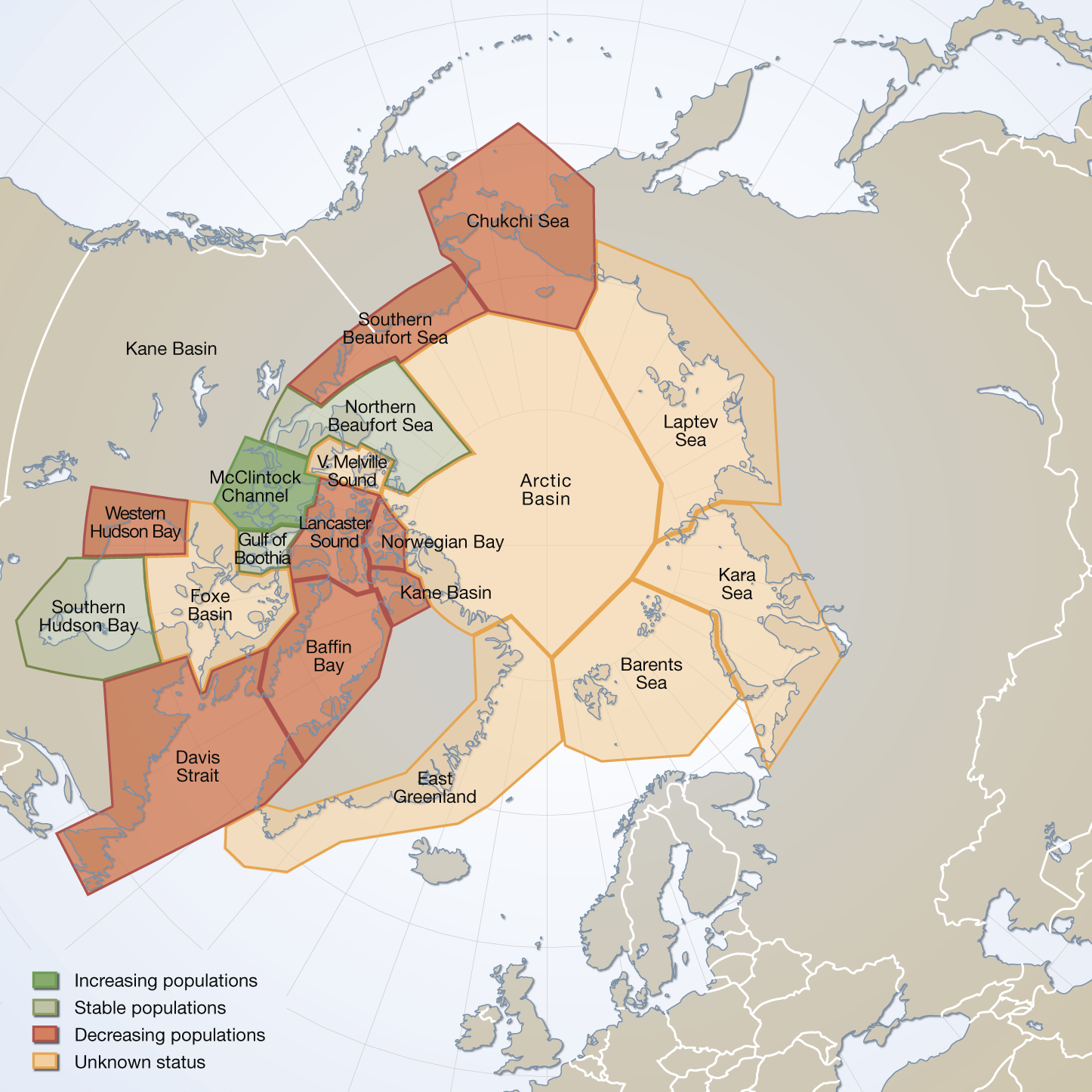
Circumpolar map of all polar bear subpopulation as recognized by the IUCN/Polar Bear Specialist Group in 2009 (PBSG 2010a). Total area covered = 24 mill. km(2). Vongraven, D and Peacock, E. Development of a pan-Arctic monitoring plan for polar bears:background paper. Published in the Arctic Biodiversity trends 2010, Indicator #01 - released in May 2010 Updated in feb.2025 with spatial data from 2022
-
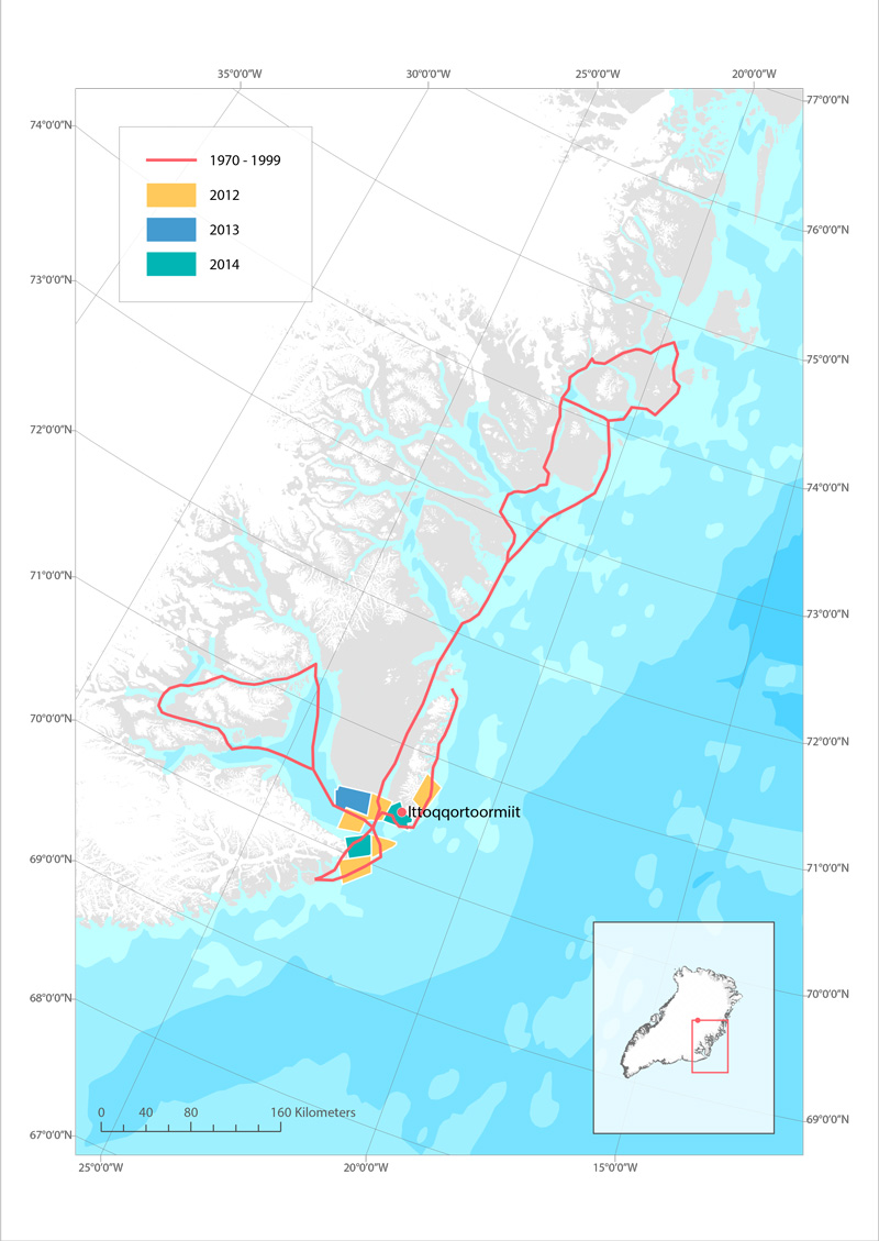
Routes used for hunting polar bear in Ittoqqoortoormiit, East Greenland before 1999 (red line), and in 2012 (yellow), 2013 (blue) and 2014 (green). STATE OF THE ARCTIC MARINE BIODIVERSITY REPORT - <a href="https://arcticbiodiversity.is/findings/marine-mammals" target="_blank">Chapter 3</a> - Page 159 - Box figure 3.6.1
-
Wildlife Key Areas (WKA) are locations used by wildlife for critical, seasonal life functions. WKAs are identified by interpreting observed locations of wildlife at key times of year, not through intensive habitat assessment. Polygons derived from interviews with locals and from GIS interpretation of wildlife/habitat surveys. GIS interpretation follows criteria specific for taxon and/or populations of taxon. Key Areas are based on observed locations of wildlife at key times of year, not on habitat assessment. With new information, boundaries and designations of Key Areas can change and additional Key Areas can be identified. Furthermore, Key Areas are not the only sites important for wildlife. Other information sources can identify other sites important for wildlife for reasons outside the scope of the WKA Inventory Program. Updates to Key Areas occur only periodically. For the most current information, please consult with the Regional Biologist for your area of interest. If you have questions or would like to contribute to the WKA database, please contact the WKA Inventory Program ( wka@yukon.ca ). Distributed from GeoYukon by the Government of Yukon . Discover more digital map data and interactive maps from Yukon's digital map data collection. For more information: geomatics.help@yukon.ca
-
This feature delineates forest and vegetation stands in the Yukon at a scale of 1: 40 ,000. It is a management level forest inventory (as opposed to a n operational level) - meaning that analysis and mapping are most effective close to the 1:40,000 scale and not larger . This inventory has been completed in various stages : delineation from hardcopy black and white photographs took place from 1987 to 2002; while recent data collection has proceeded through a digital (aka 'softcopy') methodology of scanned photographs and digital elevation models. Distributed from GeoYukon by the Government of Yukon . Discover more digital map data and interactive maps from Yukon's digital map data collection. For more information: geomatics.help@yukon.ca