 Arctic SDI catalogue
GTiff
Type of resources
Available actions
Topics
Keywords
Contact for the resource
Provided by
Years
Formats
Resolution
-
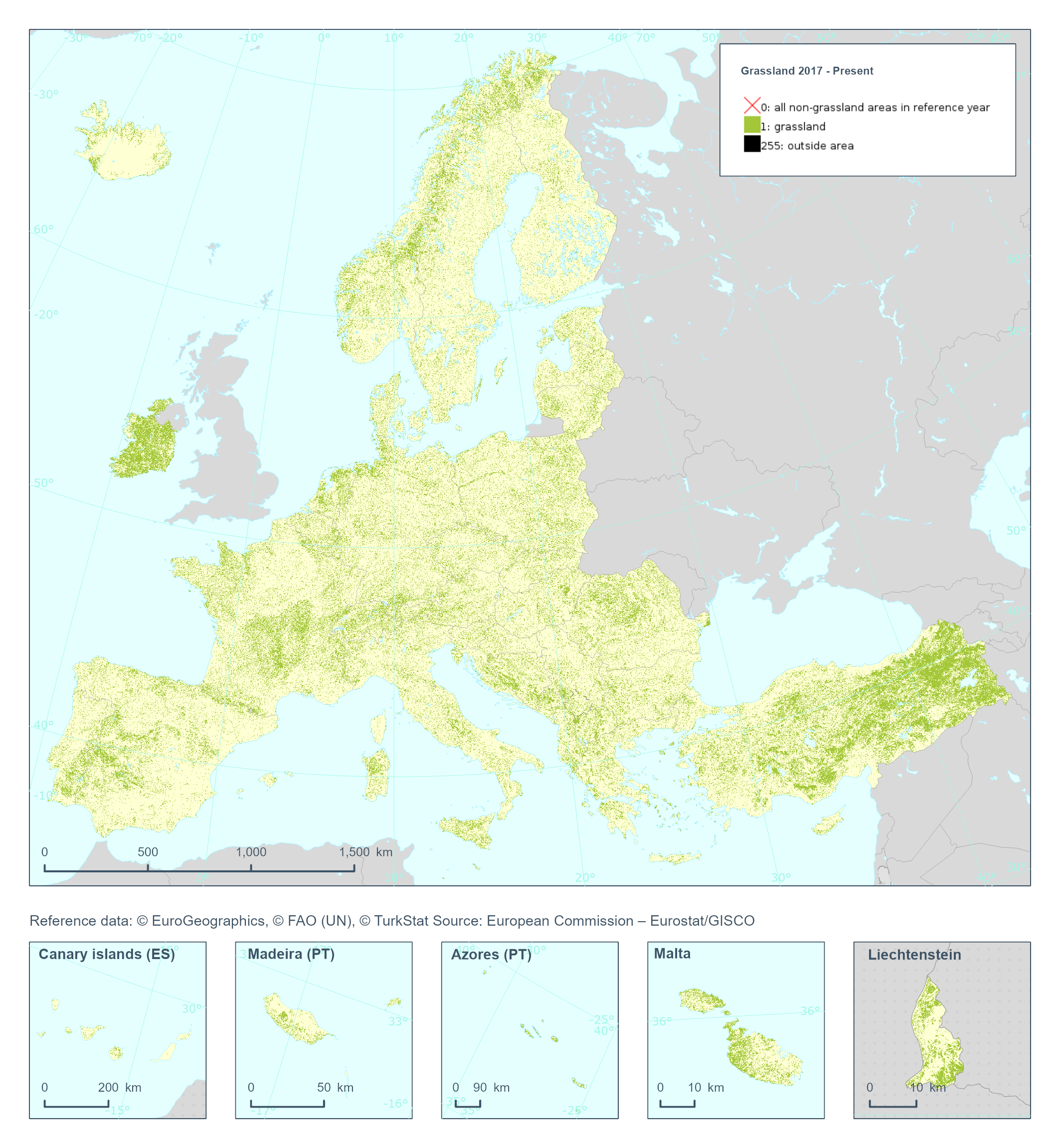
The High Resolution Layer Grassland (GRA) raster product provides a binary status layer of grassland/non-grassland mask. This grassy and non-woody vegetation baseline product includes all kinds of grasslands: managed grassland, semi-natural grassland and natural grassy vegetation. It does not include temporary grasslands, which are masked out using the corresponding Ploughing indicator (PLOUGH), indicating on the number of years since a pixel was last ploughed. In the 100 meter raster product, the number of Grassland pixels are counted and the percentages stored in each 100 meter cell. The class 255 = outside area is predefined by the 100m boundary layer and remains unchanged. This dataset is provided annually starting in 2017 with 100 meter rasters (fully conformant with the EEA reference grid) in 100 x 100 km tiles covering the EEA38 countries. High Resolution Layer Grasslands product is part of the European Union’s Copernicus Land Monitoring Service. This dataset includes data from the French Overseas Territories (DOMs)
-
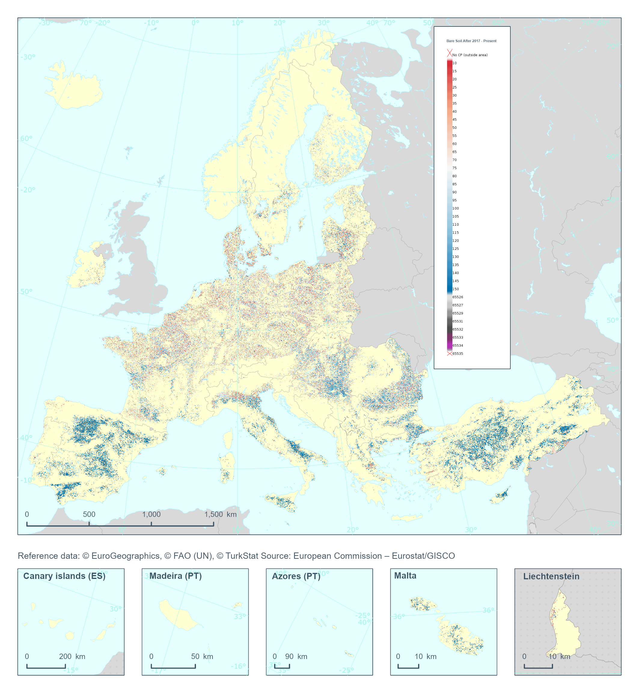
The High Resolution Layer Cropping Patterns - Bare Soil After (CPBSA) raster product provides bare soil period (in days) after the harvest of the main annual crop. Note that the bare soil period cannot transcend the calendar year for which the product is generated. This dataset is provided annually starting in 2017 with 10 meter rasters (fully conformant with the EEA reference grid) in 100 x 100 km tiles covering the EEA38 countries. High Resolution Layer Croplands product is part of the European Union’s Copernicus Land Monitoring Service. Confidence layer available for the dataset. This dataset includes data from the French Overseas Territories (DOMs)
-
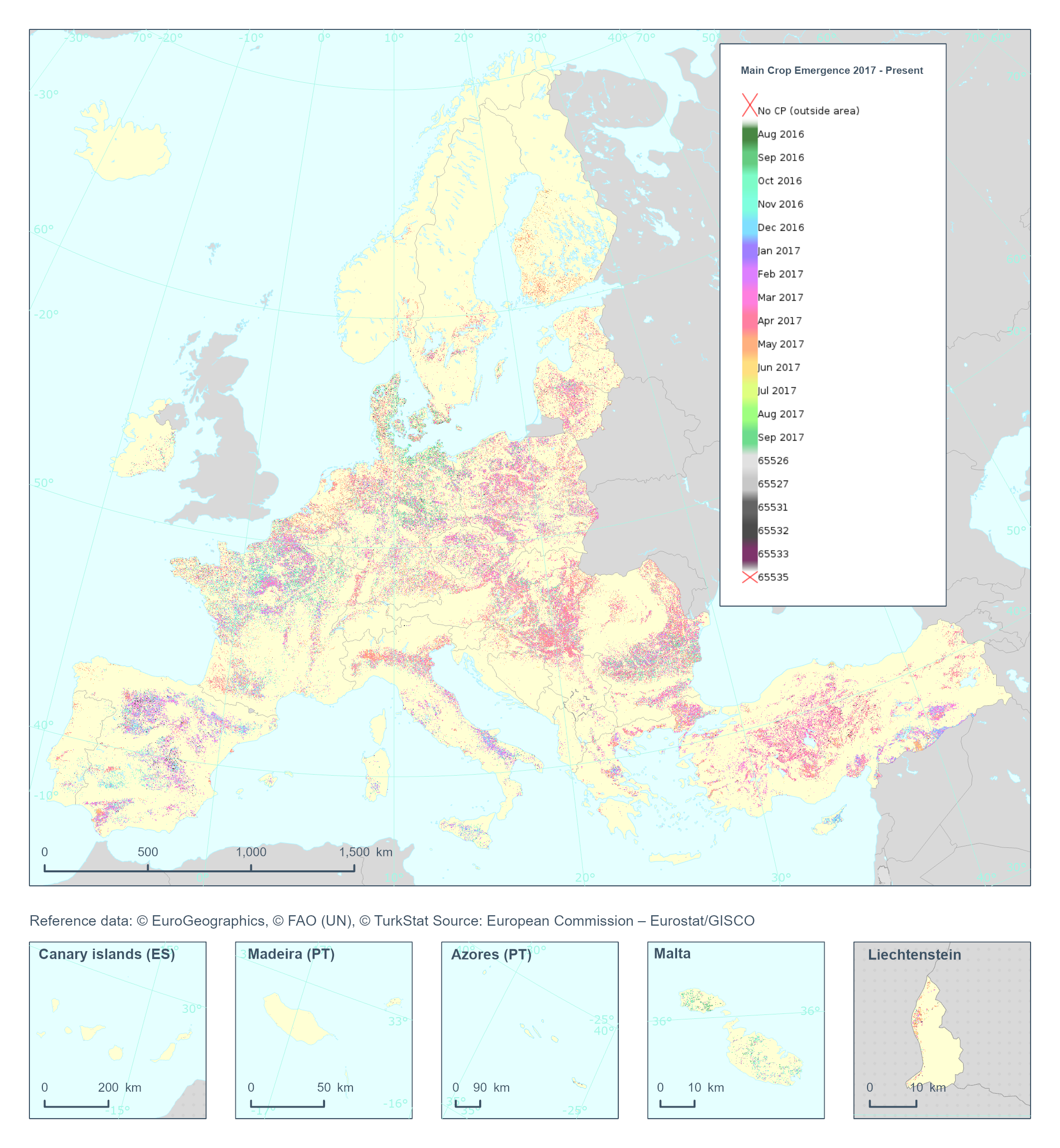
The High Resolution Layer Cropping Patterns - Main Crop Emergence (CPMCE) raster product provides the emergence date of the main (annual) crop expressed in DOY (day of year). YYDOY where YY = last 2 digits of the year (e.g. 19 for 2019) and DOY is the day of the year (1-365). This dataset is provided annually starting in 2017 with 10 meter rasters (fully conformant with the EEA reference grid) in 100 x 100 km tiles covering the EEA38 countries. High Resolution Layer Croplands product is part of the European Union’s Copernicus Land Monitoring Service. Confidence layer available for the dataset. This dataset includes data from the French Overseas Territories (DOMs)
-
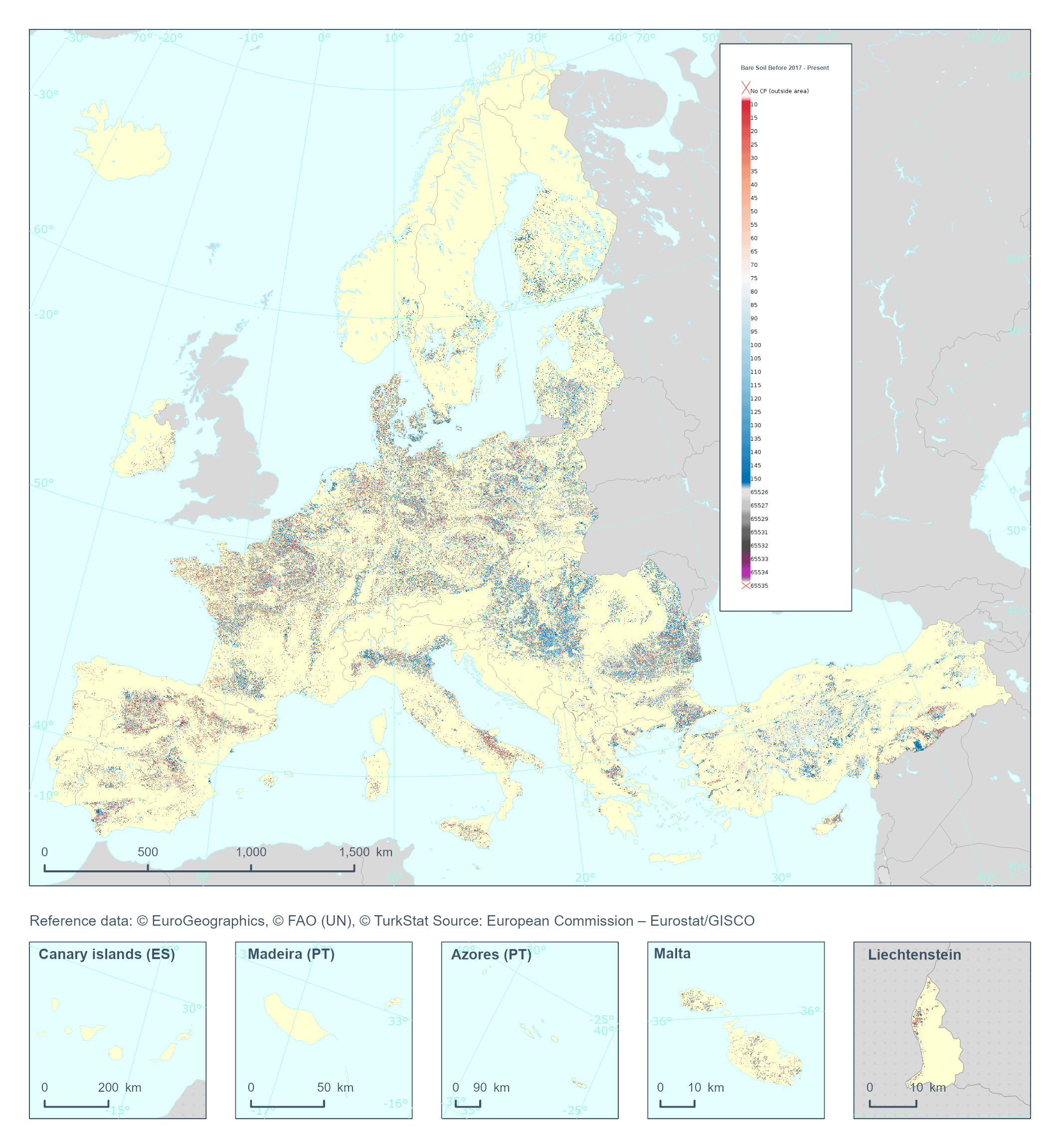
The High Resolution Layer Cropping Patterns - Bare Soil Before (CPBSB) raster product provides the bare soil period (in days) before the emergence of the main annual crop. Note that the bare soil period cannot transcend the calendar year for which the product is generated. This dataset is provided annually starting in 2017 with 10 meter rasters (fully conformant with the EEA reference grid) in 100 x 100 km tiles covering the EEA38 countries. High Resolution Layer Croplands product is part of the European Union’s Copernicus Land Monitoring Service. Confidence layer available for the dataset. This dataset includes data from the French Overseas Territories (DOMs)
-
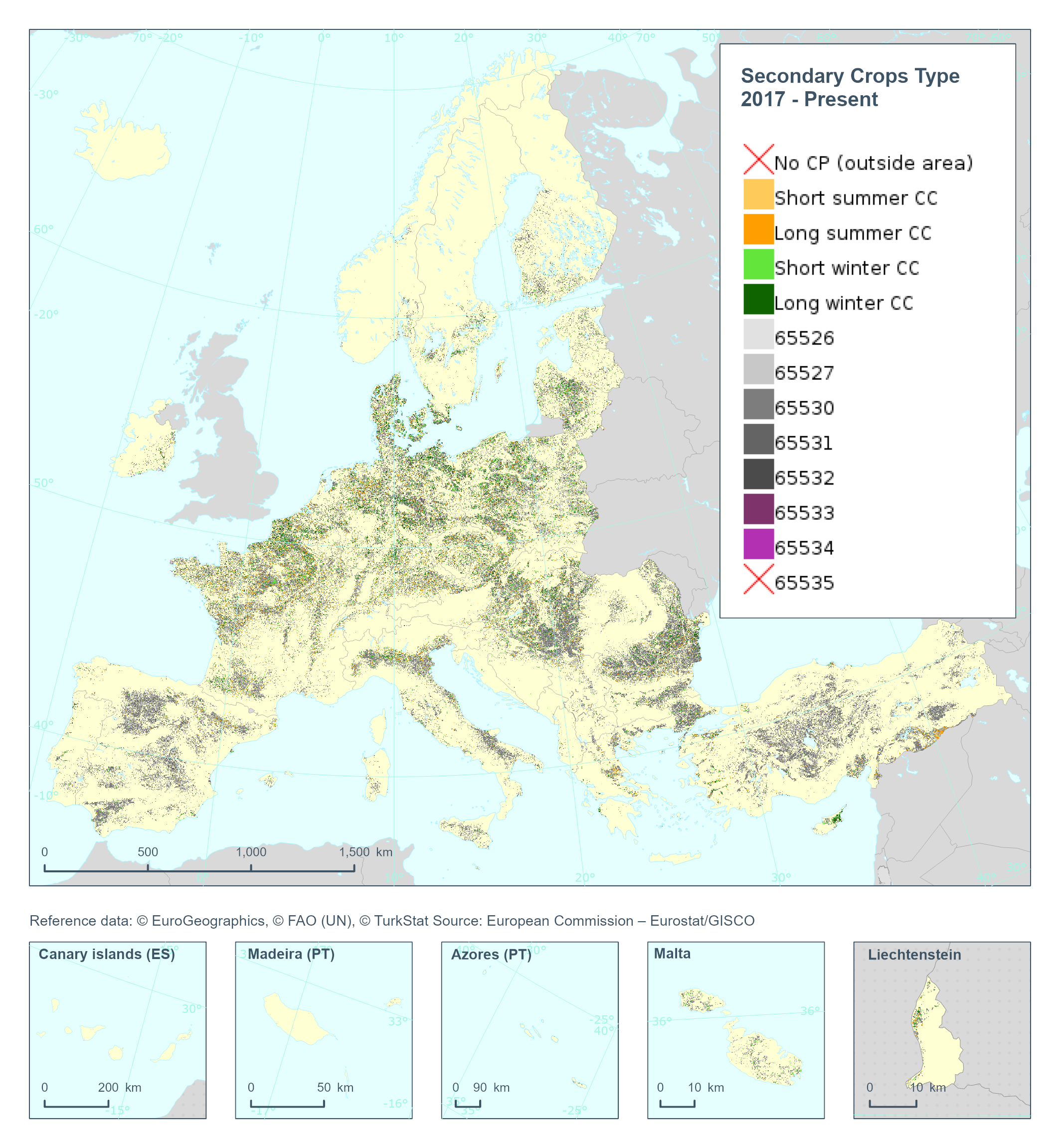
The High Resolution Layer Cropping Patterns - Secondary Crop Type (CPSCT) raster product indicates if a cover crop was present within the respective calendar year and further segregates the types of cover crop into: short summer, long summer, short winter and long winter cover crop. This dataset is provided annually starting in 2017 with 10 meter rasters (fully conformant with the EEA reference grid) in 100 x 100 km tiles covering the EEA38 countries. High Resolution Layer Croplands product is part of the European Union’s Copernicus Land Monitoring Service. Confidence layer available for the dataset. This dataset includes data from the French Overseas Territories (DOMs)
-
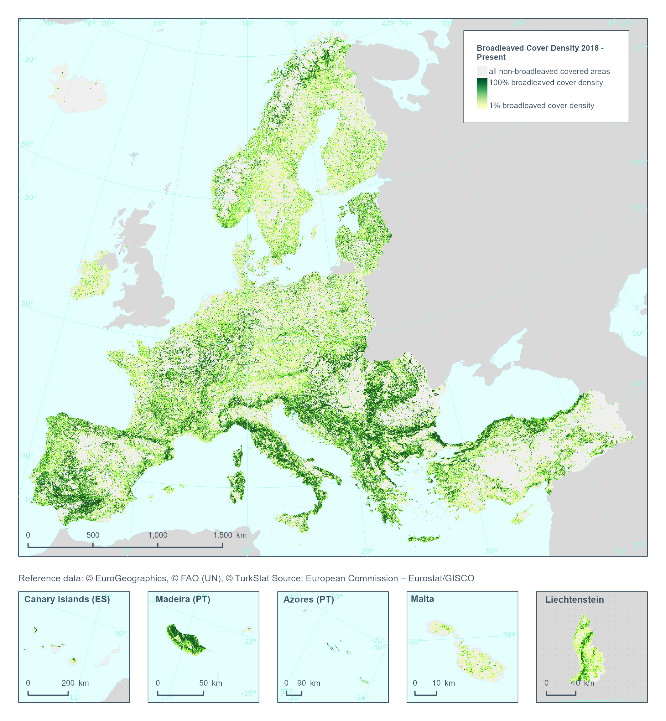
The High Resolution Layer Broadleaved Density (BCD) dataset provides information on the percentage of broadleaved pixels at 100m spatial resolution, and is derived through aggregation of the 10m DLT for the respective reference year. Within each cell the number of broadleaved pixels are counted and the percentages stored into in the 100m pixel of the BCD. The class 255 = outside area is predefined by the 100m boundary layer and remains unchanged. This dataset is provided annually starting with 2018 in 100 meter rasters (fully conformant with the EEA reference grid) in 100 x 100 km tiles covering the EEA38 countries. High Resolution Layer Tree Cover and Forest product is part of the European Union’s Copernicus Land Monitoring Service. This dataset includes data from the French Overseas Territories (DOMs)
-
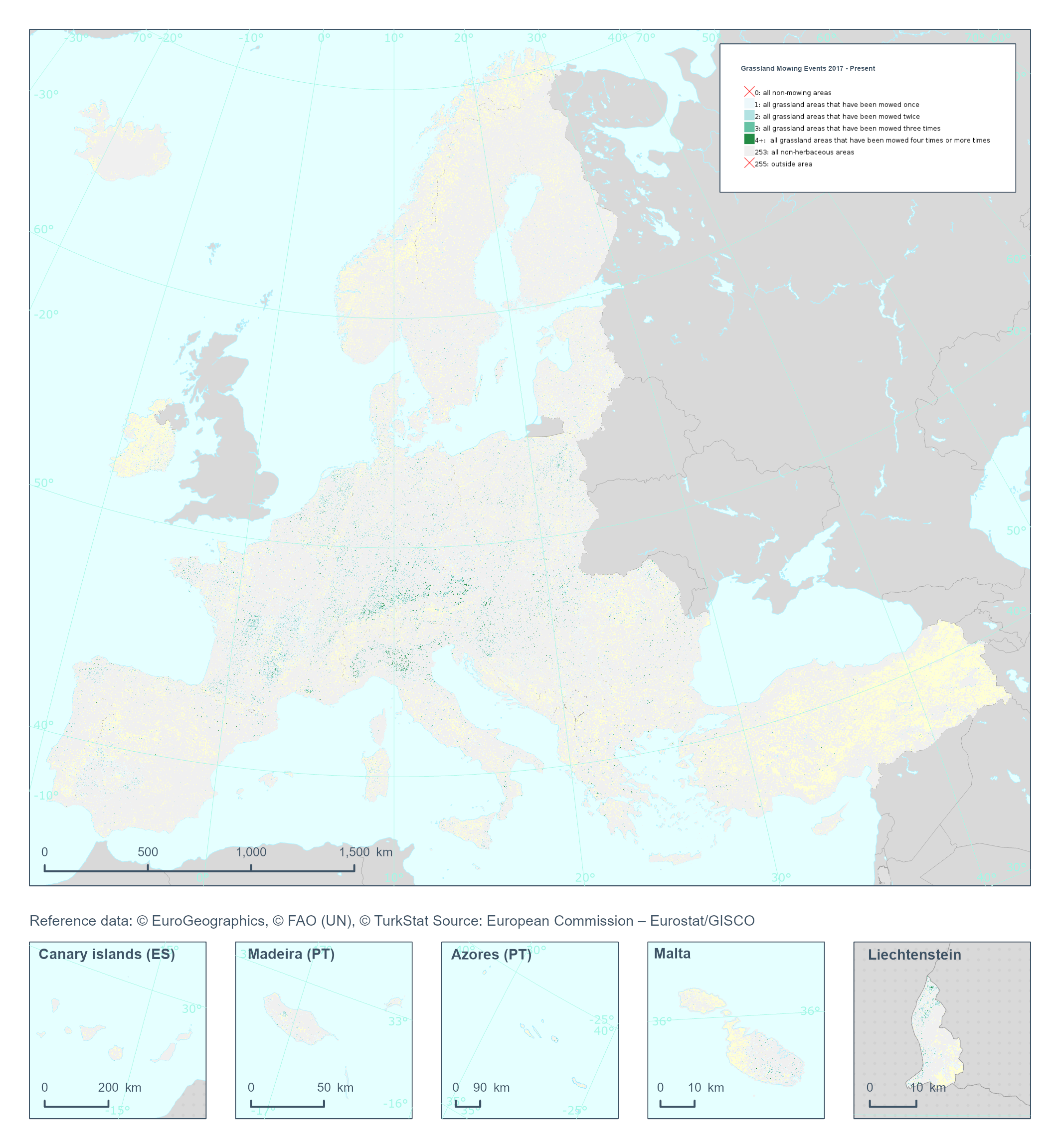
The High Resolution Layer Grassland Mowing Events (GRAME) raster product provides a basic land cover classification containing respectively the number of grassland mowing events within the detected Herbaceous cover layer (temporal and permanent grassland)) with a Minimum Mapping Unit (MMU) of 0.25 ha. The GRAME product will flag and map the number of mowing events (1, 2, 3, or 4+) on temporary or permanent grassland detected per year. This dataset is provided annually starting in 2017 with 10 meter rasters (fully conformant with the EEA reference grid) in 100 x 100 km tiles covering the EEA38 countries. High Resolution Layer Grasslands product is part of the European Union’s Copernicus Land Monitoring Service. Confidence layer available for the dataset. This dataset includes data from the French Overseas Territories (DOMs)
-
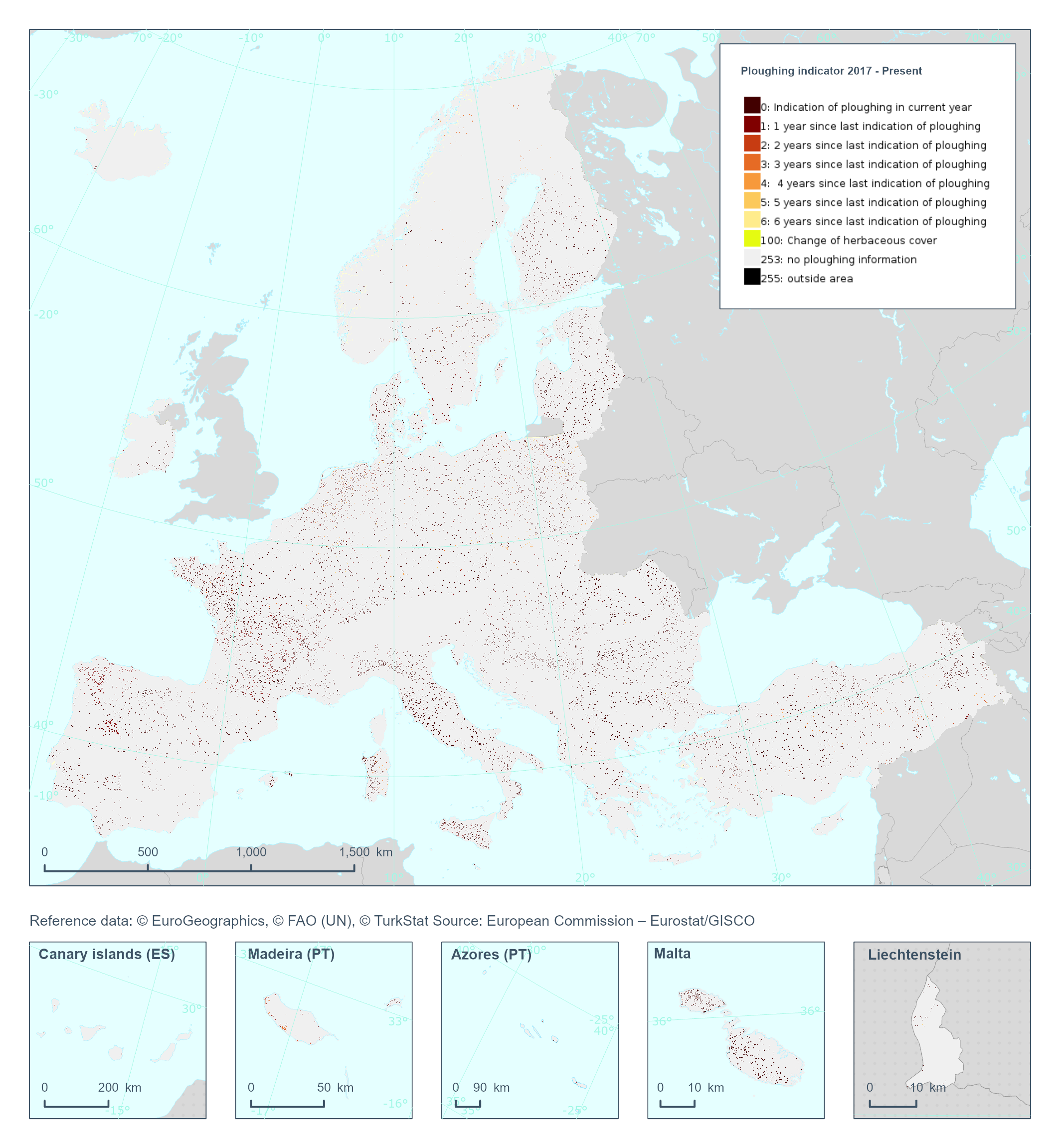
The High Resolution Layer Ploughing indicator (PLOUGH) raster product continues the 2015 and 2018 PLOUGH Layer following a rolling archive principle by adding current information and removing historic years. It indicates the number of years since the last indication of ploughing within the permanent grassland area. PLOUGH is derived by taking into account the series of binary HER layers, the BVL classifications and HR VPP PPI (Plant Phenology Index) quantiles. BVL classes 4 (crop) and 7 (overlaying layer between herbaceous and crop) indicate a ploughing event. Low HR VPP PPI quantiles indicate low vegetation at a certain time of the year. For years with missing information (2016 and earlier) the ploughing information from the historic PLOUGH product is considered which causes some issues. This dataset is provided annually starting in 2017 with 10 meter rasters (fully conformant with the EEA reference grid) in 100 x 100 km tiles covering the EEA38 countries. High Resolution Layer Grasslands product is part of the European Union’s Copernicus Land Monitoring Service. This dataset includes data from the French Overseas Territories (DOMs)
-
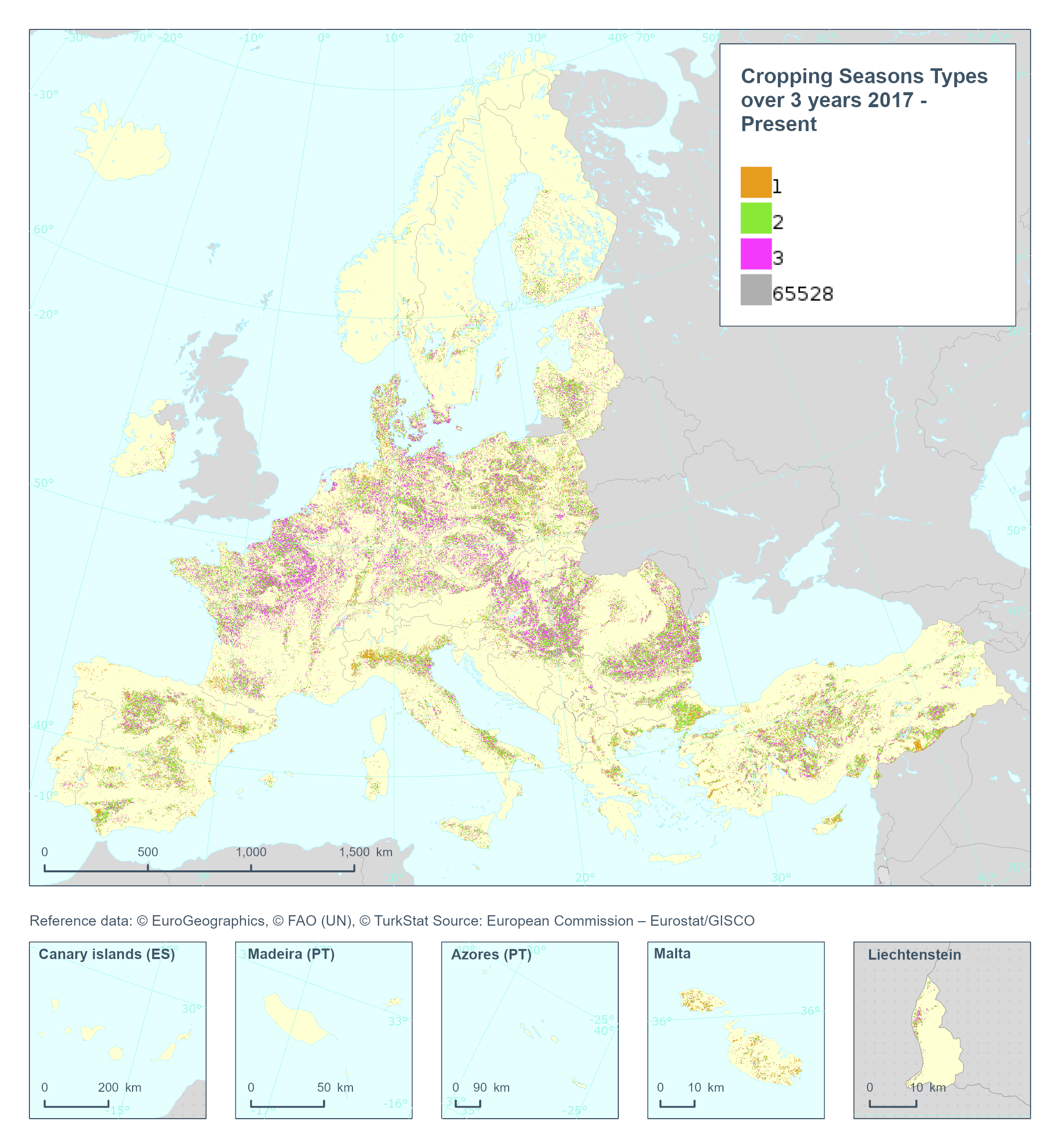
The High Resolution Layer Cropping Patterns - Cropping Seasons Types (CPCSY) raster product provides the number of different crop types grown in a 3-year period [0-3] (excluding cover crops). This dataset is provided annually starting in 2017 with 10 meter rasters (fully conformant with the EEA reference grid) in 100 x 100 km tiles covering the EEA38 countries. High Resolution Layer Croplands product is part of the European Union’s Copernicus Land Monitoring Service. This dataset includes data from the French Overseas Territories (DOMs)
-
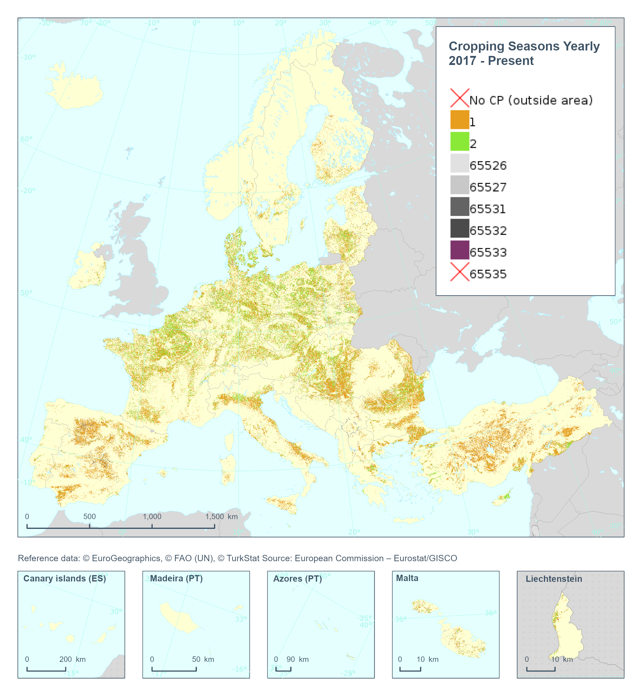
The High Resolution Layer Cropping Patterns - Cropping Seasons Yearly (CPCSY) raster product provides number of growing seasons detected within 1 year (0/1/2). This dataset is provided annually starting in 2017 with 10 meter rasters (fully conformant with the EEA reference grid) in 100 x 100 km tiles covering the EEA38 countries. High Resolution Layer Croplands product is part of the European Union’s Copernicus Land Monitoring Service. This dataset includes data from the French Overseas Territories (DOMs)