 Arctic SDI catalogue
Physics
Type of resources
Topics
Keywords
Contact for the resource
Provided by
Formats
Representation types
Update frequencies
status
-

Gridded temperature and salinity of the Estuary and Gulf of St. Lawrence bottom waters including shallow waters. Data are a result of a 3D interpolation on a 1km x 1km x bottom depth grid. They mostly come from the 2 multidisciplinary surveys but all the available CTD data sampled in August and September were used. The dataset contains 24 layers: one layer per year per variable from 2014 to 2023, two layers of temperature and salinity climatologies and two layers of anomalies for the last year. Purpose Since 1990, the Department of Fisheries and Oceans has been conducting an annual multidisciplinary survey in the Estuary and northern Gulf of St. Lawrence using a standardized protocol. In the southern Gulf of St. Lawrence, these bottom trawl surveys has been carrying out each September since 1971. These missions are an important source of information about the status of the marine ressources. The objectives of the surveys are multiple: to estimate the abundance and biomass of groundfish and invertebrates, to identify the spatial distribution and biological characteristics of these species, to monitor the biodiversity of the Estuary and Gulf and finally, to describe the environmental conditions observed in the area at the moment of the sampling. The southern Gulf surveys are realized using the following standardized protocol: Hurlbut,T. and D.Clay (eds) 1990. Protocols for Research Vessel Cruises within the Gulf Region (Demersal Fish) (1970-1987). Can. MS Rep. Fish. Aquat. Sci. No. 2082: 143p. The sampling protocols used for the Estuary and northern Gulf surveys are described in details in the following publications: Bourdages, H., Archambault, D., Bernier, B., Fréchet, A., Gauthier, J., Grégoire, F., Lambert, J., et Savard, L. 2010. Résultats préliminaires du relevé multidisciplinaire de poissons de fond et de crevette d’août 2009 dans le nord du golfe du Saint-Laurent. Rapp. stat. can. sci. halieut. aquat. 1226 : xii+ 72 p. Bourdages, H., Archambault, D., Morin, B., Fréchet, A., Savard, L., Grégoire, F., et Bérubé, M. 2003. Résultats préliminaires du relevé multidisciplinaire de poissons de fond et de crevette d’août 2003 dans le nord du golfe du Saint-Laurent. Secr. can. consult. sci. du MPO. Doc. rech. 2003/078. vi + 68 p. Annual reports are available at the Canadian Science Advisory Secretariat (CSAS), (http://www.dfo-mpo.gc.ca/csas-sccs/index-eng.htm). Bourdages, H., Brassard, C., Desgagnés, M., Galbraith, P., Gauthier, J., Légaré, B., Nozères, C. and Parent, E. 2017. Preliminary results from the groundfish and shrimp multidisciplinary survey in August 2016 in the Estuary and northern Gulf of St. Lawrence. DFO Can. Sci. Advis. Sec. Res. Doc. 2017/002. v + 87 p.
-

Bottom temperature time series at the 3 fixed stations and 46 stations, grouped into transects, of the Atlantic Zonal Monitoring Program (AZMP) under the Quebec region responsibility. The mean bottom temperature of the last ten years are displayed as 2 layers, one for the June survey (2014-2023, 2020 not sampled), another for the autumn survey (2014-2023). A third layer shows the positions of the fixed stations of the program (Anticosti Gyre, Gaspé Current and Rimouski). Each station is linked with a .png file showing the bottom temperature time series and with a .csv file containing all the bottom temperature data acquired at those stations since the beginning of the program sampling (columns : Station, Latitude, Longitude, Date(UTC), Sounding(m), Depth/Profondeur(m), Temperature/Température(ºC)). Purpose The Atlantic Zone Monitoring Program (AZMP) was implemented in 1998 with the aim of increasing the Department of Fisheries and Oceans Canada’s (DFO) capacity to detect, track and predict changes in the state and productivity of the marine environment. The AZMP collects data from a network of stations composed of high-frequency monitoring sites and cross-shelf sections in each following DFO region: Québec, Gulf, Maritimes and Newfoundland. The sampling design provides basic information on the natural variability in physical, chemical, and biological properties of the Northwest Atlantic continental shelf. Cross-shelf sections sampling provides detailed geographic information but is limited in a seasonal coverage while critically placed high-frequency monitoring sites complement the geography-based sampling by providing more detailed information on temporal changes in ecosystem properties. In Quebec region, two surveys (46 stations grouped into transects) are conducted every year, one in June and the other in autumn in the Estuary and Gulf of St. Lawrence. Historically, 3 fixed stations were sampled more frequently. One of these is the Rimouski station that still takes part of the program and is sampled about weekly throughout the summer and occasionally in the winter period. Annual reports (physical, biological and a Zonal Scientific Advice) are available from the Canadian Science Advisory Secretariat (CSAS), (http://www.dfo-mpo.gc.ca/csas-sccs/index-eng.htm). Devine, L., Scarratt, M., Plourde, S., Galbraith, P.S., Michaud, S., and Lehoux, C. 2017. Chemical and Biological Oceanographic Conditions in the Estuary and Gulf of St. Lawrence during 2015. DFO Can. Sci. Advis. Sec. Res. Doc. 2017/034. v + 48 pp. Supplemental Information The bottom temperature is determined from CTD profile in the water column according to AZMP sampling protocol: Mitchell, M. R., Harrison, G., Pauley, K., Gagné, A., Maillet, G., and Strain, P. 2002. Atlantic Zonal Monitoring Program sampling protocol. Can. Tech. Rep. Hydrogr. Ocean Sci. 223: iv + 23 pp.
-

This dataset contains the surface temperature and salinity data of the enlarged coastal thermograph network of the St. Lawrence river, estuary and gulf system. It includes data from the Canadian Hydrographic Service water level network (SINECO), the Department of Fisheries and Oceans (DFO)-Quebec long-termed thermograph monitoring program network and the oceanographic buoy network. Each station is linked with a .png file showing the temperature and salinity time series and with a .csv file containing the surface temperature and salinity data themselves (columns : Station,Latitude,Longitude,Date(UTC),Depth/Profondeur(m),Temperature/Température(ºC),Salinity/Salinité(psu)). Supplemental Information A detailed description of the networks (SINECO, oceanographic buoys and the DFO-Quebec thermograph monitoring program) is available at the St. Lawrence Global Observatory (SLGO) portal : SINECO : https://ogsl.ca/en/tide-gauges-dfo-chs/ Oceanographic buoys : https://ogsl.ca/en/marine-conditions-buoys-dfo/ Thermographs: https://ogsl.ca/en/marine-conditions-thermographs-dfo/ Technical Reports related to the Thermograph Network (the last one is also available at the same hypertext link mentionned above) : Pettigrew, B., Gilbert, D. and Desmarais R. 2016. Thermograph network in the Gulf of St. Lawrence. Can. Tech. Rep. Hydrogr. Ocean Sci. 311: vi + 77 p. Pettigrew, B., Gilbert, D. and Desmarais R. 2017. Thermograph network in the Gulf of St. Lawrence: 2014-2016 update. Can. Tech. Rep. Hydrogr. Ocean Sci. 317: vii + 54 p.
-

The Strait of Belle Isle connects the Labrador Shelf and Gulf of St. Lawrence. Few observations of currents in the Strait of Belle Isle exist despite its important contribution to the heat, salt, and mass budgets of the Gulf of St. Lawrence. This is because the deployment of instruments is complicated by the Strait’s remote location, its strong currents, and the presence of thick winter sea ice and icebergs. The present data set aims to provide a long-term time series of currents in the Strait of Belle Isle. Data were collected using a moored Teledyne RDI Workhorse 300 KHz acoustic Doppler current profiler (ADCP). The ADCP was mounted on a subsurface buoy anchored 5 m from the sea floor, in water approximately 70 m deep near the north shore of the Strait (56° 37.2 W, 51° 34.7 N). This instrument provides three-dimensional current profiles every 30 minutes at a vertical resolution of 4 m. Backscatter intensity is also collected at the same resolution. Raw data were processed using the Magtogoek software (https://github.com/iml-gddaiss/magtogoek), developed by the Department of Fisheries and Oceans Canada. Quality flags have been assigned to the data based on beam sidelobe contamination and required thresholds for extreme velocities, beam correlation and percentage of good four-beam transformations. The ancillary data used to apply this quality control are included in the data set. Reference : Shaw, J.-L., & Galbraith, P. S. (2023). Climatology of transport in the Strait of Belle Isle. Journal of Geophysical Research: Oceans, 128, e2022JC019084. https://doi.org/10.1029/2022JC019084
-

Mean 2013 to 2022 summer surface conditions in the Estuary and Gulf of St. Lawrence. Data come from the August and the September multidisciplinary surveys. Surface conditions are described by temperature, salinity and nutrient concentration (mmol/m³) interpolated on a 10 km x 10 km grid. Purpose Since 1990, the Department of Fisheries and Oceans has been conducting an annual multidisciplinary survey in the Estuary and northern Gulf of St. Lawrence using a standardized protocol. In the southern Gulf of St. Lawrence, these bottom trawl surveys has been carrying out each September since 1971. These missions are an important source of information about the status of the marine ressources. The objectives of the surveys are multiple: to estimate the abundance and biomass of groundfish and invertebrates, to identify the spatial distribution and biological characteristics of these species, to monitor the biodiversity of the Estuary and Gulf and finally, to describe the environmental conditions observed in the area at the moment of the sampling. The southern Gulf surveys are realized using the following standardized protocol: Hurlbut,T. and D.Clay (eds) 1990. Protocols for Research Vessel Cruises within the Gulf Region (Demersal Fish) (1970-1987). Can. MS Rep. Fish. Aquat. Sci. No. 2082: 143p. The sampling protocols used for the Estuary and northern Gulf surveys are described in details in the following publications: Bourdages, H., Archambault, D., Bernier, B., Fréchet, A., Gauthier, J., Grégoire, F., Lambert, J., et Savard, L. 2010. Résultats préliminaires du relevé multidisciplinaire de poissons de fond et de crevette d’août 2009 dans le nord du golfe du Saint-Laurent. Rapp. stat. can. sci. halieut. aquat. 1226 : xii+ 72 p. Bourdages, H., Archambault, D., Morin, B., Fréchet, A., Savard, L., Grégoire, F., et Bérubé, M. 2003. Résultats préliminaires du relevé multidisciplinaire de poissons de fond et de crevette d’août 2003 dans le nord du golfe du Saint-Laurent. Secr. can. consult. sci. du MPO. Doc. rech. 2003/078. vi + 68 p. Annual reports are available at the Canadian Science Advisory Secretariat (CSAS), (http://www.dfo-mpo.gc.ca/csas-sccs/index-eng.htm). Bourdages, H., Brassard, C., Desgagnés, M., Galbraith, P., Gauthier, J., Légaré, B., Nozères, C. and Parent, E. 2017. Preliminary results from the groundfish and shrimp multidisciplinary survey in August 2016 in the Estuary and northern Gulf of St. Lawrence. DFO Can. Sci. Advis. Sec. Res. Doc. 2017/002. v + 87 p.
-
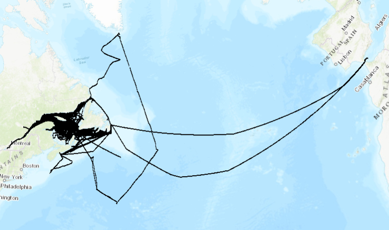
1999 to 2023 surface temperature and salinity measured along the track of commercial ships, mostly between Montreal (Quebec) and St. John's (Newfoundland). Monitoring of surface water conditions in the Estuary and Gulf of St. Lawrence is carried out with different complementary methods such as thermosalinographs (TSG) installed on commercial ships. These ships are sailing all year long from Montreal to St. John’s, one round trip per week, and are sampling water near the surface (3 to 8 meters deep) to determine the temperature and salinity all along the route. Purpose The recorded data are used as input to numerical forecasting models for sea ice conditions and as a monitoring tool for the Gulf of St. Lawrence. Annual reports are available at the Canadian Science Advisory Secretariat (CSAS), (http://www.dfo-mpo.gc.ca/csas-sccs/index-eng.htm). Galbraith, P.S., Chassé, J., Caverhill, C., Nicot, P., Gilbert, D., Lefaivre, D. and Lafleur, C. 2018. Physical Oceanographic Conditions in the Gulf of St. Lawrence during 2017. DFO Can. Sci. Advis. Sec. Res. Doc. 2018/050. v + 79 p.
-

Mean 2014 to 2023 winter surface conditions in the Estuary and Gulf of St. Lawrence. The survey has been taking place every year in March. Surface conditions are described by temperature, salinity and nutrient concentration (mmol/m3) interpolated on a 10km x 10km grid. Purpose Since many years, the Department of Fisheries and Oceans Canada (DFO) has been conducting annual surveys, at different periods of the year, in the Estuary and Gulf of St. Lawrence, each having many objectives including assessment of environmental conditions. However, these surveys, carried out on vessels, did not cover the winter period. Since 1996, a regional monitoring program, conducted by Maurice-Lamontagne Institute scientists, is taking place in order to fill this gap. The annual helicopter survey is undertaken in the beginning of March to evaluate physical oceanographic conditions of waters up to 200 m and surface water nutrient contains. These surveys are usually sampled from a Canadian Coast Guard helicopter but from an icebreaker in 2016 and 2017. Data from regional monitoring programs are combined with the ones from the Atlantic Zone Monitoring Program (AZMP) to produce annual reports (physical, biological and a Zonal Scientific Advice) which are available at the Canadian Science Advisory Secretariat (CSAS), (http://www.dfo-mpo.gc.ca/csas-sccs/index-eng.htm). Galbraith, P.S., Chassé, J., Caverhill, C., Nicot, P., Gilbert, D., Pettigrew, B., Lefaivre, D., Brickman, D., Devine, L., and Lafleur, C. 2017. Physical Oceanographic Conditions in the Gulf of St. Lawrence in 2016. DFO Can. Sci. Advis. Sec. Res. Doc. 2017/044. v + 91 p. Devine, L., Scarratt, M., Plourde, S., Galbraith, P.S., Michaud, S., and Lehoux, C. 2017. Chemical and Biological Oceanographic Conditions in the Estuary and Gulf of St. Lawrence during 2015. DFO Can. Sci. Advis. Sec. Res. Doc. 2017/034. v + 48 pp. Additional Information Water sampling for nutrient analysis is done from Niskin bottles according to AZMP sampling protocol: Mitchell, M. R., Harrison, G., Pauley, K., Gagné, A., Maillet, G., and Strain, P. 2002. Atlantic Zonal Monitoring Program sampling protocol. Can. Tech. Rep. Hydrogr. Ocean Sci. 223: iv + 23 pp. Nitrate titration is carried out according to the following method ((nitrite + nitrate) – nitrite): Nitrite + nitrate: Armstrong, FAJ, CR Stearns, JDH Strickland (1967) The measurement of upwelling and subsequent biological processes by means of the Technicon Autoanalyzer and associated equipment. Deep-Sea Res 14(3) 381-389. Nitrite: American Public Health Assoc. (1971) Standard Methods for the examination of water and wastewater. 13th edition, pp. 240-243, Washington D.C. Phosphate: Murphy, J, JP Riley (1962) A modified single solution method for the determination of phosphate in natural waters. Anal Chim. Acta 27 : 30. Silicate: Strickland, JDH, TR Parsons (1972) A Practical Handbook of Seawater Analysis, second edition. Fish Res Board Can, Bulletin 167, 310 pp. The surface water temperature and salinity are determined from CTD profiles.
-

Available information for the Estuary and Gulf of St. Lawrence on salinity, temperature, dissolved oxygen, depth, slope, and variability in landscape and sediments, were aggregated using a grid made up of 100 km2 cells as a basis for mapping and describing marine habitats for conservation and integrated management purposes. For example, 26 variables were selected to describe depth, slope, salinity and temperature. Based on that information, cluster analyses were conducted grouping cells into 13 different megahabitats. Four megahabitats described the deep waters, and areas outside channels formed 9 megahabitats: four in the southern Gulf and five in the northern Gulf. Purpose The tool proposes a novel way of making validated and integrated data available to end users. Potential applications include the screening of areas considered for inclusion in a network of protected areas and a quantitative assessment of surface areas for each class of habitat. The method can also be applied to describe the habitats of species at risk. Additional Information See the report mentioned below for a more detailed description of the treatments for each variable: Dutil, J.-D., Proulx, S., Chouinard, P.-M., and Borcard. D. 2011. A hierarchical classification of the seabed based on physiographic and oceanographic features in the St. Lawrence. Can. Tech. Rep. Fish. Aquat. Sci. 2916: vii + 72 p.
-

For several years, Fisheries and Oceans Canada (DFO) has conducted annual ship-based surveys in the St. Lawrence Estuary and the Gulf of St. Lawrence to assess environmental conditions and support a range of scientific objectives. Because these surveys do not extend into winter, a complementary regional monitoring program has been implemented annually in early March since 1996. This monitoring program is typically carried out using a Canadian Coast Guard helicopter, although in 2016 and 2017 it was conducted aboard an icebreaker. The winter survey measures physical oceanographic conditions to approximately 200 m depth along with nutrient concentrations in the surface layer. Starting in 2023, the survey was expanded to include phytoplankton measurements. Data from this program are integrated with those from the Atlantic Zone Monitoring Program (AZMP) to produce annual reports including physical (CTD) and biological (bottle) assessments and a Zonal Scientific Advisory for the Gulf of St. Lawrence which can be found on the following webpage under the given year : Atlantic Zone Monitoring Program (AZMP) - https://www.dfo-mpo.gc.ca/science/data-donnees/azmp-pmza/index-eng.html Here, raw data on physical oceanographic conditions, nutrient concentrations and phytoplankton collected during the winter survey are presented. This publication contains three data files: ‘donnees_data_heli_CTD’ which contains links per year to the CTD data, ‘donnees_data_heli_bottle_bouteille’, which contains nutrient data, and ‘donnees_data_heli_phyto’ which contains phytoplankton data. The dataset covers the period of 1996 to present and is updated annually as new data becomes available. Note: this publication contains raw data, please use with caution or contact the data management team (gddaiss-dmsaisb@dfo-mpo.gc.ca) if you have any questions. For further methodological information please see the supporting document for citations. For mean winter surface conditions in the Estuary and Gulf of St. Lawrence please see the following related publication Winter surface conditions – Helicopter survey - Open Government Portal - https://open.canada.ca/data/en/dataset/9a42d891-fc9c-44b3-8fba-9d9ed96890cf
-

A geospatial database involving 130 descriptors was created describing the pelagic and benthic habitats of the 0–30 m surface layer in the estuary and Gulf of St. Lawrence. A grid made of 6.25 km² cells (2.5 x 2.5 km) was used to aggregate the data. Each of the 39,337 cells overlapping the marine environment was characterized using landscape, hydrographic, and oceanographic parameters determined from observations (including satellite imagery), a 3D circulation model, and published and unpublished material available at local and regional scales. Purpose The dataset provides useful information on the spatial extent of major coastal epipelagic habitats in the study area and can be used for mapping purposes and for analyses of species-habitat relationships. Additional Information The low tide limit was taken as the upper (0 m) boundary, but neighbouring landscape features, such as the proximity to freshwater inflows, surface area of the tidal zone, and characteristics of the shoreline, were also taken into consideration. Also, each cell was classified as being marine, intertidal, or terrestrial using the high and low tide marks. Those marks were determined using NRCan CANVEC topographic map products (1:50,000). The high tide mark was determined as the limit between the land and water layers. The low tide mark (0 m depth) was determined as the lower limit of the tidal zone in areas with a tidal zone, and as the limit between the land and water layers elsewhere. See the report mentioned below for a more detailed description of the treatments for each variable: Dutil, J.-D., S. Proulx, P. Galbraith, J. Chassé and N. Lambert 2012. Coastal and epipelagic habitats of the St. Lawrence estuary and Gulf. Can. Tech. Rep. Fish. Aquat. Sci. 3009 : ix +87 pp.