 Arctic SDI catalogue
Porifera
Type of resources
Topics
Keywords
Contact for the resource
Provided by
Formats
Representation types
Update frequencies
status
-

Polygons denoting concentrations of sea pens, small and large gorgonian corals and sponges on the east coast of Canada have been identified through spatial analysis of research vessel survey by-catch data following an approach used by the Northwest Atlantic Fisheries Organization (NAFO) in the Regulatory Area (NRA) on Flemish Cap and southeast Grand Banks. Kernel density analysis was used to identify high concentrations and the area occupied by successive catch weight thresholds was used to identify aggregations. These analyses were performed for each of the five biogeographic zones of eastern Canada. The largest sea pen fields were found in the Laurentian Channel as it cuts through the Gulf of St. Lawrence, while large gorgonian coral forests were found in the Eastern Arctic and on the northern Labrador continental slope. Large ball-shaped Geodia spp. sponges were located along the continental slopes north of the Grand Banks, while on the Scotian Shelf a unique population of the large barrel-shaped sponge Vazella pourtalesi was identified. The latitude and longitude marking the positions of all tows which form these and other dense aggregations are provided along with the positions of all tows which captured black coral, a non-aggregating taxon which is long-lived and vulnerable to fishing pressures. These polygons identify sponge grounds from the broader distribution of sponges in the region as sampled by Western II A trawl gear in the Scotian Shelf biogeographic zone. A 2 kg minimum threshold for the sponge catch was identified as the weight that separated the sponge ground habitat from the broader distribution of sponges with these research vessel tow data and gear type.
-

Polygons denoting concentrations of sea pens, small and large gorgonian corals and sponges on the east coast of Canada have been identified through spatial analysis of research vessel survey by-catch data following an approach used by the Northwest Atlantic Fisheries Organization (NAFO) in the Regulatory Area (NRA) on Flemish Cap and southeast Grand Banks. Kernel density analysis was used to identify high concentrations and the area occupied by successive catch weight thresholds was used to identify aggregations. These analyses were performed for each of the five biogeographic zones of eastern Canada. The largest sea pen fields were found in the Laurentian Channel as it cuts through the Gulf of St. Lawrence, while large gorgonian coral forests were found in the Eastern Arctic and on the northern Labrador continental slope. Large ball-shaped Geodia spp. sponges were located along the continental slopes north of the Grand Banks, while on the Scotian Shelf a unique population of the large barrel-shaped sponge Vazella pourtalesi was identified. The latitude and longitude marking the positions of all tows which form these and other dense aggregations are provided along with the positions of all tows which captured black coral, a non-aggregating taxon which is long-lived and vulnerable to fishing pressures. These polygons identify sponge grounds from the broader distribution of sponges in the region as sampled by Campelen trawl gear in the Newfoundland - Labrador Shelves biogeographic zone. A 200 kg minimum threshold for the sponge catch was identified as the weight that separated the sponge ground habitat from the broader distribution of sponges with these research vessel tow data and gear type.
-

Polygons denoting concentrations of sea pens, small and large gorgonian corals and sponges on the east coast of Canada have been identified through spatial analysis of research vessel survey by-catch data following an approach used by the Northwest Atlantic Fisheries Organization (NAFO) in the Regulatory Area (NRA) on Flemish Cap and southeast Grand Banks. Kernel density analysis was used to identify high concentrations and the area occupied by successive catch weight thresholds was used to identify aggregations. These analyses were performed for each of the five biogeographic zones of eastern Canada. The largest sea pen fields were found in the Laurentian Channel as it cuts through the Gulf of St. Lawrence, while large gorgonian coral forests were found in the Eastern Arctic and on the northern Labrador continental slope. Large ball-shaped Geodia spp. sponges were located along the continental slopes north of the Grand Banks, while on the Scotian Shelf a unique population of the large barrel-shaped sponge Vazella pourtalesi was identified. The latitude and longitude marking the positions of all tows which form these and other dense aggregations are provided along with the positions of all tows which captured black coral, a non-aggregating taxon which is long-lived and vulnerable to fishing pressures. These polygons identify sponge grounds from the broader distribution of sponges in the Southern Gulf region as sampled by Western II A gear in the Gulf biogeographic zone. A 3 kg minimum threshold for the sponge catch was identified as the weight that separated the sponge ground habitat from the broader distribution of sponges with these research vessel tow data and gear type.
-

Polygons denoting concentrations of sea pens, small and large gorgonian corals and sponges on the east coast of Canada have been identified through spatial analysis of research vessel survey by-catch data following an approach used by the Northwest Atlantic Fisheries Organization (NAFO) in the Regulatory Area (NRA) on Flemish Cap and southeast Grand Banks. Kernel density analysis was used to identify high concentrations and the area occupied by successive catch weight thresholds was used to identify aggregations. These analyses were performed for each of the five biogeographic zones of eastern Canada. The largest sea pen fields were found in the Laurentian Channel as it cuts through the Gulf of St. Lawrence, while large gorgonian coral forests were found in the Eastern Arctic and on the northern Labrador continental slope. Large ball-shaped Geodia spp. sponges were located along the continental slopes north of the Grand Banks, while on the Scotian Shelf a unique population of the large barrel-shaped sponge Vazella pourtalesi was identified. The latitude and longitude marking the positions of all tows which form these and other dense aggregations are provided along with the positions of all tows which captured black coral, a non-aggregating taxon which is long-lived and vulnerable to fishing pressures. These polygons identify sponge grounds from the broader distribution of sponges in the Northern Gulf region as sampled by Campelen gear in the Gulf biogeographic zone. A 2 kg minimum threshold for the sponge catch was identified as the weight that separated the sponge ground habitat from the broader distribution of sponges with these research vessel tow data and gear type.
-

Emerald Basin on the Scotian Shelf off Nova Scotia, Canada, is home to a globally unique aggregation of the glass sponge Vazella pourtalesi, first documented in the region in 1889. In 2009, Fisheries and Oceans Canada (DFO) implemented two Sponge Conservation Areas to protect these sponge grounds from bottom fishing activities. Together, the two conservation areas encompass 259 km2. In order to ascertain the degree to which the sponge grounds remain unprotected, we modelled the presence probability and predicted range distribution of V. pourtalesi on the Scotian Shelf using random forest modelling on presence-absence records. With a high degree of accuracy the random forest model predicted the highest probability of occurrence of V. pourtalesi in the inner basins on the central Scotian Shelf, with lower probabilities at the shelf break and in the Fundian and Northeast Channels. Bottom temperature was the most important determinant of its distribution in the model. Although the two DFO Sponge Conservation Areas protect some of the more significant concentrations of V. pourtalesi, much of its predicted distribution remains unprotected (over 99%). Examination of the hydrographic conditions in Emerald Basin revealed that the V. pourtalesi sponge grounds are associated with a warmer and more saline water mass compared to the surrounding shelf. Reconstruction of historical bottom temperature and salinity in Emerald Basin revealed strong multi-decadal variability, with average bottom temperatures varying by 8˚C. We show that this species has persisted in the face of this climatic variability, possibly indicating how it will respond to future climate change. Cite this data as: Beazley, Lindsay ; Wang, Zeliang ; Kenchington, Ellen ; Yashayaev, Igor ; Rapp Tore, Hans ; Xavier, Joana R. ; Murillo, Francisco Javier ; Fenton, Derek ; Fuller, Susanna(2023). Predicted distribution of the glass sponge Vazella pourtalesi on the Scotian Shelf and its persistence in the face of climatic variability. Published April 2023. Ocean Ecosystems Science Division, Fisheries and Oceans Canada, Dartmouth, N.S. https://open.canada.ca/data/en/dataset/326bfc06-4b48-408f-9a74-1e118665e7b0
-

Identification of significant concentrations of sponges in the Gulf of St. Lawrence biogeographic unit using Kernel density estimation (KDE). This method was applied to create a modelled biomass surface for each taxa and an aerial expansion method was permitted to identify significant concentrations. Only geo-referenced biomass data have been used to identify the “hot spots”. The borders of the areas were refined using knowledge of null catches and species distribution models. Predictive models were produced using a random forest machine-learning technique. For more details, please refer to this report: Kenchington, E., L. Beazley, C. Lirette, F.J. Murillo, J. Guijarro, V. Wareham, K. Gilkinson, M. Koen Alonso, H. Benoît, H. Bourdages, B. Sainte-Marie, M. Treble, and T. Siferd. 2016. Delineation of Coral and Sponge Significant Benthic Areas in Eastern Canada Using Kernel Density Analyses and Species Distribution Models. DFO Can. Sci. Advis. Sec. Res. Doc. 2016/093. vi + 178 p. http://waves-vagues.dfo-mpo.gc.ca/Library/40577806.pdf The present layer only contains the analysis results for sponges. Purpose: As part of the Canada's commitment to the identification and protection of sensitive benthic marine ecosystems, maps of the location of significant concentrations of corals and sponges on the east coast of Canada were produced through quantitative analyses of research vessel trawl survey data, supplemented with other data sources where available. The taxa analyzed are sponges (Porifera), large and small gorgonian corals (Alcyonacea), and sea pens (Pennatulacea). However, only the sponges (Porifera) and sea pens (Pennatulacea) have been considered in the analysis concerning the Gulf of St. Lawrence biogeographic unit.
-

From August 2nd to September 9th, 2013, Fisheries and Oceans Canada conducted a baseline survey of marine fishes and their habitats on the Canadian Beaufort Shelf and slope. Sampling was conducted from the F/V Frosti at 64 stations along ten transects. Standardized sampling was conducted on the transects at pre-determined depth stations (20-40, 75, 200, 350, 500, 750, and 1000 m) using a variety of sampling equipment including benthic fishing trawls, plankton nets, sediment cores, and CTD and water sample profiles. A specialized CTD probe (UCTD) was deployed at an additional 72 locations while the ship was underway.Presented here is the information on the sampling locations, and the sampling gear deployed at each station.
-

From August 5th to September 3rd, 2012, Fisheries and Oceans Canada conducted a baseline survey of marine fishes and their habitats on the Canadian Beaufort Shelf and slope. Sampling was conducted from the F/V Frosti at 28 stations along four transects. Standardized sampling was conducted at pre-determined depth stations (20-40, 75, 200, 350, 500, 750, and 1000 m) using a variety of sampling equipment including benthic fishing trawls, plankton nets, sediment cores, and CTD and water sample profiles. A specialized CTD probe (UCTD) was deployed at an additional 30 locations while the ship was underway. Presented here is the information on the sampling locations, and the sampling gear deployed at each station.
-
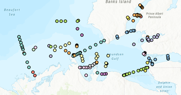
PURPOSE: The Department of Fisheries and Oceans (DFO) conducted a baseline survey of biological communities and habitat parameters in the offshore Canadian Beaufort Sea between 2012 and 2014, as part of the federally administered Beaufort Regional Environmental Assessment. The BREA-Marine Fishes Project (BREA-MFP) was the first comprehensive baseline study of offshore marine fish diversity and associated habitats in the Canadian Beaufort Sea. Knowledge gained during the BREA-MFP supports regulatory processes pertaining to offshore development and Oceans Management in the Inuvialuit Settlement Region, and provides baseline context for studies of the effects of climate change and variability. The Canadian Beaufort Sea – Marine Ecosystem Assessment (CBS-MEA, 2017-2019 and 2021-2024) is building on system baselines and ecological knowledge derived from the BREA-MFP to develop a comprehensive research and monitoring approach for the offshore Canadian Beaufort Sea. This approach will enable us to better understand the relationship between oceanographic drivers and ecosystem responses. The CBS-MEA focuses on integrating oceanography, food web linkages, physical-biological couplings and spatial and inter-annual variabilities, while also expanding baseline coverage of species diversity, abundances, and habitat associations to areas of the Beaufort Sea and Canadian Archipelago that are previously unstudied in this context. DESCRIPTION: Between 2017 and 2019, and between 2021 and 2024, Fisheries and Oceans Canada conducted a baseline survey of marine fishes and their habitats on the Canadian Beaufort Shelf and slope in August and early September each year. Sampling was conducted from the F/V Frosti at over 150 stations along ten multi-year transects, and over 50 non-transect stations. Standardized sampling was conducted at pre-determined depth stations (20-40, 75, 200, 350, 500, 750, and 1000 m) using a variety of sampling equipment including benthic fishing trawls, plankton nets, sediment cores, and CTD and water sample profiles. Presented here is the information on the sampling locations, and the sampling gear deployed at each station.
-

From August 6th to September 9th, 2014, Fisheries and Oceans Canada conducted a baseline survey of marine fishes and their habitats on the Canadian Beaufort Shelf and slope. Sampling was conducted from the F/V Frosti at 56 stations along thirteen transects, with an additional three stations not located on transects. Standardized sampling was conducted on the transects at pre-determined depth stations (20-40, 75, 200, 350, 500, 750, and 1000 m) using a variety of sampling equipment including benthic fishing trawls, plankton nets, sediment cores, and CTD and water sample profiles. Presented here is the information on the sampling locations, and the sampling gear deployed at each station.