 Arctic SDI catalogue
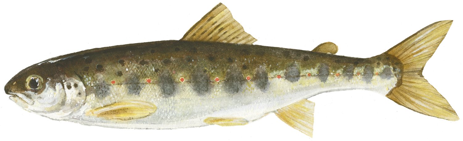
Salmons/Trouts
Type of resources
Topics
Keywords
Contact for the resource
Provided by
Formats
Representation types
Update frequencies
status
-

PURPOSE: Adult salmon logbook data are collected annually from volunteer anglers on the Margaree River. These data are used as an input to the current model for predicting abundance of large and small salmon returns each season in the Margaree River (Breau and Chaput 2012). Logbook data used in the model come from in-season fishing. However, the dataset provided also includes early out-of-season fishing that was conducted by volunteer anglers under a scientific license issued by DFO. This early out-of-season early fishing began in 2015 as a pilot project and ran until 2023. DESCRIPTION: Tabularized data from logbooks of anglers in SFA 18A and 18B PHYSICAL SAMPLE DETAILS: Logbooks USE LIMITATION: To ensure scientific integrity and appropriate use of the data, we would encourage you to contact the data custodian.
-
PURPOSE: To track juvenile Atlantic salmon densities. DESCRIPTION: Indices of freshwater production are derived annually from electrofishing surveys in the rivers of Nova Scotia flowing into the Gulf of St. Lawrence. Fixed site sampling for juvenile salmon has been conducted most consistently since the mid-1980s for these rivers. Juvenile salmon abundances at sites, in terms of number of fish per habitat area sampled by age or size group (densities), are obtained using successive removal sampling or catch per unit effort sampling calibrated to densities. Sampling intensities vary among years and among rivers. PARAMETERS COLLECTED: distribution (ecological); species counts (ecological); point (spatial) USE LIMITATION: To ensure scientific integrity and appropriate use of the data, we would encourage you to contact the data custodian.
-

PURPOSE: Estimation of Atlantic salmon smolt abundance in the Restigouche watershed. DESCRIPTION: Each spring (May-June), DFO installs a Rotary Screw Trap (RST; smolt wheel) on the Kedgwick river, a tributary of the Restigouche River. The number of individuals of each species of fish caught in the trap is recorded, and length and weight are measured for a portion of Atlantic salmon smolts captured. All Atlantic salmon smolts captured in the RST are tagged with uniquely-numbered polyethylene streamer tags and released upstream of the trap with the intention of using their rate of recapture to estimate the efficiency of the trap and the abundance of smolts (Capture-Mark-Recapture experiment). PARAMETERS COLLECTED: species counts (ecological); point (spatial); capture-mark-recapture data for Atlantic salmon smolts (ecological) NOTES ON QUALITY CONTROL: The data is stored in a relational database and therefore benefits from referential integrity between tables and observations. The database also defines data types for columns of the tables, ensuring a degree of consistency across observations. The field data sheets are also entered into a web app which provides an additional layer of quality control. USE LIMITATION: To ensure scientific integrity and appropriate use of the data, we would encourage you to contact the data custodian.
-

Basic biological data for all fish caught during the 2012 BSMFP expedition. Includes identification, weight, length (total, fork, and, standard), liver weight, gonad weight, sex and maturity level.
-

PURPOSE: From August 1st to September 11th, 2014, Fisheries and Oceans Canada conducted a baseline survey of marine fishes and their habitats in the southern Canadian Beaufort Sea and Amundsen Gulf as part of the Beaufort Regional Environmental Assessment (BREA) called the Beaufort Sea Marine Fishes Project (BSMFP). Sampling was conducted from the F/V Frosti at 54 stations along 14 transects. Standardized sampling was conducted at pre-determined depth stations (20-1500 m) using benthic trawling nets. The BSMFP is the first research project to use large research trawls to assess the biodiversity and abundance of offshore marine fishes in this area. In total, 42 species of fish were caught. This report contains information on fishing net deployments, catch per unit effort (CPUE), and basic biological data for all fishes caught. DESCRIPTION: Basic biological data for all fish caught during the 2014 BSMFP expedition. Includes identification, weight, length (total, fork, and, standard), liver weight, gonad weight, sex and maturity level. PARAMETERS COLLECTED: family species weight total length fork length standard length liver weight gonad weight sex maturity SAMPLING METHODS: Various trawl types.
-
PURPOSE: From August 2nd to September 9th, 2013, Fisheries and Oceans Canada conducted a baseline survey of marine fishes and their habitats in the southern Canadian Beaufort Sea and Amundsen Gulf as part of the Beaufort Regional Environmental Assessment (BREA) called the Beaufort Sea Marine Fishes Project (BSMFP). Sampling was conducted from the F/V Frosti at 53 stations along 8 transects. Standardized sampling was conducted using benthic trawling nets. The BSMFP is the first research project to use a large research trawls to assess the biodiversity and abundance of offshore marine fishes in this area. In total, 48 species of fish were caught, one of which was a new occurrence in the Canadian Beaufort Sea, Lycodes lavalaei. DESCRIPTION: Basic biological data for all fish caught during the 2013 BSMFP expedition. Includes identification, weight, length (total, fork, and, standard), liver weight, gonad weight, sex and maturity level. PARAMETERS COLLECTED: family species weight total length fork length standard length liver weight gonad weight sex maturity SAMPLING METHODS: Various trawl types.
-

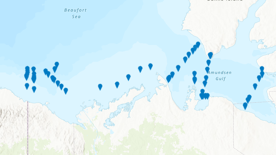
From August 5th to September 3rd, 2012, Fisheries and Oceans Canada conducted a baseline survey of marine fishes and their habitats on the Canadian Beaufort Shelf and slope. Sampling was conducted from the F/V Frosti at 28 stations along four transects. Standardized sampling was conducted at pre-determined depth stations (20-40, 75, 200, 350, 500, 750, and 1000 m) using a variety of sampling equipment including benthic fishing trawls, plankton nets, sediment cores, and CTD and water sample profiles. A specialized CTD probe (UCTD) was deployed at an additional 30 locations while the ship was underway. Presented here is the information on the sampling locations, and the sampling gear deployed at each station.
-

From August 2nd to September 9th, 2013, Fisheries and Oceans Canada conducted a baseline survey of marine fishes and their habitats on the Canadian Beaufort Shelf and slope. Sampling was conducted from the F/V Frosti at 64 stations along ten transects. Standardized sampling was conducted on the transects at pre-determined depth stations (20-40, 75, 200, 350, 500, 750, and 1000 m) using a variety of sampling equipment including benthic fishing trawls, plankton nets, sediment cores, and CTD and water sample profiles. A specialized CTD probe (UCTD) was deployed at an additional 72 locations while the ship was underway.Presented here is the information on the sampling locations, and the sampling gear deployed at each station.
-
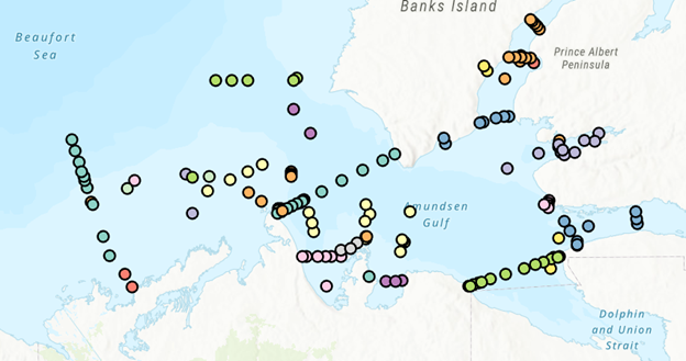
PURPOSE: The Department of Fisheries and Oceans (DFO) conducted a baseline survey of biological communities and habitat parameters in the offshore Canadian Beaufort Sea between 2012 and 2014, as part of the federally administered Beaufort Regional Environmental Assessment. The BREA-Marine Fishes Project (BREA-MFP) was the first comprehensive baseline study of offshore marine fish diversity and associated habitats in the Canadian Beaufort Sea. Knowledge gained during the BREA-MFP supports regulatory processes pertaining to offshore development and Oceans Management in the Inuvialuit Settlement Region, and provides baseline context for studies of the effects of climate change and variability. The Canadian Beaufort Sea – Marine Ecosystem Assessment (CBS-MEA, 2017-2019 and 2021-2024) is building on system baselines and ecological knowledge derived from the BREA-MFP to develop a comprehensive research and monitoring approach for the offshore Canadian Beaufort Sea. This approach will enable us to better understand the relationship between oceanographic drivers and ecosystem responses. The CBS-MEA focuses on integrating oceanography, food web linkages, physical-biological couplings and spatial and inter-annual variabilities, while also expanding baseline coverage of species diversity, abundances, and habitat associations to areas of the Beaufort Sea and Canadian Archipelago that are previously unstudied in this context. DESCRIPTION: Between 2017 and 2019, and between 2021 and 2024, Fisheries and Oceans Canada conducted a baseline survey of marine fishes and their habitats on the Canadian Beaufort Shelf and slope in August and early September each year. Sampling was conducted from the F/V Frosti at over 150 stations along ten multi-year transects, and over 50 non-transect stations. Standardized sampling was conducted at pre-determined depth stations (20-40, 75, 200, 350, 500, 750, and 1000 m) using a variety of sampling equipment including benthic fishing trawls, plankton nets, sediment cores, and CTD and water sample profiles. Presented here is the information on the sampling locations, and the sampling gear deployed at each station.
-

From August 6th to September 9th, 2014, Fisheries and Oceans Canada conducted a baseline survey of marine fishes and their habitats on the Canadian Beaufort Shelf and slope. Sampling was conducted from the F/V Frosti at 56 stations along thirteen transects, with an additional three stations not located on transects. Standardized sampling was conducted on the transects at pre-determined depth stations (20-40, 75, 200, 350, 500, 750, and 1000 m) using a variety of sampling equipment including benthic fishing trawls, plankton nets, sediment cores, and CTD and water sample profiles. Presented here is the information on the sampling locations, and the sampling gear deployed at each station.