 Arctic SDI catalogue
Sentinel-2
Type of resources
Topics
Keywords
Contact for the resource
Provided by
Formats
Representation types
Update frequencies
status
Scale
-

These three satellite mosaics cover the entire territory of Quebec and include images taken in 2018, 2019 and 2020. The spectral bands are blue (band 2), near infrared (band 8), and short wave infrared (band 11). The Copernicus Sentinel-2 mission includes a constellation of two satellites in orbit that are in tandem and 180° apart from each other. The orbital configuration allows coverage with a revisit rate varying from two to ten days depending on the latitude. The Sentinel-2 constellation captures multispectral satellite images at a resolution of 10 m for the next generation of operational products, such as land use maps, land change detection maps, and geophysical variables. [Product Technical Specifications] (https://diffusion.mern.gouv.qc.ca/diffusion/RGQ/Matriciel/Satellite/Regional/Mosaiques_Sentinel-2/Document/Sentinel-2_User_Handbook.pdf) **This third party metadata element was translated using an automated translation tool (Amazon Translate).**
-
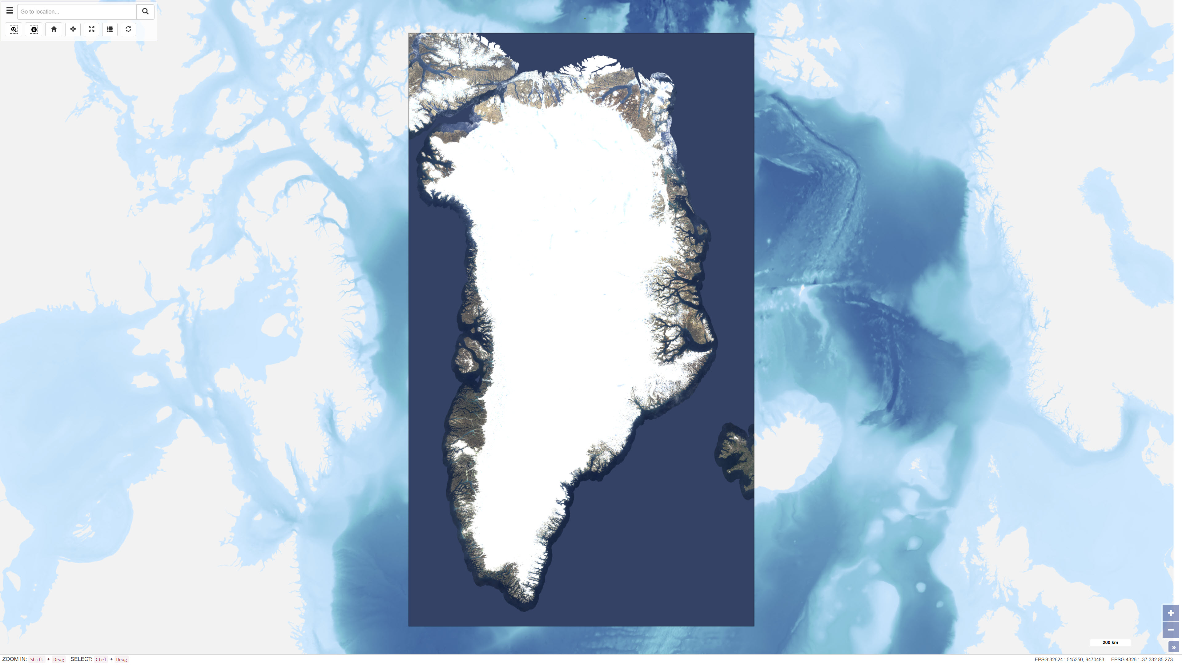
EOxCloudless is a global satellite imagery dataset consisting of near-cloudless mosaics derived from Copernicus Sentinel-2 multispectral satellite data. The dataset is produced by EOX IT Services GmbH and is designed to provide consistent, high-resolution surface imagery for mapping, analysis, and visualization purposes. The mosaics are generated by combining a large number of Sentinel-2 Level-1C observations acquired over defined time periods. Advanced pixel selection algorithms and thematic masks (including clouds, cloud shadows, and water) are applied to reduce cloud contamination. For each pixel location, the most representative observation is selected based on statistical criteria and temporal analysis, resulting in near-cloudless composite images. The dataset provides global land coverage and is typically delivered at a spatial resolution of 10 metres for the utilised spectral bands (blue, green, red, and near-infrared). EOxCloudless is suitable for use as a basemap as well as for environmental monitoring, land analysis, spatial planning, and other geoscientific applications.
-
This geographic reference system shows the mapping of land occupancy in Quebec. Land use is defined as physical and biological land cover. It includes artificial surfaces, agricultural areas, forests, forests, semi-natural areas, wetlands, and water bodies. This map covers the territory of southern Quebec and will be extended to northern regions in a later version. The data is generated by a semi-automated classification of high-resolution satellite images, which makes it possible to more accurately identify types of land use. Mapping is available in a unified matrix format. A metadata index as well as a [user guide] (https://diffusion.mern.gouv.qc.ca/diffusion/RGQ/Imagerie/COTQ/Documentation/guide-utilisation.pdf) presenting the data structure and land use classes are available to users.**This third party metadata element was translated using an automated translation tool (Amazon Translate).**