 Arctic SDI catalogue
Water balance
Type of resources
Available actions
Topics
Keywords
Contact for the resource
Provided by
Formats
Representation types
Update frequencies
status
Scale
-
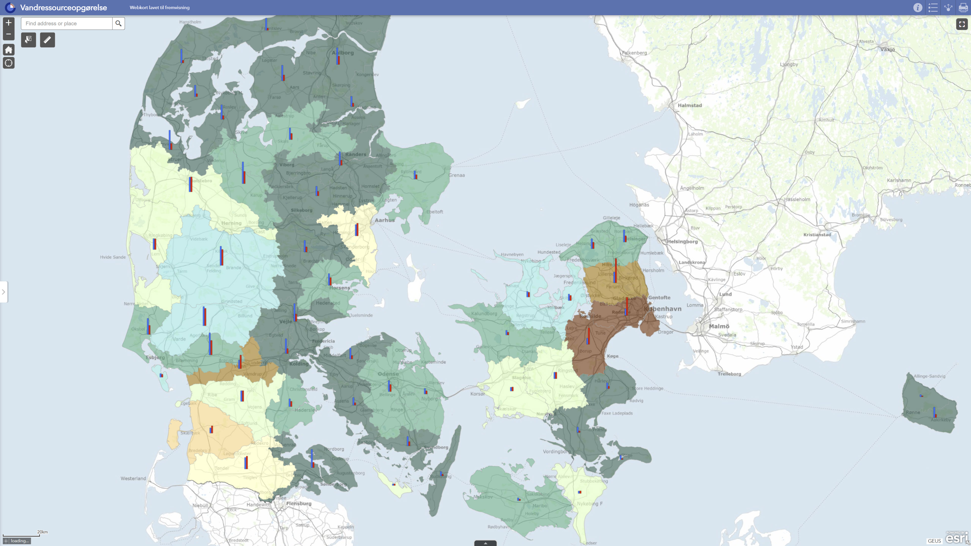
DK model 2019 – Water resources assessment comprises derived results from GEUS’ national hydrological model for Denmark for assessing the use and quantitative status of groundwater resources. The dataset contains model-based assessments of groundwater recharge, water abstraction, exploitation rates, water balance, groundwater drawdown and related assessments at groundwater body level. Exploitation rates are calculated as the ratio between abstraction and groundwater recharge and are used together with information on drawdown and streamflow impacts to assess whether groundwater bodies may be at risk with respect to water balance and quantitative status. The dataset is suitable for regional screening, documentation and overall assessment of groundwater resources, but should not be used as the sole basis for local-scale decisions without additional expert evaluation.
-
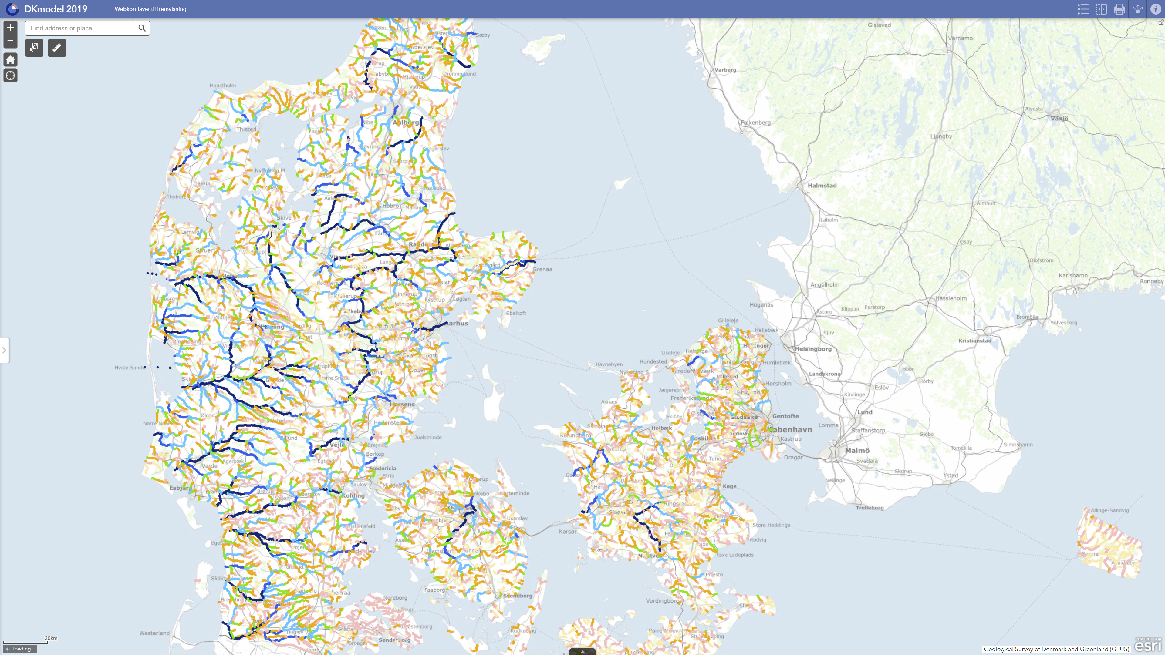
DK model 2019 – Simulation results comprises calculated hydrological results from GEUS’ national hydrological model for Denmark. The dataset contains derived results from model runs with DK model 2019, including calculations of water balance, groundwater recharge, impacts of water abstraction, groundwater drawdown, streamflow impacts and changes in flow-related indicators. The results include, among other outputs, comparisons between scenarios with current abstraction and reference scenarios without abstraction. The dataset is used for regional assessment of hydrological conditions, screening of water resource and impact conditions, and documentation of model-calculated results. The results are model-based and should be used with due consideration of the regional purpose, model uncertainties and limitations of DK model in relation to local-scale applications.
-
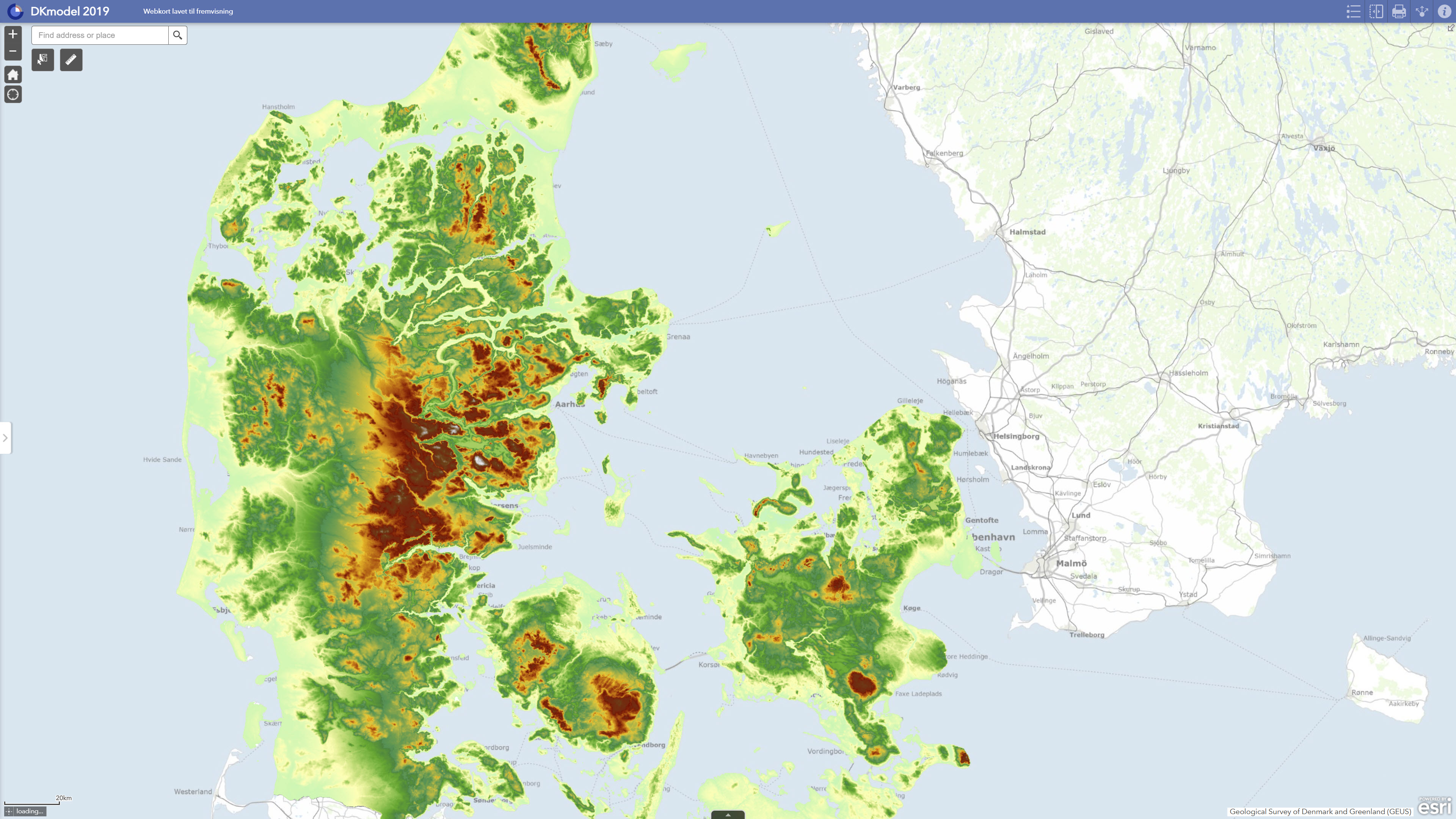
DK model 2019 – Model data comprises core model data from GEUS’ national hydrological model for Denmark. The dataset describes the model basis used in DK model 2019, including the hydrogeological model structure, computational grid, groundwater bodies, climate input, water abstraction data, stream network and other thematic input data included in the model setup. DK model 2019 was updated with new groundwater bodies, new hydrogeological mapping information and a new calibration against observed groundwater heads and stream discharge. The model data form the basis for calculations of groundwater recharge, water balance, water abstraction, drawdown, exploitation rates and impacts on streams. The dataset is suitable as documentation of the model basis and as input to regional analyses, screening and further modelling studies, but should not be used directly for local-scale issues without a separate assessment.