 Arctic SDI catalogue
mowing
Type of resources
Available actions
Topics
Keywords
Contact for the resource
Provided by
Years
Formats
Resolution
-
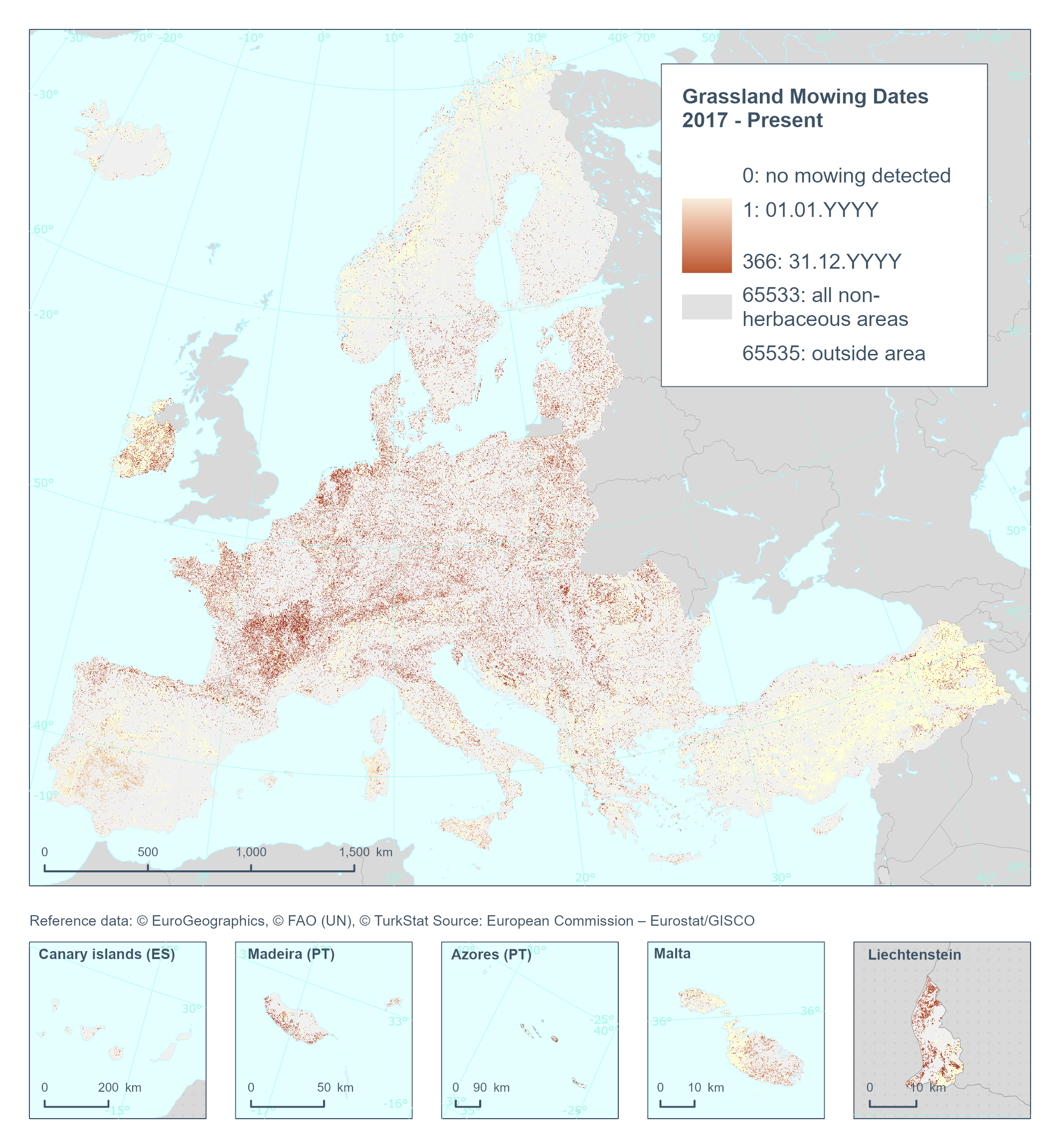
The High Resolution Layer Grassland Mowing Dates (GRAMD) raster product provides at pan-European level in the spatial resolution of 10 m a basic land cover classification, flagging and mapping the start date (DOY) (GRAMD) within the detected Herbaceous cover layer (temporal and permanent grassland)) with a Minimum Mapping Unit (MMU) of 0.25 ha. The GRAMD product will flag and map the dates (Day of Year) of each mowing event on temporary or permanent grassland per year, resulting in a product split in four different rasters per year. This dataset is provided annually starting with 2017 in 10 meter rasters (fully conformant with the EEA reference grid) in 100 x 100 km tiles covering the EEA38 countries. High Resolution Layer Grasslands product is part of the European Union’s Copernicus Land Monitoring Service. This dataset includes data from the French Overseas Territories (DOMs)
-
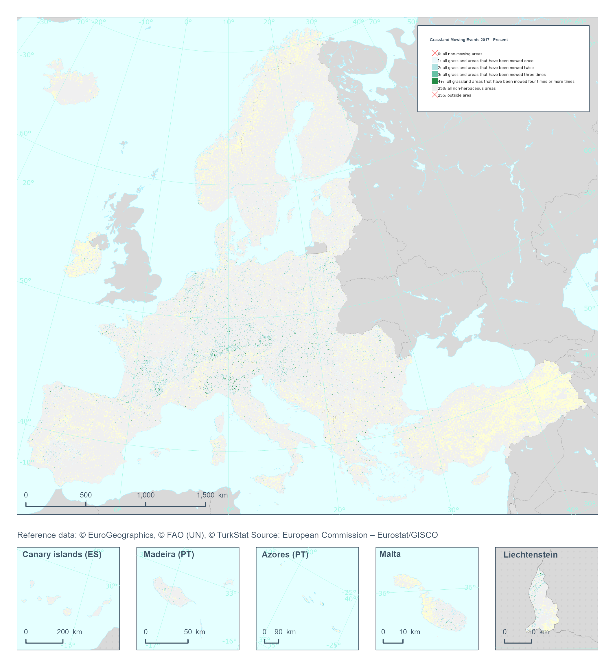
The High Resolution Layer Grassland Mowing Events (GRAME) raster product provides a basic land cover classification containing respectively the number of grassland mowing events within the detected Herbaceous cover layer (temporal and permanent grassland)) with a Minimum Mapping Unit (MMU) of 0.25 ha. The GRAME product will flag and map the number of mowing events (1, 2, 3, or 4+) on temporary or permanent grassland detected per year. This dataset is provided annually starting in 2017 with 10 meter rasters (fully conformant with the EEA reference grid) in 100 x 100 km tiles covering the EEA38 countries. High Resolution Layer Grasslands product is part of the European Union’s Copernicus Land Monitoring Service. Confidence layer available for the dataset. This dataset includes data from the French Overseas Territories (DOMs)