 Arctic SDI catalogue
20
Type of resources
Available actions
Topics
Keywords
Contact for the resource
Provided by
Years
Formats
Scale
Resolution
-

HRL, 6 háupplausnargagnalög: yfirborðsgegndræpi, skógar (trjákrónuþéttleiki), skógar (barrtré/lauftré), graslendi, votlendi, vötn. Rastagögn, 20 m myndpunktsstærð, upprunaleg og endurbætt gagnalög og skýrslur, ISN2004. Hægt er að sækja gögnin á niðurhalssíðu Landmælinga Íslands. Nánari upplýsingar um hvert lag fylgja gögnunum. HRL, 6 High Resolution Layers: imperviousness, tree cover density, forest type, grasslands, wetlands, permanent water bodies. Raster data, 20 m pixel size, intermediate and enhanced results, data and verification/enhancement reports, ISN2004. The datasets can be downloaded from the National Land Survey of Iceland Download Site where more details information about each layer are included.
-
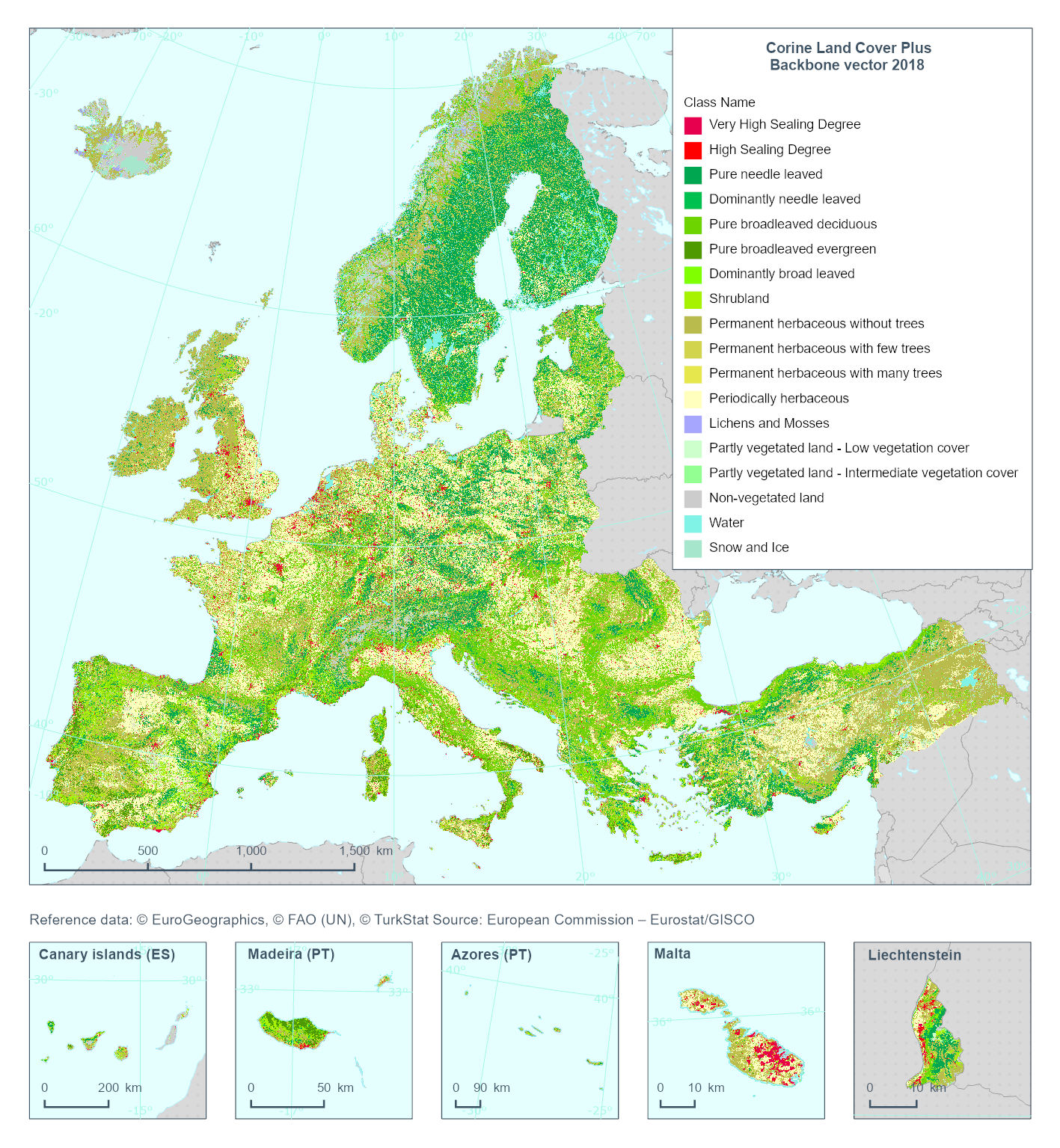
This metadata refers to the 'Corine Land Cover Plus Backbone' (CLCplus Backbone), a spatially detailed, large-scale, Earth Observation-based land cover inventory which is produced by the Copernicus Land Monitoring Service (CLMS). The CLCplus Backbone vector is a land cover map that contains vector polygon geometries (minimum mapping unit: 0.5 ha; minimum mapping width: 20 m) and is based on Sentinel satellite time series and a combination of existing reference datasets for geometries containing transportation and hydrological networks. Each polygon represents aggregated landscape objects and contains their dominant land cover among the 18 basic land cover classes. See polygon class codes in the additional information section. In addition, polygons are enriched with land cover fractions from the CLCplus Backbone raster as well as aggregated attributes based on other CLMS and Copernicus products (e.g. topography). CLCplus Backbone vector is an independent product and its thematic and geometric contents differ from CLCplus Backbone raster and Corine Land Cover. The CLCplus Backbone vector is available for the 2018 reference year.