 Arctic SDI catalogue
Aeromagnetic
Type of resources
Available actions
Topics
Keywords
Contact for the resource
Provided by
Formats
Representation types
Update frequencies
status
Scale
-
%20-%20datas%C3%A6t.jpg)
The dataset contains aeromagnetic measurements acquired during 1993–1996 in East and North-East Greenland as part of the AWI-AEROMAG project conducted by the Alfred Wegener Institute (AWI). The measurements represent regional airborne magnetometry and include total magnetic field intensity corrected for diurnal variations and the main geomagnetic field. The survey was carried out to support geological mapping and tectonic analysis of eastern Greenland. The dataset constitutes an important geophysical reference for studies of crystalline basement rocks, sedimentary basins and structural features in the region.
-
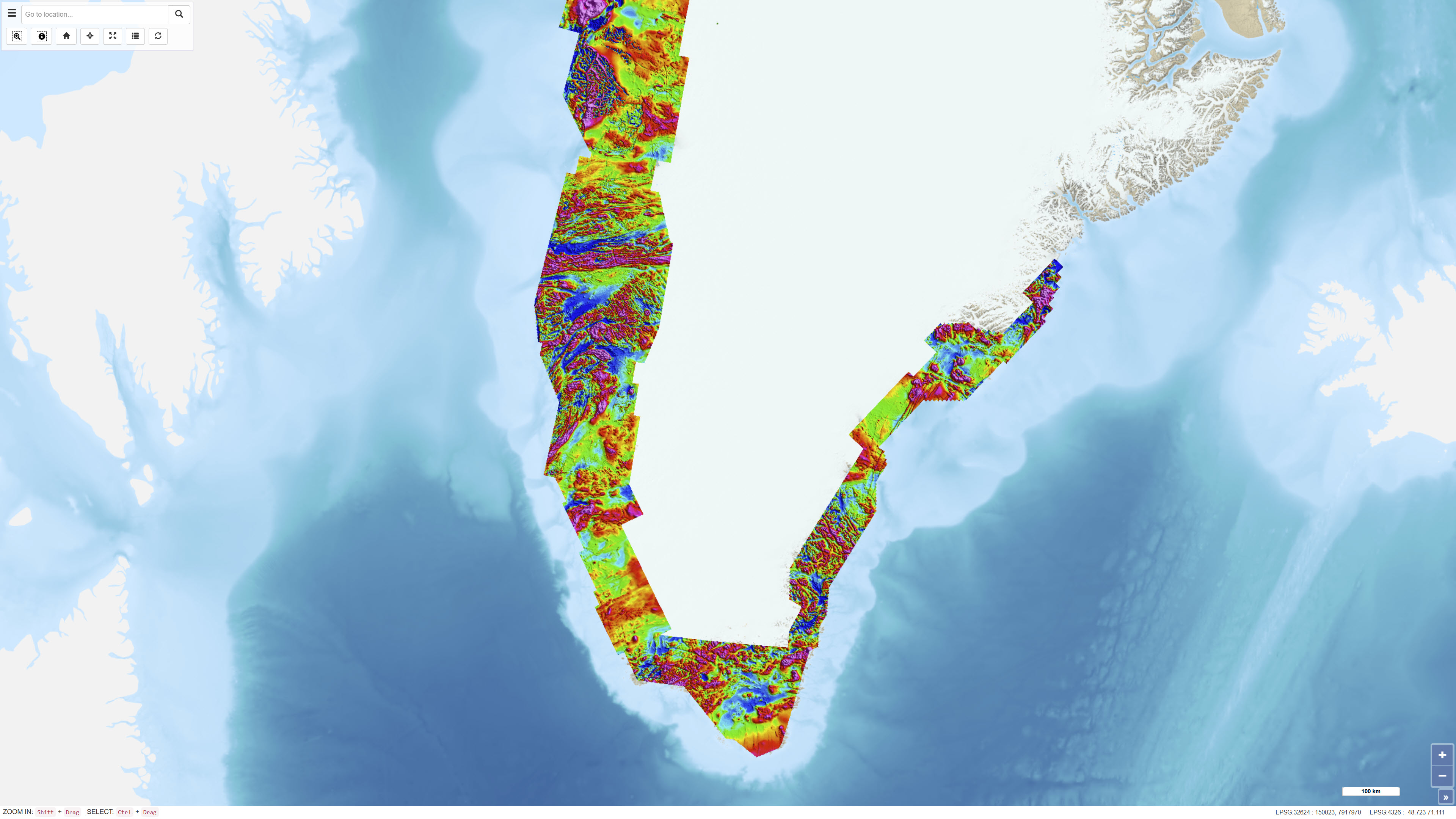
The Regional AEROMAG 1992–2013 Surveys comprise a compilation of high-resolution airborne magnetic surveys acquired by GGU/GEUS between 1993 and 2013 and financed by the Government of Greenland. The overlapping surveys cover approximately 300,000 km² and include the total ice-free onshore areas and near-coastal offshore regions of West Greenland, South Greenland and southern East Greenland. All surveys were acquired using aircraft with similar flight parameters, including line spacings of 500–1,000 m and cross-line spacing of approximately 5,000 m, and with flight altitudes of about 300 m above ground level or seafloor along gently draped surfaces. These consistent acquisition parameters allow the individual surveys to be integrated into a coherent, high-quality regional magnetic data compilation. The total magnetic anomaly map was generated by merging grids from separately processed datasets using the grid-knitting module in Oasis Montaj. The data are IGRF-corrected but not reduced to the pole, and the crustal magnetic field model MF7 was used as a regional reference grid during compilation.