 Arctic SDI catalogue
REST
Type of resources
Available actions
Topics
Keywords
Contact for the resource
Provided by
Formats
Representation types
Update frequencies
status
Scale
-
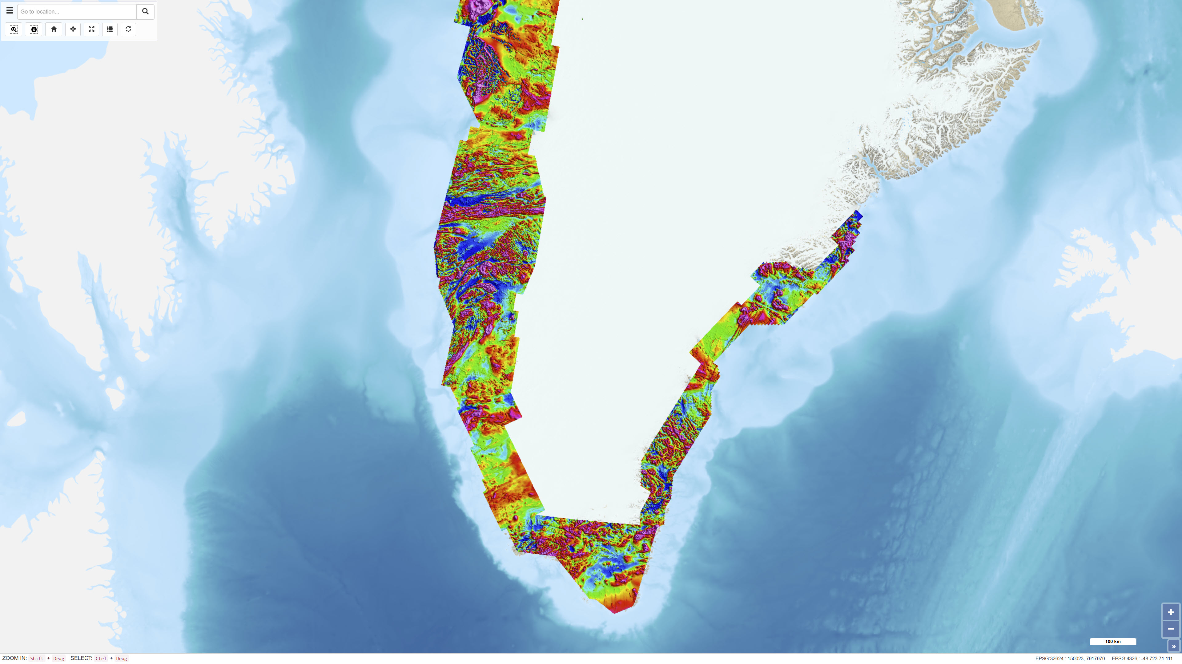
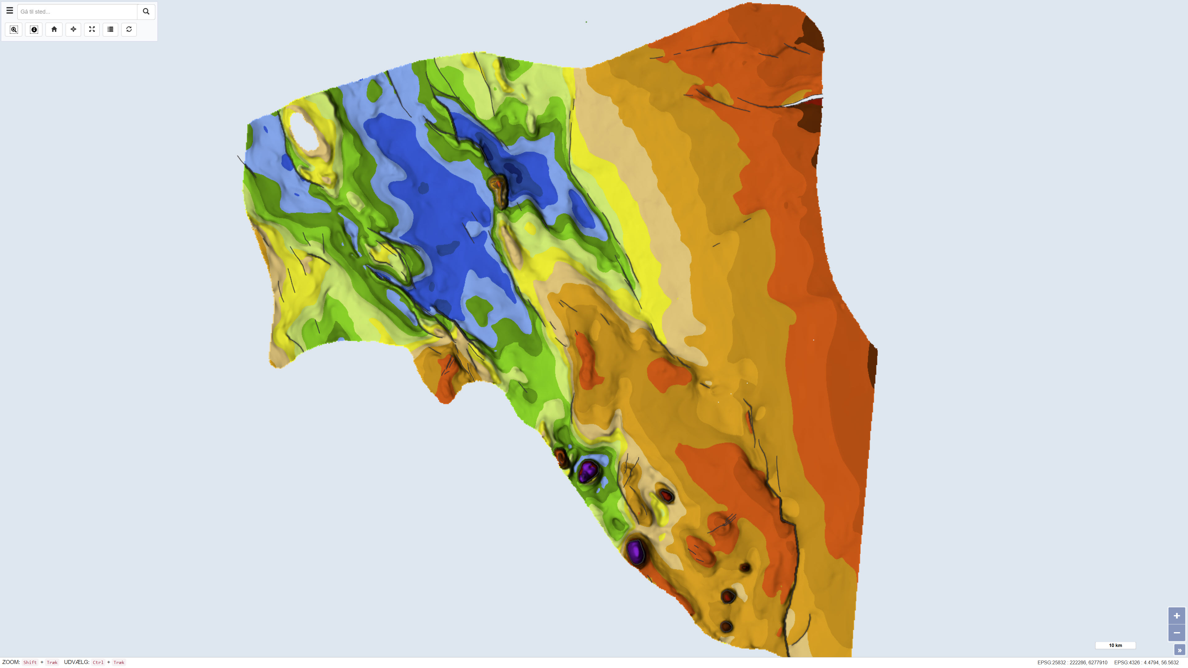
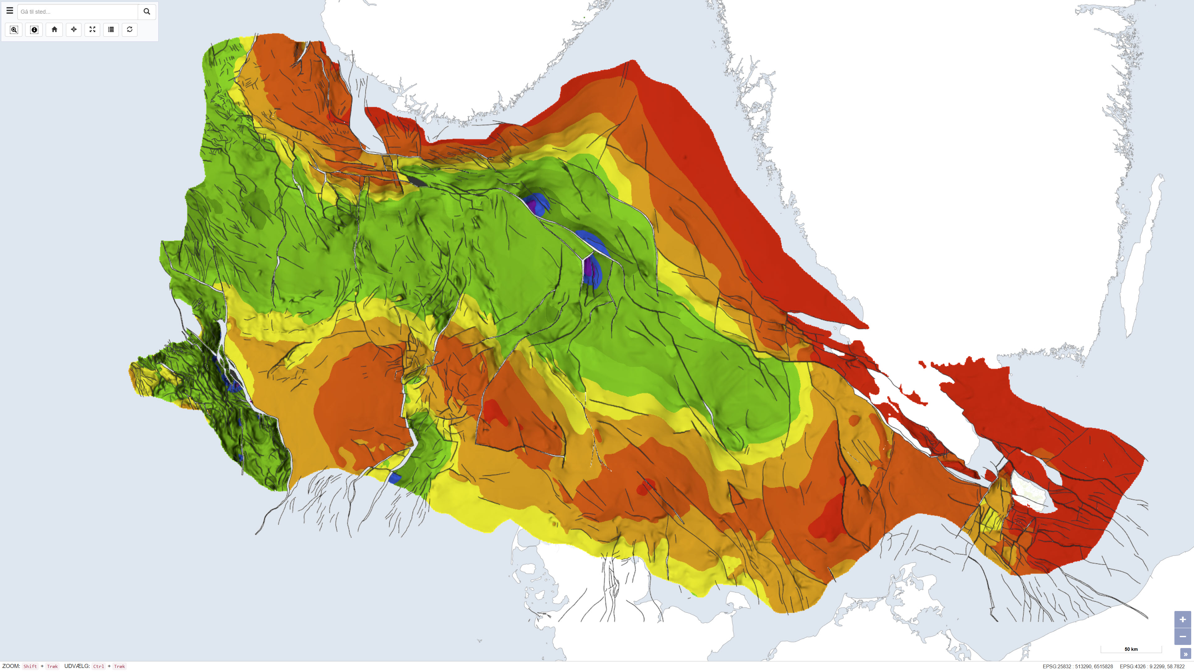
The Regional AEROMAG 1992–2013 Surveys comprise a compilation of high-resolution airborne magnetic surveys acquired by GGU/GEUS between 1993 and 2013 and financed by the Government of Greenland. The overlapping surveys cover approximately 300,000 km² and include the total ice-free onshore areas and near-coastal offshore regions of West Greenland, South Greenland and southern East Greenland. All surveys were acquired using aircraft with similar flight parameters, including line spacings of 500–1,000 m and cross-line spacing of approximately 5,000 m, and with flight altitudes of about 300 m above ground level or seafloor along gently draped surfaces. These consistent acquisition parameters allow the individual surveys to be integrated into a coherent, high-quality regional magnetic data compilation. The total magnetic anomaly map was generated by merging grids from separately processed datasets using the grid-knitting module in Oasis Montaj. The data are IGRF-corrected but not reduced to the pole, and the crustal magnetic field model MF7 was used as a regional reference grid during compilation.
-

The dataset consists of three different datasets with combined place names in various geological maps: Geological map of Greenland 1:2.500.000, Geological maps of Greenland 1:500.000 and Topographic map of Greenland 1:250.000. The dataset has not been updated or maintained since 2014.
-
%20-%20datas%C3%A6t.jpg)
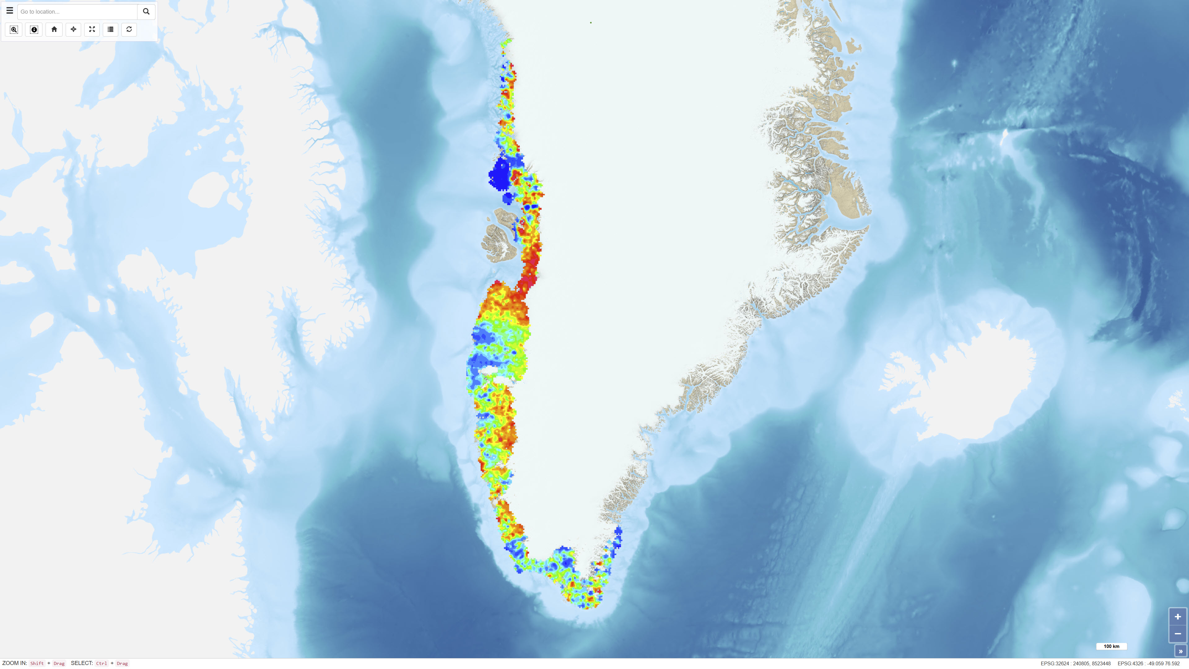
The dataset contains aeromagnetic measurements acquired during 1993–1996 in East and North-East Greenland as part of the AWI-AEROMAG project conducted by the Alfred Wegener Institute (AWI). The measurements represent regional airborne magnetometry and include total magnetic field intensity corrected for diurnal variations and the main geomagnetic field. The survey was carried out to support geological mapping and tectonic analysis of eastern Greenland. The dataset constitutes an important geophysical reference for studies of crystalline basement rocks, sedimentary basins and structural features in the region.
-
The dataset comprises more than 6,400 oblique aerial photographs acquired during the systematic 1:500,000 geological mapping programme in North Greenland carried out by the Geological Survey of Greenland (now GEUS) between 1978 and 1985. The photographs document steep fjord and valley walls and were collected as part of geological field investigations. The images have been digitised and made available through a web-based interface, allowing users to access individual photographs, their geographic locations and associated geological coding linked to the regional geological map. The dataset represents a systematic visual documentation of geological features in North and Northeast Greenland.
-
This dataset represents the structure and topography of the Top Chalk surface, i.e. the top of the Chalk Group (including Upper Cretaceous to Danian), in the Danish subsurface. The map illustrates regional variations in the depth and structural configuration of the chalk surface from the central North Sea to the eastern Danish areas. It is based on an integrated geological and geophysical interpretation of seismic profiles, well data and earlier mapping. The map provides an essential basis for geological, geophysical and subsurface reservoir analyses.
-
The dataset comprises digital element distribution maps based on geochemical analyses of stream sediments collected in West and South Greenland. The maps were produced as part of the geochemical mapping programme underlying the Geochemical Atlas of West and South Greenland. The data represent analyses of various elements in defined grain-size fractions and provide a regional overview of geochemical variations.
-
The dataset comprises a geological map of the Danish Central Graben at a scale of 1:200,000 presenting regional maps of ‘Base Chalk’ and the Chalk Group in terms of two-way travel time, depth, interval velocity and vertical thickness (isochore). The map was published in 1995 as part of the DGU Map Series no. 48 and was produced as part of a comprehensive geological mapping of the Danish Central Graben. The mapping is based on regional interpretation of seismic data supplemented by information from boreholes. The map covers the Danish part of the Central Graben and parts of the eastern North Sea, and adjacent areas in the Norwegian, British and German sectors are included in order to define regional structural relationships. The map sheet consists of several thematic sub-maps that together describe the structure and stratigraphy of the area.
-
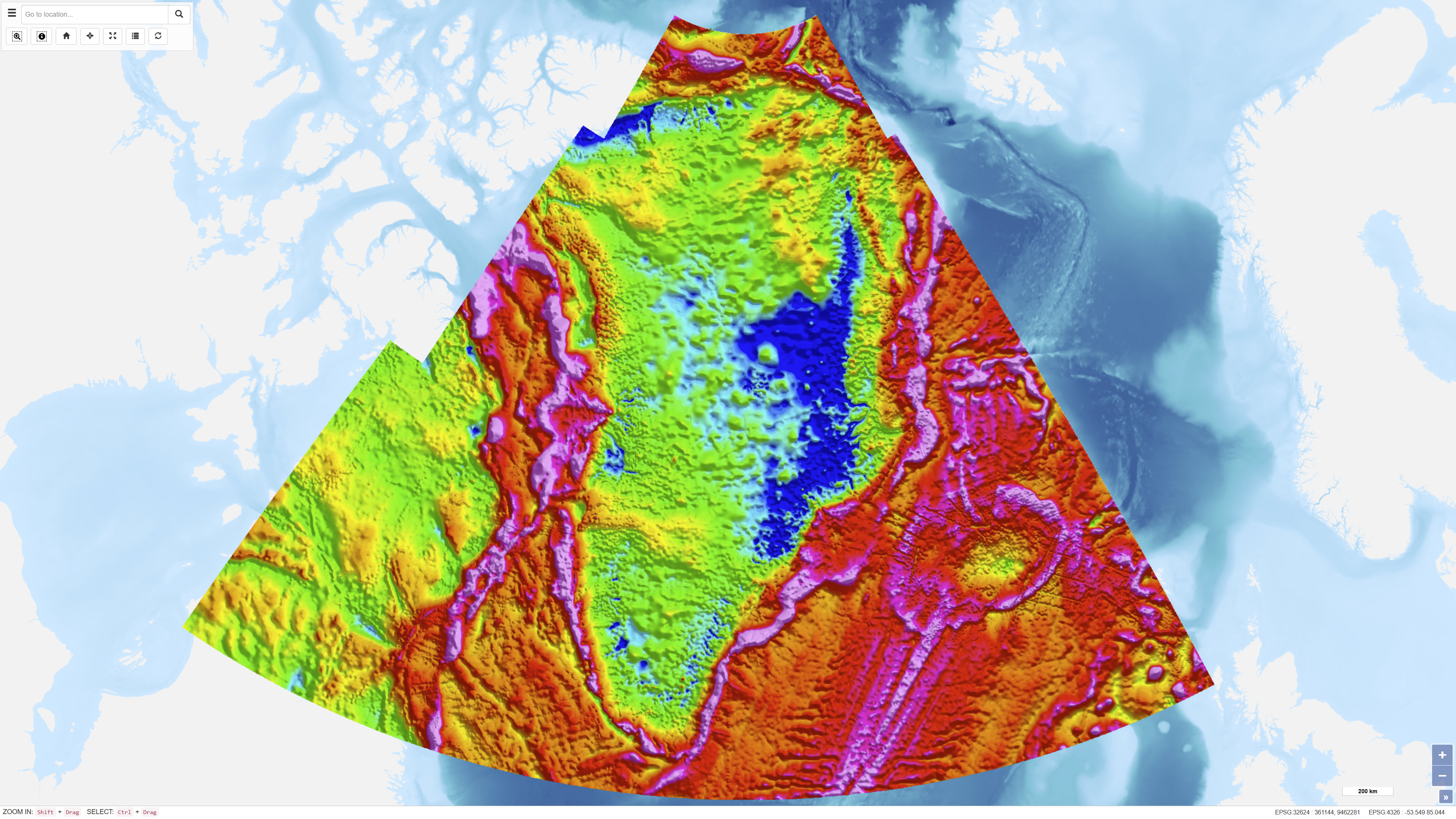
The dataset represents a regional compilation of terrestrial, marine, airborne and satellite-derived gravity data for Greenland, prepared by DTU Space. The compilation includes calculation of free-air (Faye) and terrain-corrected Bouguer anomalies based on homogenised gravity observations. In areas lacking direct measurements, satellite-derived gravity models have been applied as supplementary data. Over the Greenland Ice Sheet, Bouguer anomalies are calculated using an ice thickness model based on Bamber et al. (2013). The dataset provides a regional gravity framework for geological and geophysical interpretation.
-
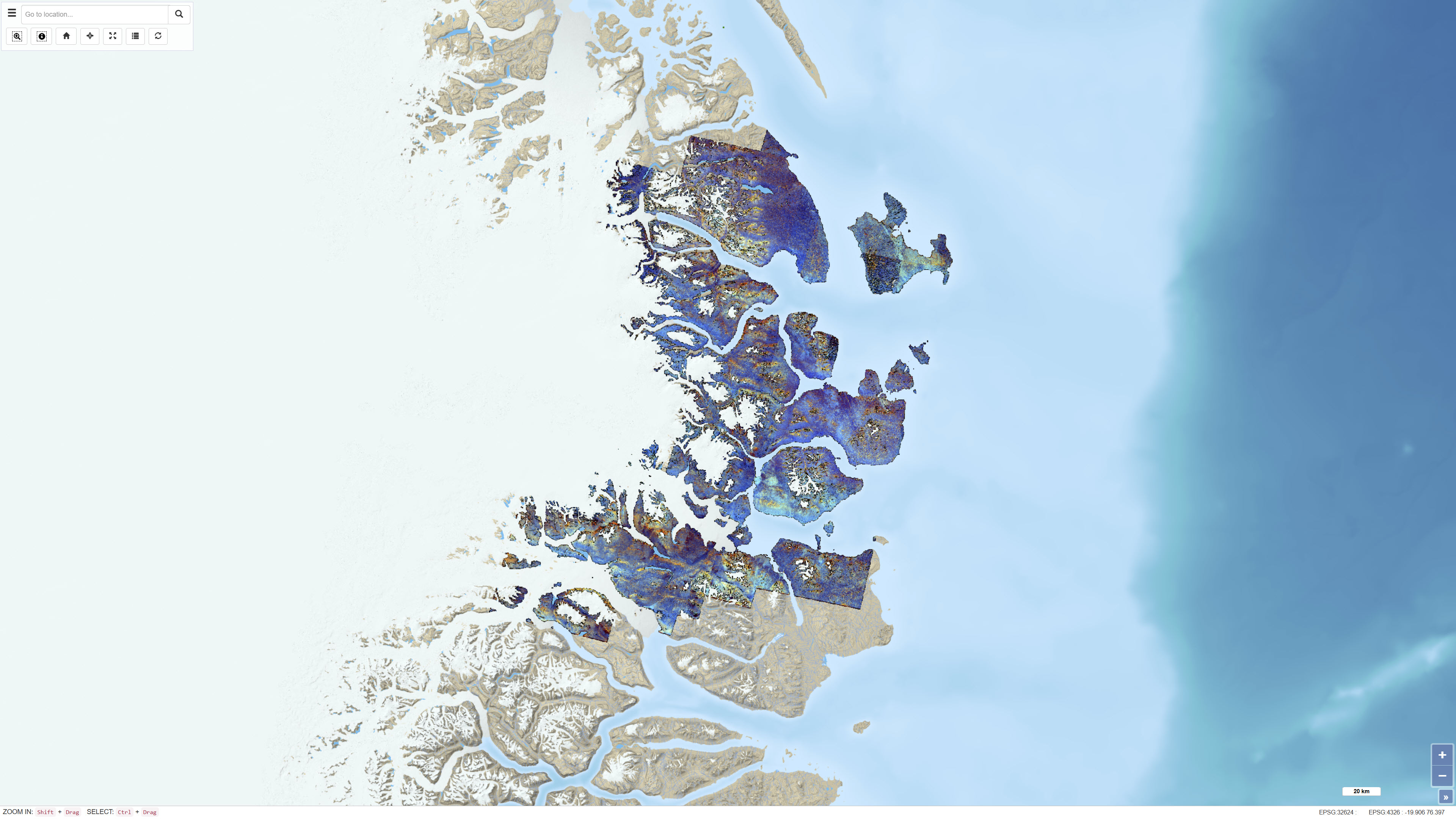
The dataset consists of a series of ASTER band ratios combined into colour composite images designed to highlight mineralogical distributions and lithological variability in Northeast Greenland. The ASTER scenes were preprocessed with atmospheric, radiometric and topographic corrections, including radiative transfer modelling using ATCOR-3 in rugged terrain mode. A surface elevation model was applied to adjust illumination effects. Non-outcrop pixels were masked prior to generating the final mosaic. Calibrated radiance data were converted to apparent surface reflectance; however, further calibration against ground-based reflectance measurements was not feasible. The dataset represents a derived remote sensing product and not primary satellite data.
-
This dataset depicts the depth to the top of the pre-Zechstein succession in the Danish subsurface. The map represents the structural surface beneath the Zechstein evaporites and provides a regional overview of the geological framework of the subsurface. The dataset is based on interpretation of seismic data, deep boreholes and previous geological mapping and was produced as part of the Geological Survey of Denmark map series no. 45. The map is used as a reference for regional structural geology and subsurface modelling.