DSM
Type of resources
Topics
Keywords
Contact for the resource
Provided by
Years
Formats
Representation types
Update frequencies
status
Service types
-

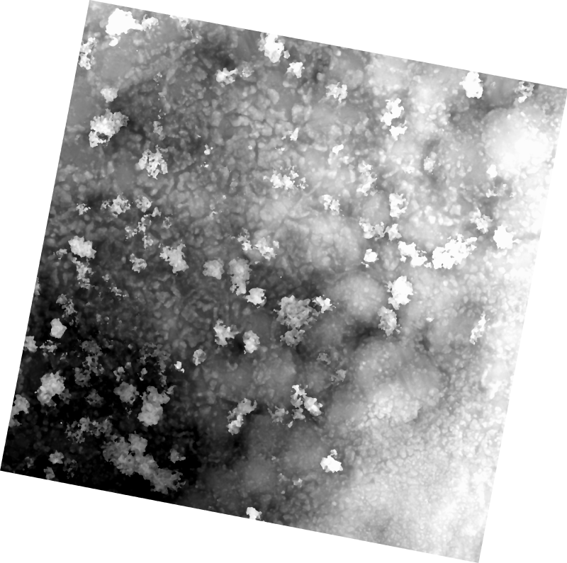
The 1 cm resolution digital surface model (DSM) was created from unmanned aerial vehicle (UAV) imagery acquired from a single day survey, July 28th 2016, in Cambridge Bay, Nunavut. Five control points taken from a Global Differential Positioning System were positioned in the corners and the center of the vegetation survey. The DSM covering 525m2 was produced by Canada Centre for Remote Sensing /Canada Centre for Mapping and Earth Observation. The UAV survey was completed in collaboration with the Canadian High Arctic Research Station (CHARS) for northern vegetation monitoring research. For more information, refer to our current Arctic vegetation research: Fraser et al; "UAV photogrammetry for mapping vegetation in the low-Arctic" Arctic Science, 2016, 2(3): 79-102. http://www.nrcresearchpress.com/doi/abs/10.1139/AS-2016-0008
-

__LiDAR__ (__Li__ght __D__etection __A__nd __R__anging) is a modern survey method that produces three-dimensional spatial information in the form of a data point cloud. LiDAR is an active remote sensing system; it produces its own energy to acquire information, versus passive systems, like cameras, that only receive energy. LiDAR systems are made up of a scanner, which is a laser transmitter and receiver; a GNSS (GPS) receiver; and an inertial navigation system (INS). These instruments are mounted to an aircraft. The laser scanner transmits near-infrared light to the ground. The light reflects off the ground and returns to the scanner. The scanner measures the time interval and intensity of the reflected signals. This information is integrated with the positional information provided by the GNSS and INS to create a three-dimensional point cloud representing the surface. A LiDAR system can record millions of points per second, resulting in high spatial resolution, which allows for differentiation of many fine terrain features. Point clouds collected with LiDAR can be used to create three-dimensional representations of the Earth’s surface, such as Digital Elevation Models (DEMs) and Digital Surface Models (DSMs). DEMs model the elevation of the ground without objects on the surface, and DSMs model ground elevations as well as surface objects such as trees and buildings. LidarBC's **Open LiDAR Data Portal** (see link under Resources) is an initiative to provide **open** public access to LiDAR and associated datasets collected by the Government of British Columbia. The data in the portal is released as Open Data under the [**Open Government Licence – British Columbia**](https://www2.gov.bc.ca/gov/content/data/open-data/open-government-licence-bc) (OGL-BC). Four Government of British Columbia business areas and one department of the Government of Canada make LiDAR data available through the portal: * [**GeoBC**](https://www2.gov.bc.ca/gov/content/data/about-data-management/geobc) * [**Emergency Management and Climate Readiness**](https://www2.gov.bc.ca/gov/content/safety/emergency-management) (EMCR) * [**BC Timber Sales**](https://www2.gov.bc.ca/gov/content/industry/forestry/bc-timber-sales) (BCTS) * [**Forest Analysis and Inventory Branch**](https://www2.gov.bc.ca/gov/content/industry/forestry/managing-our-forest-resources/forest-inventory) (FAIB) * [**Natural Resources Canada**](https://www.nrcan.gc.ca/home) (NRCan) GeoBC is the provincial branch that oversees and manages LidarBC’s Open LiDAR Data Portal, including storage, distribution, maintenance, and updates. Please direct questions to **LiDAR@gov.bc.ca**.
-
The USGS 3D Elevation Program (3DEP) Index service from The National Map shows two general categories of downloadable elevation data: (1) digital elevation model (DEM) datasets at standardized horizontal resolutions, and (2) elevation source data including that used to produce standard DEMs, and additional datasets derived from ifsar in Alaska only. Distributable DEM products include: 2 arc-second (in Alaska only); 1 arc-second; 1/3 arc-second; 1/9 arc-second; 5 meter (in Alaska only); and 1 meter. The 2-, 1-, and 1/3-arc-second products are staged for download in 1x1 degree tiles in ArcGrid, GridFloat, or IMG formats, while 1/9 arc-second products are staged in 15x15 minute tiles in IMG format only. The 5-meter products are staged for download in ArcGrid only as a single mosaicked raster to each project extent. The 1-meter products are staged in 10,000x10,000 meter tiles in IMG format only. Distributable elevation source data include: lidar point clouds (LPC) in LAS format for various parts of the U.S., and ifsar-derived digital surface models (DSM) and orthorectified radar images (ORI) in TIFF format in Alaska only. For additional information on the 3DEP, go to http://nationalmap.gov/3DEP/index.html.
 Arctic SDI catalogue