 Arctic SDI catalogue
Danish Central Graben
Type of resources
Available actions
Topics
Keywords
Contact for the resource
Provided by
Formats
Representation types
Update frequencies
status
Scale
-
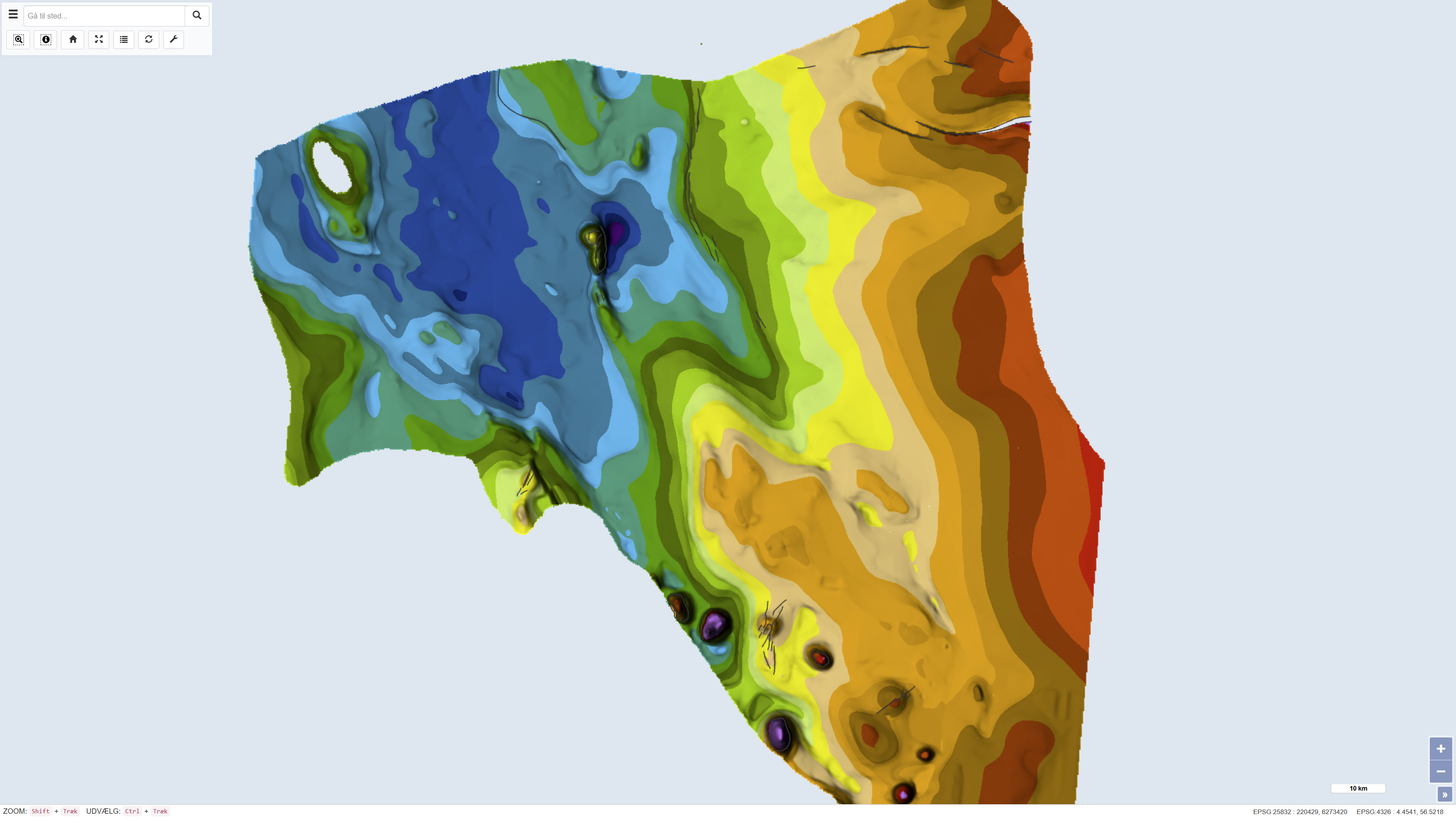
The dataset comprises a geological map of the Danish Central Graben at a scale of 1:200,000 presenting regional maps of ‘Top Chalk’ and the Post-Chalk Group in terms of two-way travel time, depth and interval velocity. The map was published in 1995 as part of the DGU Map Series no. 47 and was produced as part of a comprehensive geological mapping of the Danish Central Graben. The mapping is based on interpretation of seismic data supplemented by information from boreholes. The map covers the Danish part of the Central Graben and parts of the eastern North Sea block, and adjacent areas in the Norwegian, British and German sectors are included where data were available in order to define regional structural relationships. The map sheet comprises several thematic sub-maps that together describe regional variations in structure and stratigraphy.
-
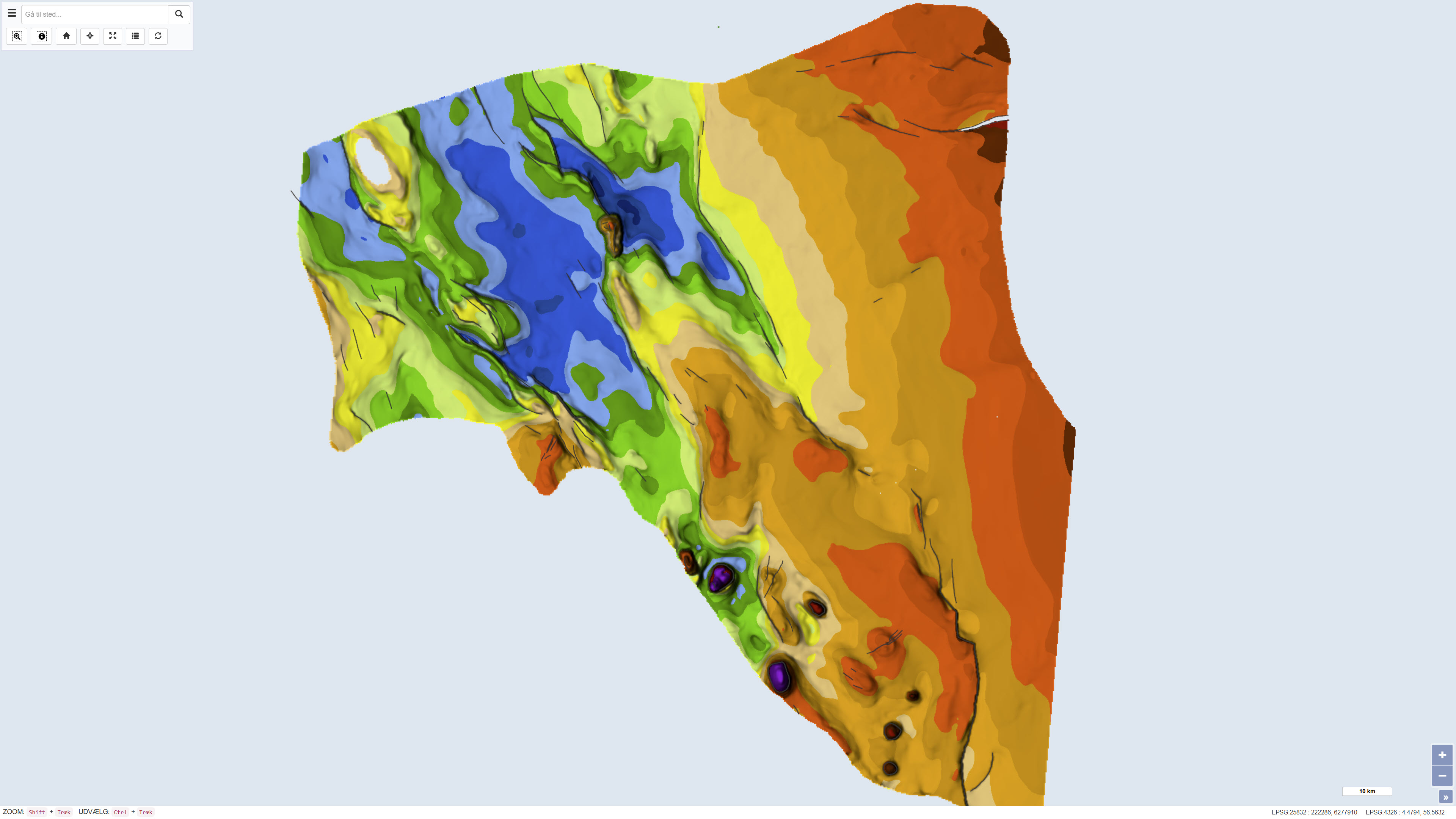
The dataset comprises a geological map of the Danish Central Graben at a scale of 1:200,000 presenting regional maps of ‘Base Cretaceous’ and the Cromer Knoll Group. The map was published in 1995 as part of the DGU Map Series no. 49 and was produced as part of a comprehensive geological mapping of the Danish Central Graben. The mapping is based on regional interpretation of seismic data supplemented by information from boreholes. The map covers the Danish part of the Central Graben and parts of the eastern North Sea, and adjacent areas in the Norwegian, British and German sectors are included in order to define regional structural relationships. The map sheet consists of several thematic sub-maps that together describe the structure and stratigraphy of the area.
-
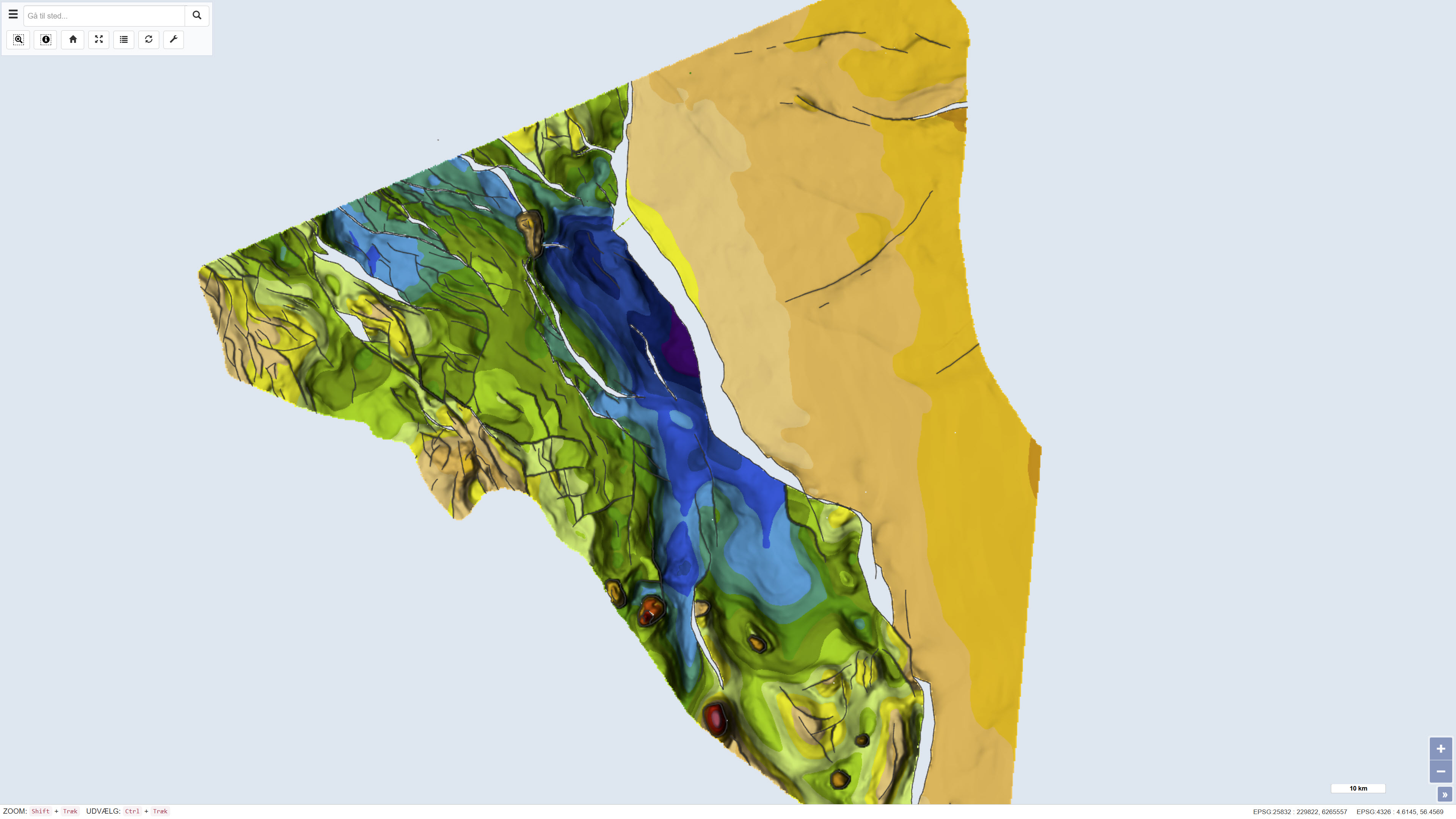
The dataset comprises a geological map of the Danish Central Graben at a scale of 1:200,000 presenting regional maps of the Base Upper Jurassic and the Upper Jurassic. The map was published in 1995 as part of the DGU Map Series no. 50 and was produced as part of a comprehensive geological mapping of the Danish Central Graben. The mapping is based on regional interpretation of seismic data supplemented by information from boreholes. The map covers the Danish part of the Central Graben and parts of the eastern North Sea, and adjacent areas in the Norwegian, British and German sectors are included in order to define regional structural relationships. The map sheet consists of several thematic sub-maps that together describe the structure and stratigraphy of the area.