 Arctic SDI catalogue
Dissolved Oxygen
Type of resources
Topics
Keywords
Contact for the resource
Provided by
Formats
Representation types
Update frequencies
status
-

This dataset was compiled as part of a multiyear effort lead by Fisheries and Oceans Canada (DFO) to support sustainable aquaculture regulation in the Coast of Bays, an area of the south coast of Newfoundland. It is the second of a series aiming to provide an oceanographic knowledge baseline of the Coast of Bays. This dataset includes temperature, salinity, and dissolved oxygen concentration profiles collected during CTD surveys, each survey containing a varying number of casts/profiles taken within the area of interest. In total, 760 profiles from 11 surveys, executed over 276 stations, were collected from June 2009 to November 2013. Data were processed and quality controlled using the instrumentation manufacturer guidelines, custom tools as well as visual inspection. Data are provided in tab-delimited text-based format compatible with most data processing language and tools (e.g. MS. Excel) as well as with the Ocean Data View software (https://odv.awi.de/) for rapid visualisation. A summary of the CTD profiles and stations surveyed is also provided as a comma separated values (CSV) file. A full description of the data and of its use in the context of the motivating project can be found in http://www.dfo-mpo.gc.ca/csas-sccs/Publications/ResDocs-DocRech/2017/2017_077-eng.html. Analyses from this dataset were presented during a Canadian Science Advisory Secretariat (CSAS) meeting which took place in St John’s in March 2015 (http://www.dfo-mpo.gc.ca/csas-sccs/schedule-horraire/2015/03_25-26b-eng.html) and from which a Science Advisory Report (http://www.dfo-mpo.gc.ca/csas-sccs/Publications/SAR-AS/2016/2016_039-eng.html) and Proceedings (http://www.dfo-mpo.gc.ca/csas-sccs/Publications/Pro-Cr/2017/2017_043-eng.html) were published.
-

Moored instrument time series data include current velocity, temperature, salinity, oxygen, fluorescence, transmissivity, turbidity, and particle capture of carbon, nitrogen, and silicon. Also included are sediment trap, ice drift and ice draft data. These data were collected by researchers from the Institute of Ocean Sciences, Sidney, BC, from locations ranging from the Beaufort Sea, and across the Canadian Arctic Archipelago to Baffin Bay. The data links below are only a representative sample of the entire collection. If you require more data, please send your request to the data contact.
-

Moored instrument time series data include current velocity, temperature, salinity, oxygen, fluorescence, transmissivity, turbidity, sediment trap data and particle capture of carbon, nitrogen, and silicon. These data were collected by researchers from the Institute of Ocean Sciences, Sidney, BC, from locations in the North Pacific. The data links below are only a representative sample of the entire collection. If you require more data, please send your request to the data contact.
-
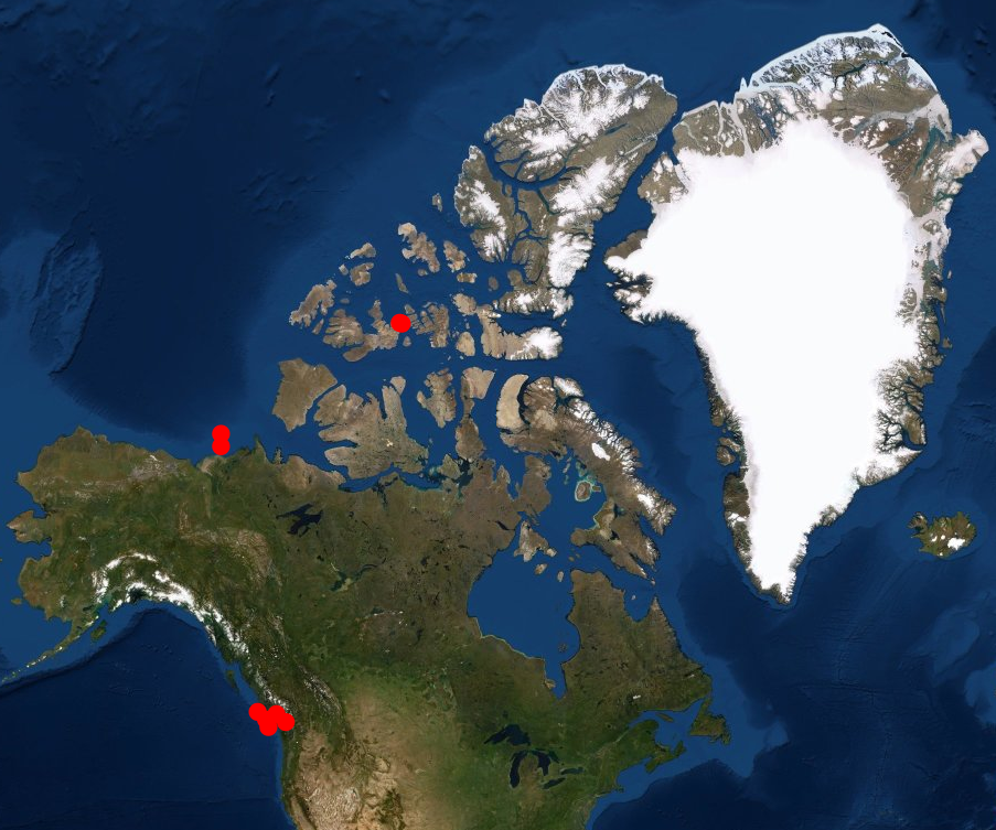
Moored instrument time series data include current velocity, temperature, salinity, oxygen, fluorescence, transmissivity, turbidity, and particle capture of carbon, nitrogen, and silicon as well as sediment trap, ice drift and ice draft data. These data were collected by researchers from the Institute of Ocean Sciences, Sidney, BC, from locations ranging from the North Pacific, the Beaufort Sea, and across the Canadian Arctic Archipelago to Baffin Bay.
-

Water quality and ecosystem health data used to conduct a cumulative effects assessment of Canadian Great Lakes nearshore waters in support of the Great Lakes Water Quality Agreement are included in this dataset. The data was collected by various government and non-government agencies and organizations and integrated into this dataset to allow the assessment to be conducted. By conducting a regular, systematic assessment of cumulative effects in the nearshore waters of the Great Lakes Environment and Climate Change Canada (ECCC) is able to identify areas of high quality and areas under stress. Knowledge of ecological thresholds, other Great Lakes assessments, stressor information, indicators and local and traditional ecological knowledge will be used to aid in: 1) the identification and mapping of high quality nearshore areas and areas that are or may become subject to high stress and; 2) the determination of factors and cumulative effects that are causing stress or threats. Cumulative effects impacting the nearshore and future threats to areas of high ecological value will be better understood and the knowledge shared will assist in priority setting for science and management at a meaningful and practical spatial scale within each Great Lake and connecting channel.