 Arctic SDI catalogue
Dissolved oxygen
Type of resources
Topics
Keywords
Provided by
Representation types
Update frequencies
status
-
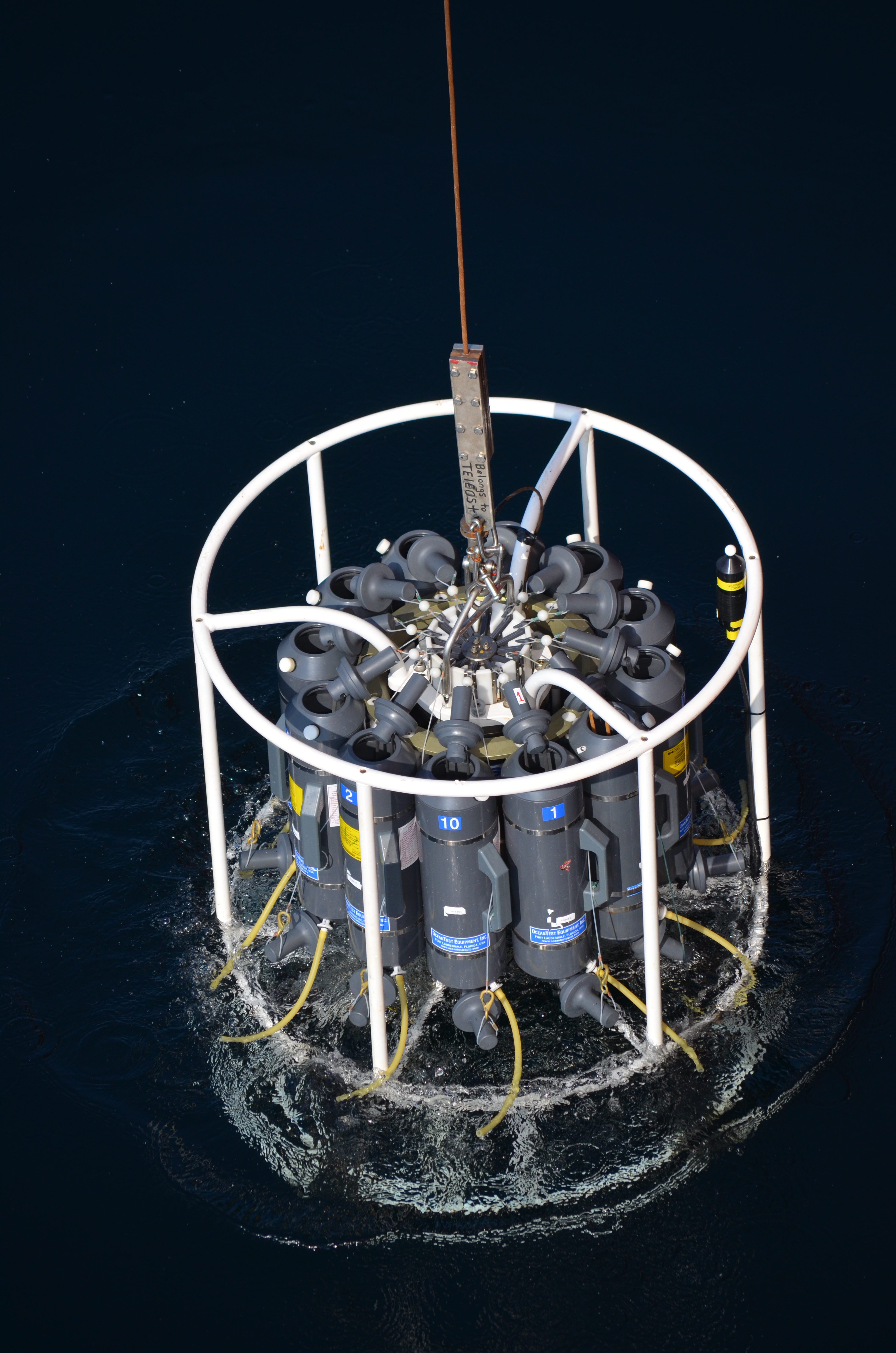
The Department of Fisheries and Oceans (DFO) holds discrete oceanographic, biological, and chemical data collected throughout the St. Lawrence Estuary, the Gulf of St. Lawrence, and the Saguenay Fjord, as well as data gathered outside of these zones during non-routine surveys (collected by the Quebec region). These data come from samples taken at different depths in the water column (surface, bottom, and intermediate depths), mainly during annual scientific missions such as: - weekly monitoring at fixed stations (Rimouski, Shediac Valley) - annual multispecies surveys (Northern and Southern Gulf) - spring and fall missions of the Atlantic Zone Monitoring Program This dataset presents the variables most frequently sampled for the period 1990 to two years prior to the present, namely, salinity, dissolved oxygen concentration, chlorophyll-a concentration, nutrient concentrations (nitrite, nitrate, silicate, phosphate), pH and alkalinity. These measurements are often accompanied by data from CTD profiles (Conductivity, Temperature, Depth/Pressure) and auxiliary sensors (fluorescence, turbidity, pH). Annual synthesis of the chemical and biological oceanographic conditions of the study area have been published since 2011, and reports on zonal conditions of the four Atlantic regions of DFO are also available for certain years: https://www.dfo-mpo.gc.ca/science/data-donnees/azmp-pmza/index-eng.html This record is updated annually as new data become available. To obtain access to earlier data, less frequently sampled variables, or specifications regarding laboratory analyses (analytical methods, preservation, and storage), please contact the data management team at: gddaiss-dmsaisb@dfo-mpo.gc.ca. Notes: This publication contains data extracted from the national BioChem database (Biological and Chemical Marine Data: DFO.BioChemDatabase-BasededonneesBioChem.MPO@DFO-MPO.GC.CA). When replicate samples were present, the values were averaged, and values were grouped by variable regardless of the analysis method, preservation method, or storage method. The grouping of variables collected at the same station is based on spatial and temporal metadata: LATITUDE, LONGITUDE, DATE, and TIME.
-

For several years, Fisheries and Oceans Canada (DFO) has conducted annual ship-based surveys in the St. Lawrence Estuary and the Gulf of St. Lawrence to assess environmental conditions and support a range of scientific objectives. Because these surveys do not extend into winter, a complementary regional monitoring program has been implemented annually in early March since 1996. This monitoring program is typically carried out using a Canadian Coast Guard helicopter, although in 2016 and 2017 it was conducted aboard an icebreaker. The winter survey measures physical oceanographic conditions to approximately 200 m depth along with nutrient concentrations in the surface layer. Starting in 2023, the survey was expanded to include phytoplankton measurements. Data from this program are integrated with those from the Atlantic Zone Monitoring Program (AZMP) to produce annual reports including physical (CTD) and biological (bottle) assessments and a Zonal Scientific Advisory for the Gulf of St. Lawrence which can be found on the following webpage under the given year : Atlantic Zone Monitoring Program (AZMP) - https://www.dfo-mpo.gc.ca/science/data-donnees/azmp-pmza/index-eng.html Here, raw data on physical oceanographic conditions, nutrient concentrations and phytoplankton collected during the winter survey are presented. This publication contains three data files: ‘donnees_data_heli_CTD’ which contains links per year to the CTD data, ‘donnees_data_heli_bottle_bouteille’, which contains nutrient data, and ‘donnees_data_heli_phyto’ which contains phytoplankton data. The dataset covers the period of 1996 to present and is updated annually as new data becomes available. Note: this publication contains raw data, please use with caution or contact the data management team (gddaiss-dmsaisb@dfo-mpo.gc.ca) if you have any questions. For further methodological information please see the supporting document for citations. For mean winter surface conditions in the Estuary and Gulf of St. Lawrence please see the following related publication Winter surface conditions – Helicopter survey - Open Government Portal - https://open.canada.ca/data/en/dataset/9a42d891-fc9c-44b3-8fba-9d9ed96890cf