 Arctic SDI catalogue
pH
Type of resources
Topics
Keywords
Contact for the resource
Provided by
Formats
Representation types
Update frequencies
status
-

The SiIGsol-100m maps make it possible to document the spatial evolution of the properties of the mineral part of the soil at a spatial resolution of 100 m. These values were simulated by combining point observation data and spatially explicit covariates, derived from remote sensing data, using automated learning methods. These values should not be interpreted as an observation, but rather as the most likely value for a given distribution of observations and set of predictor variables. Soil property values are simulated for all non-urbanized land surfaces. All attributes whose value is likely to change with the depth are available in 6 layers, which make it possible to translate the evolution of properties with depth. The depth limits used come from the GlobalSoilMap.net project mapping standard: 00-05 cm, 05-15 cm, 15-30 cm, 30-60 cm, 60-100 cm, and 100-200 cm. Map products are currently divided into 6 variables; the sand fraction, the silt fraction, the clay fraction, the pH, the cation exchange capacity and the proportion of organic matter. They cover the entire territory of the Province of Québecois located south of the 55th parallel.**This third party metadata element was translated using an automated translation tool (Amazon Translate).**
-

The Lake Simcoe lake monitoring program provides measurements of chemical and physical water quality limits such as total phosphorus, nitrogen, chlorophyll a, pH, alkalinity, conductivity, dissolved organic and inorganic carbon, silica, other ions, water transparency, temperature and dissolved oxygen. Samples are collected biweekly during the spring, summer and fall. *[pH]: potential of hydrogen
-
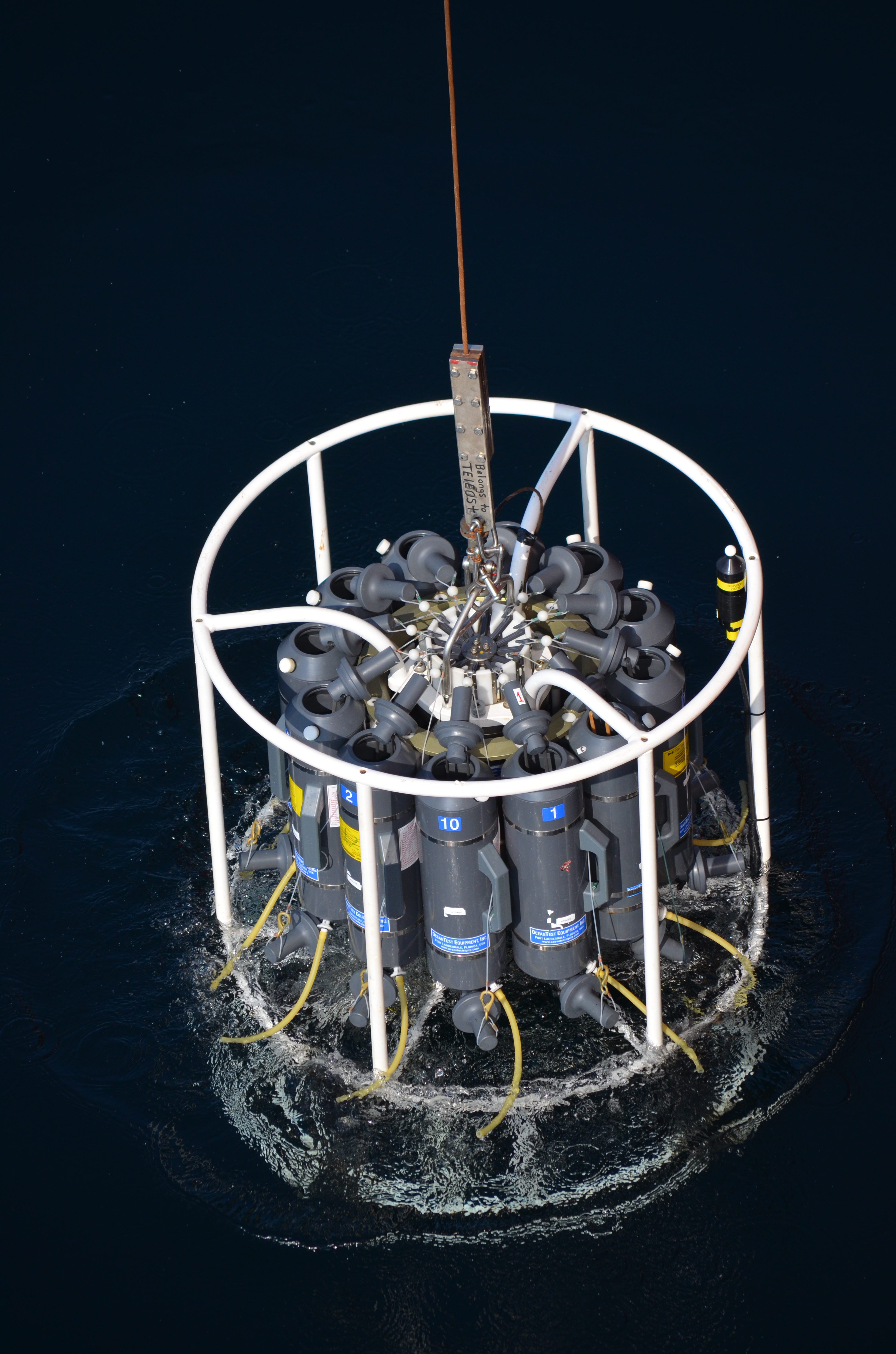
The Department of Fisheries and Oceans (DFO) holds discrete oceanographic, biological, and chemical data collected throughout the St. Lawrence Estuary, the Gulf of St. Lawrence, and the Saguenay Fjord, as well as data gathered outside of these zones during non-routine surveys (collected by the Quebec region). These data come from samples taken at different depths in the water column (surface, bottom, and intermediate depths), mainly during annual scientific missions such as: - weekly monitoring at fixed stations (Rimouski, Shediac Valley) - annual multispecies surveys (Northern and Southern Gulf) - spring and fall missions of the Atlantic Zone Monitoring Program This dataset presents the variables most frequently sampled for the period 1990 to two years prior to the present, namely, salinity, dissolved oxygen concentration, chlorophyll-a concentration, nutrient concentrations (nitrite, nitrate, silicate, phosphate), pH and alkalinity. These measurements are often accompanied by data from CTD profiles (Conductivity, Temperature, Depth/Pressure) and auxiliary sensors (fluorescence, turbidity, pH). Annual synthesis of the chemical and biological oceanographic conditions of the study area have been published since 2011, and reports on zonal conditions of the four Atlantic regions of DFO are also available for certain years: https://www.dfo-mpo.gc.ca/science/data-donnees/azmp-pmza/index-eng.html This record is updated annually as new data become available. To obtain access to earlier data, less frequently sampled variables, or specifications regarding laboratory analyses (analytical methods, preservation, and storage), please contact the data management team at: gddaiss-dmsaisb@dfo-mpo.gc.ca. Notes: This publication contains data extracted from the national BioChem database (Biological and Chemical Marine Data: DFO.BioChemDatabase-BasededonneesBioChem.MPO@DFO-MPO.GC.CA). When replicate samples were present, the values were averaged, and values were grouped by variable regardless of the analysis method, preservation method, or storage method. The grouping of variables collected at the same station is based on spatial and temporal metadata: LATITUDE, LONGITUDE, DATE, and TIME.
-

This dataset was collected in support of a Competitive Science and Research Fund project (21-CC-05-06 Impacts of coastal acidification and climate change stressors on the Atlantic sea scallop: larval supply, recruitment and adaptive capacity to multiple global change drivers) lead by Fisheries and Oceans Canada (DFO). The objective of this research is to characterize coastal environmental conditions associated with scallop spawning and larval drift in Passamaquoddy Bay, New Brunswick. This dataset includes temperature, conductivity, salinity, sigma-theta, sea pressure, and depth information taken at weekly intervals at the sampling stations. In total, this dataset represents a total of 62 CTD profiles collected across 3 sampling stations over 22 sampling days from June to October 2022. Sampling stations were selected to compare scallop recruitment signals from Chamcook Harbour, a decommissioned scallop aquaculture site in Big Bay (MS-1077) and in the middle of Passamaquoddy Bay. Data were processed in accordance with instrumentation manufacturer guidelines and DFO Ocean Data and Information Section QAQC procedures. Cite this data as: Miller, E., Quinn, B., Azetsu-Scott, K., Childs, D., Gabriel, C-E., Newhook, M. 2025. Impacts of coastal acidification and climate change stressors on the Atlantic sea scallop. Published October 2025. Coastal Ecosystems Science Division, Fisheries and Oceans Canada, St. Andrews, N.B