 Arctic SDI catalogue
Eau salée
Type of resources
Available actions
Keywords
Contact for the resource
Provided by
Years
Formats
Representation types
Update frequencies
status
Service types
-

A newer dataset developed in 2021, called Aquifer Vulnerability to Sea Water Intrusion, has replaced this version. This dataset remains available for download for comparison purposes. This dataset was developed as part of the Risk Assessment Framework for Coastal Bedrock Aquifers project completed by Simon Fraser University, for the BC Ministry of Environment and the BC Ministry of Forests, Lands and Natural Resource Operations. Features in the dataset show the vulnerability of coastal aquifers on the Gulf Islands to salt water intrusion, based on their intrinsic susceptibility (aquifer properties such as distance from the coast and topography) and groundwater pumping (well density and type of use). This [link](http://summit.sfu.ca/item/15778) refers to the Master of Science Thesis Report prepared by Jeanette Klassen in 2015 as a component of the collaborative study between Simon Fraser University and the Province of British Columbia.
-
Polygon features representing the vulnerability of coastal aquifers to sea water intrusion.
-

Bottom dissolved oxygen time series at the 3 fixed stations and 46 stations, grouped into transects, of the Atlantic Zonal Monitoring Program (AZMP) under the Quebec region responsibility. The mean bottom dissolved oxygen of the last ten years are displayed as 2 layers, one for the June survey (2014-2023, 2020 not sampled), another for the autumn survey (2014-2023). A third layer shows the positions of the fixed stations of the program (Anticosti Gyre, Gaspé Current and Rimouski). Each station is linked with a .png file showing the bottom dissolved oxygen time series and with a .csv file containing all the bottom dissolved oxygen data acquired at those stations since the beginning of the program sampling (columns : Station, Latitude, Longitude, Date(UTC), Sounding(m), Depth/Profondeur(m), Dissolved_Oxygen/Oxygène_Dissous(%sat)). Purpose The Atlantic Zone Monitoring Program (AZMP) was implemented in 1998 with the aim of increasing the Department of Fisheries and Oceans Canada’s (DFO) capacity to detect, track and predict changes in the state and productivity of the marine environment. The AZMP collects data from a network of stations composed of high-frequency monitoring sites and cross-shelf sections in each following DFO region: Québec, Gulf, Maritimes and Newfoundland. The sampling design provides basic information on the natural variability in physical, chemical, and biological properties of the Northwest Atlantic continental shelf. Cross-shelf sections sampling provides detailed geographic information but is limited in a seasonal coverage while critically placed high-frequency monitoring sites complement the geography-based sampling by providing more detailed information on temporal changes in ecosystem properties. In Quebec region, two surveys (46 stations grouped into transects) are conducted every year, one in June and the other in autumn in the Estuary and Gulf of St. Lawrence. Historically, 3 fixed stations were sampled more frequently. One of these is the Rimouski station that still takes part of the program and is sampled about weekly throughout the summer and occasionally in the winter period. Annual reports (physical, biological and a Zonal Scientific Advice) are available from the Canadian Science Advisory Secretariat (CSAS), (http://www.dfo-mpo.gc.ca/csas-sccs/index-eng.htm). Devine, L., Scarratt, M., Plourde, S., Galbraith, P.S., Michaud, S., and Lehoux, C. 2017. Chemical and Biological Oceanographic Conditions in the Estuary and Gulf of St. Lawrence during 2015. DFO Can. Sci. Advis. Sec. Res. Doc. 2017/034. v + 48 pp. Supplemental Information Bottom dissolved oxygen is determined from CTD profile in the water column according to AZMP sampling protocol: Mitchell, M. R., Harrison, G., Pauley, K., Gagné, A., Maillet, G., and Strain, P. 2002. Atlantic Zonal Monitoring Program sampling protocol. Can. Tech. Rep. Hydrogr. Ocean Sci. 223: iv + 23 pp.
-

Bottom salinity time series at the 3 fixed stations and 46 stations, grouped into transects, of the Atlantic Zonal Monitoring Program (AZMP) under the Quebec region responsibility. The mean bottom salinity of the last ten years are displayed as 2 layers, one for the June survey (2014-2023, 2020 not sampled), another for the autumn survey (2014-2023). A third layer shows the positions of the fixed stations of the program (Anticosti Gyre, Gaspé Current and Rimouski). Each station is linked with a .png file showing the bottom salinity time series and with a .csv file containing all the bottom salinity data acquired at those stations since the beginning of the program sampling (columns : Station, Latitude, Longitude, Date(UTC), Sounding(m), Depth/Profondeur(m), Salinity/Salinité). Purpose The Atlantic Zone Monitoring Program (AZMP) was implemented in 1998 with the aim of increasing the Department of Fisheries and Oceans Canada’s (DFO) capacity to detect, track and predict changes in the state and productivity of the marine environment. The AZMP collects data from a network of stations composed of high-frequency monitoring sites and cross-shelf sections in each following DFO region: Québec, Gulf, Maritimes and Newfoundland. The sampling design provides basic information on the natural variability in physical, chemical, and biological properties of the Northwest Atlantic continental shelf. Cross-shelf sections sampling provides detailed geographic information but is limited in a seasonal coverage while critically placed high-frequency monitoring sites complement the geography-based sampling by providing more detailed information on temporal changes in ecosystem properties. In Quebec region, two surveys (46 stations grouped into transects) are conducted every year, one in June and the other in autumn in the Estuary and Gulf of St. Lawrence. Historically, 3 fixed stations were sampled more frequently. One of these is the Rimouski station that still takes part of the program and is sampled about weekly throughout the summer and occasionally in the winter period. Annual reports (physical, biological and a Zonal Scientific Advice) are available from the Canadian Science Advisory Secretariat (CSAS), (http://www.dfo-mpo.gc.ca/csas-sccs/index-eng.htm). Devine, L., Scarratt, M., Plourde, S., Galbraith, P.S., Michaud, S., and Lehoux, C. 2017. Chemical and Biological Oceanographic Conditions in the Estuary and Gulf of St. Lawrence during 2015. DFO Can. Sci. Advis. Sec. Res. Doc. 2017/034. v + 48 pp. Supplemental Information The bottom salinity is determined from CTD profile in the water column according to AZMP sampling protocol: Mitchell, M. R., Harrison, G., Pauley, K., Gagné, A., Maillet, G., and Strain, P. 2002. Atlantic Zonal Monitoring Program sampling protocol. Can. Tech. Rep. Hydrogr. Ocean Sci. 223: iv + 23 pp.
-

Deep water (> 200 m) dissolved oxygen interpolated on a grid cell of 10 km x10 km in the Estuary and Gulf of St. Lawrence. Input data are from the annual August multidisciplinary survey hold in 2014 to 2023. Purpose Since 1990, the Department of Fisheries and Oceans has been conducting an annual multidisciplinary survey in the Estuary and northern Gulf of St. Lawrence using a standardized protocol. These surveys are an important source of information about the status of the marine ressources. The objectives of the survey are multiple: to estimate the abundance and biomass of groundfish and invertebrates, to identify the spatial distribution and biological characteristics of these species, to monitor the biodiversity of the Estuary and the northern Gulf and finally, to describe the environmental conditions observed in August in the sampling area. Annual reports are available at the Canadian Science Advisory Secretariat (CSAS), (http://www.dfo-mpo.gc.ca/csas-sccs/index-eng.htm). Bourdages, H., Brassard, C., Desgagnés, M., Galbraith, P., Gauthier, J., Légaré, B., Nozères, C. and Parent, E. 2017. Preliminary results from the groundfish and shrimp multidisciplinary survey in August 2016 in the Estuary and northern Gulf of St. Lawrence. DFO Can. Sci. Advis. Sec. Res. Doc. 2017/002. v + 87 p. Supplemental Information The bottom dissolved oxygen is determined from a CTD profile in the water column according to AZMP sampling protocol: Mitchell, M. R., Harrison, G., Pauley, K., Gagné, A., Maillet, G., and Strain, P. 2002. Atlantic Zonal Monitoring Program sampling protocol. Can. Tech. Rep. Hydrogr. Ocean Sci. 223: iv + 23 pp.
-

Chlorophyll-a (mg/m2) time series at the 3 fixed stations and 46 stations, grouped into transects, of the Atlantic Zonal Monitoring Program (AZMP) under the Quebec region responsibility. The mean integrated chlorophyll-a data (0-100 m) of the last ten years are displayed as 2 layers, one for the June survey (2013-2022. 2020 not sampled), another for the autumn survey (2013-2022). A third layer shows the positions of the fixed stations of the program (Anticosti Gyre, Gaspé Current and Rimouski). Each station is linked with a .png file showing the chlorophyll-a time series and with a .csv file containing all the integrated chlorophyll-a data acquired at those stations since the beginning of the program sampling (columns : Station, Latitude, Longitude, Date(UTC), Sounding(m), Depth_min/Profondeur_min(m), Depth_max/Profondeur_max(m), Integrated_chlorophyll-a/Chlorophylle-a_intégrée(mg/m²)). Purpose The Atlantic Zone Monitoring Program (AZMP) was implemented in 1998 with the aim of increasing the Department of Fisheries and Oceans Canada’s (DFO) capacity to detect, track and predict changes in the state and productivity of the marine environment. The AZMP collects data from a network of stations composed of high-frequency monitoring sites and cross-shelf sections in each following DFO region: Québec, Gulf, Maritimes and Newfoundland. The sampling design provides basic information on the natural variability in physical, chemical, and biological properties of the Northwest Atlantic continental shelf. Cross-shelf sections sampling provides detailed geographic information but is limited in a seasonal coverage while critically placed high-frequency monitoring sites complement the geography-based sampling by providing more detailed information on temporal changes in ecosystem properties. In Quebec region, two surveys (46 stations grouped into transects) are conducted every year, one in June and the other in autumn in the Estuary and Gulf of St. Lawrence. Historically, 3 fixed stations were sampled more frequently. One of these is the Rimouski station that still takes part of the program and is sampled about weekly throughout the summer and occasionally in the winter period. Annual reports (physical, biological and a Zonal Scientific Advice) are available from the Canadian Science Advisory Secretariat (CSAS), (http://www.dfo-mpo.gc.ca/csas-sccs/index-eng.htm). Devine, L., Scarratt, M., Plourde, S., Galbraith, P.S., Michaud, S., and Lehoux, C. 2017. Chemical and Biological Oceanographic Conditions in the Estuary and Gulf of St. Lawrence during 2015. DFO Can. Sci. Advis. Sec. Res. Doc. 2017/034. v + 48 pp. Supplemental Information Water sampling for chlorophyll-a analysis (Welschmeyer 1994 method) is done from Niskin bottles according to AZMP sampling protocol: Mitchell, M. R., Harrison, G., Pauley, K., Gagné, A., Maillet, G., and Strain, P. 2002. Atlantic Zonal Monitoring Program sampling protocol. Can. Tech. Rep. Hydrogr. Ocean Sci. 223: iv + 23 pp.
-
A newer dataset developed in 2021, called Aquifer Vulnerability to Sea Water Intrusion, has replaced this version. This dataset remains available for download for comparison purposes. This dataset was developed as part of the Risk Assessment Framework for Coastal Bedrock Aquifers project completed by Simon Fraser University, for the Ministry of Environment and the Ministry of Forests, Lands and Natural Resource Operations. Features in the dataset show the vulnerability of coastal aquifers on Salt Spring Island to salt water intrusion, based on their intrinsic susceptibility (aquifer properties such as distance from the coast and topography), groundwater pumping (well density and type of use) and coastal hazard (coastal morphology and vulnerability to flooding from storm surges). This [link](http://summit.sfu.ca/item/15778) refers to the Master of Science Thesis Report prepared by Jeanette Klassen in 2015 as a component of the collaborative study between Simon Fraser University and the Province of British Columbia.
-
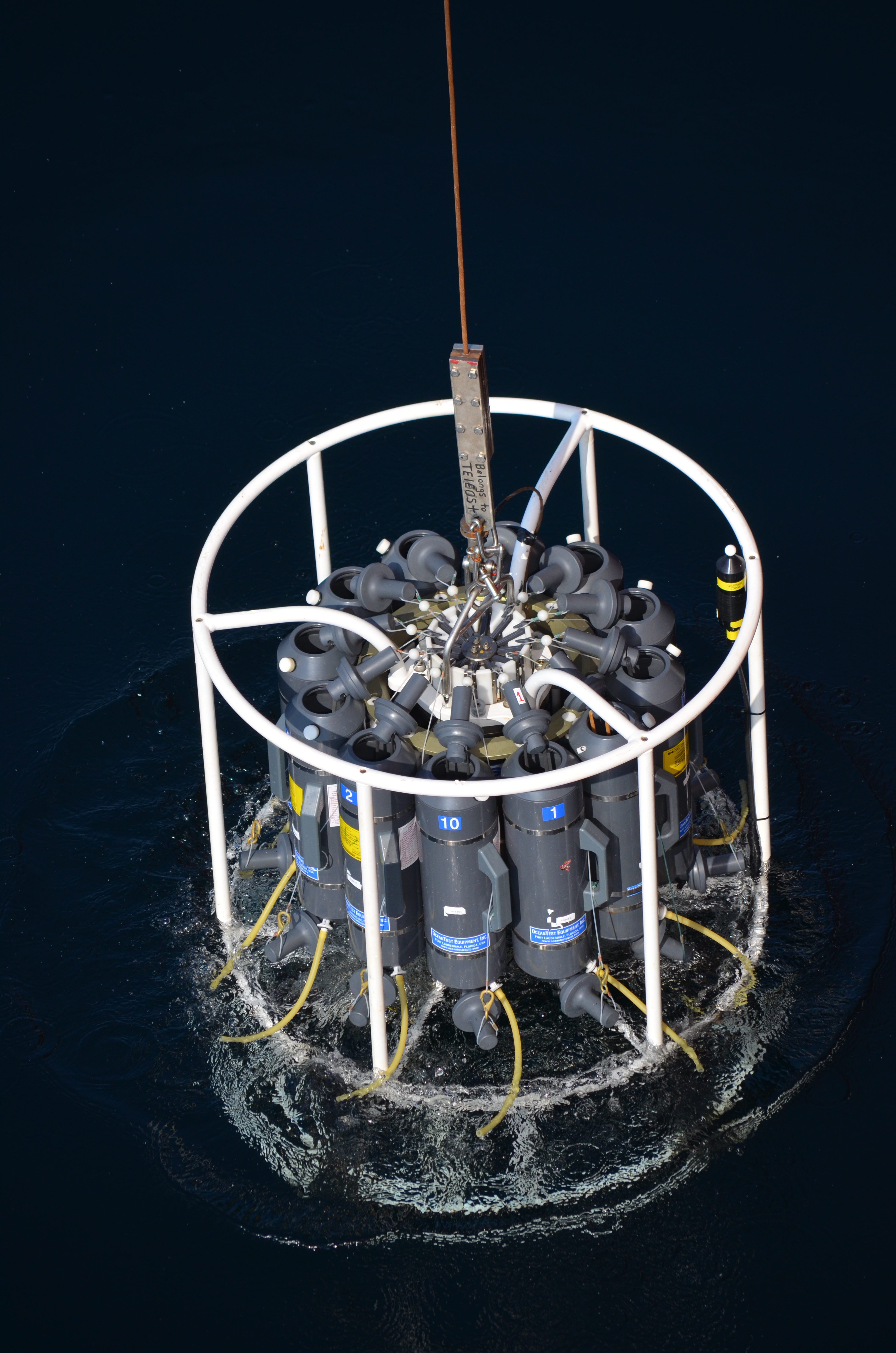
The Department of Fisheries and Oceans (DFO) holds discrete oceanographic, biological, and chemical data collected throughout the St. Lawrence Estuary, the Gulf of St. Lawrence, and the Saguenay Fjord, as well as data gathered outside of these zones during non-routine surveys (collected by the Quebec region). These data come from samples taken at different depths in the water column (surface, bottom, and intermediate depths), mainly during annual scientific missions such as: - weekly monitoring at fixed stations (Rimouski, Shediac Valley) - annual multispecies surveys (Northern and Southern Gulf) - spring and fall missions of the Atlantic Zone Monitoring Program This dataset presents the variables most frequently sampled for the period 1990 to two years prior to the present, namely, salinity, dissolved oxygen concentration, chlorophyll-a concentration, nutrient concentrations (nitrite, nitrate, silicate, phosphate), pH and alkalinity. These measurements are often accompanied by data from CTD profiles (Conductivity, Temperature, Depth/Pressure) and auxiliary sensors (fluorescence, turbidity, pH). Annual synthesis of the chemical and biological oceanographic conditions of the study area have been published since 2011, and reports on zonal conditions of the four Atlantic regions of DFO are also available for certain years: https://www.dfo-mpo.gc.ca/science/data-donnees/azmp-pmza/index-eng.html This record is updated annually as new data become available. To obtain access to earlier data, less frequently sampled variables, or specifications regarding laboratory analyses (analytical methods, preservation, and storage), please contact the data management team at: gddaiss-dmsaisb@dfo-mpo.gc.ca. Notes: This publication contains data extracted from the national BioChem database (Biological and Chemical Marine Data: DFO.BioChemDatabase-BasededonneesBioChem.MPO@DFO-MPO.GC.CA). When replicate samples were present, the values were averaged, and values were grouped by variable regardless of the analysis method, preservation method, or storage method. The grouping of variables collected at the same station is based on spatial and temporal metadata: LATITUDE, LONGITUDE, DATE, and TIME.
-

2014 to 2023 demersal fish abundance in the Estuary and the Gulf of St. Lawrence. The abundance is expressed as a number of individuals per normalized trawl set. Each species is individually represented in the northern Gulf and in the southern Gulf. Input data are from the annual August (North) and September (South) multidisciplinary surveys. The demersal species represented are: Alewife, Alligatorfish, American Plaice, Arctic Alligatorfish, Arctic Hookear Sculpin, Arctic Shanny, Arctic Staghorn Sculpin, Atlantic Cod, Atlantic Eelpout, Atlantic Halibut, Atlantic Hookear Sculpin, Atlantic Poacher, Atlantic Spiny Lumpsucker, Atlantic Wolffish, Black Dogfish, Blacksnout Seasnail, Brill/Windowpane, Common Grenadier, Common Wolf Eel, Cunner, Daubed Shanny, Esmark's Eelpout, Fish Doctor, Fourbeard Rockling, Fourline Snakeblenny, Greenland Cod, Greenland Halibut, Haddock, Longfin Hake, Longhorn Sculpin, Lowfin Snailfish, Monkfish, Goosefish, Moustache Sculpin, Newfoundland Eelpout, Northern Hagfish, Ocean Pout, Rockfishes, Sea Sculpin, Sea Tadpole, Shorthorn Sculpin, Smooth Skate, Snakeblenny, Spatulate Sculpin, Spiny Dogfish, Spinytail Skate, Spotted Wolffish, Stout Eelblenny, Thorny Skate, Twohorn Sculpin, Vahl's Eelpout, Variegated Snailfish, White Hake, Winter Flounder, Winter Skate, Witch Flounder, Wolf Eelpout, Wrymouth and Yellowtail Flounder. Purpose Since 1990, the Department of Fisheries and Oceans has been conducting an annual multidisciplinary survey in the Estuary and northern Gulf of St. Lawrence using a standardized protocol. In the southern Gulf of St. Lawrence, these bottom trawl surveys has been carrying out each September since 1971. These missions are an important source of information about the status of the marine ressources. The objectives of the surveys are multiple: to estimate the abundance and biomass of groundfish and invertebrates, to identify the spatial distribution and biological characteristics of these species, to monitor the biodiversity of the Estuary and Gulf and finally, to describe the environmental conditions observed in the area at the moment of the sampling. The southern Gulf surveys are realized using the following standardized protocol: Hurlbut,T. and D.Clay (eds) 1990. Protocols for Research Vessel Cruises within the Gulf Region (Demersal Fish) (1970-1987). Can. MS Rep. Fish. Aquat. Sci. No. 2082: 143p. The sampling protocols used for the Estuary and northern Gulf surveys are described in details in the following publications: Bourdages, H., Archambault, D., Bernier, B., Fréchet, A., Gauthier, J., Grégoire, F., Lambert, J., et Savard, L. 2010. Résultats préliminaires du relevé multidisciplinaire de poissons de fond et de crevette d’août 2009 dans le nord du golfe du Saint-Laurent. Rapp. stat. can. sci. halieut. aquat. 1226 : xii+ 72 p. Bourdages, H., Archambault, D., Morin, B., Fréchet, A., Savard, L., Grégoire, F., et Bérubé, M. 2003. Résultats préliminaires du relevé multidisciplinaire de poissons de fond et de crevette d’août 2003 dans le nord du golfe du Saint-Laurent. Secr. can. consult. sci. du MPO. Doc. rech. 2003/078. vi + 68 p. Annual reports are available at the Canadian Science Advisory Secretariat (CSAS), (http://www.dfo-mpo.gc.ca/csas-sccs/index-eng.htm). Bourdages, H., Brassard, C., Desgagnés, M., Galbraith, P., Gauthier, J., Légaré, B., Nozères, C. and Parent, E. 2017. Preliminary results from the groundfish and shrimp multidisciplinary survey in August 2016 in the Estuary and northern Gulf of St. Lawrence. DFO Can. Sci. Advis. Sec. Res. Doc. 2017/002. v + 87 p.
-

Production of a layer that includes the known information on seaweed medium to high density areas in the Chaleur Bay, the Estuary and the Gulf of St. Lawrence according to a literature review of documents produced between 1995 and 1999. Additional Information Seaweed density areas were produced according to a literature review of the following documents: Mariculture de Percé inc. 1995. Essai d'augmentation de la biomasse du homard "Récifs artificiels", Rapport no 95, Programme d'essai et d'expérimentation halieutiques et aquicoles. Lemieux, C. 1995. Acquisition de connaissances des habitats côtiers dans la région de Rimouski (1995). Rapport du Groupe-Conseil GENIVAR présenté au Ministère des Pêches et des Océans du Canada, Division de la Gestion de l’Habitat du Poisson, 52 pages + 2 annexes. Belzile, L., Lalumière, R., Cloutier, O. et J.F. Martel. 1997. Inventaire des laminaires dans la Baie des Chaleurs entre Miguasha et Bonaventure. Rapport conjoint Groupe-conseil Génivar inc. et Regroupement des pêcheurs professionnels du sud de la Gaspésie pour le compte de Pêches et Océans Canada, Québec. 13 pages Vaillancourt, M.-A. et C. Lafontaine. 1999. Caractérisation de la Baie Mitis. Jardins de Métis et Pêches et Océans Canada. Grand-Métis. 185 p. Calderón, I. 1996. Caractérisation de la végétation et de la faune ichtyenne de la baie de Sept-Îles. Document réalisé par la Corporation de protection de l'environnement de Sept-Îles pour Pêches et Océans Canada. 26p. + 5 annexes. Calderón, I. 1996. Caractérisation des habitats du poisson de la baie de Sept-Îles - Phase II. Corporation de protection de l'environnement de Sept-Îles. 37 pages.