 Arctic SDI catalogue
Migratory birds
Type of resources
Available actions
Topics
Keywords
Contact for the resource
Provided by
Formats
Representation types
Update frequencies
status
-
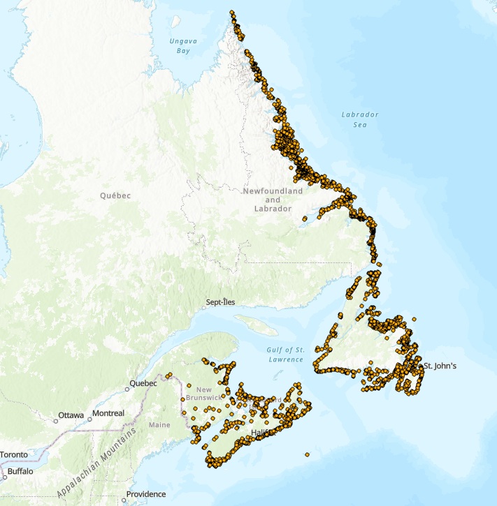
The Atlantic Colonial Waterbird Monitoring database captures geo-referenced data collected under the Atlantic Region’s Canadian Wildlife Service (CWS) Colonial Seabird Monitoring program, and data collected under CWS’ waterfowl and protected areas programs. These programs collectively monitor 22 species of colonial waterbirds breeding in the Atlantic Region of the following groups: fulmars, shearwaters, storm-petrels, gannets, gulls, terns, alcids, eiders, herons and cormorants, with the primary outcome to update information on the distribution, status, and trends of waterbirds breeding in all four Atlantic provinces. Surveys are conducted using one of three platforms: aerial, boat, or ground. Aerial surveys provide the most cost-effective way of conducting a comprehensive population census of diurnal species visible from air, namely gulls (Herring, Great Black-backed, Ring-billed, Glaucous), Black-legged Kittiwakes, Northern Gannets, terns (Arctic, Common, Roseate, Caspian), cormorants (Greater, Double-crested), Black Guillemots, and Common Eiders. Aerial surveys are also effective in identifying new colonies and provide additional information on how to most effectively conduct boat and ground surveys. Boat and ground surveys are conducted at smaller geographic scales and are necessary to obtain complementary information on the species composition of colonies and correction factors to finalize gull, tern and eider estimates obtained from the aerial surveys. Ground and/or boat surveys are also necessary to conduct colony counts of cliff-nesting birds (murres and fulmars), crevice nesting birds (razorbills and guillemots) and burrow-nesting birds (puffins, storm-petrels, shearwaters). Raw data are captured using various survey methods, including:1) visual estimates, 2) direct counts of number of individuals or apparently occupied sites and/or photo counts, 3) sub-sampling the colony through plot counts and extrapolating the estimated occupied densities over the occupied area which in turn is estimated using a variety of geographic information system approaches (e.g., Wilhelm et al. 2015). Important outcomes for how data are used include informing marine spatial planning, emergency preparedness, impact assessment of various anthropogenic threats, and COSEWIC status assessment (e.g., COSEWIC 2020). Further, these data are regularly used internally or in collaboration with partners to form the basis of peer-reviewed publications on regional, national, and/or global population trends for target species (e.g., Langlois Lopez et al. 2022, Iles et al. 2025). This dataset represents a subset of data collected from surveys led by CWS spanning from 1910 to 2024 and summarized to present, at a given colony, the year and count of birds from the most recent survey, the year and maximum count of birds within the last 20 years (if available), and the year and maximum count of birds ever recorded. In addition, CWS works closely with a variety of partners (e.g., provincial, other federal departments, academic, not-for profit organizations) to supplement colonial waterbird data collected in the Atlantic Region. To request additional census or survey data, please contact CWS. COSEWIC. 2020. COSEWIC assessment and status report on the Leach’s Storm-Petrel (Atlantic population) Oceanodroma leucorhoa in Canada. Committee on the Status of Endangered Wildlife in Canada. Ottawa. xii + 70 pp. (https://www.canada.ca/en/environment-climate-change/services/species-risk-public-registry.html). Iles, D.T., S.E. Gutowsky, A.M. Calvert, S.I. Wilhelm, J.-F. Rail, A. Hedd, H.L. Major, A.C. Smith, and G.J. Robertson. 2025. Estimating regional trajectories and trends of seabirds from sparse and inconsistent colony counts: case studies from eastern Canada with Leach’s Storm-Petrel and Atlantic Puffin. Avian Conservation and Ecology 20(2):16. https://doi.org/10.5751/ACE-02931-200216 Langlois Lopez, S., Bond, A.L., O’Hanlon, N.J., Wilson, J.M., Vitz, A., Mostello, C.S., Hamilton, F., Rail, J.-F., Welch, L., Boettcher, R., Wilhelm, S.I., Anker-Nilssen, T., Daunt, F., and Masden, E. 2022. Global population and conservation status of the Great Black-backed Gull Larus marinus. Bird Conservation International, 1–11. https://doi.org/10.1017/S0959270922000181 Wilhelm, S.I., Mailhiot, J., Arany, J., Chardine, J.W., Robertson, G.J., and Ryan, P.C. 2015. Update and trends of three important seabird populations in the western North Atlantic using a geographic information system approach. Marine Ornithology 43: 211-222.
-
Hunting districts as presented in the Compendium of Migratory Bird Hunting Regulations: Quebec https://www.canada.ca/fr/environnement-changement-climatique/services/chasse-oiseaux-migrateurs-gibier/reglementation-resumes-provinciaux-territoriaux/quebec.html These boundaries are presented for information purposes only and have no legal value.
-
This data set includes the locations of all known seabird colonies along the coast of British Columbia, and provides a compilation of the population estimates of seabirds breeding at those colonies since 1980, and historical estimates prior to 1980 for some colonies. It does not include an estimate of the numbers of juvenile birds or non-breeders in the population. The rationale for developing this inventory was the recognized need for a product that could assist with: coastal zone and conservation area planning; emergency response to environmental emergencies and identifying areas of potential interactions between seabirds and anthropogenic activities. In addition, the data used to develop the document provides a baseline to compare with future seabird population estimates in order to measure the impacts of shifts in composition, abundance and/or distribution of prey, and climatic and oceanographic changes. The database is not a substitute for on-site surveys usually required for environmental assessment. Here we present data on the breeding colony population estimates of the 17 species of seabirds (including two storm petrels, three cormorants, one gull, and eight alcids) and one shorebird (Black Oystercatcher Haematopus bachmani) that breed on the coast of British Columbia. Over 5.5 million colonial birds are currently estimated to nest at 649 sites (Rodway et al. 2024). Five species (Cassin's Auklets Ptychoramphus aleuticus, Fork-tailed Storm-petrels (Hydrobates fucatus), Rhinoceros Auklets Cerorhinca monocerata, Ancient Murrelets Synthliboramphus antiquus, and Leach's Storm-petrels (Hydrobates leucorhous), comprise the vast majority of that population, although Black Oystercatchers (Haematopus bachmani), Pigeon Guillemots (Cepphus columba), and Glaucous-winged Gulls (Larus glaucescens), nest at the most sites. Marbled Murrelets (Brachyramphus marmoratus), which nest on the mossy limbs of mature and old-growth trees within the coastal forests, are not included in this database, due to their dispersed nesting habit. The population estimates presented in this database are compiled from the results of several surveys. Many of the seabird breeding colonies in British Columbia have been known for more than 50 years, but because of the remoteness of the sites, visits to them have been rare. The majority of the data are the results of comprehensive inventories of colonial nesting seabirds along the British Columbia coastline conducted between 1974 and 1977 by the British Columbia Provincial Museum (BCPM; now Royal British Columbia Museum ) and between 1980 and 1989 by the Canadian Wildlife Service of Environment and Climate Change Canada (CWS). The goal of the BCPM surveys was to explore the entire BC coast to identify seabird nesting sites. Reliable, quantitative data were gathered on the breeding populations of all surface-nesting seabird species and rough estimates of population sizes were made for burrow-nesting species. The goal of the CWS survey program was to establish baseline estimates of breeding populations of burrow-nesting species in BC using standardized survey techniques to allow future comparisons and monitoring of those populations. During the 1980s, repeat surveys of surface-nesting species were also conducted by CWS in most regions of the BC coast. A few colonies on small remote islands were not visited during those surveys. Therefore, for some colonies the most current population estimates are from the first complete survey of the BC coastline, carried out by the Royal British Columbia Museum in the mid 1970’s. Since 1989, surveys have been conducted by CWS on some alcid, cormorant and gull colonies along the BC coast, and results have been included in the dataset (data entry ongoing). As well as data from CWS surveys, we have attempted to obtain recent data from all other sources including Parks Canada, Transport Canada, the BC Ministry of Forests, Lands, Natural Resource Operations and Rural Development, the City of Vancouver, the Bamfield Marine Station, and the Laskeek Bay Conservation Society. Since 2000, inventories of nesting Black Oystercatchers have been conducted in some regions of the coast by Parks Canada and partners (Gulf Islands National Park Reserve, Pacific Rim National Park Reserve, and Gwaii Haanas National Park Reserve) and results have been included in the dataset (data entry ongoing). A long time series of nesting Black Oystercatcher data collected by Laskeek Bay Conservation Society in the Laskeek Bay area of the East Coast of Moresby Island has also been included in this dataset.
-
In 2022, the federal government launched the second phase of the Oceans Protection Plan, a vast interdepartmental program designed to enhance marine safety in Canada by improving our ability to prevent and respond to marine incidents. For the Canadian Wildlife Service (CWS) of Environment and Climate Change Canada (ECCC), this means filling gaps in our knowledge of marine and coastal bird species. In order to identify these gaps for the province of Quebec, we carried out a prioritization exercise in 2022 and concluded that major efforts needed to be made in the Nunavik marine region, since data were lacking in several sectors and for several species. Understanding the vulnerability of wildlife species over time and space will help us, among other things, to assess risks and act quickly and appropriately in the event of incidents affecting the marine environment, such as an oil spill or shipwreck. Another important objective of the Oceans Protection Plan is to implement sustainable partnerships with the Inuit in order to share our respective knowledge of migratory birds, develop joint projects and support Inuit-led marine bird projects. It is in this context that ground surveys of marine bird nests on the islands of Nunavik are being carried out by the CWS, in collaboration with Nunavimmiut. The main objective of these surveys is to update available data on the abundance and distribution of nesting seabirds in this area, particularly Common Eiders (Somateria mollissima). On each island visited, a team follows transects distributed from one end to the other and across the entire width of the island, in order to obtain complete and systematic coverage of the island and to count all the nests present. The spacing between transects can vary according to the size of the island, its topography and the density of nests present. This database provides access to the survey results and shows, for each island surveyed, the number of nests of each species present. In the case of the Black Guillemot (Cepphus grylle), since nests are very difficult to find, it is rather the number of adults present around the island that is reported. Finally, in some cases, notably for gulls (Larus spp.), if no nests were found, but adults were observed on or around the island, then a number of adult individuals was reported.
-
In 2022, the federal government launched the second phase of the Oceans Protection Plan, a vast interdepartmental program designed to enhance marine safety in Canada by improving our ability to prevent and respond to marine incidents. For the Canadian Wildlife Service (CWS) of Environment and Climate Change Canada (ECCC), this means filling gaps in our knowledge of marine and coastal bird species. In order to identify these gaps for the province of Quebec, we carried out a prioritization exercise in 2022. We concluded that major efforts needed to be made in the Nunavik marine region, since data were lacking in several sectors and for several species. Understanding the vulnerability of wildlife species over time and space will help us, among other things, to assess risks and act quickly and appropriately in the event of incidents affecting the marine environment, such as an oil spill or shipwreck. Another important objective of the Oceans Protection Plan is to implement sustainable partnerships with the Inuit in order to share our respective knowledge of migratory birds, develop joint projects and support Inuit-led marine bird projects. It is in this context that aerial inventories aimed at identifying avian diversity, counting seabirds and coastal birds and better understanding their distribution at different times of the year have been taking place in Nunavik since 2023. These inventories are particularly aimed at sites of large gatherings, such as molting and staging areas, where birds are more vulnerable. During flights, the crew scans the sea, bays, river mouths and coasts for single birds or groups of birds. When birds are spotted, the number of individuals is estimated and a formal identification is made to the most precise taxonomic level possible, usually species or genus. In some cases, particularly for species that are more difficult to identify or in the case of very large groups, high-resolution photographs are taken to confirm identifications and estimates of the number of individuals a posteriori. Where possible, individuals are identified by age and sex. For the purposes of these inventories, flight-capable birds are considered adults unless immature plumage is easily identifiable from a moving aircraft. Thus, most ducks, as well as shorebirds, are considered adults as soon as they are able to fly. Occasionally, the aircraft lands on the ground for short periods to allow the team to refine the identification of the species, genus and age of the birds. These observations are then included in the database. Observations made over land, during various trips, are also recorded opportunistically. Source to quote : Canadian Wildlife Service - Quebec Region. Aerial surveys of marine and coastal birds in Nunavik. Data collected as part of the Oceans Protection Plan. Version October 2025.
-
Canadian nesting zones are broad, general areas, corresponding roughly to Bird Conservation Regions (version 2014. updates have been made in 2022) https://www.canada.ca/en/environment-climate-change/services/avoiding-harm-migratory-birds/general-nesting-periods/nesting-periods.html The limits of nesting zones reflect: - variations in species diversity - variations in mean annual temperature - similarities in the nesting periods within and between zones Changes in the nesting period between adjacent nesting zones occur as a gradient. When working near the boundary of a zone, you should also consider the nesting period of the adjacent zone.. More detail technical information are available here: https://publications.gc.ca/site/eng/9.843362/publication.html Warning: This technical information on timing of nesting migratory birds are published by EC to support the planning of activities in order to reduce the risk of detrimental effects to migratory birds, their nests and eggs. This technical information constitutes advice only. This information does not provide an authorization for harming or killing migratory birds or for the disturbance, destruction or taking of nests or eggs as prohibited under the MBR. This information does not provide a guarantee that the activities will avoid contravening the MBR or other laws and regulations. This is general information not intended to be relied on as official advice concerning the legal consequences of any specific activity. It is not a substitute for the MBCA, the MBR, or any other legislation. It is the responsibility of individuals and companies to assess their risk with regards to migratory birds and design relevant avoidance and mitigation measures.