 Arctic SDI catalogue
Natural sciences
Type of resources
Topics
Keywords
Contact for the resource
Provided by
Formats
Representation types
Update frequencies
status
-

Biological samples of Geoduck Clams have been collected during surveys in British Columbia as part of the broader survey objectives of determining Geoduck density, distribution and population structure. Samples of Geoducks were collected from 41 locations throughout British Columbia between 1993 and 2002. Clams were measured for total weight, shell length, shell weight and were aged. Biological parameters are presented here for individual clams sampled. See Bureau D., W. Hajas, N.W. Surry, C.M. Hand, G. Dovey and A. Campbell. 2002. Age, size structure and growth parameters of Geoducks (Panopea abrupta, Conrad 1849) from 34 locations in British Columbia sampled between 1993 and 2000. Can Tech. Rep. Fish. Aquat. Sci. 2413: 84 p. and Bureau D., W. Hajas, C.M. Hand and G. Dovey. 2003. Age, size structure and growth parameters of Geoducks (Panopea abrupta, Conrad 1849) from seven locations in British Columbia sampled in 2001 and 2002. Can. Tech. Rep. Fish. Aquat. Sci. 2494: 29 p.
-

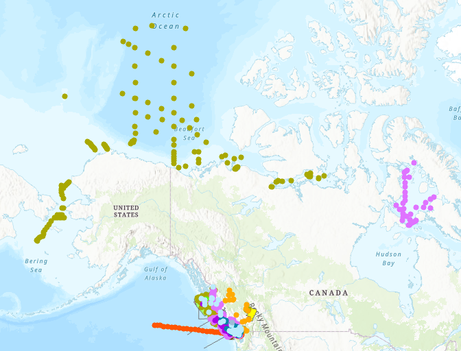
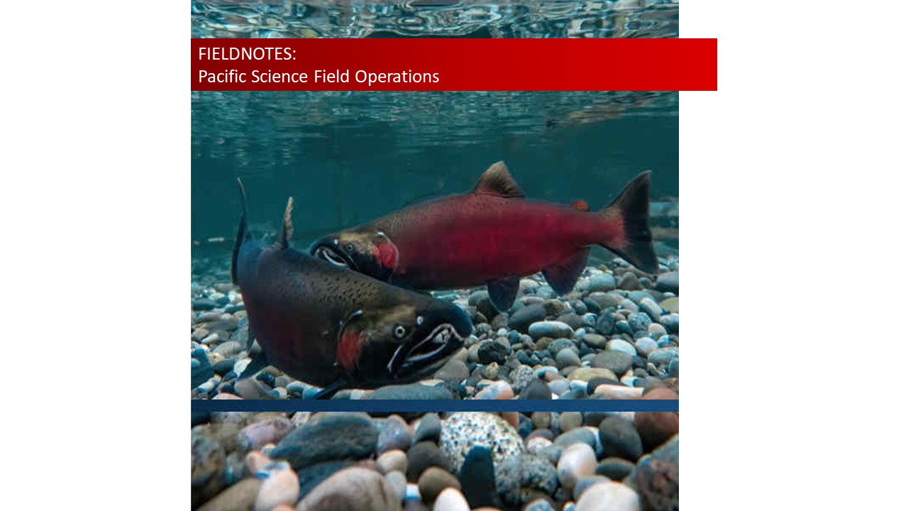
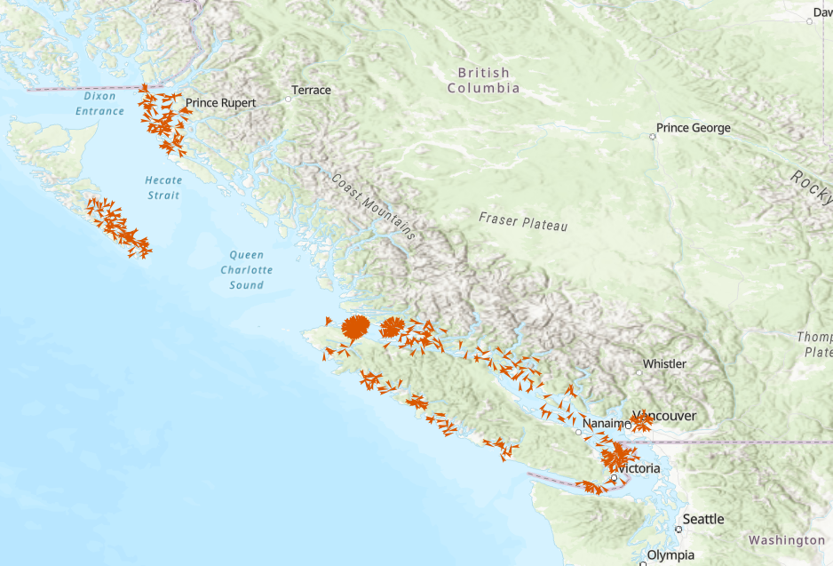
The Fieldnotes dataset represents the anticipated locations of DFO Science field operations for 2020-2021 in the North Pacific and Arctic oceans, as well as in the coastal and interior waters of British Columbia and the Yukon.
-

The Fieldnotes dataset represents anticipated locations of science field research and monitoring to be conducted throughout the year by Fisheries and Oceans Canadas' Pacific Science team and collaborators in the Northeast Pacific and Arctic oceans, and in the coastal and interior waters of British Columbia and Yukon.
-

Fisheries and Oceans Canada (DFO) conducts research and undertakes monitoring surveys of the marine and freshwater environment in support of sustainable fisheries, healthy aquatic ecosystems and living resources, and safe and effective marine services. In an effort to effectively inform and ensure Canadians feel engaged in the delivery of its science mandate, DFO produces Fieldnotes, an annual compendium of planned science field operations in the North Pacific and Arctic oceans, as well as in the coastal and interior waters of British Columbia and Yukon.
-

The Fieldnotes dataset represents the anticipated locations of DFO Science field operations for 2022-2023 in the North Pacific and Arctic oceans, as well as in the coastal and interior waters of British Columbia and the Yukon.
-

The Fieldnotes dataset represents the anticipated locations of DFO Science field operations for 2021-2022 in the North Pacific and Arctic oceans, as well as in the coastal and interior waters of British Columbia and the Yukon.
-
The Fieldnotes dataset represents anticipated locations of science field research and monitoring to be conducted throughout the year by Fisheries and Oceans Canadas' Pacific Science team and collaborators in the Northeast Pacific and Arctic oceans, and in the coastal and interior waters of British Columbia and Yukon.
-
The Fieldnotes dataset represents the anticipated locations of DFO Science field operations in the North Pacific and Arctic oceans, as well as in the coastal and interior waters of British Columbia and the Yukon.
-

Fisheries and Oceans Canada (DFO) selected the Manicouagan Peninsula area as a site of interest for the possible establishment of a Marine Protected Area (MPA) in 1998. With this in mind, DFO conducted surveys to assess benthic biodiversity between 2006 and 2008. During the various campaigns, more than a hundred stations were sampled using various tools to target epibenthic and endobenthic species. Various tools were used during the three years of sampling, including an SM (Smith-McIntyre) grab with an area of 0.1 m² and a height of 20 cm, an IKU-type grab with a surface area of 1.5 m² and a height of 50 cm, and a hydraulic dredge measuring 1.36 m wide and 0.66 m high with a net mesh size of 2.3 cm. As the dredge clogged fairly quickly, small organisms were collected in abundance. In 2006 and 2007, a camera mounted on a sled pulled by a boat along transects of varying lengths depending on the sampling campaign collected images (3,008 x 2,000 pixels) every 10 seconds, representing a seabed area of 40 x 40 cm. The data are presented in Darwin Core format in the file “donnees_manicouagan_data” The available data include taxonomic identifications of samples (individuals collected or identified in images) as well as metadata related to stations, including sampling date, depth, and geographic coordinates. Please note that the depths are for informational purposes only, since the bathymetry is very steep in this region. Further details on sampling can be found in the following report: Provencher, L et Nozères, C. 2011. Protocole de suivi des communautés benthiques de la zone de protection marine Manicouagan. Secr. can. de consult. sci. du MPO. Doc. de rech. 2011/051. iv +25 p. https://waves-vagues.dfo-mpo.gc.ca/library-bibliotheque/344357.pdf
-
The Department of Fisheries and Oceans (DFO) Science Branch has designed a multispecies dive survey protocol to provide unbiased, coast wide monitoring of benthic invertebrate stocks (as may be required under the updated Fisheries Act) and associated habitat information for a suite of benthic marine invertebrate species (Green (Strongylocentrotus droebachiensis), Purple (S. purpuratus) and Red Sea Urchin (Mesocentrotus franciscanus), Geoduck (Panopea generosa), Giant Red Sea Cucumber (Apostichopus californicus), Northern Abalone (Haliotis kamtschatkana), and Sunflower Sea Star (Pycnopodia helianthoides)). Based on information available at this time, the proposed survey design can provide estimates of coast wide stock status for Red Sea Urchin and Giant Red Sea Cucumber, and relative abundance indices for Geoduck, Green Sea Urchin, Purple Sea Urchin, Northern Abalone and Sunflower Sea Star. The new protocol was tested through a series of pilot surveys conducted on a subset of areas of the BC coast each September from 2016-2021. Design of the pilot surveys was based on previous dive survey data and experience and demonstrated the practical feasibility of the protocol, while also gathering preliminary information to guide recommendations about the statistical design of the survey. The dataset consists of a relational database containing tables representing each component of the survey methodology. The primary component of the survey is a transect location. Along each transect, systematically spaced quadrats are sampled, and on each quadrat, substrate observations are recorded, multiple species of algae are recorded, and multiple individual invertebrates are measured or counted. The tables are linked by transect number and quadrat number.