 Arctic SDI catalogue
Océans
Type of resources
Keywords
Contact for the resource
Provided by
Years
Representation types
Update frequencies
status
Service types
-
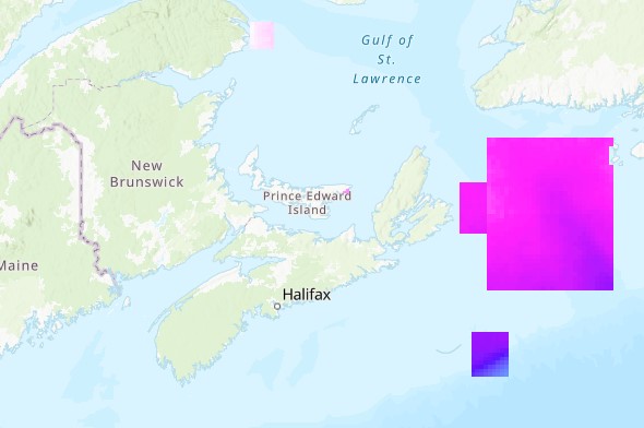
Ce document affiche la couverture des produits créés par le Service hydrographique du Canada, dont les cartes marines individuelles sur support papier, les cartes électroniques de navigation (CÉN) vectorielles et les collections de cartes marines numériques matricielles (BSB).
-
Ce document affiche la couverture des produits créés par le Service hydrographique du Canada, dont les cartes marines individuelles sur support papier, les cartes électroniques de navigation (CÉN) vectorielles et les collections de cartes marines numériques matricielles (BSB).
-
Ce document affiche la couverture des produits créés par le Service hydrographique du Canada, dont les cartes marines individuelles sur support papier, les cartes électroniques de navigation (CÉN) vectorielles et les collections de cartes marines numériques matricielles (BSB).
-
Ce document affiche la couverture des produits créés par le Service hydrographique du Canada, dont les cartes marines individuelles sur support papier, les cartes électroniques de navigation (CÉN) vectorielles et les collections de cartes marines numériques matricielles (BSB).
-
Ce document affiche la couverture des produits créés par le Service hydrographique du Canada, dont les cartes marines individuelles sur support papier, les cartes électroniques de navigation (CÉN) vectorielles et les collections de cartes marines numériques matricielles (BSB).
-
Ce document affiche la couverture des produits créés par le Service hydrographique du Canada, dont les cartes marines individuelles sur support papier, les cartes électroniques de navigation (CÉN) vectorielles et les collections de cartes marines numériques matricielles (BSB).
-

Plankton (zooplankton and large phytoplankton) are collected using the Continuous Plankton Recorder (CPR) in the Northwest (NW) Atlantic along tracks transited by container ships from Reykjavik (Iceland) to St. John’s, NL (the Z line), and between St. John’s and the New England Coast, along the Scotian Shelf (the E and MD lines). The CPR Survey is the longest running, most geographically extensive marine ecological survey in the world, providing comparable data on the geographical distribution, seasonal cycles and year-to-year changes in abundance of plankton over a large spatial area. The first northwest Atlantic samples were collected in the Irminger Sea in 1957, and sampling was extended farther west to the Scotian Shelf a few years later. Sampling has continued to the present with some interruptions during the late 1970s and 1980s. Sampling is nominally once per month along the E, MD, and Z lines. DFO Sample collection and analysis are led by the Continuous Plankton Recorder Survey program at the Marine Biological Association of the UK. DFO provides partial support for the northwest Atlantic survey carried out on the E, MD, and Z lines and incorporates CPR data in Atlantic Zone Monitoring Program ocean environmental status reporting.
-
This dataset provides refined monthly climatological projections for six key ocean variables: surface and bottom temperature, surface and bottom salinity, mixed layer depth, and bottom current speed. The projections are provided for six Maritime Marine Protected Areas: the Gully, the Laurentian Channel, St. Anns Bank, Musquash Estuary, Banc-des-Américains, and Basin Head. These projections are based on downscaled outputs from 22 CMIP6 models under four emissions scenarios (SSP1-2.6, SSP2-4.5, SSP3-7.0, and SSP5-8.5) for four 20-year periods spanning 2020 to 2099 (2020–2039, 2040–2059, 2060–2079, and 2080–2099). For each model and scenario, 20-year climatological means were computed for each future period. These climatologies were then aggregated to produce ensemble means and ensemble standard deviations for all variables. The released dataset includes only these ensemble summary fields and is provided as gridded data with dimensions longitude × latitude × scenario × time. Cite this data as: Wang., Z. Data of High-resolution climate projection data for Marine Protected Areas in the Maritimes. Published: May 2026. Ocean Ecosystems Science Division, Maritimes Region, Fisheries and Oceans Canada, Dartmouth NS. https://open.canada.ca/data/en/dataset/fb4b3212-bca3-4192-8401-687faccc534b
-

Description: Seasonal climatologies for salinity of the Northeast Pacific Ocean were computed to cover the period 2001 to 2020. Historibal observations included all available conductivity-temperature_depth (CTD), bottle and profiling floats in the NODC World Ocean Database, Marine Environmental Data Services (MEDS), Institute of Ocean Sciences Water Properties website and the Canadian Integrated Ocean Observing System (CIOOS Pacific). Methods: Interpolation was carried out in up to fifty-two vertical levels from surface to 5000m. Data-Interpolating Variational Analysis (DIVA) was used for spatial interpolation for all years within each season and estimates projected onto a consistent grid. The average of the grid nodes was calculated to obtain the seasonal climatology. DIVA was used again on the final climatology followed by a median filter and a 5-point smoother. Spring months were defined as April to June, summer months were defined as July to September, fall months were defined as October to December, and winter months were defined as January to March. The data available here contain raster layers of seasonal salinity climatology for the Canadian Pacific Exclusive Economic Zone (EEZ), a subset of seasonal climatology of the Northeast Pacific Ocean, with high spatial resolution of 1/300 degree. Data Sources: NODC, MEDS, IOS and CIOOS Pacific Data. Uncertainties: Uncertainties are introduced when quality controlled observational data are spatially interpolated to varying distances from the observation point. Climatological averages are calculated from these interpolated values.
-

The hydrographic 1991 to 2020 climatology for the Maritimes region Atlantic Zone Monitoring Program core transects, Cabot Strait, Louisbourg, Halifax, Browns Bank, and Northeast Channel, are calculated to support annual reporting on seasonal variability. Details on data coverage for these transects and ancillary transects occupied since the inception of the program are provided. Comparisons with the previous climatology period, years 1981 to 2010, are summarized when possible. Cite this data as: Layton, C. Data of: Maritimes Region Atlantic Zone Monitoring Program 1991 to 2020 Hydrographic Transect Climatology. Published: August 2025. Ocean Ecosystems Science Division, Fisheries and Oceans Canada, Dartmouth, N.S. https://open.canada.ca/data/en/dataset/5f9c5d65-3ce1-4bdd-8b43-34086620d1e3