 Arctic SDI catalogue
Pipelines
Type of resources
Available actions
Topics
Keywords
Contact for the resource
Provided by
Formats
Representation types
Update frequencies
status
-

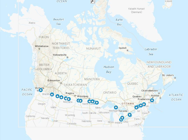
This dataset represents the Environmental and Socio-economic Assessments (ESA) submitted to the Canada Energy Regulator (CER). The CER has made this and other ESAs available through an online search tool called BERDI (Biophysical Socio-Economic Regional Data and Information). Data extraction methodology is available on the BERDI website. Pipelines represented in this layer include a start and end point.
-
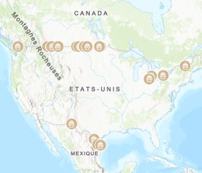
Border crossings of liquids pipelines. Mapping Resources implemented as part of the North American Cooperation on Energy Information (NACEI) between the Department of Energy of the United States of America, the Department of Natural Resources of Canada, and the Ministry of Energy of the United Mexican States. The participating Agencies and Institutions shall not be held liable for improper or incorrect use of the data described and/or contained herein. These data and related graphics, if available, are not legal documents and are not intended to be used as such. The information contained in these data is dynamic and may change over time and may differ from other official information. The Agencies and Institutions participants give no warranty, expressed or implied, as to the accuracy, reliability, or completeness of these data. Parent Collection: [North American Cooperation on Energy Information, Mapping Data](https://open.canada.ca/data/en/dataset/aae6619f-f9f3-435d-bc32-42decd58b674)
-
Border crossings of natural gas pipelines. Mapping Resources implemented as part of the North American Cooperation on Energy Information (NACEI) between the Department of Energy of the United States of America, the Department of Natural Resources of Canada, and the Ministry of Energy of the United Mexican States. The participating Agencies and Institutions shall not be held liable for improper or incorrect use of the data described and/or contained herein. These data and related graphics, if available, are not legal documents and are not intended to be used as such. The information contained in these data is dynamic and may change over time and may differ from other official information. The Agencies and Institutions participants give no warranty, expressed or implied, as to the accuracy, reliability, or completeness of these data. Parent Collection: [North American Cooperation on Energy Information, Mapping Data](https://open.canada.ca/data/en/dataset/aae6619f-f9f3-435d-bc32-42decd58b674)
-

The dataset contains the digital boundaries for significant discovery licences, production licences, drilled wells, major pipelines and the jurisdictional boundary of the area administered by the Canada-Nova Scotia Offshore Energy Regulator (CNSOER), as well as the inactive Georges Bank permits formerly administered by the Canada Oil and Gas Lands Administration (COGLA). All production facilities have been removed and active projects were fully abandoned and decommissioned by November 2020. As of January 2022 there are no active exploration licences. A significant discovery licence (SDL) may be issued for lands within a declared significant discovery area under the Accord Acts. The term of a significant discovery licence is indefinite and was designed to maintain an explorer's rights during the period between first discovery and eventual production. Significant discovery licence interest representatives in 2021 include BP Canada Energy Company, ExxonMobil Canada Ltd., ExxonMobil Canada Properties, Ovintiv Canada ULC, and Shell Canada Limited. Most of the SDLs predate the CNSOEB; they were issued at various times from 1980 to 1986 by COGLA before the Offshore Board existed. On January 5, 1990, they were all rolled into CNSOEB’s governance. The only exception is SDL 2702 which was issued June 6, 2007. A production licence (PL) gives interest holders the right to produce petroleum in an area which is subject to a declared commercial discovery. In order to be declared a commercial discovery, an operator must demonstrate that the discovery contains reserves that will justify the investment of capital and effort to bring the discovery to production. A production licence has a term of 25 years but may be extended if commercial production is continuing or is likely to recommence. Production licence interest representatives in 2021 include ExxonMobil Canada Ltd. and Ovintiv Canada ULC. The PLs were effective on the following dates: • 2901, 2902: 1991-04-01 • 2903, 2904, 2905, 2906: 1999-07-06 • 2907: 2003-10-31 • 2908: 2004-11-25 • 2909, 2910, 2911: 2010-12-31 Inactive Georges Bank permit interest representatives include BP Canada Energy Company and Chevron Canada Ltd. Each production licence, significant discovery licence and inactive Georges Bank permit polygon is a mapped representation of the permit interest abstract. The offshore area is divided into grid areas and permit interest abstracts are defined by this land division. The land division system consists of grid areas, sections, and units – all referenced to the North American Datum of 1927 (NAD27). For more information on the Canada lands defined areas (Land Division), See: Canada oil and gas regulations land division (https://laws-lois.justice.gc.ca/eng/regulations/C.R.C.%2C_c._1518/page-1.html#h-525569 or https://www.cnsopb.ns.ca/resource-library/land-division-guideline). The area of a PL or SDL can be found in the permit interest abstract for that licence, available for download on the CNSOER's website (https://www.cnsopb.ns.ca/sites/default/files/resource/interest_summary_table.pdf) . The directory of wells point dataset contains the surface locations for all wells drilled in Offshore Nova Scotia. The file includes well names, locations, spud dates, termination dates, rig table elevations, water depths, well total depth, well type (exploratory, delineation, production, or injector), well result, and current status. Original data for wells drilled prior to 1990 was collected and maintained by the Geological Survey of Canada and COGLA. Data are also available on the Basin database online (https://basin.gdr.nrcan.gc.ca/index_e.php). CNSOER’s directory of wells was last updated January, 2020. Jurisdictional boundary point and lines datasets define the outer limit of the jurisdiction of the CNSOER, as described in the Canada-Nova Scotia Offshore Petroleum Resources Accord Implementation Act - Schedule 1 (Canada-Nova Scotia Offshore Petroleum Resources Accord Implementation Act (https://laws-lois.justice.gc.ca/eng/acts/C-7.8/page-1.html)), excluding the 200-nautical mile exclusive economic zone (EEZ) limit as described under Part VI of the United Nations Convention on the Law of the Sea (https://www.un.org/Depts/los/convention_agreements/texts/unclos/unclos_e.pdf?msclkid=5309c2b9cfc911ecb5bb107f67772ec1). The offshore gas pipeline polyline dataset contains locations of major pipelines in the CNSOER's jurisdictional area, associated with petroleum production in offshore Nova Scotia. This file is considered to be approximate and is not an official record. Some pipeline coordinates are sourced from CAD documents (DXF), supplied by operators. Some were created using ArcMap, digitized from paper records. As of October 2021, all pipelines within this file have been fully flushed with sea water and abandoned. All shapefiles were transformed into the NAD83 datum using the NTv2 transformation.
-

In August 2025 the Major Projects Office was launched, with the mandate to advance major projects in Canada and streamline federal regulatory project approval. This dataset was created to provide open access to key information about the projects and transformative strategies that have been referred to the Major Projects Office. This dataset can be layered with other data available on the Open Science and Data Platform. By accessing this data, users can conduct more comprehensive analyses to support evidence-based decision-making and inform regulatory processes including future impact assessments. Please visit the Major Projects Office for more information.