 Arctic SDI catalogue
Sciences de la Terre
Type of resources
Available actions
Keywords
Contact for the resource
Provided by
Years
Representation types
Update frequencies
status
Service types
-
Le Canada est divisé en 338 circonscriptions. Un représentant du Parlement ou député est élu pour chacune des circonscriptions. Après la diffusion des chiffres de population de chaque recensement décennal, le directeur général des élections détermine le nombre de sièges à la Chambre des communes et publie cette information dans la Gazette du Canada. Les commissions de délimitation des circonscriptions déterminent ensuite les modifications à apporter aux limites des circonscriptions. Les commissions de délimitation des circonscriptions fédérales sont des organismes indépendants qui prennent toutes les décisions concernant les limites proposées et définitives des circonscriptions fédérales. Élections Canada offre des services de soutien à la commission de délimitation des circonscriptions dans chaque province. À la lumière des rapports de ces commissions, le directeur général des élections prépare un décret de représentation électorale faisant état des limites, du nom et de la population de chaque CF. Le décret de représentation électorale prend effet à la première dissolution du Parlement qui se produit au moins sept mois après sa proclamation. Le décret de représentation électorale de 2013 (proclamée le 5 octobre 2013) était fondée sur les chiffres de population du recensement de 2011; le nombre de CF, établi à 308 selon le décret de représentation électorale de 2003, est passé à 338. L’Ontario s’est accru de quinze sièges, l’Alberta et la Colombie-Britannique en ont gagné six chacun, alors que le Québec en a ajouté trois. Le 19 juin 2014, la Loi de 2014 sur les changements de noms de circonscriptions (Projet de loi C-37) a reçu la sanction royale modifiant les noms de 31 CF. Le nom des CF peut être modifié n’importe quand par une loi fédérale.
-
Le Canada est divisé en 308 circonscriptions. Un représentant du Parlement ou député est élu pour chacune des circonscriptions. Après la diffusion des chiffres de population de chaque recensement décennal, le directeur général des élections détermine le nombre de sièges à la Chambre des communes et publie cette information dans la Gazette du Canada. Les commissions de délimitation des circonscriptions déterminent ensuite les modifications à apporter aux limites des circonscriptions. Les commissions de délimitation des circonscriptions fédérales sont des organismes indépendants qui prennent toutes les décisions concernant les limites proposées et définitives des circonscriptions fédérales. Élections Canada offre des services de soutien à la commission de délimitation des circonscriptions dans chaque province. À la lumière des rapports de ces commissions, le directeur général des élections prépare une ordonnance de représentation faisant état des limites, du nom et de la population de chaque CF. L'ordonnance de représentation prend effet à la première dissolution du Parlement qui se produit au moins un an après sa proclamation. L'Ordonnance de représentation de 2003 (proclamée le 25 août 2003) était fondée sur les chiffres de population du recensement de 2001; le nombre de CF, établi à 301 selon l'Ordonnance de représentation de 1996, est passé à 308. L'Ontario s'est accru de trois sièges, alors que l'Alberta et la Colombie-Britannique en ont gagné deux chacun. Le 19 juin 2014, la Loi de 2014 sur les changements de noms de circonscriptions (Projet de loi C-37) a reçu la sanction royale modifiant le nom de la CF de Western Arctic à Territoires du Nord-Ouest. Le nom des CF peut être modifié n'importe quand par une loi fédérale.
-

Canada is divided into 308 electoral districts. A representative or member of Parliament is elected for each electoral district. Following the release of population counts from each decennial census, the Chief Electoral Officer determines the number of seats in the House of Commons and publishes the information in the Canada Gazette. Electoral boundaries commissions then determine the adjustments to the constituency boundaries. The federal electoral boundaries commissions are independent bodies that make all decisions regarding the proposed and final federal electoral boundaries. Elections Canada provides support services to the boundaries commission in each province. Based on reports from these commissions, the Chief Electoral Officer prepares a representation order that describes the boundaries and specifies the name and the population of each FED. The representation order is in force on the first dissolution of Parliament that occurs at least one year after its proclamation. The 2003 Representation Order (proclaimed on August 25, 2003) was based on 2001 Census population counts, and increased the number of FEDs to 308, up from 301 from the previous 1996 Representation Order. Ontario received three additional seats, while Alberta and British Columbia each gained two seats. The names of FEDs may change at any time through an Act of Parliament.
-

Temporal analysis of changes in Quebec city based on GeoAI features automatically extracted from satellite images acquired in 2006 and 2022. Simple geospatial analysis enables the detection of features present in 2022 that were not already there in 2006. The addition of new buildings is a good indicator of urban development and/or sprawl. GeoAI enables temporal coverage of various areas in Canada, thus providing a useful tool for change detection and trend analysis at high resolution. While the series is still fairly new, and such examples are limited for the time being, NRCan strives to gradually increase its GeoAI data offering for both spatial and temporal coverage. For more information about the GeoAI - GeoBase Series, please visit the following link: https://open.canada.ca/data/en/dataset/74738ff5-5367-5958-9aee-98fffdcd1876
-
GeoAI are buildings, hydrography, forests, and roads automatically extracted using Deep Learning models applied to a source dataset, typically aerial or satellite images. The primary aim of GeoAI is to increase Canada's availability of high-resolution foundational geospatial data for both spatial and temporal coverage. The infrastructure and expertise put in place by NRCan enables a rapid, efficient, and scalable data creation process through the use of leading-edge technology and Artificial Intelligence models. Published datasets for a given source can be revisited at a later date as more accurate models are developed and put into production. For now, only static files are available, but as the series develops, new products and services will be added. Several use cases of GeoAI data for change detection have been created. To view them, please follow the links below: - Iqaluit: https://open.canada.ca/data/en/dataset/ef29513d-a007-408c-beba-65f86e7b5b01 - Calgary: https://open.canada.ca/data/en/dataset/bd07b597-5166-4b62-ae9c-245b3c62ea03 - Québec City: https://open.canada.ca/data/en/dataset/4026720e-f7fb-478e-a58f-c62ebe20005d - Winnipeg: https://open.canada.ca/data/en/dataset/a6874aac-cfcd-4b92-bb3f-6031eedb5b57 - Victoria: https://open.canada.ca/data/en/dataset/f011c7b9-f79e-42f8-9481-9bf9788bb189 - Trois-Rivières: https://open.canada.ca/data/en/dataset/2b11a323-52c2-43d5-9c09-bc4b15b1bcc8
-

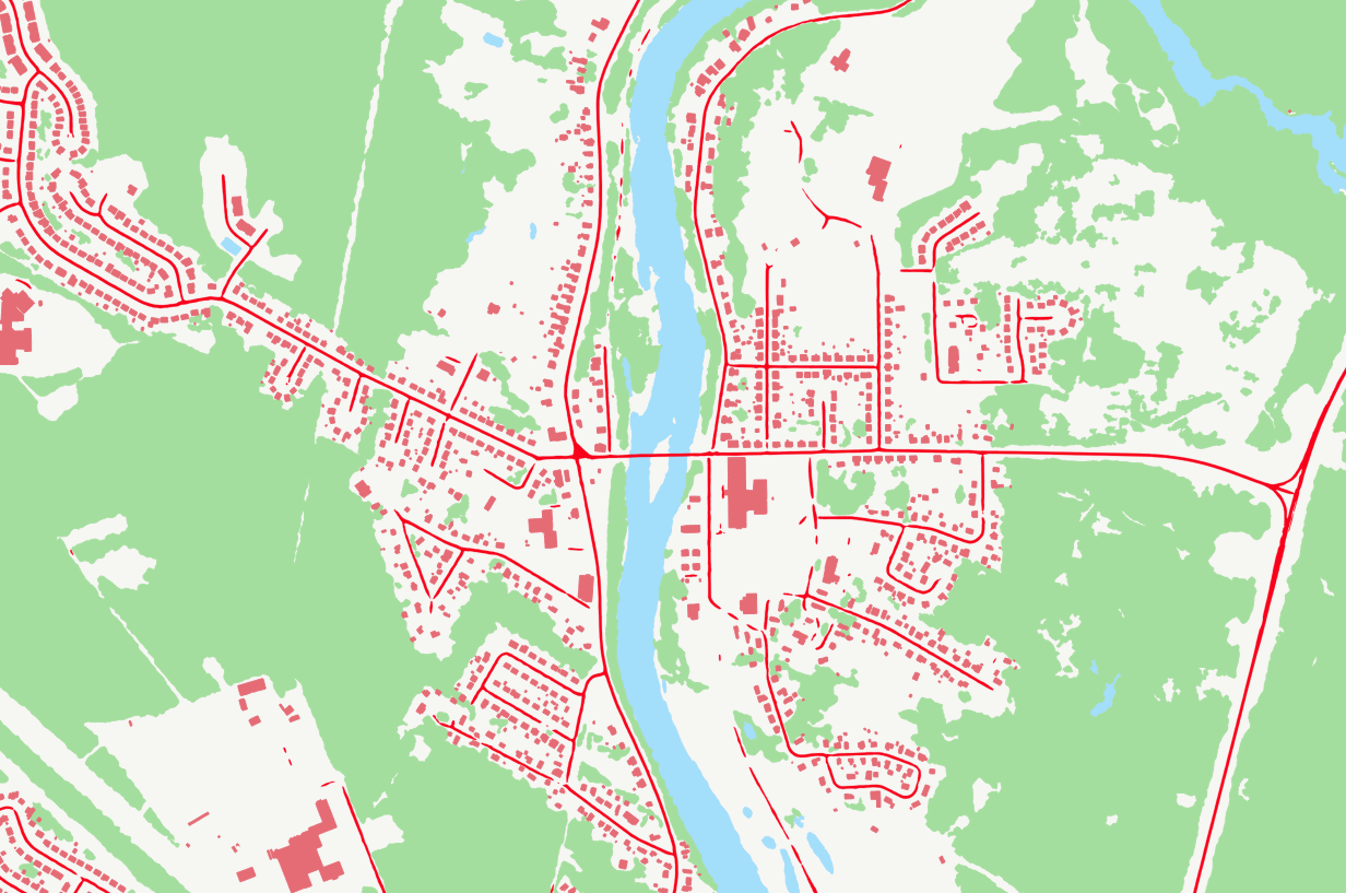
The National Rail Network (NRWN) is a geometric and attributive description of the Canadian rail network. The NRWN product consists of the features classes: Track Segment, Railway Crossing, Railway Station, Marker Post, Junction and Railway Structure. Descriptive attributes include amongst others: Track Classification, Track Name, Track Operator, Track User, Track Owner, Subdivision Name, Junction Type, Crossing Type, Level of Crossing, Warning System, Transport Canada Identifier, Station Name, Station Type, Station User, Structure Type.
-

This is a legacy product that is no longer supported. It may not meet current government standards. The Canadian Digital Surface Model (CDSM) is part of Natural Resources Canada's altimetry system designed to better meet the users' needs for elevation data and products. The 0.75-second (~20 m) CDSM consists of a derived product from the original 1-second (30 m) Shuttle Radar Topographic Mission (SRTM) digital surface model (DSM). In these data, the elevations are captured at the top of buildings, trees, structures, and other objects rather than at ground level. A CDSM mosaic can be obtained for a pre-defined or user-defined extent. The coverage and resolution of a mosaic varies according to the extent of the requested area. Derived products such as slope, shaded relief and colour shaded relief maps can also be generated on demand by using the Geospatial-Data Extraction tool. Data can then be saved in many formats. The pre-packaged GeoTiff datasets are based on the National Topographic System of Canada (NTS) at the 1:50 000 scale; the NTS index file is available in the Resources section in many formats.
-

Temporal analysis of changes in the Iqaluit region, Nunavut, based on GeoAI features automatically extracted from satellite images acquired in 2012 and 2022. Simple geospatial analysis intersecting GeoAI multidate building features enables the detection of buildings observed in 2022 that were not detected in 2012. The addition of new buildings is a good indicator of urban development and/or sprawl. GeoAI enables temporal coverage of various areas in Canada, thus providing a useful tool for change detection and trend analysis at high resolution. While the series is still fairly new, and such examples are limited for the time being, NRCan strives to gradually increase its GeoAI data offering for both spatial and temporal coverage. For more information about the GeoAI - GeoBase Series, please visit the following link: https://open.canada.ca/data/en/dataset/74738ff5-5367-5958-9aee-98fffdcd1876
-

Temporal analysis of changes for Victoria, British Columbia, based on GeoAI features automatically extracted from satellite images acquired in the 2000s, 2010s and 2020s. Simple geospatial analysis intersecting Statistics Canada's Open Database of Buildings, version 3 (ODB v3) with GeoAI multidate building features enables the detection of buildings observed in the 2000s, 2010s and 2020s. The addition of new buildings is a good indicator of urban development and/or sprawl. Using the same approach, GeoAI multidate roads enable the detection of Statistics Canada's National Roads Network (NRN) segments present in the 2000s, 2010s and 2020s. The development of new roads is also indicator of urban development and/or sprawl. Complementarily, an analysis of changes in the forest coverage from the GeoAI datasets is done between the 2000s and the 2020s. This analysis reflects the gains and losses between both dates. GeoAI enables temporal coverage of various areas in Canada, thus providing a useful tool for change detection and trend analysis at high resolution. While the series is still fairly new, and such examples are limited for the time being, NRCan strives to gradually increase its GeoAI data offering for both spatial and temporal coverage. For more information about the GeoAI - GeoBase Series, please visit the following link: https://open.canada.ca/data/en/dataset/74738ff5-5367-5958-9aee-98fffdcd1876
-

Temporal analysis of changes in Trois-Rivières, Québec, based on GeoAI features automatically extracted from satellite images acquired in 2013 and 2021-22. Simple geospatial analysis intersecting Statistics Canada's Open Database of Buildings, version 3 (ODB v3) with GeoAI multidate building features enables the detection of buildings observed in 2021-22 that were not detected in 2013. The addition of new buildings is a good indicator of urban development and/or sprawl. GeoAI enables temporal coverage of various areas in Canada, thus providing a useful tool for change detection and trend analysis at high resolution. While the series is still fairly new, and such examples are limited for the time being, NRCan strives to gradually increase its GeoAI data offering for both spatial and temporal coverage. For more information about the GeoAI - GeoBase Series, please visit the following link: https://open.canada.ca/data/en/dataset/74738ff5-5367-5958-9aee-98fffdcd1876