 Arctic SDI catalogue
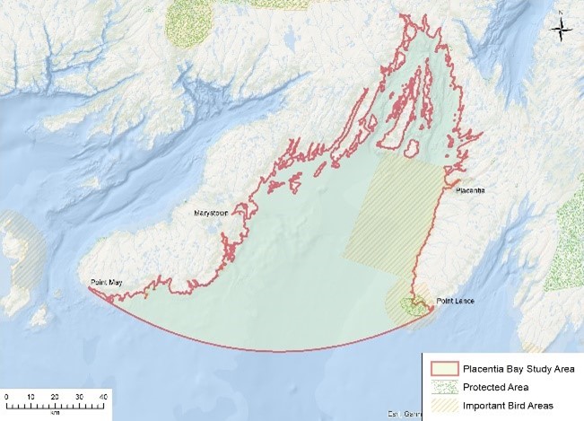
Species Distribution
Type of resources
Topics
Keywords
Contact for the resource
Provided by
Formats
Representation types
Update frequencies
status
-

This project was completed by the Pelagics Section in the Newfoundland and Labrador Science Branch of Fisheries and Oceans Canada (DFO). As part of the Coastal Environmental Baseline Program, a historical research gillnet program was reinitiated in Placentia Bay. Four local fishers each set fleets of standardized nets to catch herring for 6 weeks during the spring. The data collected was used to update a time series and provide advice at the herring stock assessment in October 2022. This program was continued in the 22/23 fiscal year. Data collected from this program included gillnet catch rates, bycatch, temperature and biological (herring) samples; from which biological metrics such as length, weight, sex, maturity and age were measured. This record contains catch data for 2018 to 2021, as well as biological data from 2018.
-

This project was completed by the Shellfish Section in the Newfoundland and Labrador Science Branch of Fisheries and Oceans Canada (DFO), in collaboration with industry partners. The Coastal Environmental Baseline program supported the Placentia Bay portion of project work for an ongoing industry-DFO collaborative post-season trap survey for Snow Crab that was initiated in 2003 and has occurred each year. This survey is conducted by Snow Crab harvesters accompanied by at-sea observers and takes place in NAFO Divisions 2J3KLNOP4R. Historically the survey focused on commercial fishing grounds but began transitioning to a partly random stratified design in 2017. Since 2018, approximately 50% of survey stations are randomly allocated while 50% remain fixed. At each station, six (for inshore stations) or ten (for offshore stations) commercial traps are set in a fleet. To gather data on non-commercial sized Snow Crab, including females, many fleets also include one small-mesh trap. The coverage of small-mesh traps has been expanding in recent years with the aim of one small-mesh trap for every station in the coming years. Biological sampling is undertaken on at least one commercial trap and the small-mesh trap at each station. The data from this survey is incorporated into the annual stock assessment for Snow Crab in the Newfoundland and Labrador region. This record contains trap locations for Placentia Bay, and information on the types of data collected. More detailed information can be found in Pantin et al. (2022). https://publications.gc.ca/collections/collection_2023/mpo-dfo/fs70-5/Fs70-5-2022-076-eng.pdf
-

This project was completed by the Groundfish Section in the Newfoundland and Labrador Science Branch of Fisheries and Oceans Canada (DFO). From 2018 to 2020, 14 year-round, acoustic receivers were deployed in Placentia Bay as a part of the Coastal Environmental Baseline Program to form 4 gates: Bar Haven (2 receivers), Centre Channel (1 receiver), Eastern Channel (6 receivers), and Western Channel (5 receivers). Additionally, 162 transmitters were deployed in Atlantic cod in the 3Ps region (2019-2022). Over the deployment period these receivers recorded a total of 2 094 024 detections from 63 unique transmitters including 45 Cod tagged through the Groundfish acoustic telemetry program. Most cod detected were tagged in Placentia Bay (43 fish) and many were detected at multiple receivers or multiple years (37 fish). Passive data collection for this project may extend up to 2030. This record contains the locations of the acoustic receivers in Placentia Bay, NL.
-

This project was completed by the Salmonids Section in the Newfoundland and Labrador Science Branch of Fisheries and Oceans Canada (DFO). The Coastal Environmental Baseline Program has supported efforts in 2018 and 2019 of tagged Atlantic salmon smolts leaving the Bay de L’eau River and Rushoon River region of Placentia Bay. This was part of a larger four year tracking study in this region (2018, 2019, 2021, 2022) trying to improve DFO’s understanding of the residency, survival, and migration routes of Atlantic salmon smolts during the first months at sea within northwest Placentia Bay. As of spring 2023, four years of detection data were being processed with the goal of presenting this work at the next Atlantic salmon CSAS meeting and developing a primary publication. This record contains the locations there smolt were tagged in Placentia Bay, NL.
-

This project was completed by the Coastal Environmental Baseline Program (Coastal and Freshwater Ecology Section) in the Newfoundland and Labrador Science Branch of Fisheries and Oceans Canada (DFO). The nearshore fish and invertebrate community was sampled annually in Placentia Bay at 14 sites for 5 years (2018 – 2022). The objective of this program was to collect data on juvenile fish (specifically Atlantic cod) communities and habitats within Placentia Bay. The sites and timing (October) were selected based on historical sampling. There were several data types collected during each of these sampling trips. Boat-based beach seining was used to collect data on fish and invertebrate diversity, abundance, distribution, and size. Visual transects were used to identify vegetation and substrate (habitat) types and proportions at seine sites. CTD profiles (temperature, conductivity, depth, and salinity) were obtained using a castaway CTD. Finally, eDNA samples were collected at each site (2018-2021) to obtain complementary information on the presence of juvenile fish and other species present. This record contains the geographic locations of the 14 sites, and information on the timing and type of data collected at each site.
-

This project was completed by the Productive Capacity group (Coastal and Freshwater Ecology Section) in the Newfoundland and Labrador Science Branch of Fisheries and Oceans Canada (DFO). American lobster (Homarus americanus) is a commercially important decapod crustacean species along the east coast of North America, ranging from the Labrador coast south to Cape Hatteras. Juvenile lobster < 40 mm CL (carapace length) recruitment has been studied extensively in the southern portions of their range. However, investigations of settlement habitat association and recruitment of juvenile lobster in the northern extremes along the Newfoundland coast have been largely unsuccessful. We investigated juvenile lobster density, habitat, and depth associations in three areas of Newfoundland, using scuba – Port Saunders area, 8 dives conducted 28 September - 2 October 2017, and Burin Peninsula 10 dives (7 Placentia Bay, 3 Fortune Bay) conducted 30 September - 4 October 2018 over a total seabed area of 9,138 m2, within 200 meters of shore. Port Saunders and Fortune Bay had relatively higher lobster density (0.09 and 0.40 m-2, respectively); >65% were juveniles, in contrast to Placentia Bay where lobster densities of all size groups were low (mean 0.01 m-2) and no juvenile lobsters were observed at all. Where observed all juvenile lobster were significantly associated with shallow (<6 m) habitat and showed no overlap with distribution of adults (>82.5 mm CL) which we observed at depths 6 to 17 m. Our sites were dominated by varying mixes of cobble and pebble (77%); rock/bedrock (12%) and mud/sand/small pebble (11%) substrates interspersed with overlying kelp (32%) and eelgrass (11%) vegetation. We observed no significant associations with substrate or vegetation. This record contains the geographic locations of the 7 Placentia Bay sites surveyed, and information on the timing and type of data collected at each site, which was one component supported by Coastal Environmental Baseline Program of a larger collaborative project.
-

Fisheries and Oceans Canada’s (DFO) National Biofouling Monitoring Program (BMP) has conducted annual field surveys to monitor the introduction, establishment, spread, species richness, and relative abundance of native and non-indigenous species (NIS) since 2006. Standardized monitoring protocols employed by DFO-Maritimes, -Gulf, and -Quebec Regions include biofouling collector plates deployed from May to October at intertidal and shallow subtidal, geo-referenced sites, including public and private docks, aquaculture lease sites, public and private marinas and yacht clubs. Initially in the Maritimes Region (2006-2017) collectors consisted of 3, 10 cm by 10cm PVC plates deployed in a vertical array and spaced approximately 40-cm apart with the shallowest plate hung at least 1 m below the surface to sample shallow subtidal and intertidal species (Sephton et al. 2011, 2017). Two replicate arrays were deployed at least 5 m apart per site. Since 2018, collector arrays were modified to enhance statistical replication, including 10 individual collectors deployed per site at 1 m depth and at least 5 m apart (as above) from May to October. The percent cover of AIS on all collectors was determined by visual examination and scored as follows; (i) ‘0’ = absent, (ii) ‘1’ = ≤25 % cover, (iii) ‘2’ = 25 to ≤50 %, (iv) ‘3’ = 50–75% , and (v) ‘4’ = >75%. Average percent cover is provided for all NIS observed annually per site. Presence-absence indicates that an NIS was observed on at least one collector plate. One additional rocky intertidal species (Asian shore crab; Hemigrapsus sanguineus) was assessed via beach surveys as permitted by time and resources following its initial siting in St Mary’s Bay (Nova Scotia) in April 2020. Rapid assessment surveys conducted in the Fall of 2020 and 2021 were employed to delineate H. sanguineus’ distribution and relative abundance. Areas deemed suitable and at high risk for spread were targeted, including exposed rocky intertidal habitat in southwest regions of Nova Scotia and New Brunswick. Each rapid assessment consisted of 30-minute beach surveys per site conducted by 2 or 3 people (modified from Stephenson et al. 2011). During each survey, crabs were collected under rocks and seaweed in preferred cobble/boulder habitat (Lohrer et al. 2000). Count data was standardized for each site as the number of crabs collected per 30-min search per person. Cite as: DFO-Maritimes Biofouling Monitoring Program. Published October 2018, Updated December 2023. Coastal Ecosystems Science Division, Fisheries and Oceans Canada, Dartmouth, NS Citations: Sephton D, B Vercaemer, JM Nicolas, J Keays (2011) Monitoring for invasive tunicates in Nova Scotia, Canada (2006-2009) Aquatic Invasions 6: 391-403. Sephton D, B Vercaemer, A Silva, L Stiles, M Harris, K Godin (2017) Biofouling monitoring for aquatic invasive species (AIS) in DFO Maritimes Regions (Atlantic shore of Nova Scotia and southwest New Brunswick): May-November, 2012-2015. Canadian Technical Report of Fisheries and Aquatic Sciences 3158: 72 pp. Stephenson EH, RS Steneck, RH Seeley (2009) Possible temperature limits to range expansion of non-native Asian shore crabs in Maine. Journal of Experimental Marine Biology and Ecology 375: 21–31. doi:10.1016/j.jembe.2009.04.020
-
This project was completed by the Coastal Environmental Baseline Program (Coastal and Freshwater Ecology Section) in the Newfoundland and Labrador Science Branch of Fisheries and Oceans Canada (DFO). From 2018 to 2022 baseline biological and physical data were collected in Placentia Bay using Atlantic Zone Monitoring Program (AZMP) and Cold Ocean Productivity Experiment (COPE) protocols. Complementary data were collected in the bay using moored CTDs. Where possible, sampling was conducted monthly at 4 sites between May and November to capture broad scale spatial and temporal trends. Additionally, data were collected bi-weekly in April and May, and monthly from June to September at one of these sites to capture finer scale temporal trends, such as spring blooms, in collaboration with Dr. C. McKenzie. Phytoplankton were collected using vertical net tows and niskins. Zooplankton were collected using vertical net tows. CTDs were used to collect physical and biogeochemical water column data including temperature, pressure, salinity, depth, chlorophyll-a, turbidity, dissolved oxygen, pH, photosynthetic active radiation (PAR), fluorescent dissolved organic matter (FDOM), and conductivity. Water biogeochemistry data were obtained by collecting water samples with niskins at depths of 5, 10, 20, 30, 40m, and 10m above bottom to measure nutrients, chlorophyll-a, carbonates, and particulate organic carbon and nitrogen (POC/PON). Additionally, eDNA samples were taken at each of the 4 sampling sites. This record contains the geographic locations of the sites, and information on the timing and type of data collected at each site.